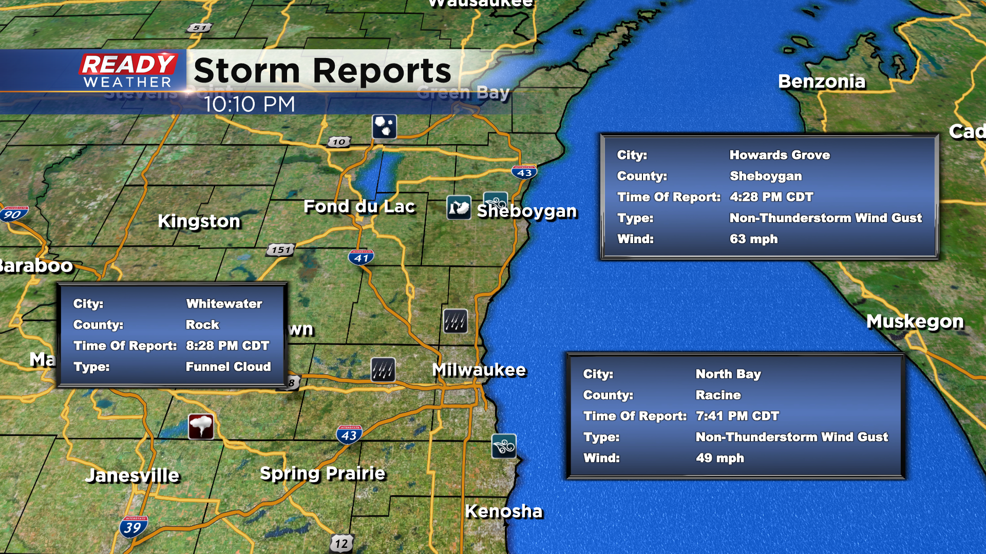
10:00 pm update: Strong storms weaken as they move southward out of Wisconsin


10:00pm Update
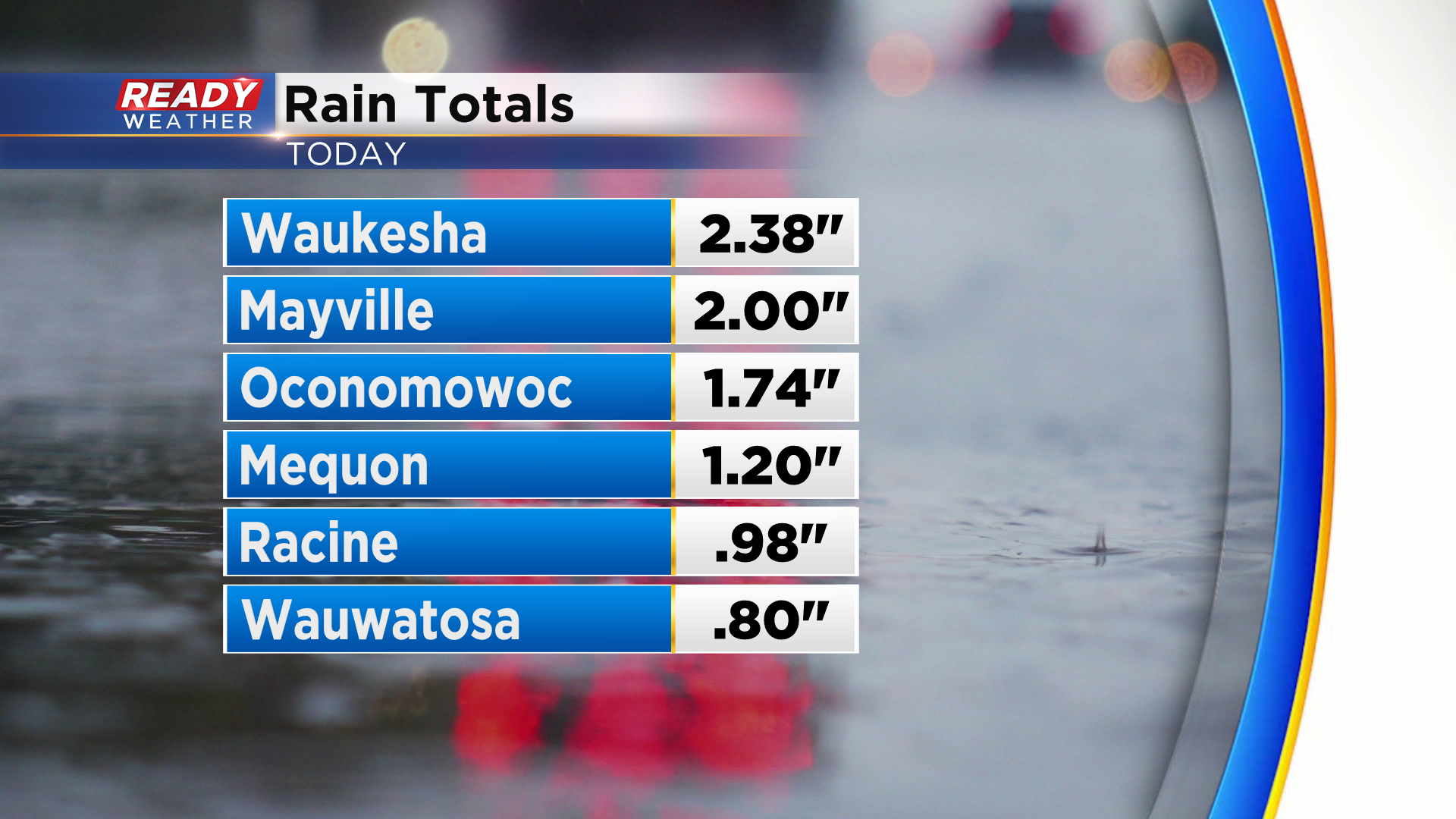
Severe weather is diminishing. And we are finally starting to dry out. The Flood Advisory for Milwaukee and Waukesha county is now over. Here's some rain totals into the office tonight:
9:30 pm Update:
It's been an active night across our area. Aside from the severe threat we have seen some really impressive rainfall which is desperately needed. Look at the estimated rainfall with our radar product:
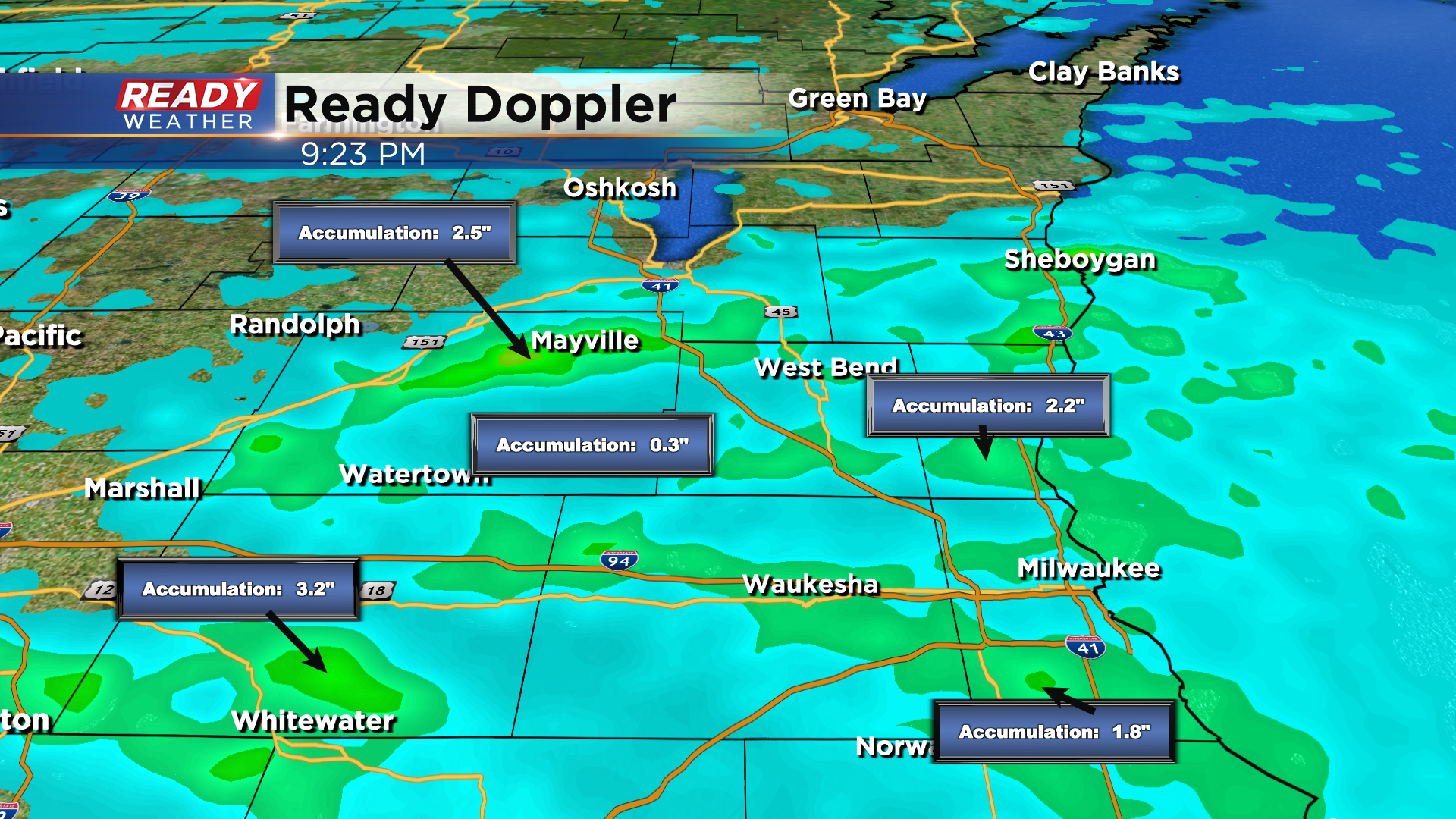
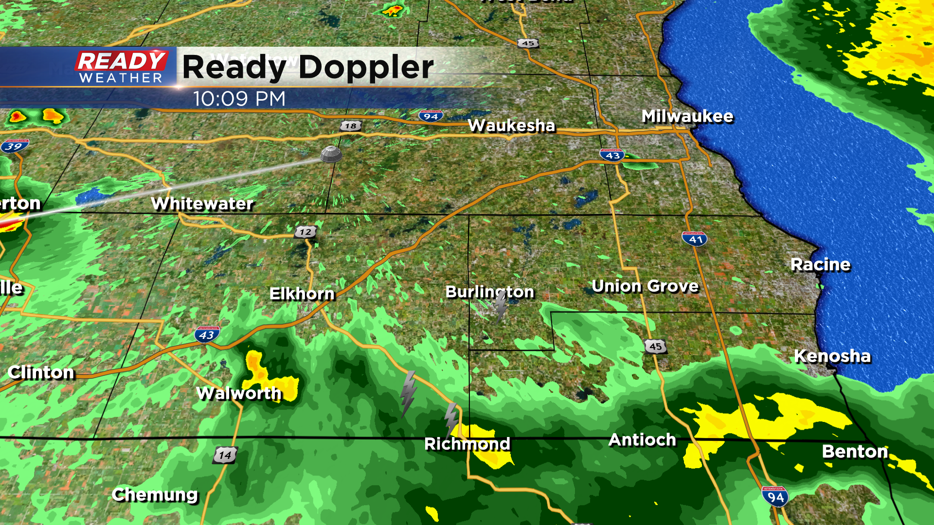
The good news is that the line of storms is drifting south of I-94 giving the Milwaukee area a chance to dry out. Officially the Food Advisory for the county goes until 10:45pm. Another report of flooding closed two lanes of Highway 41 near Center St. for a time this evening. As always if you encounter a flooded road turn around. You don't know what is underneath the water!
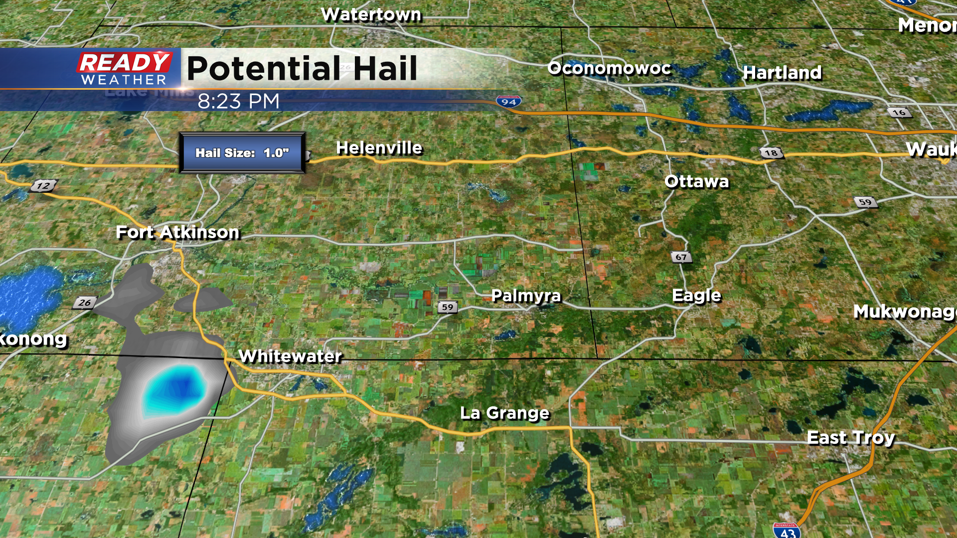
8:30pm Update: Severe storms rumble on. A newly issued Severe Thunderstorm warning is in progress for Walworth county until 8:45pm. The concern here is for quarter size hail. Our radar is picking this up nicely just southwest of the Whitewater area:
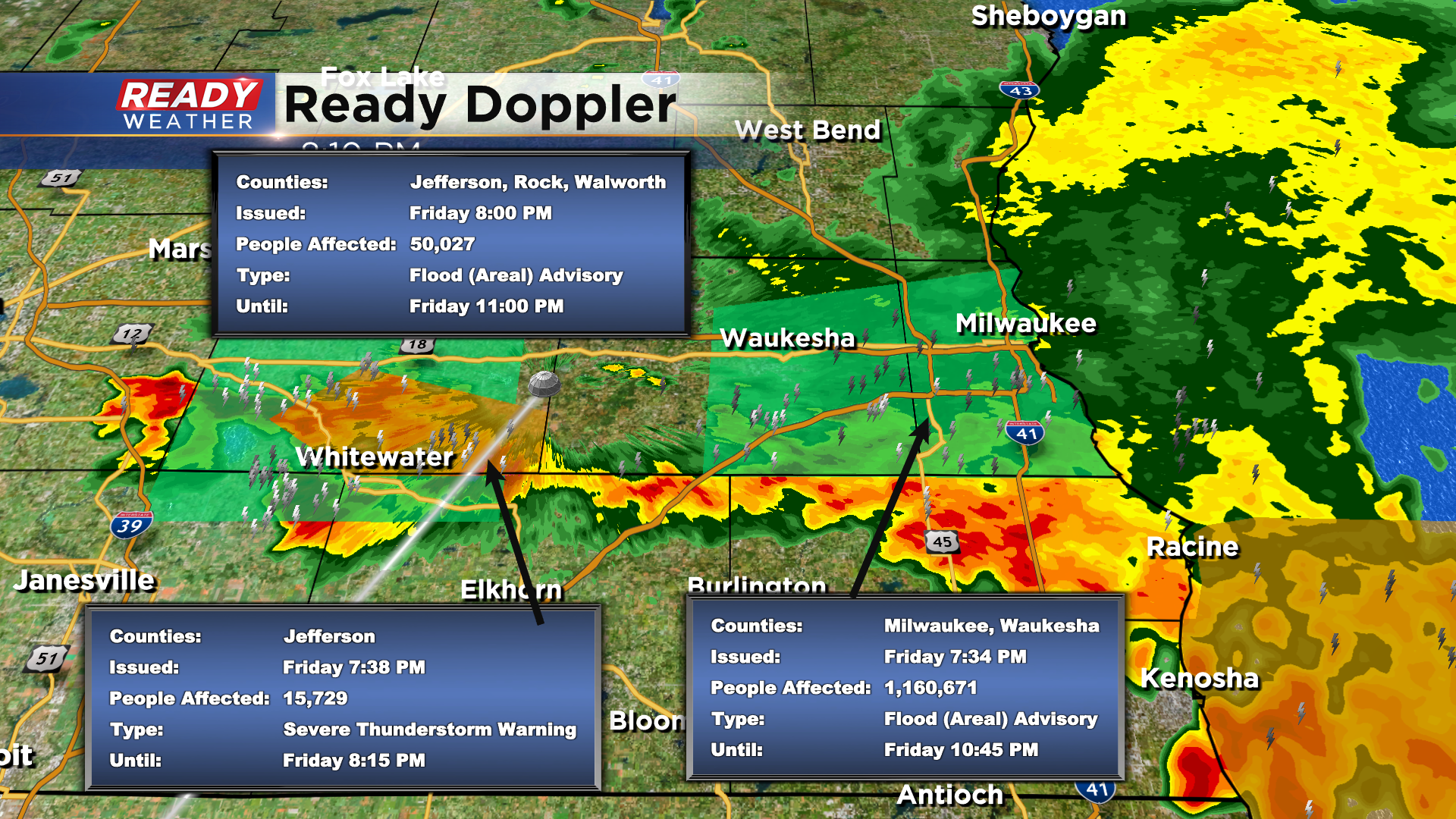
8pm Update: Strong to severe storms continue this evening. We've had reports of funnel clouds, quarter size hail and wind gusts to 50mph along with heavy rain thunder and lightning. Here's the latest on advisories and warnings:
Cluster of strong to severe storms continues to slowly drop to the east-southeast. This cluster has remained below severe limits for the last hour, but has still been producing sporadic 50 mph and pea sized hail.
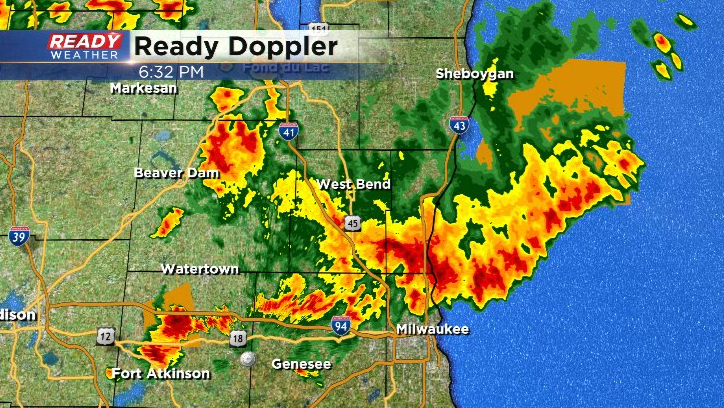
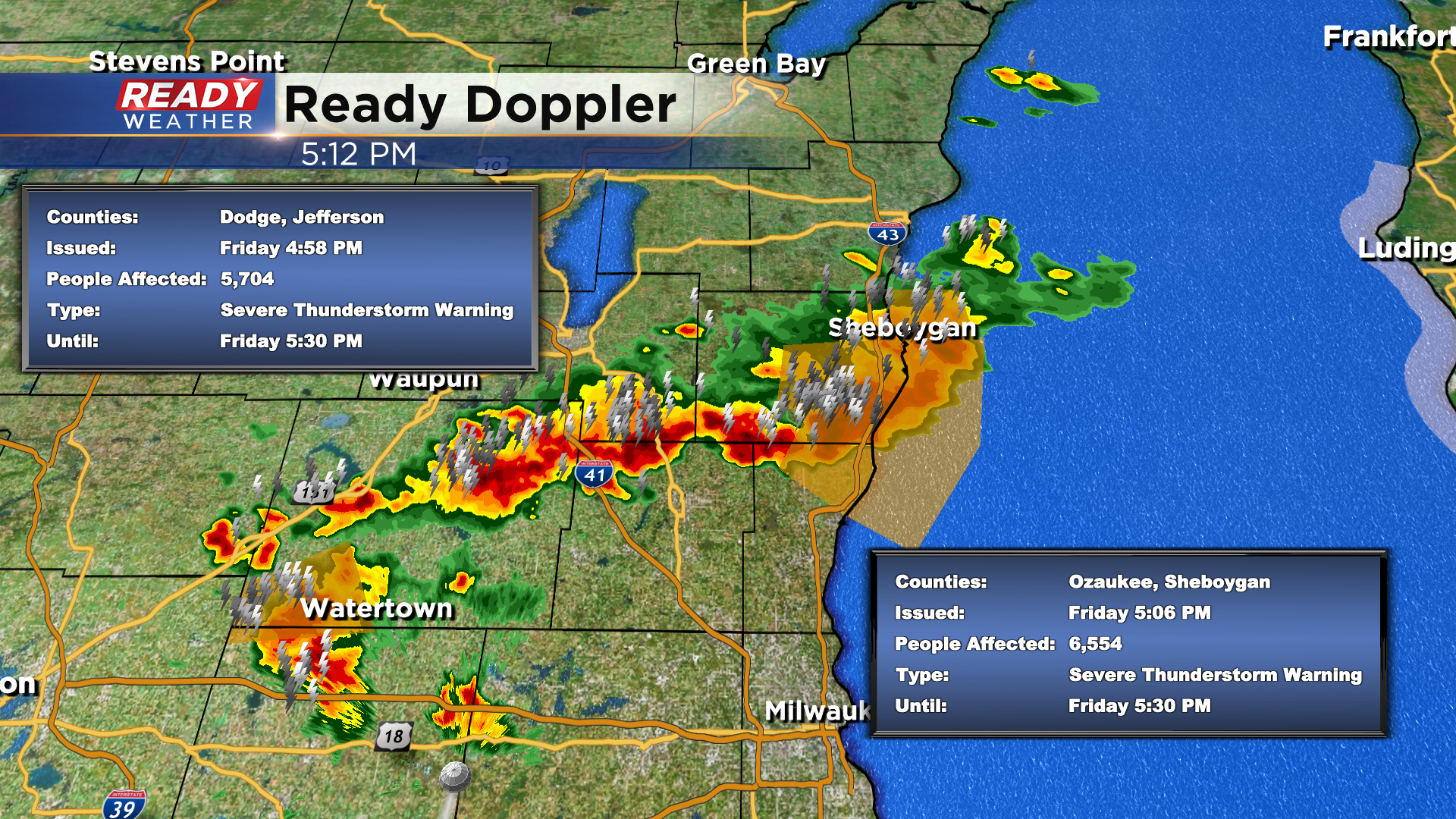
As of 6:30 pm, there's a Severe Thunderstorm Warning in effect in Jefferson county that run through 7 pm. Quarter sized hail and winds up to 60 mph are the main threats with this cell.
--------------------------------------------------------------------------------------------------------
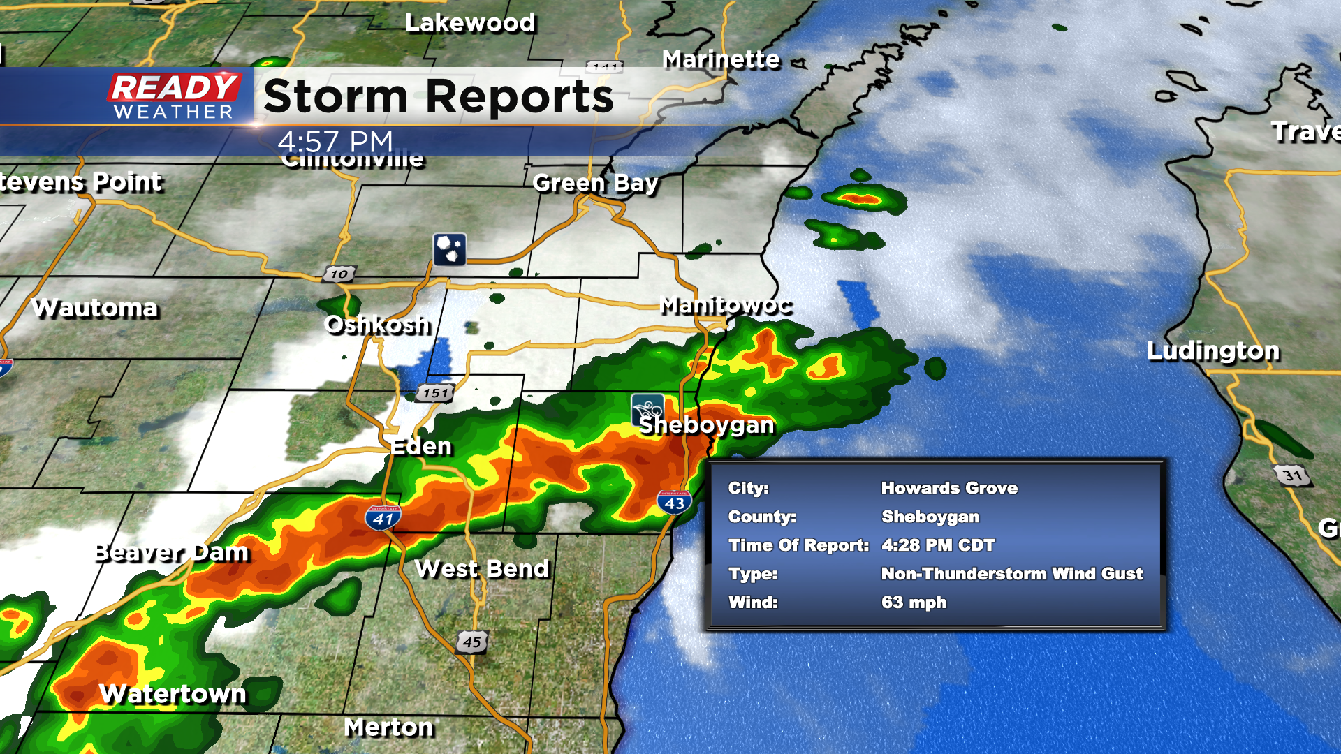
The heat and humidity is building and now we're seeing severe storms pop across the viewing area. Currently we've had wind gusting as high as 63 mph in storms rolling through Sheboygan county.