Storms return late Saturday afternoon then warmer and more humid through Memorial Day
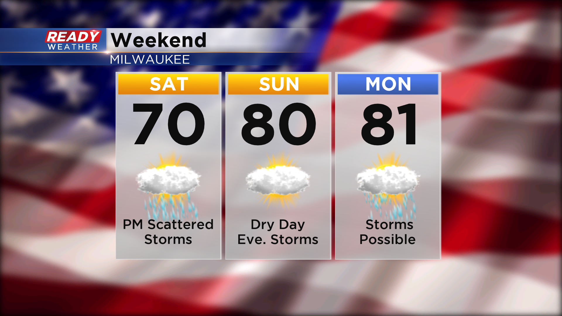
Memorial Day weekend is known as the unofficial start of summer, and our weather will more summer-like this weekend with warm and humid air moving in the area, along with a few chances for storms. While there will be chances for storms each day, there will be plenty of dry stretches throughout the weekend to get outside, including most of Sunday.
Lake clouds and fog will move onshore tonight and will hang around the area into Saturday morning, especially lakeside. While these clouds should dissipate by late morning, more clouds will move in from the west ahead of a low pressure system that’ll trigger a batch of rain and scattered storms later in the afternoon into the evening.
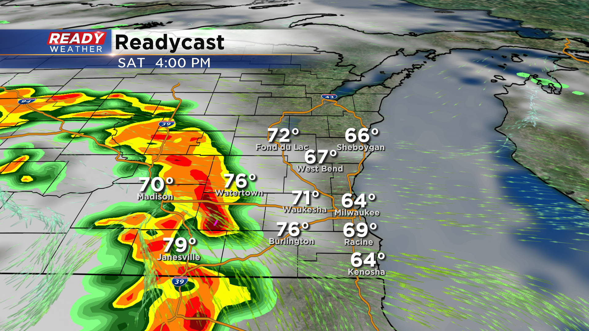
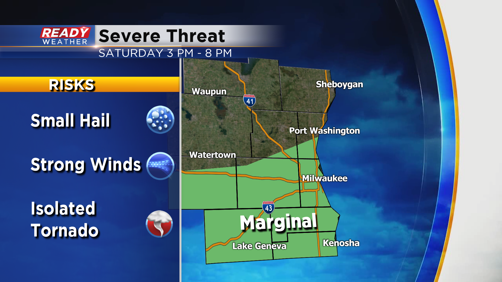
Scattered storms could be moving into south central Wisconsin as early as 2-3 p.m. Saturday afternoon, tracking through southeast Wisconsin between 4 and 8 pm. A few of these storms could be on the strong side if there are some decent breaks in the cloud cover during the afternoon.
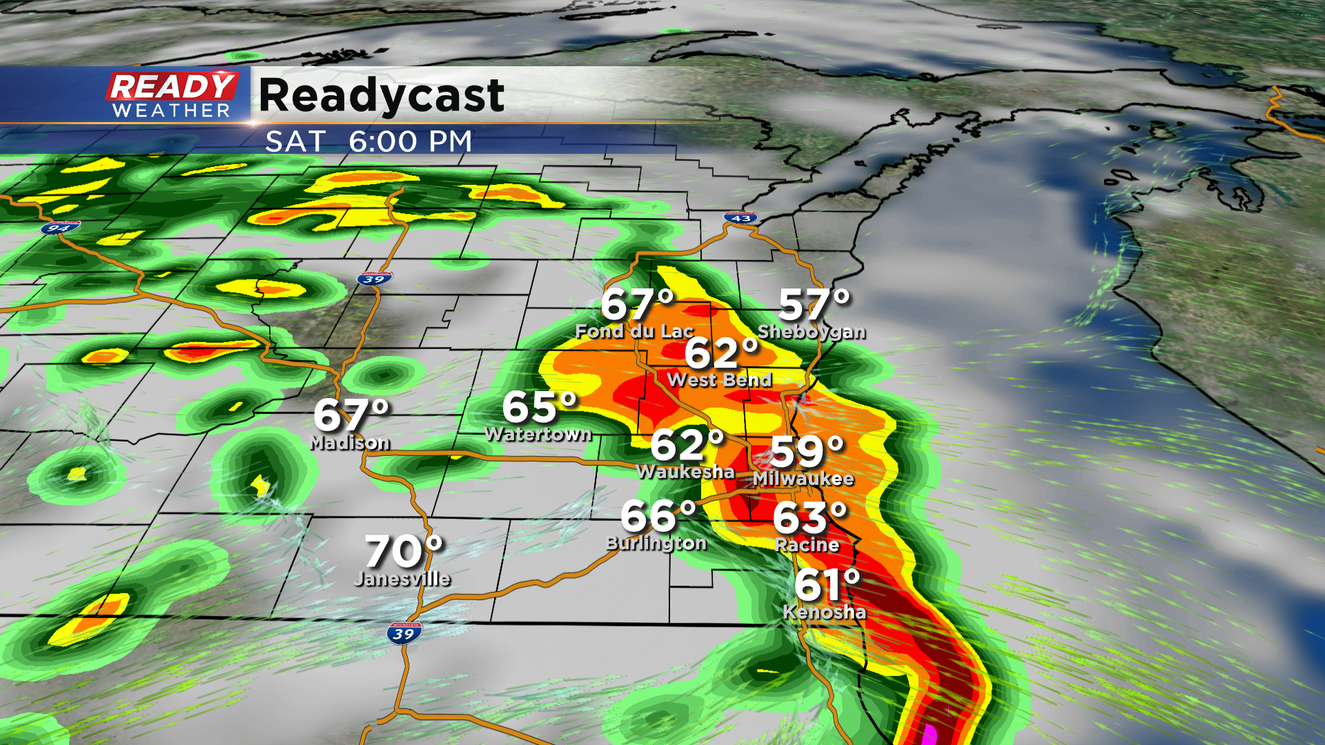
Isolated hail or strong wind gusts will be the primary threat, but an isolated tornado can’t be ruled out. An easterly wind will keep temperatures cooler and limit the severe storm potential near the lake, so the best chance for severe storms will be south and west of I-94. A level 1, Marginal Risk for severe storms is in place for parts of SE Wisconsin due to this risk.
We should dry out during the day on Sunday and turn warm and humid, but chances for storms return Sunday night. More scattered storms are possible Monday afternoon. Download the CBS 58 Ready Weather App to track the weekend storms and to get severe weather alerts sent to your phone.
