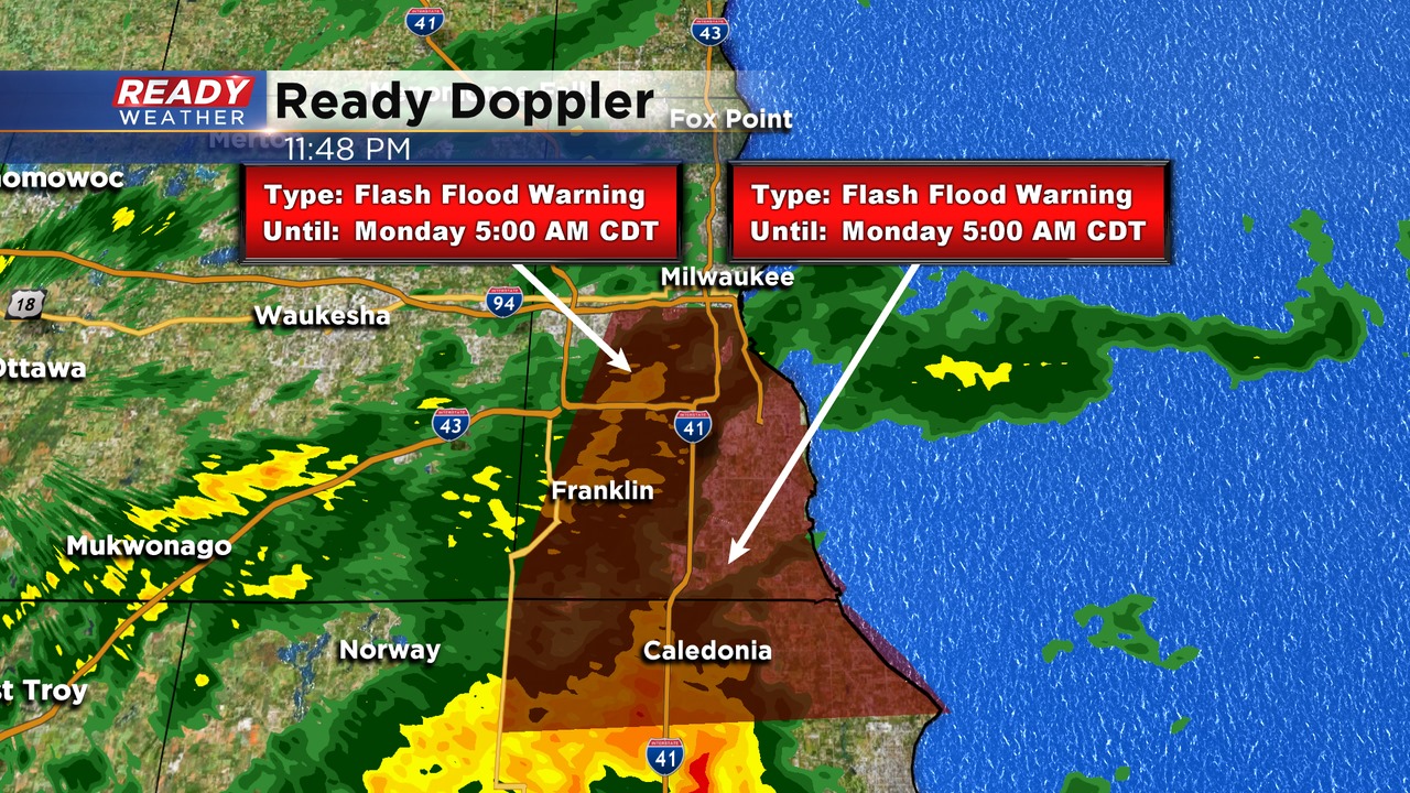
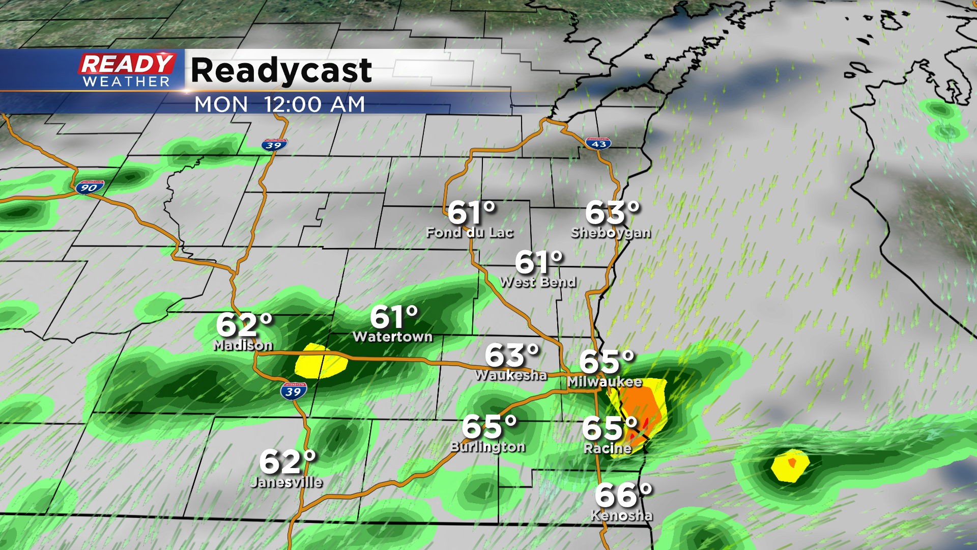
11:55 pm Update: Heavy rain is ending, but flooding continues across MKE county


Updated: 11:55 pm Sunday, August 2nd:
Due to the ongoing rain, flooding, and road closures, the Flash Flood Warning for Milwaukee and Racine counties has been extended through 5 am Monday.
--------------------------------------------------------------
Updated: 11:30 pm Sunday, August 2nd:
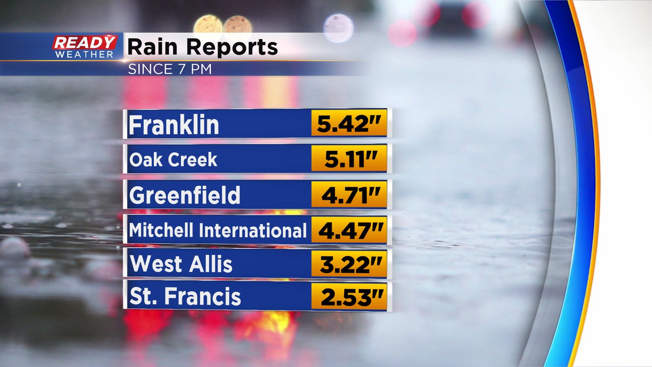
The stationary storm has finally weakened and dispersed, but not before causing flash flooding across southern Milwaukee county. A new Flash Flood Warning is in effect through 1:15 am and includes northern Racine county.
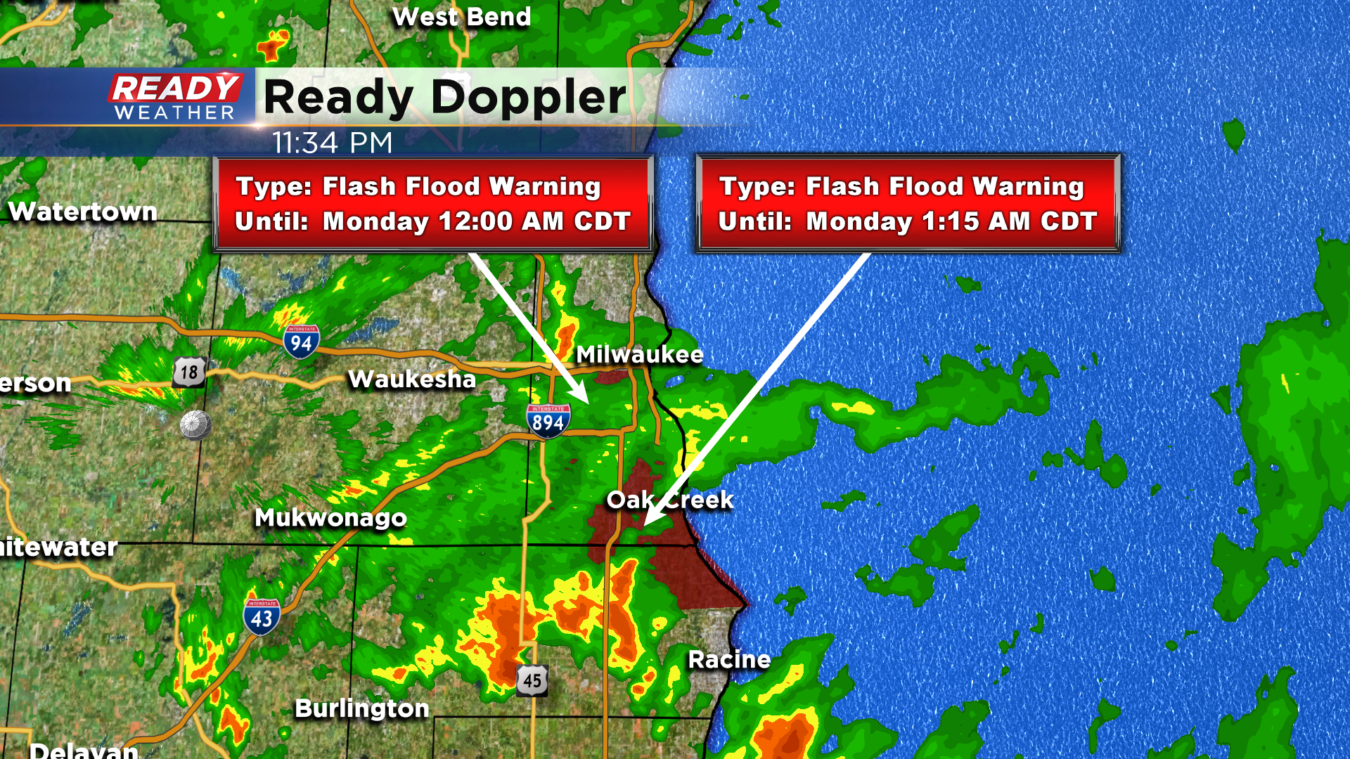
Rain totals from 7pm - 11pm show 3-5.5" of rain has fallen in parts of Milwaukee county, including 2" in one hour at the airport.
Numerous roads are closed across southern Milwaukee county, including a complete shut down of I-43 Eastbound, due to flooding. Turn around if you encounter any flooded roadways!
---------------------------------------------------------------------------
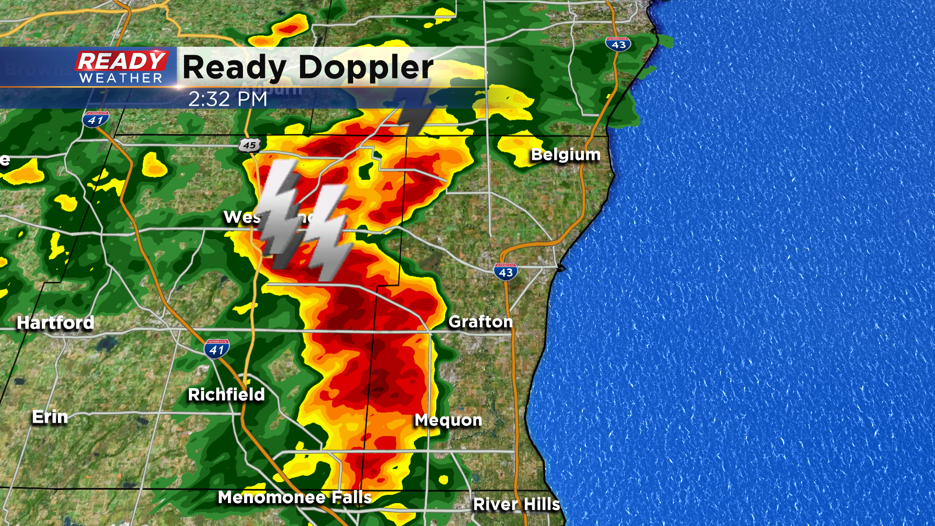
Updated: 9:05 pm Sunday, August, 2nd:
A Flash Flood Warning has been issued for Milwaukee through midnight tonight as a stationary thunderstorm has dropped 1-3" of rain in Milwaukee over the last 2 hours. The storm isn't showing any signs of movement or weakening, so flooding is imminent, especially from Greenfield to the airport to the 3rd Ward.
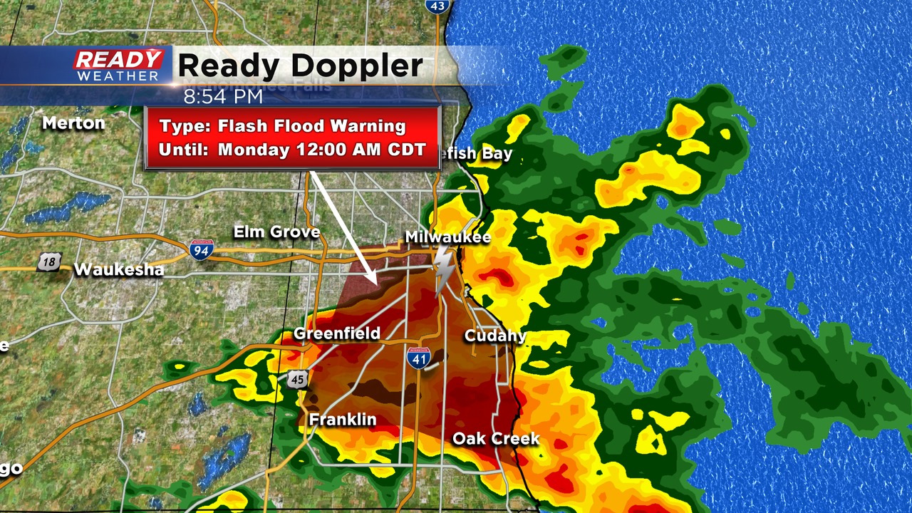
Remember to never drive through flooded roadways!
----------------------------
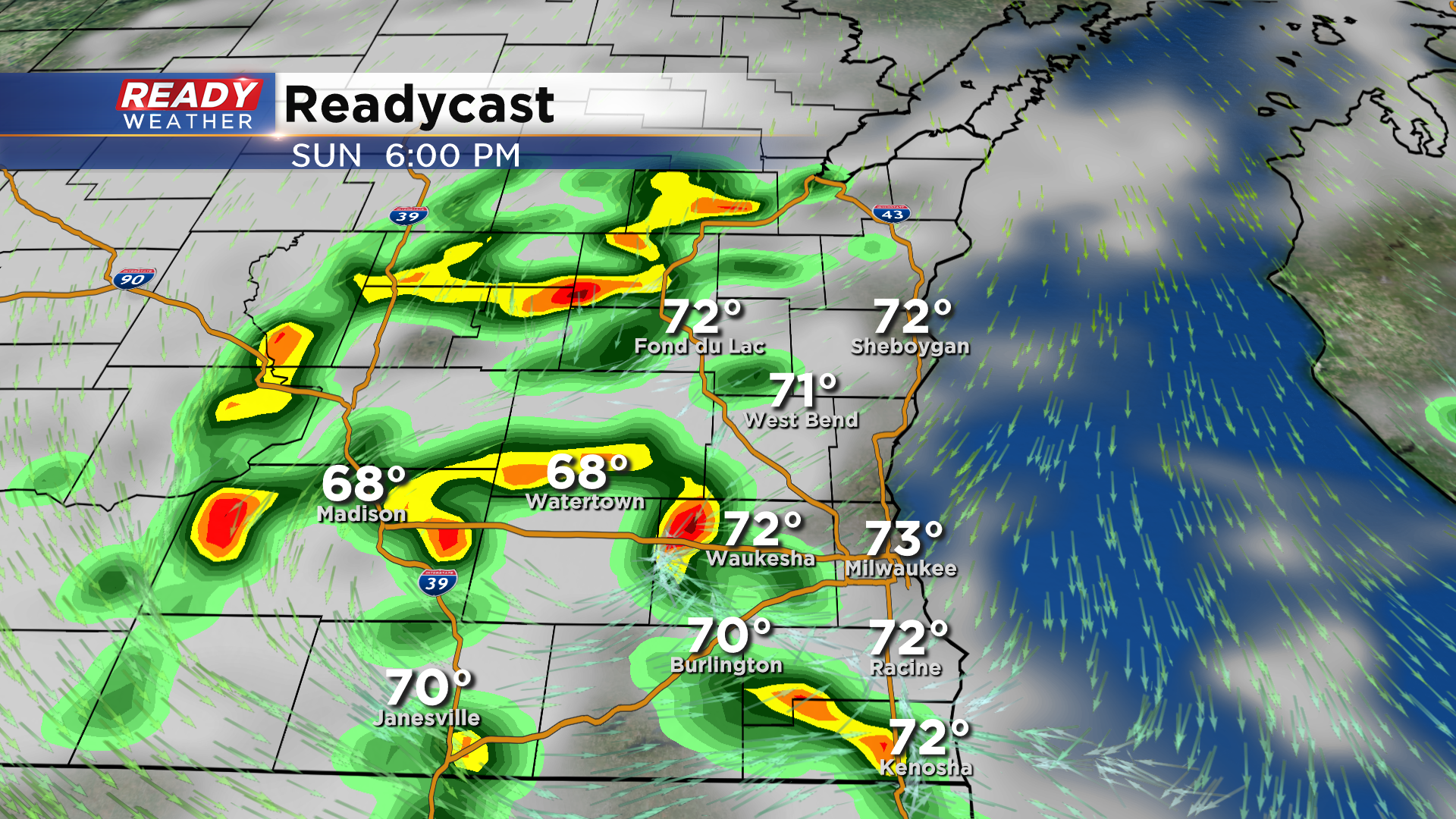
Updated: 6:15 pm Sunday, August 2nd:
Most of the thunderstorm activity has pushed over Lake Michigan, but one heavy rain producing storm is still moving southeast through Walworth county.
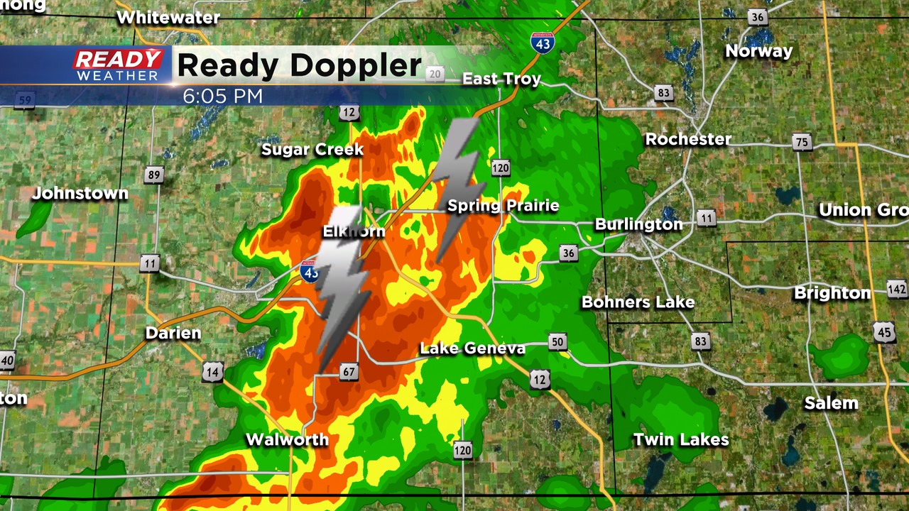
Additional spotty showers will continue through tonight, but they will be much lighter than what moved through earlier this afternoon.
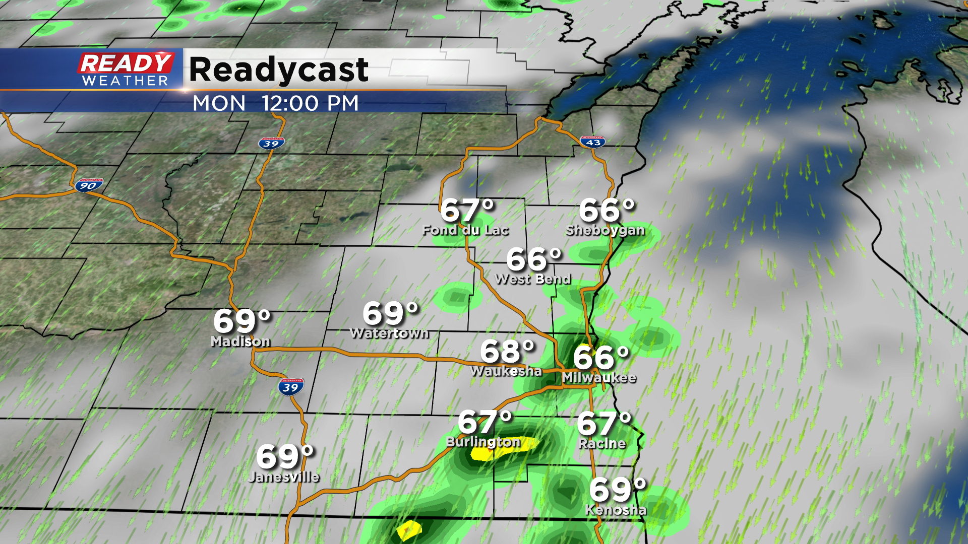
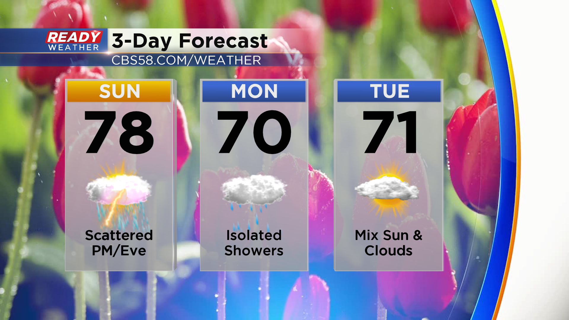
The cloud cover and isolated showers will continue off and on throughout the day Monday. Breezy NNE winds of 20-30 mph along with the clouds and showers will make Monday feel more like a fall day with highs in the upper 60s.
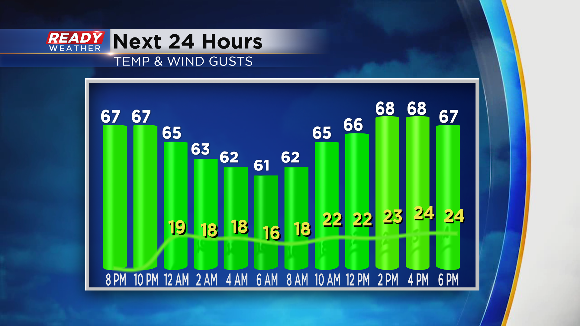
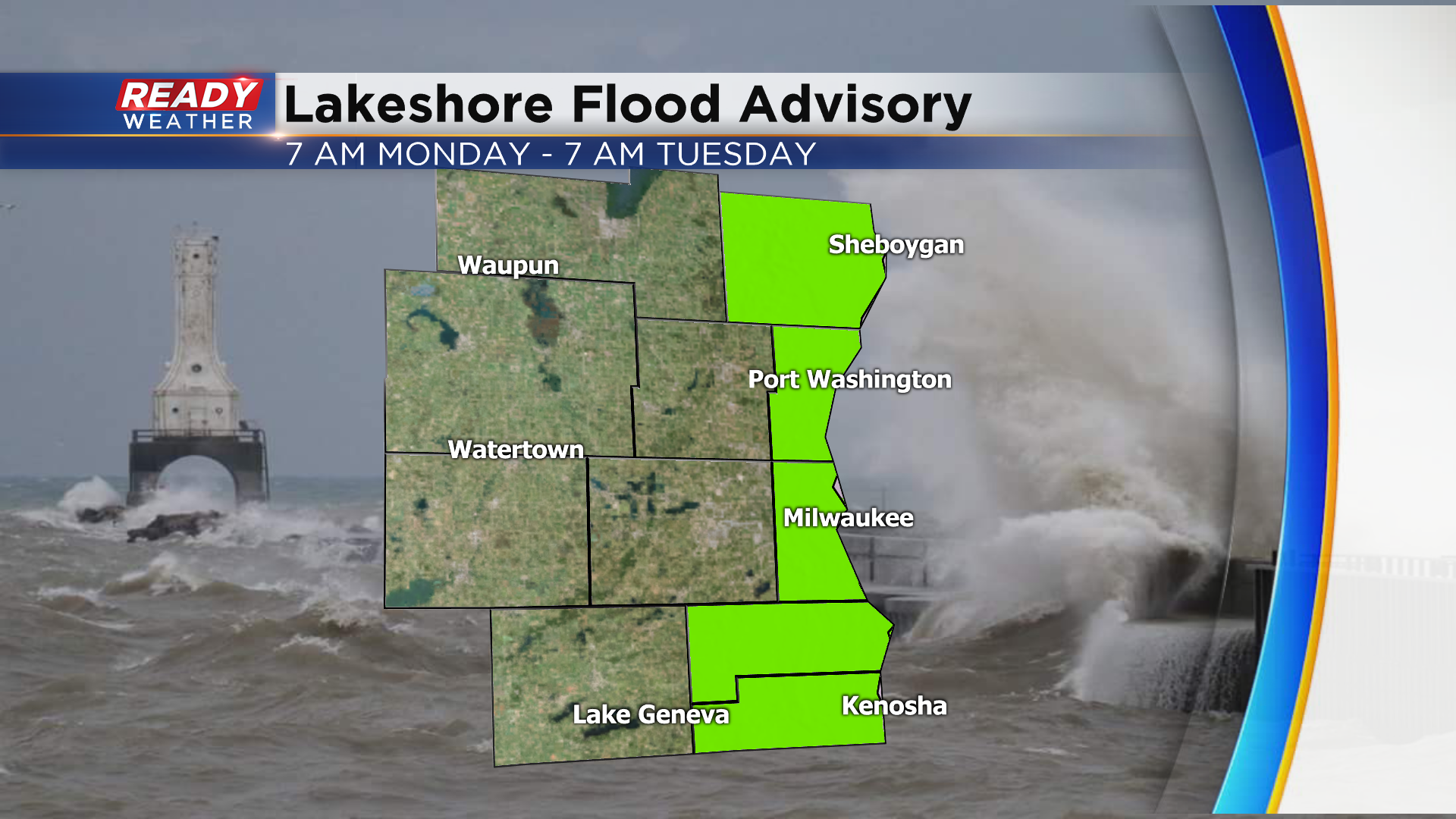
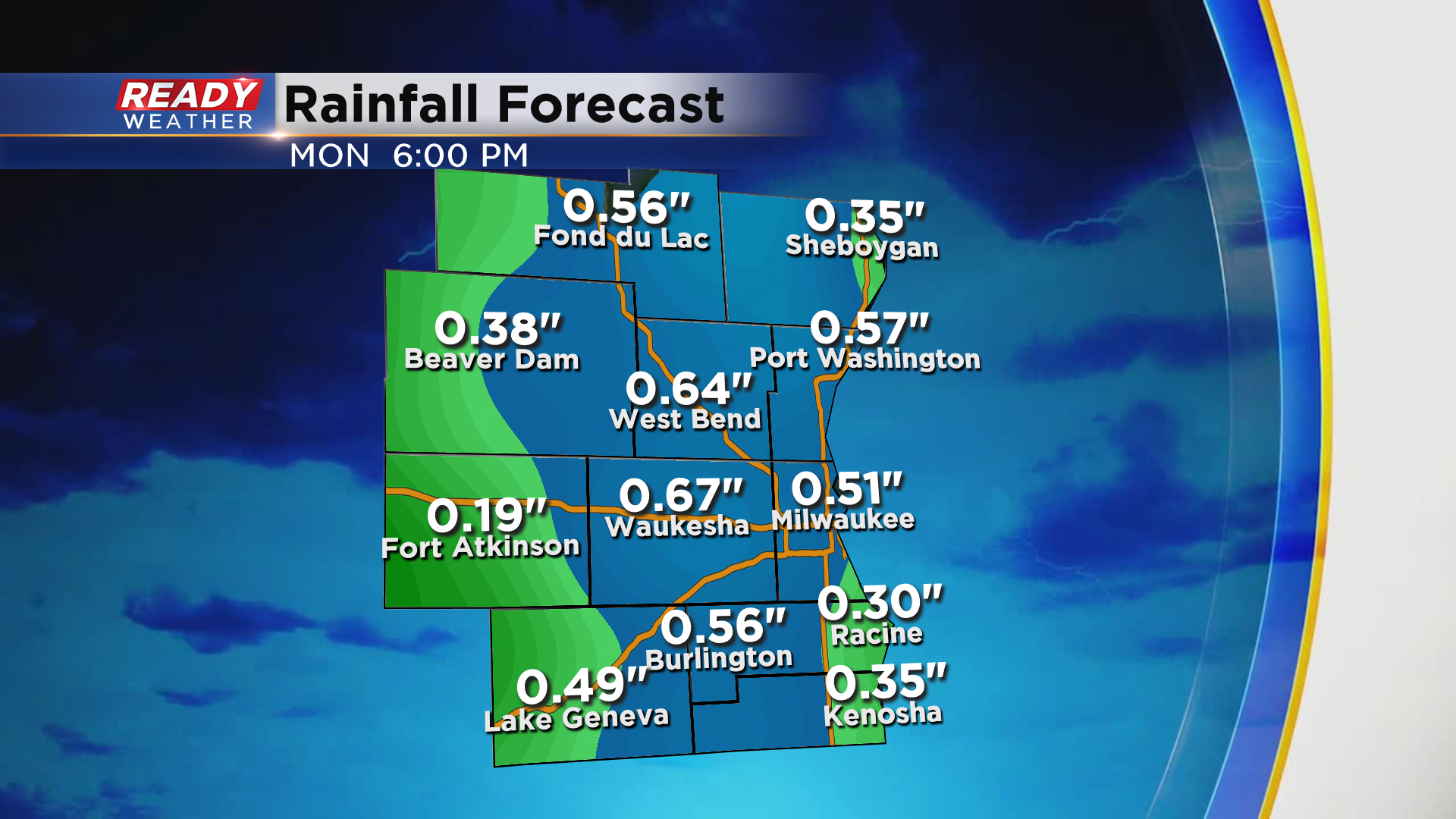
The persistent, gusty onshore winds will cause waves on Lake Michigan to grow between 5-8 ft Monday into Monday night, and with lake water levels still high we could see some lakeshore flooding. A Lakeshore Flood Advisory will go in effect Monday at 7am and continue through 7 am Tuesday for all lakeshore counties.
Drier weather will move back in for the middle of the week.
-----------------------------------------------------------------------------------------------------------------
Updated: 2:30 pm Sunday August 2nd:
A line of storms is slowly pushing to the east, but it's progress is being slowed by an inland moving lake breeze. Very heavy rain, upwards up 2 inches per hour, is falling from these storms. Due to their slow moving nature, this could lead to localized flooding, especially if the storms sit in one location for an extended period of time.
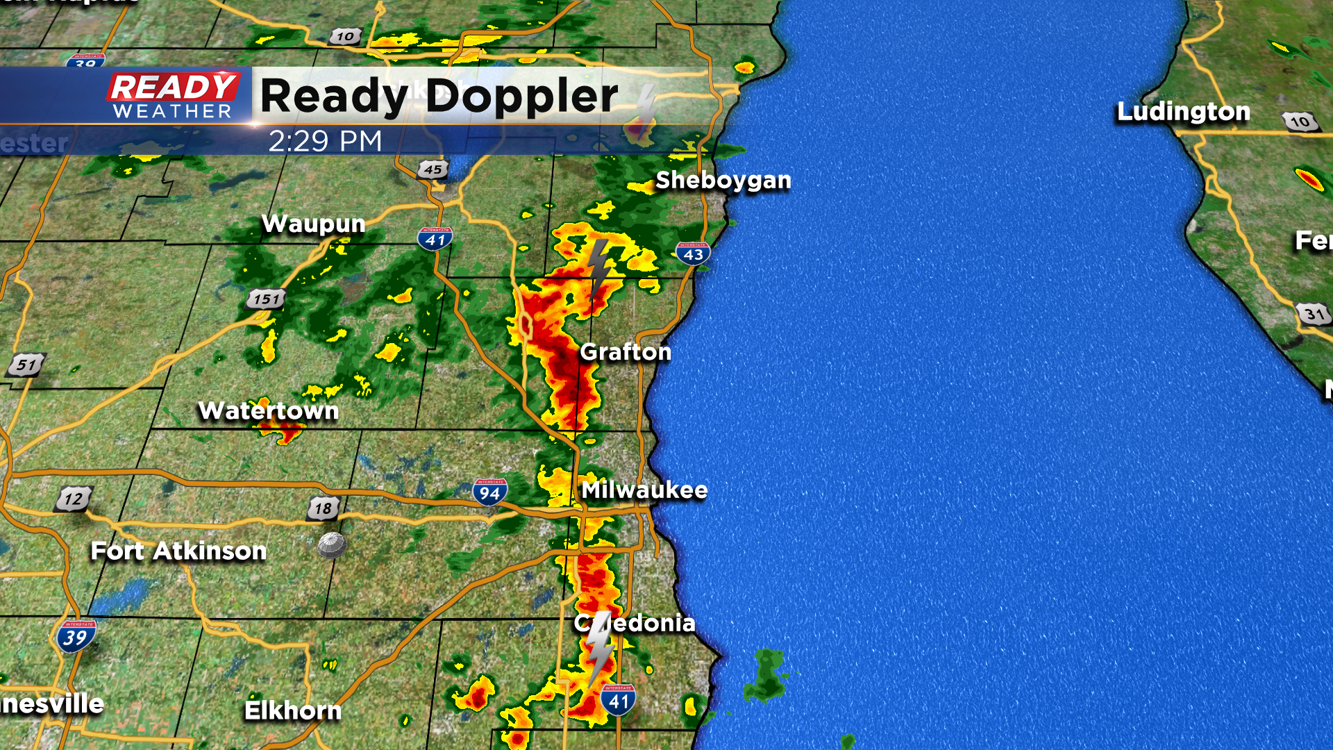
The strongest storm is closing in on Washington county, where small hail and gusty winds up to 40 mph will be possible.
Additional showers and storms are expected into this evening.
---------------------------------------------------------
We're starting this Sunday with mostly sunny skies across southeast Wisconsin, and this dry weather should continue for the next few hours. However, scattered showers in central Wisconsin are slowly approaching from the northwest and will impact the area this afternoon and evening.
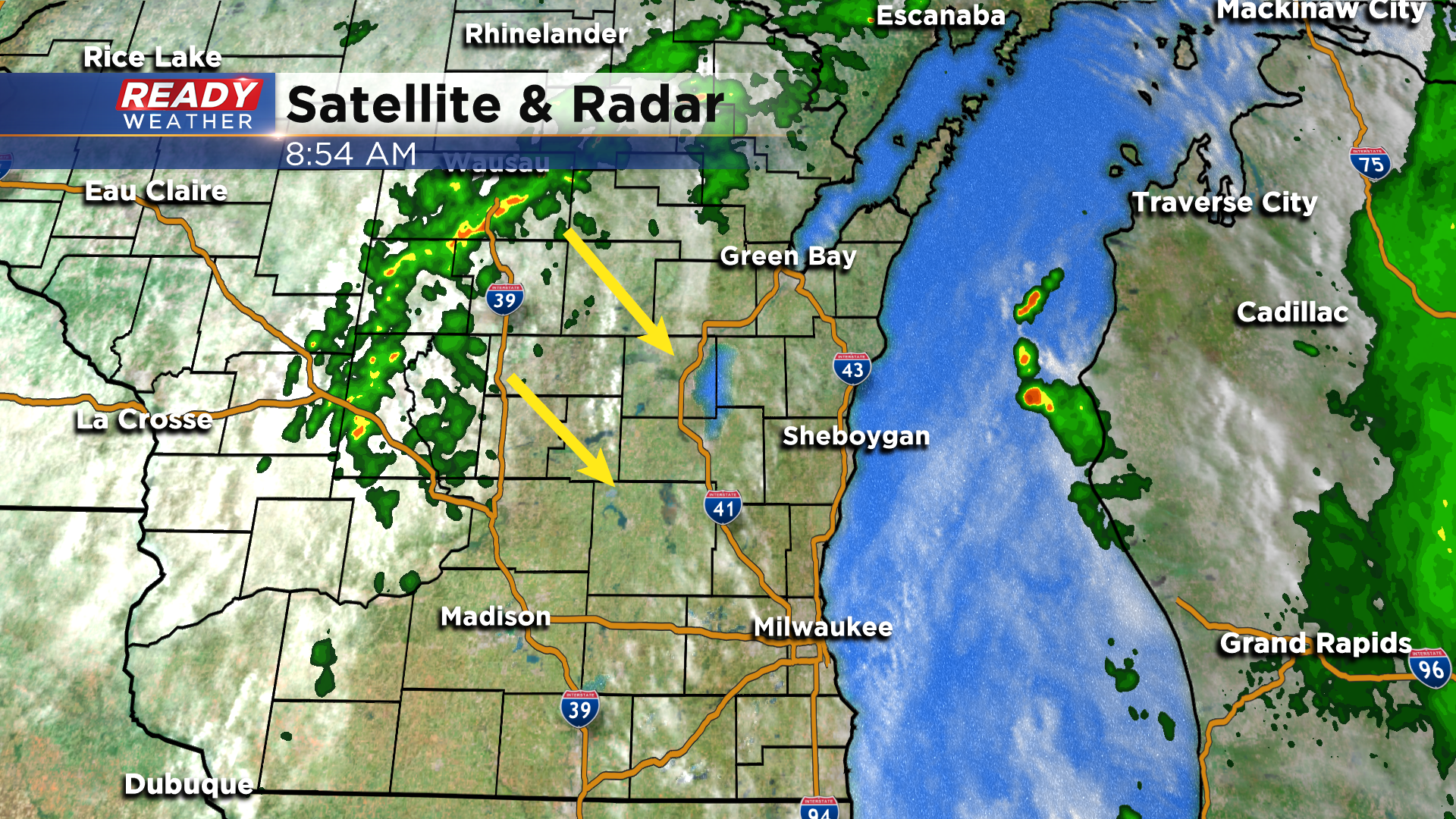
Scattered showers and isolated storms look to fire early in the afternoon along the lake breeze in our eastern counties.
Spotty rain and storms will become more numerous throughout the afternoon as a cold front slowly slides in from the northwest. A few of these storms could produce heavy downpours and cloud to ground lightning, but severe weather is not expected.
Any storms will fizzle out after sunset, but isolated showers will continue through the night.
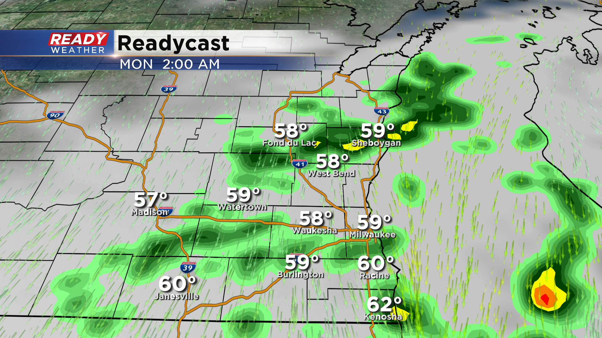
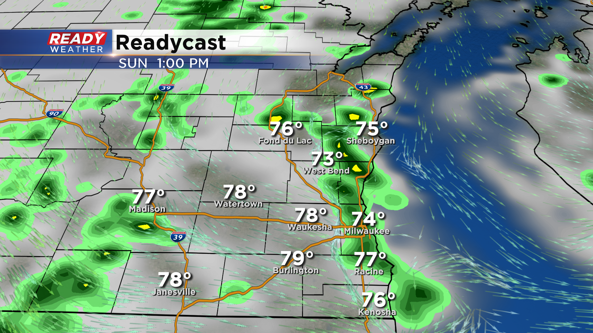
Additional spotty showers are expected off and on during the day Monday as the upper level low spins over the Great Lakes.
Rainfall totals between .25-.75" will be common around southeast Wisconsin, but totals over 1" will be easily attainable if any showers or storms sit over one location for an extended period of time.
Highs should make it into the upper 70s this morning before the showers cool us back down. The clouds, showers, and breezy northerly winds will make it feel more like a raw fall day on Monday with highs struggling to reach 70 degrees.
Download the CBS 58 Ready Weather App to track the scattered afternoon showers and storms.