Rain, warm up expected
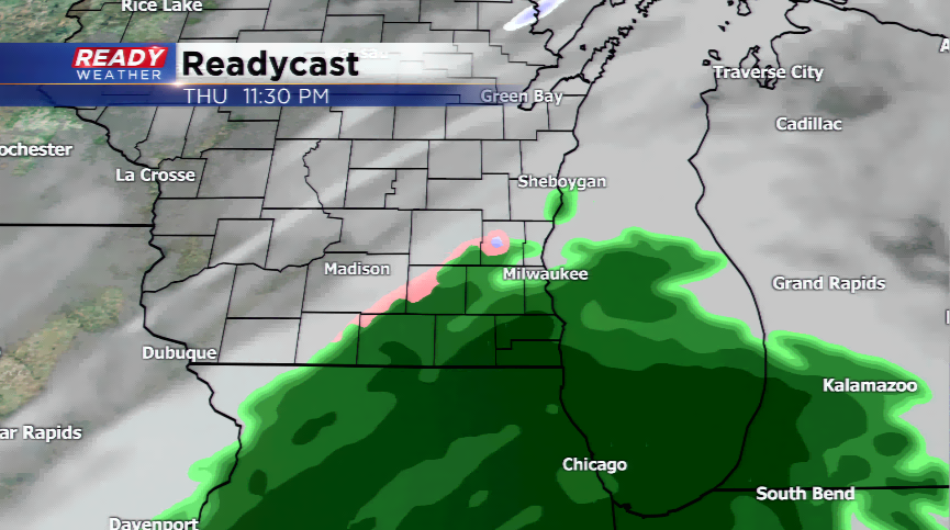
Moisture has been on the increase the last 12 hours as a Dense Fog Advisory is posted for the northern parts of our viewing area this morning. The main concern in the forecast after the fog moves out is the next storm system moving in from the south. This cutoff low will generate rain showers tonight, and at times, could produce freezing rain/mix. The primary focus will be exactly where the frozen precipitation could fall, and it looks like the best threats will be along the leading edge later tonight.
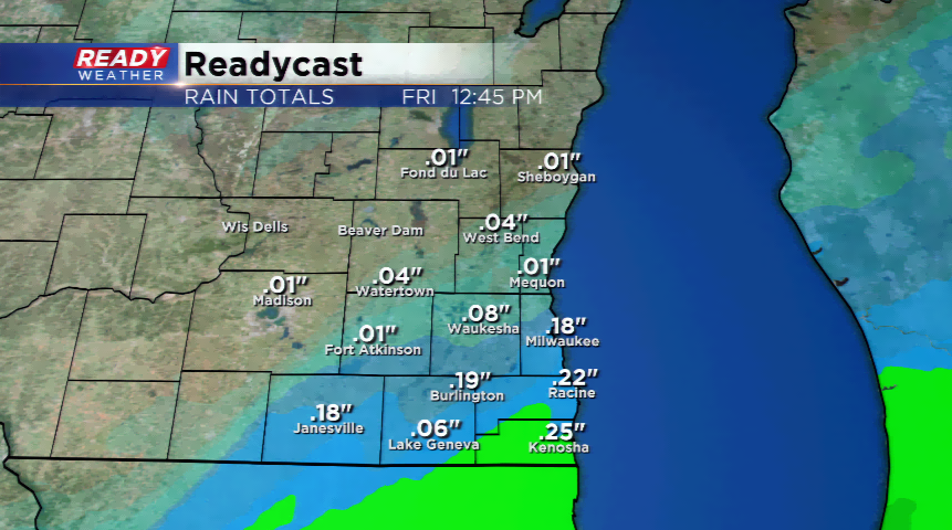
Rainfall totals will be very light, if any, north of Milwaukee. South of Milwaukee will see most of the rain, and along the border nearing 0.25”. If any snow falls it would be a dusting and likely melt quickly with the mild temperatures.
Speaking of the temperatures, a great stretch of above average temps are expected with highs nearing 40 through next week.
