A soggy Thursday continues


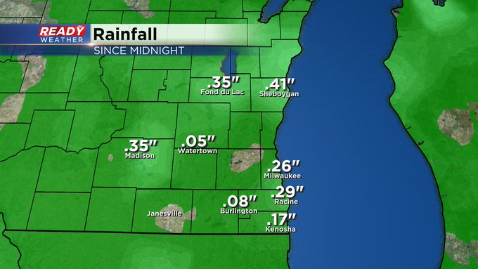
2:30pm Update: Rain is now the predominant precipitation type this afternoon in our major cities. Here's a look at totals so far today:
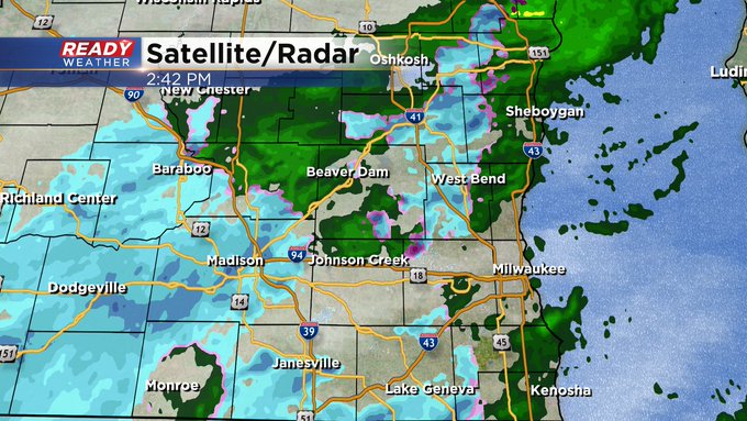
Keep the umbrella handy, although wet weather is becoming more spotty in nature. today as rain and wet snow will pass through southeast Wisconsin throughout today. Rain and wet snow have already pushed into areas near and north of I-94 early this morning and will continue to overspread the area through sunrise.

This event will mainly be rain near the lake with wet snow well inland, transitioning to a mix of wet snow and rain by midday.


Rain with a few wet snowflakes will continue through the afternoon and become more isolated later this evening. Isolated rain showers will be possible in the far SE corner of the state tonight into early Friday morning before drying out.

A coating of wet snow is possible today, mainly west of Waukesha. This will mainly accumulate on the grass, but watch out for slick spots on untreated roads in Dodge, Jefferson, and Fond du Lac counties.

Temps warm into the upper 30s to low 40s today and will stay in that range through Saturday. Temps to cool back into the mid 30s to end the year with a few light snow showers on Sunday.

Download the CBS 58 Ready Weather App to track the rain and wet snow throughout today.