


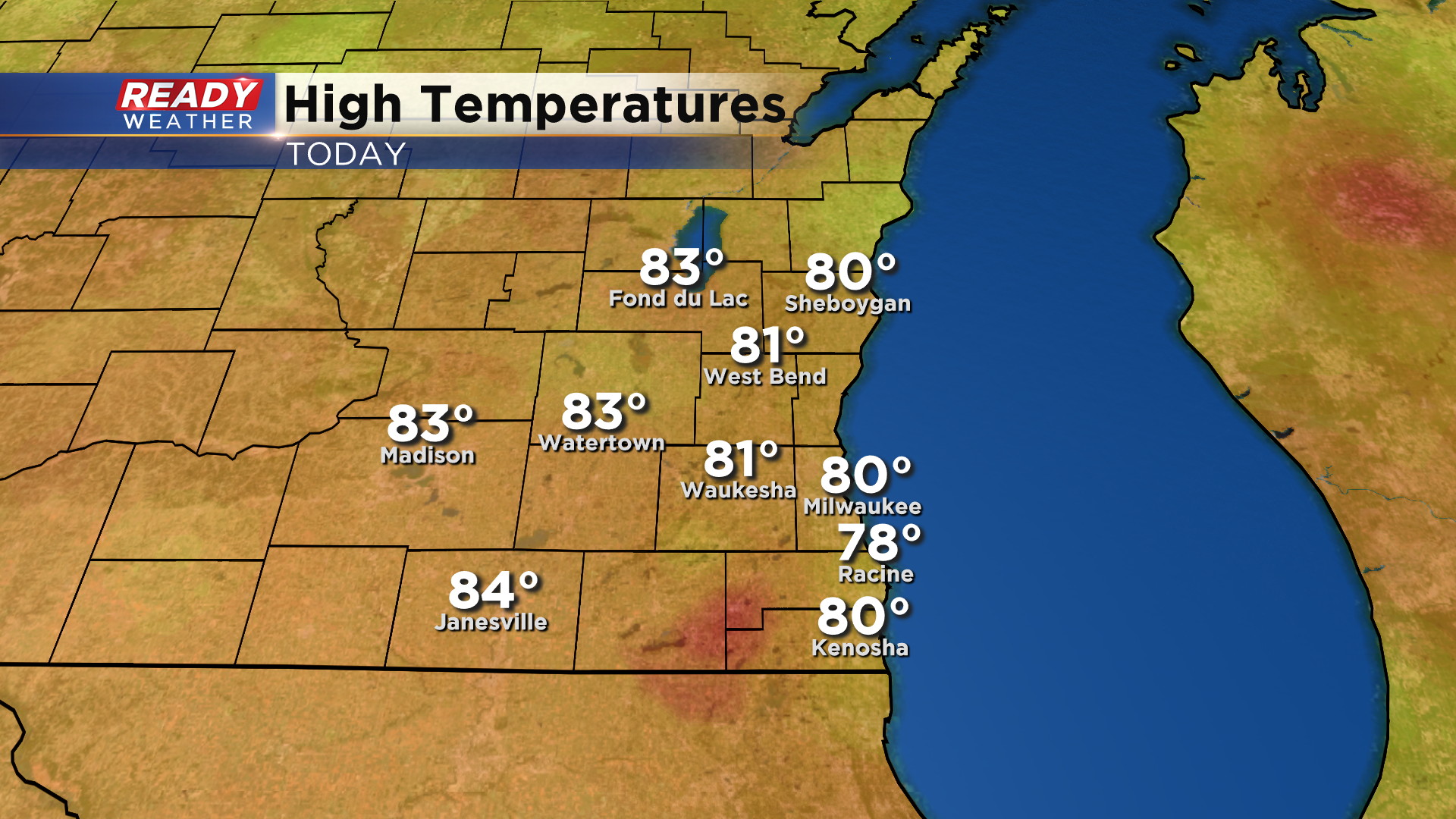
Today was a picture perfect day across southeast Wisconsin with most of the area topping out in the low 70s under sunny to partly cloudy skies.
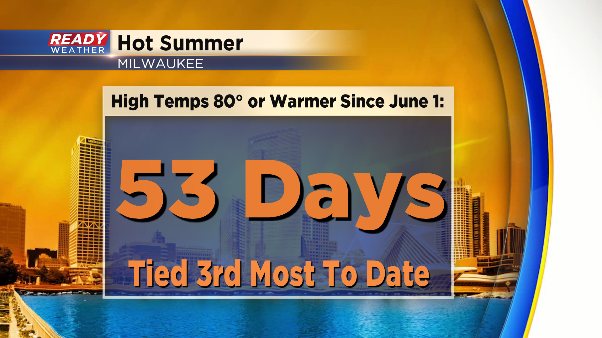
This marked Milwaukee’s 9th day in a row in the 80s and the 53rd time we’ve had a high temp in the 80s or warmer this summer. That’s tied with the summer of 2010 for 3rd most through August 16th.
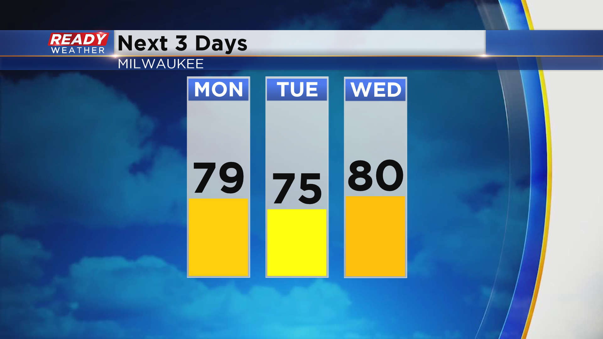
Highs will cool into the mid to upper 70s for most of us the next two days, but the 80s look to return by Wednesday and stick around through the second half of the week.
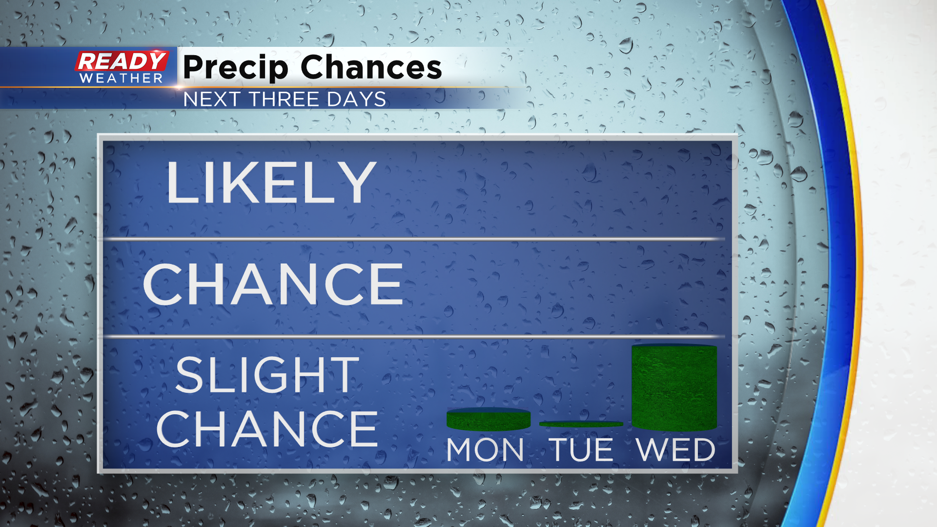
While we can't rule out an afternoon sprinkle Monday afternoon, most of the area will be dry Monday and Tuesday. A few isolated showers or storms will be possible on Wednesday as a weak disturbance moves through, but not everybody will see rain.
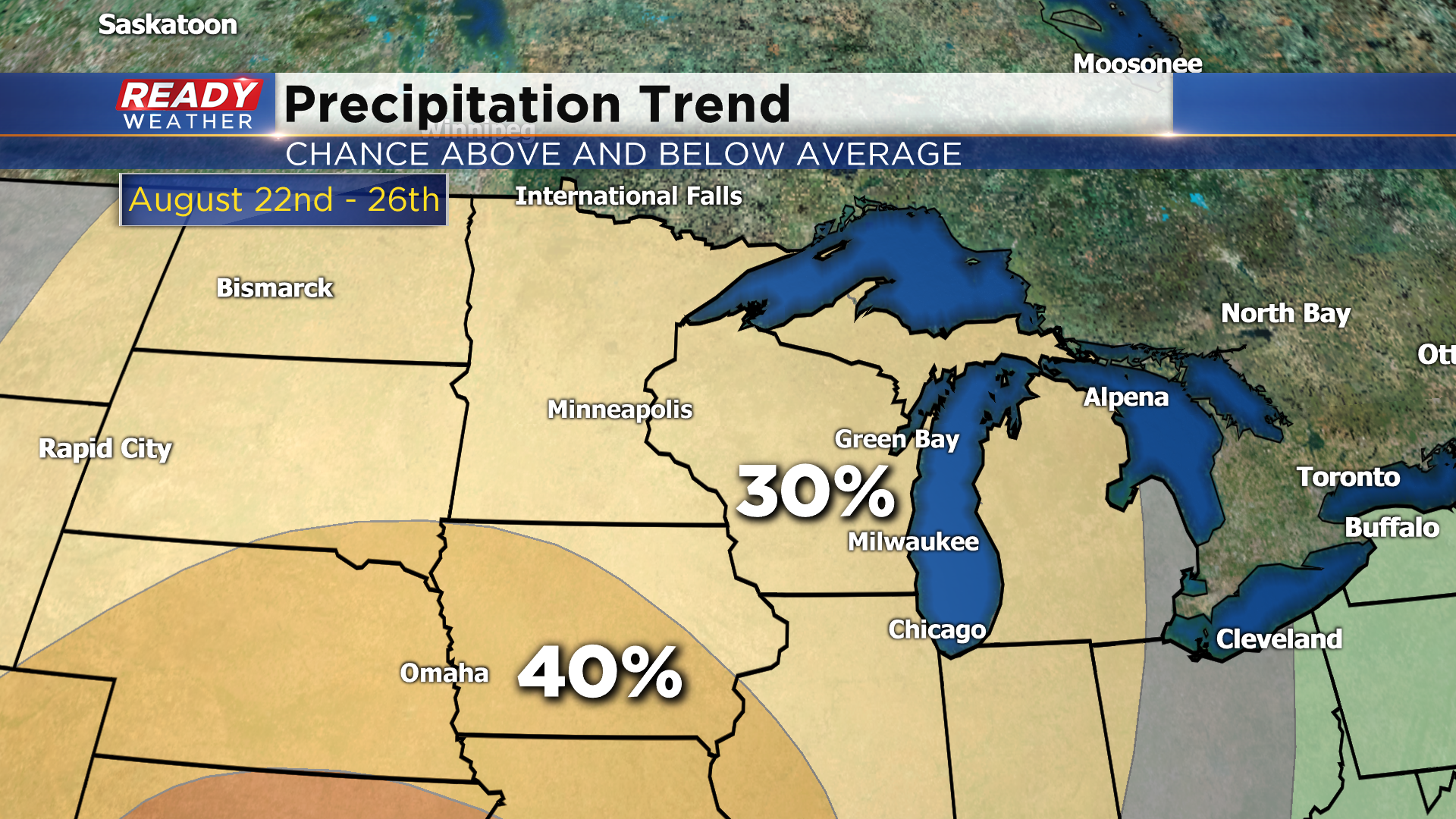
Rain chances will return with another cold front by the weekend, but there are no major systems on the horizon to provide a much needed soaking rain. In fact, the Climate Prediction Center's precipitation outlook shows a 30% chance for below normal rainfall from August 22nd through 26th.
Download the CBS 58 Ready Weather App to track any pop up sprinkles.