


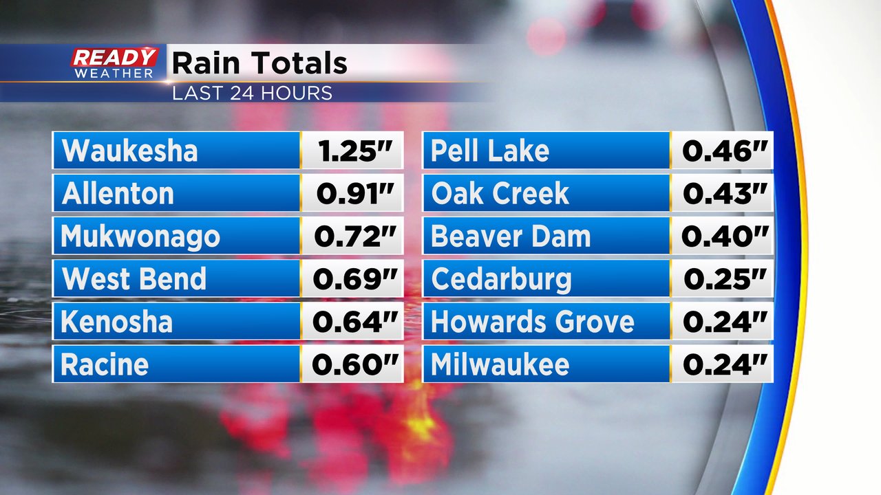
Southeast Wisconsin saw some good showers and a few storms on Monday. Thankfully all of them stayed below severe limits, but we did get some nice rain. Rain totals saw most of the area in the 0.25-0.75" range with a few locations a bit higher. Waukesha topped the list at 1.25" of fresh rain. Southern counties that are still in an extreme drought did get another nice helping of rain.
A few lingering showers from Monday will wrap up pretty quickly Tuesday morning leading to dry weather the rest of the day. Wednesday afternoon and evening look better for some showers and an isolated storm. A stronger storm can't be ruled out but the chance looks even less than Monday. Most weather models are dry for Thursday but one does bring in some PM rain, so a pretty low chance there right now.

Wednesday's rain should be confined to the afternoon and evening and then start to dry out a bit after midnight going into Thursday morning. Rain totals with any new rain on Wednesday should be lighter than Monday with less than a quarter inch expected.

Download the CBS 58 Ready Weather app to track the next round of rain.