Early this morning a few complexes of storms produced hail and very heavy rain as they moved across southeastern Wisconsin. Another chance for storms remains in the forecast for tonight.
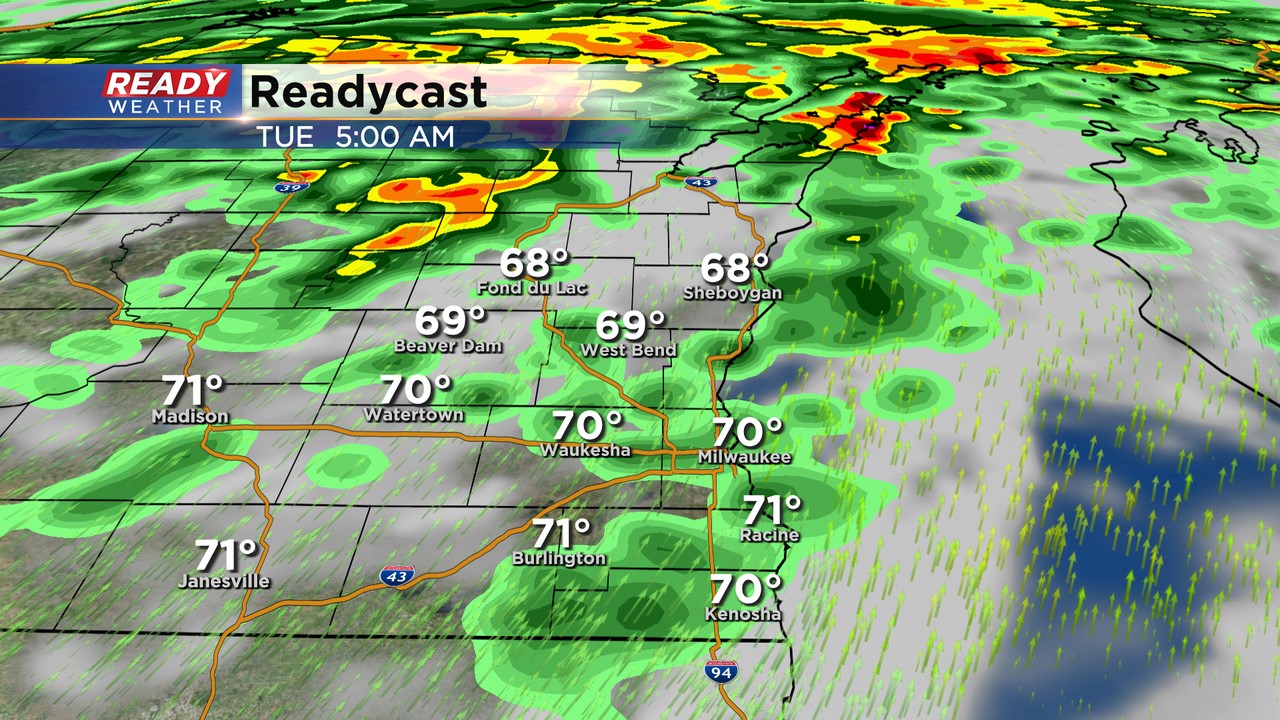
This evening plan on some isolated showers and rumbles of thunder north of I-94. These storms will likely remain well below severe limits. Later tonight a ribbon of air around 5,000 ft known as the low-level jet will increase to produce more storms.
The jet will produce another round of robust storms across central Wisconsin. The best chance for severe weather will be north of our area.
We can't rule out more storms that are capable of producing hail. Best chance for those will be throughout our northern counties.
