More snow and arctic air arrive Thursday into Friday

-
1:41

1 arrested after deadly hit-and-run near 22nd and National, police...
-
3:40

Visit Milwaukee preview: July 10-12
-
2:35

’Our hearts are broken beyond words’: All children killed...
-
6:03

CBS 58’s Theater Thursdays: ’Gail Daughtry...’ and ’Ladies...
-
2:33

Scattered storms likely Thursday after some saw heavy rain Wednesday
-
1:53

Wisconsin Athletic Hall of Fame welcomes 4 new members
-
1:00

Young adults credited with rescuing family from Lodi house fire
-
0:27

Kids help clean wheelchairs at Wauwatosa senior community
-
1:09

Bobby Portis reconnects with fans at Milwaukee pop-up shop
-
3:23

During Milwaukee visit, Vance accuses Johnson of acting ’odd’...
-
5:06

Summerfun Horse Show returns to Wisconsin State Fair Park
-
2:20

Milwaukee mayor wants I-794 freeway to stay, recommends improving...

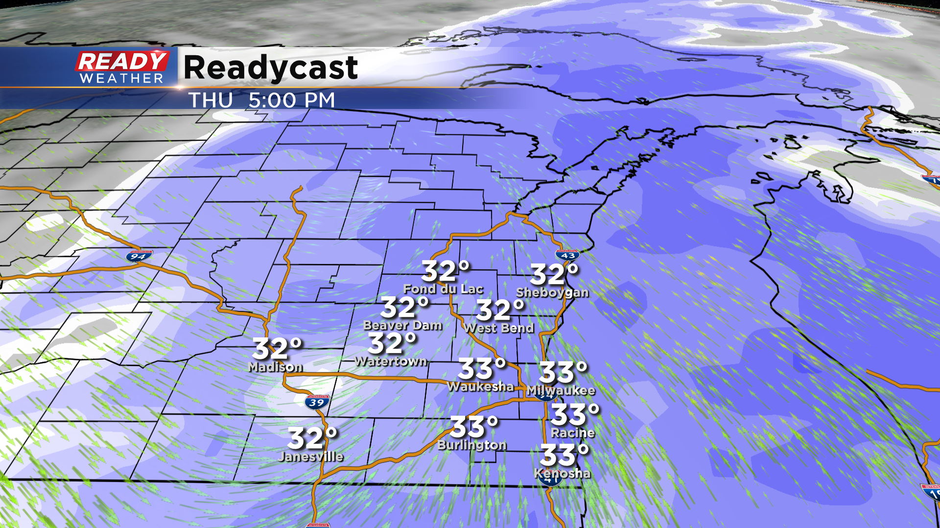
Another round of snow is set to arrive across southeastern Wisconsin on Thursday. Between 6 am and Noon expect a wintry mix before it turns over to all snow by lunchtime.
The Thursday evening commute looks very snowy across the entire metro. The snow will linger overnight into early Friday morning. Snow should be done by the morning commute on Friday. Roads Thursday evening will be slick and snowy.
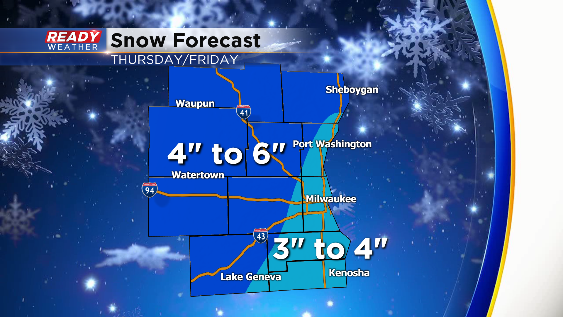
Most of the area will receive 3" to 6" of snow. The highest totals will be across our northern and northwestern areas. Some spots there could be over 6".
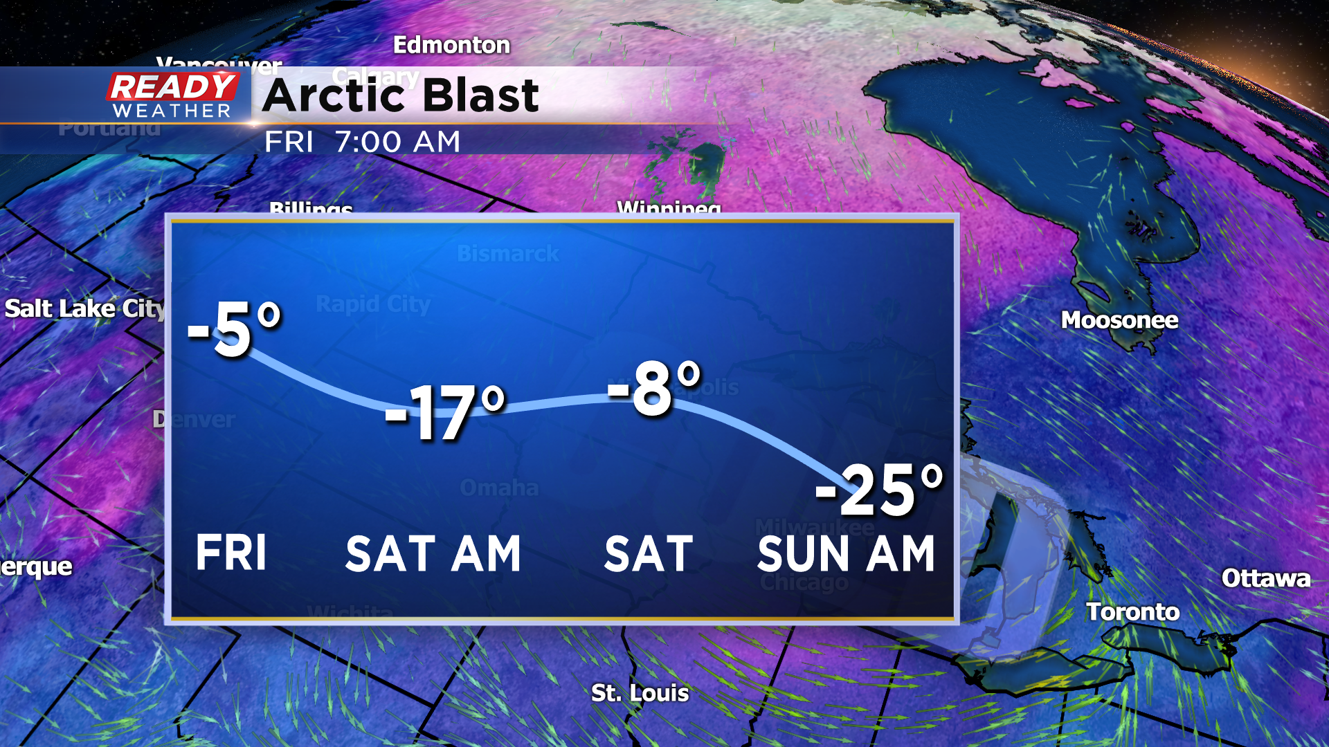
The coldest air of the season is set to arrive on Friday into the weekend as arctic air invades the Midwest. Take a look at the forecasted wind chill graphic above. Wind chills will be subzero for several days creating very dangerous conditions!