Massive storm brings rain, then snow, to southeast Wisconsin


If you have been paying to the larger national weather story then you know there's a massive winter storm moving across the entire country. Tuesday morning the storm spans from blizzard conditions in North Dakota to tornado warnings in Oklahoma and Texas. Southeast Wisconsin is seeing the lull before the storm Tuesday morning with rain and some mix arriving Tuesday evening.
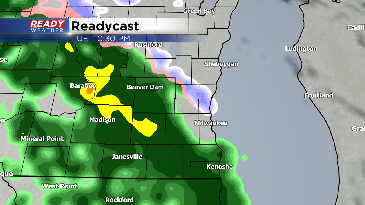
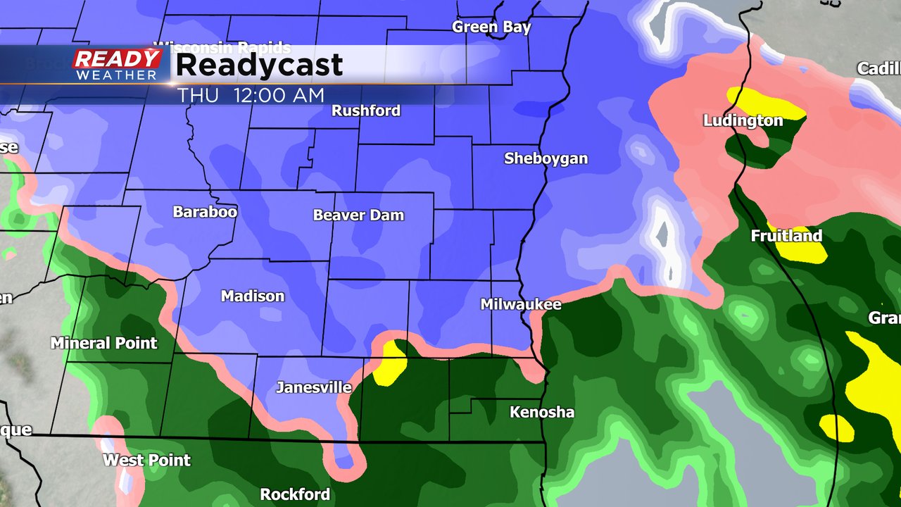
We see mostly rain during the first half of this storm. The rain could be heavy at times Tuesday night and during the day on Wednesday. There might be some snow and mix as the rain first falls Tuesday evening through the early part of the overnight going into Wednesday. Cold air will return Wednesday night mixing and switching the precip back to snow. Wednesday night into Thursday morning will be our best chance for accumulating snow in southeast Wisconsin.
With the significant impacts of this storm there are plenty of warnings, watches and advisories already issued for many regions across the Upper Midwest. A winter storm watch and winter weather advisory is already in place for northern Wisconsin where some areas could see 6-12" of snow. There's a wind advisory in Iowa, a winter storm warning in the Dakotas and Minnesota, and ice storm warning around Sioux Falls and a blizzard warning in western South Dakota and Nebraska.

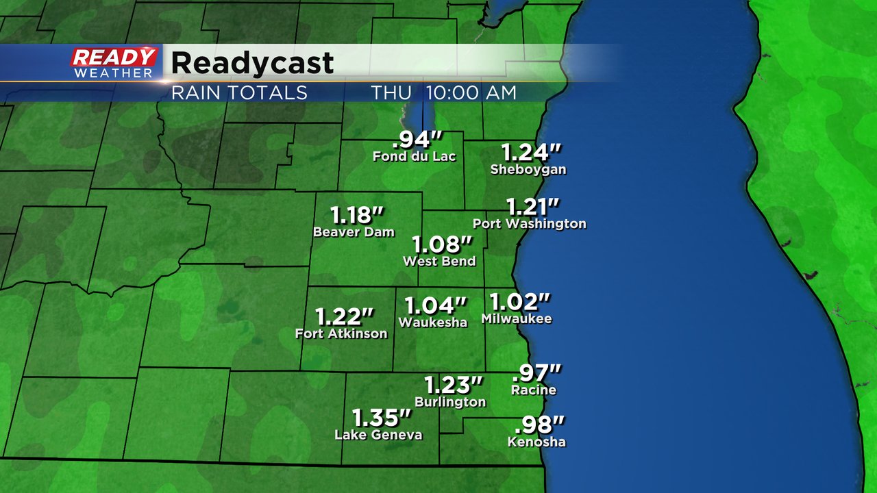
Locally the first half of the storm will be mostly all rain with heavy rain at times falling Tuesday evening through most of Wednesday and into Thursday morning. A solid half inch to full inch of rain will be possible with some areas seeing 1.25" of rain by Thursday morning.
Download the CBS 58 Ready Weather app to track all the rain and snow with the interactive radar.