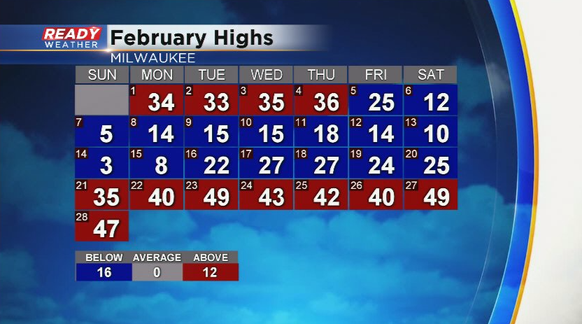
Today marks the last day of meteorological winter, and we had an early taste of spring this weekend. Abundant sunshine and warmth yesterday gave way to foggy and breezy conditions today. While temperatures warmed into the 40s the last 7 days, February will end up around 6 degrees below normal.
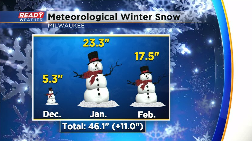
This weekend was the first weekend in 7 weeks that we didn’t have to shovel! Milwaukee picked up 17.5” of snow in February, which was 7.7” above normal. The active weather over the last 6 weeks put Milwaukee at 11” above normal for snow during meteorological winter (December-January-February) with a total of 46.1” of snow.
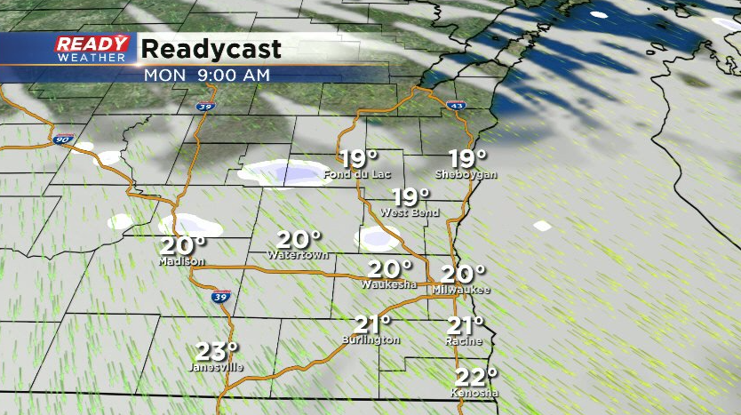
Quiet weather is expected for the first week of March. A weak wave of low pressure will pass through Monday morning, which may generate a few isolated flurries northwest of Milwaukee, but no impacts are expected.
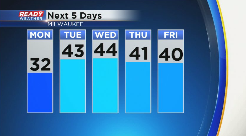
After a chilly day on Monday, temperatures rebound back into the 40s for the rest of the work week with a good deal of sunshine.
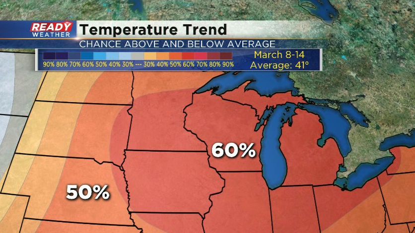
This will continue our ideal snowmelt as temperatures will still drop below freezing at night. Even better news is there’s no heavy rain or snow on the horizon which would cause flooding issues. Spring-like warmth could continue into the middle of March! The 8 to 14 day temperature outlook has a 60% chance of above normal temperatures the second week of March. By then the average high temperature in Milwaukee is 41 degrees.
Download the CBS 58 Ready Weather App to track the Monday morning flurries.
