


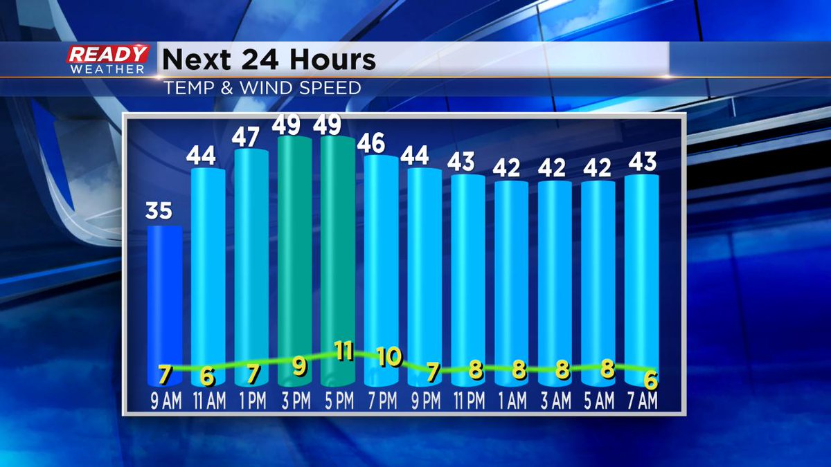
Milwaukee (CBS 58)--Springtime in Wisconsin! Gotta love it. We had record snowfall Sunday in Milwaukee. 4.9" in 24 hours. Some spots to the south, like Bristol and Twin Lakes, saw more than eight inches. Now, we focus on an impressive warmup coming, starting today. Look for highs in the 50s and 60s much of this week.
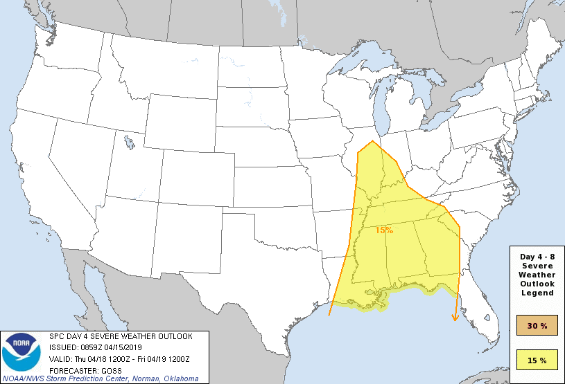
However, we have to talk about that weather trade off. It'll be getting wetter and warmer at the same time. There will be on/off showers and storms much of the week, starting early Tuesday morning. The best threat for severe weather looks to be on Thursday with the passage of a strong cold front late in the day. But perhaps some good news. The Storm Prediction Center has shifted the severe storm threat a little farther south.
Meantime, once we get through the unsettled conditions, the upcoming holiday weekend looks to be rather nice. Expect highs in the 50s and 60s.
We just have to hope we don't get inundated with a lot of rain this week. Because rapid snow melt and heavy rainfall could see an aggravated river situation. We'll be watching this carefully.