Light wintry mix possible Tuesday night after Monday's record rainfall


A ton of rain fell across southeast Wisconsin Monday. All of southeast Wisconsin saw at least an inch of rain leading to some flooding of area roadways and putting some creeks and rivers into a minor flood stage. The water in rivers will slowly come down the rest of this week. Parts of Milwaukee, Ozaukee, Walworth and Waukesha Counties saw rain totals over 2".
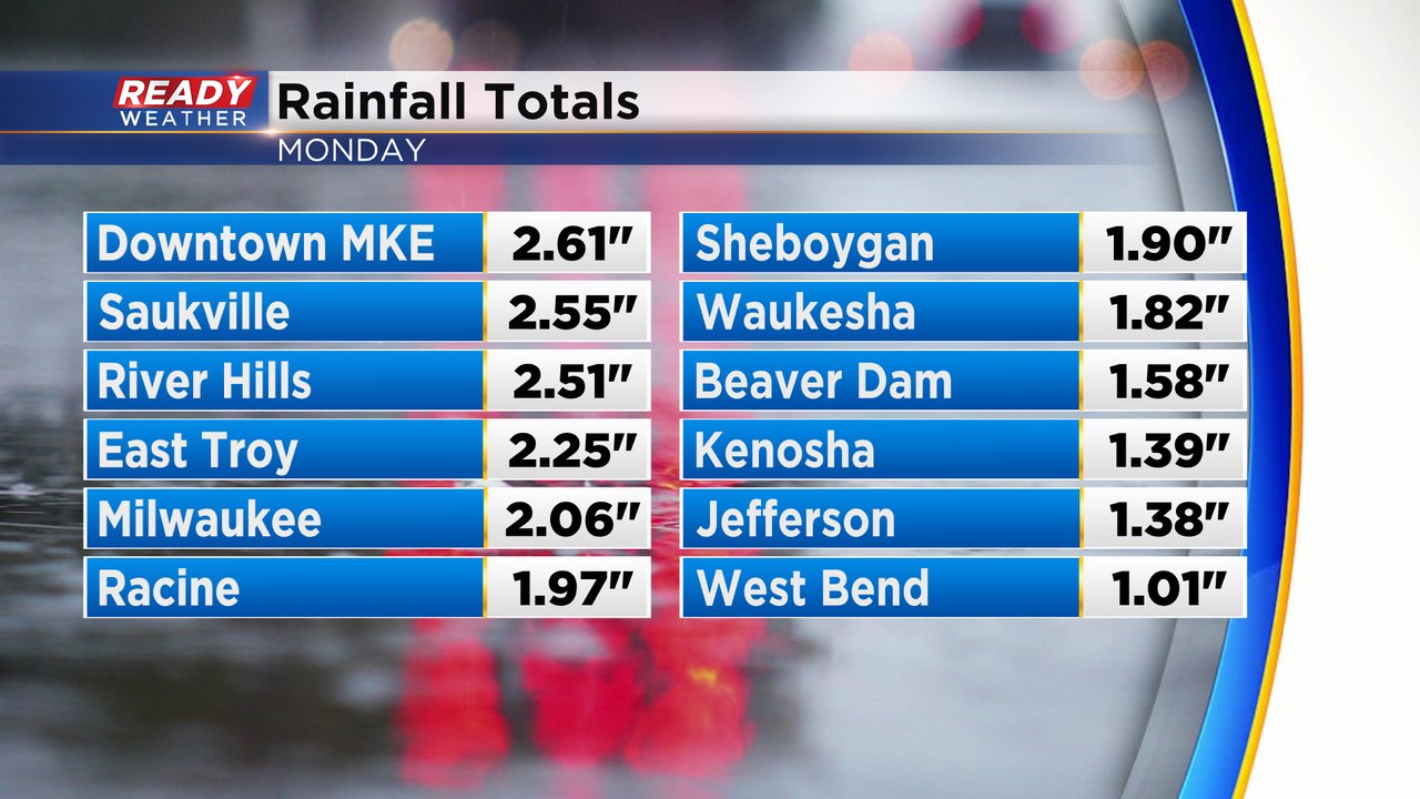
The 2.06" of rain in Milwaukee was a record shattering rain. Not only did it break the rainfall record for the date (Feb. 27) but also broke the record for the highest single day rainfall during the month of February!

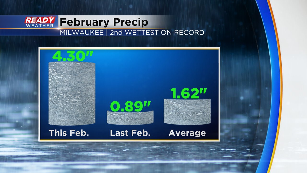
Adding Monday's rain to an already impressively wet February puts the month in second place for total precipitation since records began in the mid 1800s!
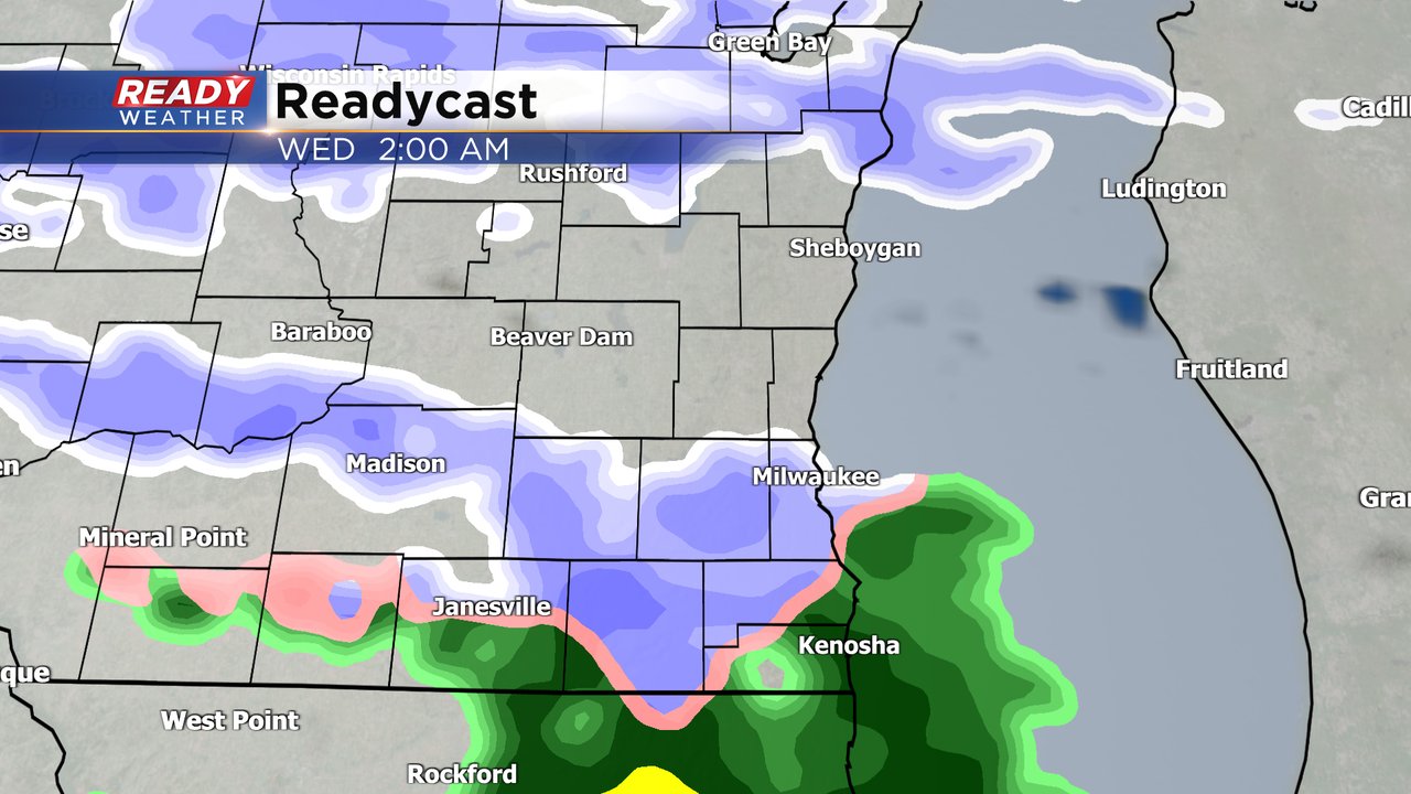
The sunshine is emerging Tuesday morning but then the clouds roll back in Tuesday afternoon. A little light wintry mix rolls in Tuesday night into Wednesday morning. A mix of rain and snow is expected with less than a tenth of rain possible. A few isolated rain and snow showers may linger into Wednesday afternoon or evening.
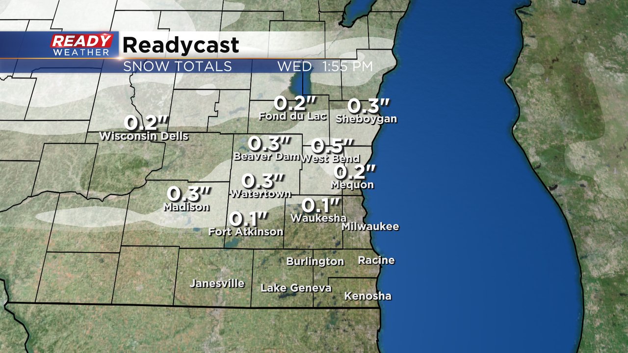
A little light snow accumulation is a possibility in northern counties where a dusting to a few tenths of an inch of snow are possible.
Download the CBS 58 Ready Weather app to track the wintry mix and look ahead to another chance for snow later this week...