Light rain and drizzle moves in overnight and continues Monday before changing to snow Monday evening


After a quiet and mild weekend, light rain and drizzle will move in from the south overnight tonight and continue into the Monday morning commute. Due to clear skies, places north and west of Waukesha have dropped below freezing, so there may be some slick spots on the roads before sunrise.
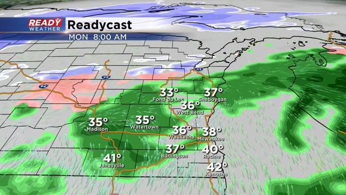
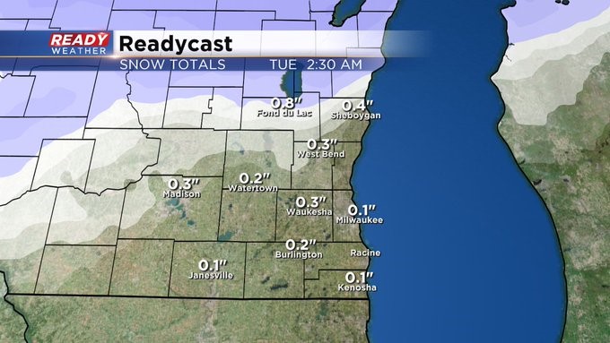
During the day Monday temperatures will be warm enough for rain for, but colder air will wrap around the low pressure system late Monday afternoon and evening, changing the rain and drizzle to a mix of light snow and freezing drizzle during the evening. The good news is the snow will quickly move out of the area before midnight.
Most of the area should only pick up around a dusting or so of snow, but up to an inch will be possible in Fond du Lac county where the changeover to snow will happen first. With temperatures well above freezing during the day, most of this snow should melt on the roads.
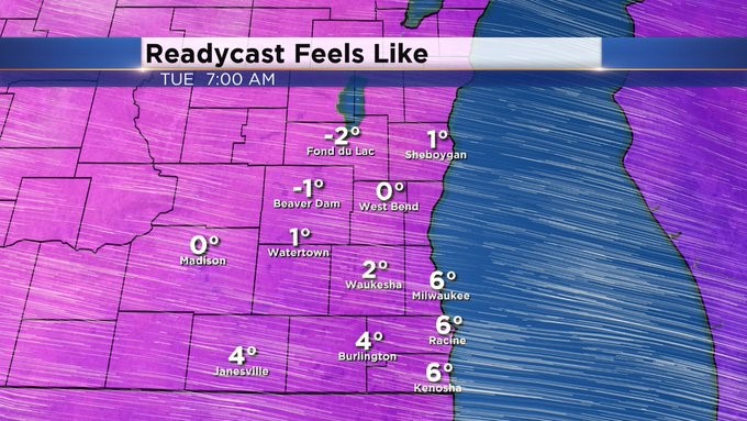
The bigger story is the cold air moving in behind this system. Winds will be breezy Monday night with wind chills in the single digits above and below zero to start the day Tuesday, and they won’t improve much during the day. The coldest air is expected Tuesday night into Wednesday as lows drop into the single digits and highs in the mid teens. Wind chills Wednesday morning will be between -5 and -10 degrees, so make sure those kids are bundled up before they head to school!