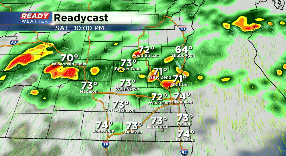
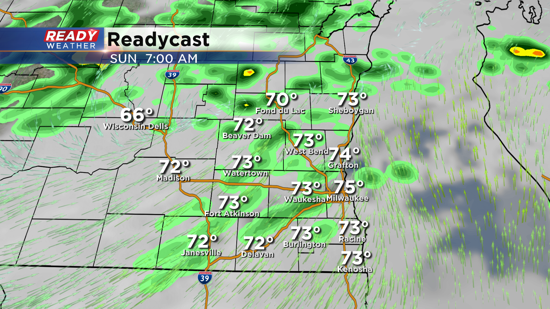
10:45 PM Update: Isolated showers possible into early Sunday morning


Updated: 10:45 pm Saturday, June 26th:
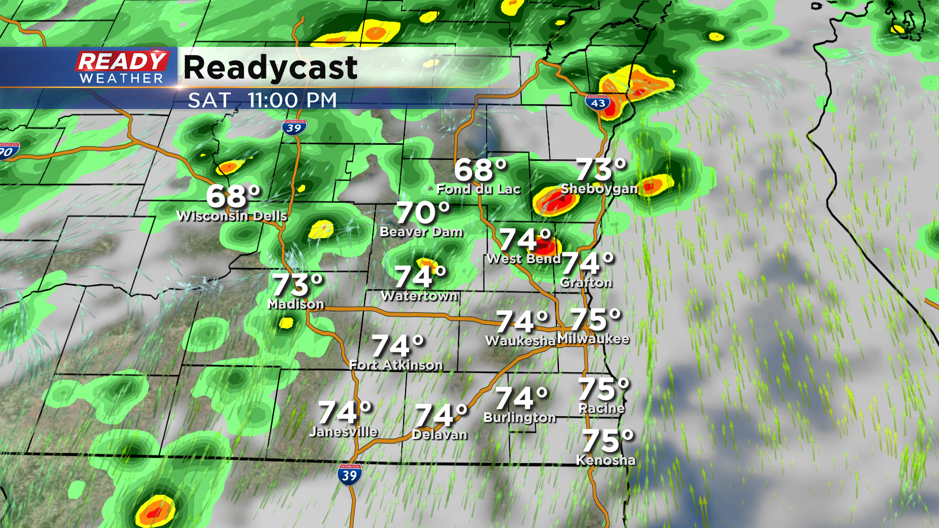
The severe storms near Chicago and lower Michigan that were ongoing for most of the day stabilized us in southeast Wisconsin this evening, which has prevented spotty showers or storms from forming. There are still a few isolated showers north of a line from Beaver Dam to Fond du Lac, and this will continue into tonight as a low pressure system slowly moves through the state.
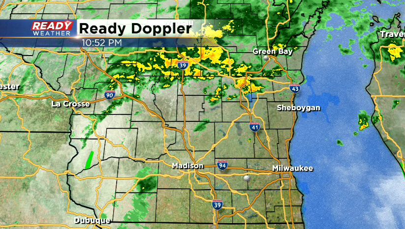
The cold front itself won't move through until Sunday morning, so expect a few lingering light showers to start the day before peeks of sun and drier weather moves in for the afternoon.
-------------------------------------------------------------
Updated: 7:10 pm Saturday, June 26th:
Clouds have filled back in across southeast Wisconsin this evening, which will likely kill any severe storm potential. However, we've been seeing weak rotation in the showers that have developed this afternoon, and weak rotation will continue to be a threat in anything that's able to develop.
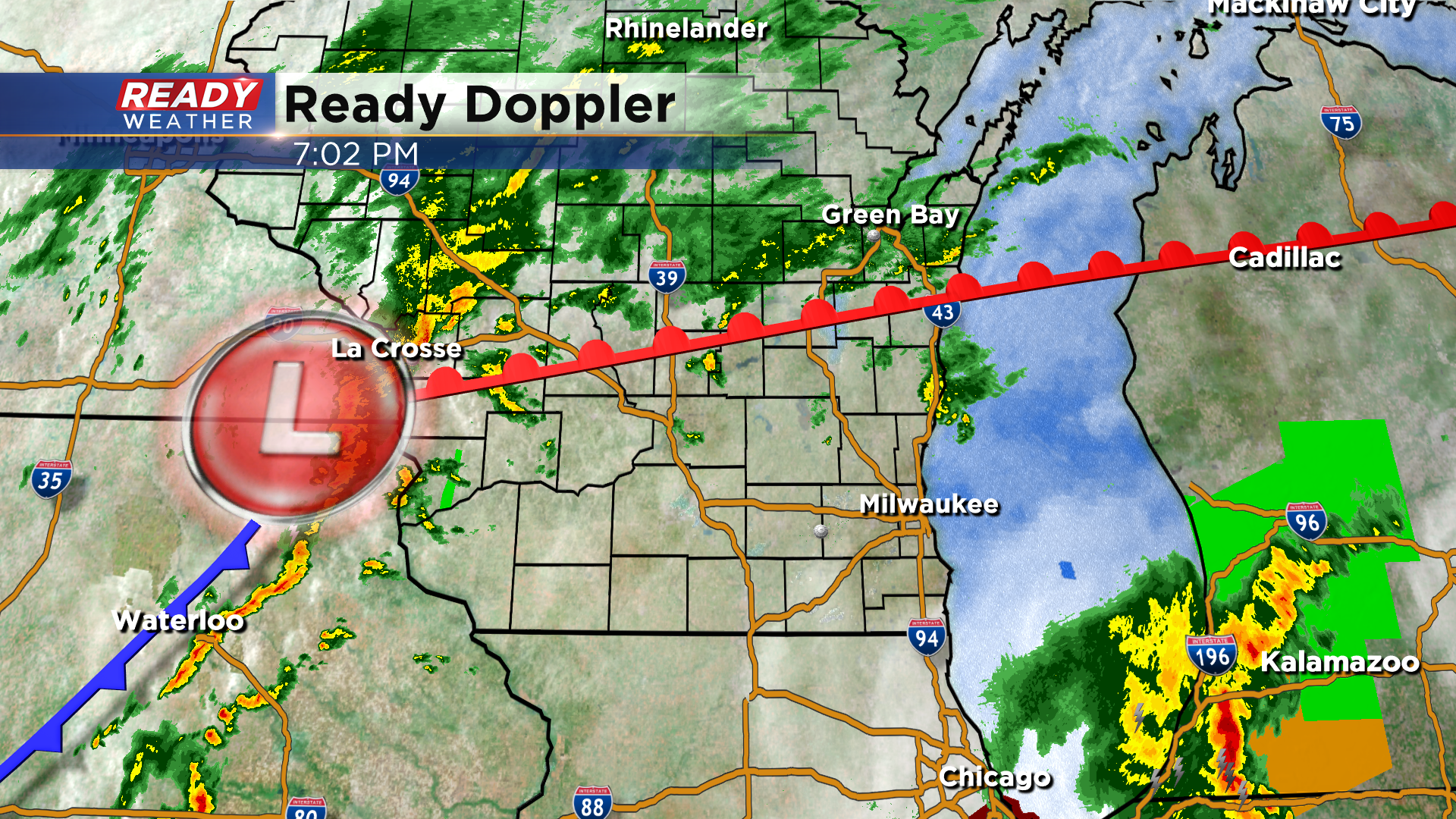
Currently, a low pressure system is situated near La Crosse, with a warm front sitting between Fond du Lac and Oshkosh. This low pressure system will track along the warm front this evening into tonight, likely generating more showers/storms as it does so. Best chance of showers and storms is right along and just south of the front.
The threat for an weak spin-up will diminish after midnight.
---------------------------------------------------------------------------------------
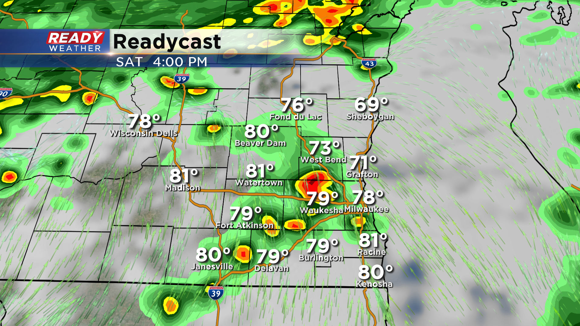
Updated: 4:15 pm Saturday, June 26th:
Additional spotty showers have popped up over the last hour, but haven't been producing any lightning. However, there has been some weak rotation in these showers, showing the spin we currently have in the atmosphere.
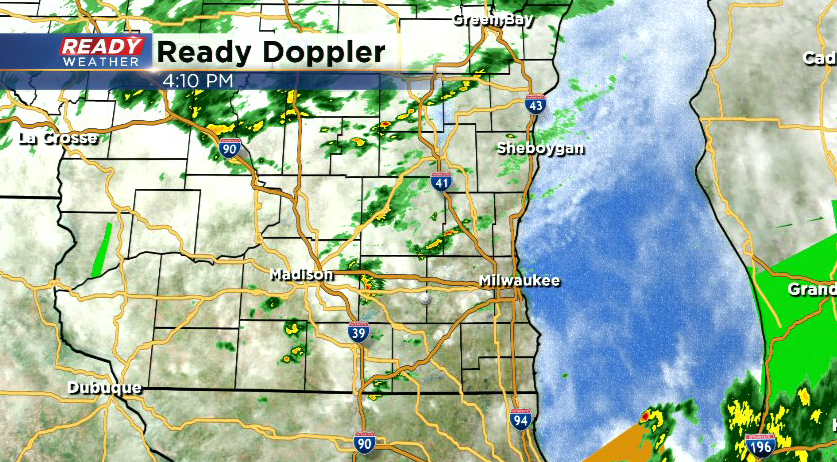
Partly cloudy skies are also being noted in northern Illinois, which could provide additional instability heading into this evening. As the low pressure system moves into west central Wisconsin this evening, we'll be watching for additional showers and storms. A few storms could be strong with an isolated tornado not out of the question.
-----------------------------------------------------------------------------
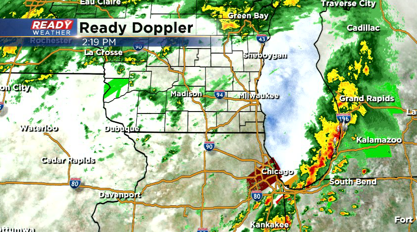
Updated: 2:20 pm Saturday, June 26th:
Many of us are seeing a break from the light shower activity, but more light showers continue to develop and push over the Illinois border. There's been some thinner cloud cover across northern Illinois, which is moving towards southeast Wisconsin. If the cloud cover remains thin, this could help destabilize us even more and lead to scattered storms late this afternoon and evening.
---------------------------------------------------------------------------------------
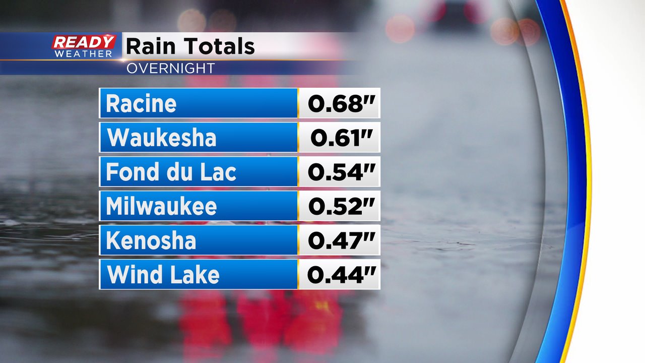
A solid line of rain with embedded storms moved through overnight, dropping some decent rainfall across drought stricken areas of southeast Wisconsin! Most of the area picked up between .25-.50" in round one.
The band of heavier rain has pushed to the north, but additional light rain has filled in across southern Wisconsin. This will be with us through midday, with a period of dry weather expected in the afternoon.
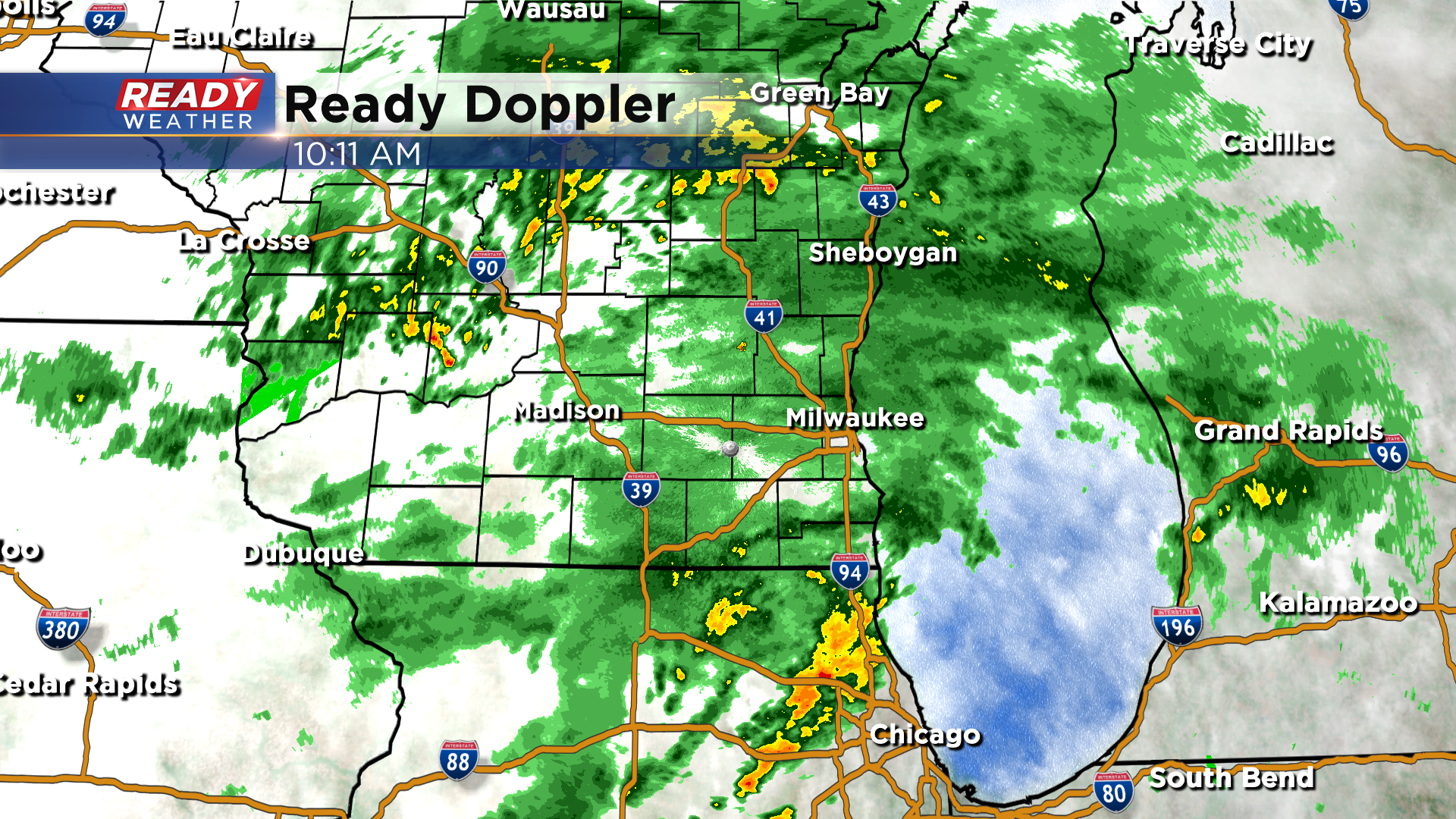
After a brief break in the rain, isolated to scattered storms look to redevelop mid to late afternoon. Exact timing and coverage of storms will depend on how quickly this current batch of rain moves out of the area.
Additional scattered storms are possible in the evening as the low pressure system begins to lift into central Wisconsin.
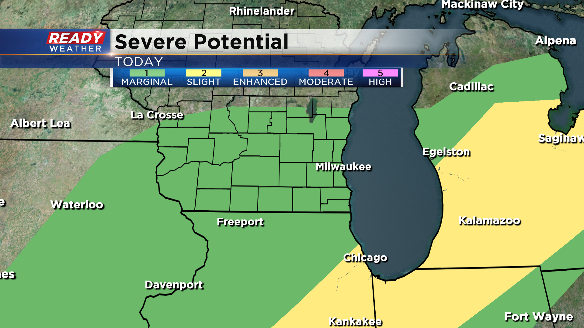
Our chance for strong to severe storms this afternoon and evening will depend on if some sunshine can break through the clouds in between rounds of rain. If we see some sunshine, storm that develop could produce damaging winds, and hail. We'll also have to watch out for an isolated tornado. As of 10 am, all of southeast Wisconsin is under a level 1, Marginal Risk for severe storms, with the higher, level 2 Slight Risk in place to our southeast where they are already seeing sunshine.
Any storms that do develop today will produce heavy downpours, regardless if the storms are strong or not. The low pressure system will track into northern Michigan overnight, with lingering light showers expected into Sunday morning. Showers should become more isolated as the day wears on.
This active weather pattern won't break down until late next week, so showers and storms will continue to be possible nearly every day next week. Download the CBS 58 Ready Weather App to get any alerts sent directly to your phone and to see the full 7 day forecast.