


Some of you might be waking up Friday morning to a fresh dusting of snow with some overnight lake effect and flurries. We have the chance for lake effect off and on through Friday with some lake effect flurries possible Friday night into Saturday. This is not a big snow maker but some light lake effect bands could result in a few tenths or up to an inch of new snow with highest totals near the lakefront.

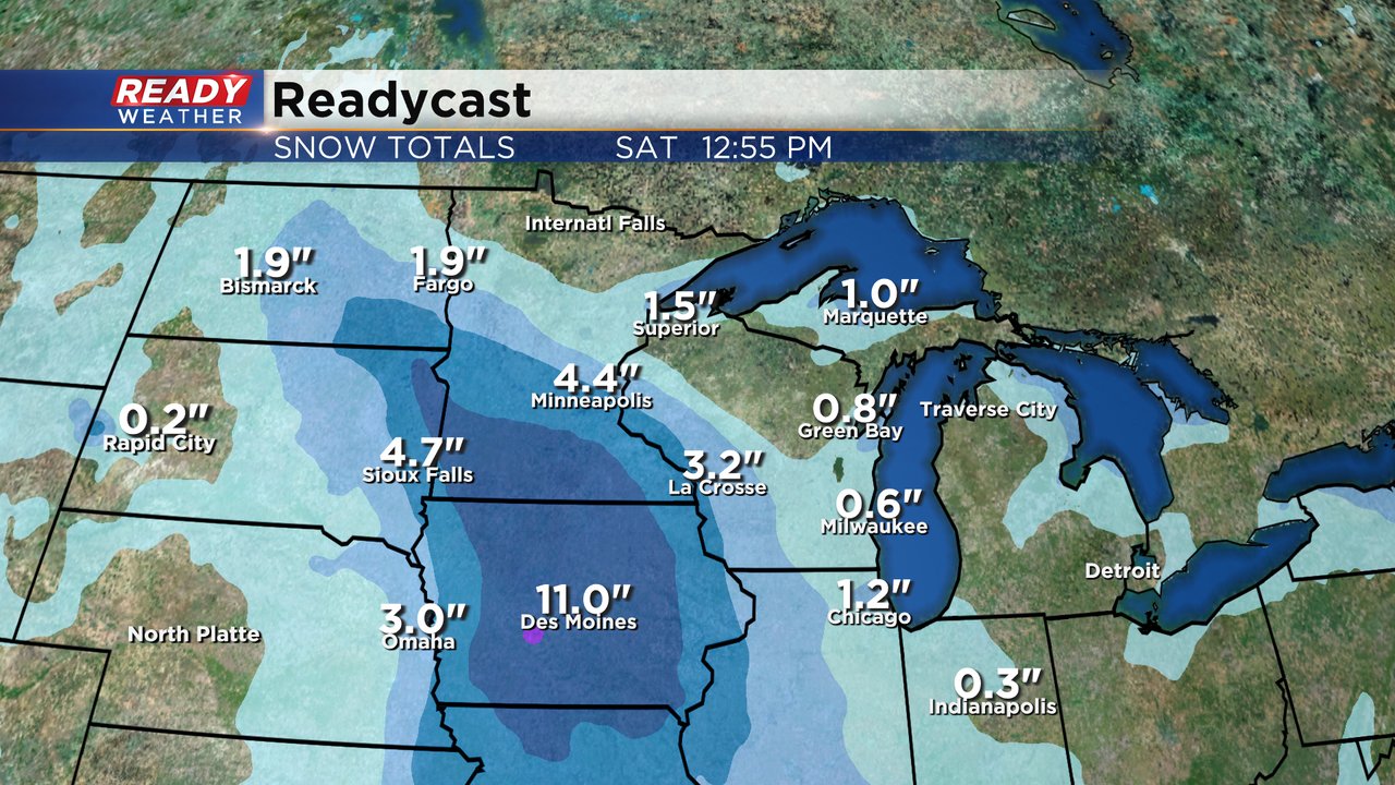
The bigger storm system is to our west. The track of this winter storm has actually trended a little farther east over the last 48 hours. Western Wisconsin could get a few inches of snow and even Madison could see some flurries or a few tenths but the majority of it should stay away from any of our local area. Winter storm warnings have been posted for the Dakotas, Minnesota and Iowa where the bulk of the snow will fall with advisories on either side.
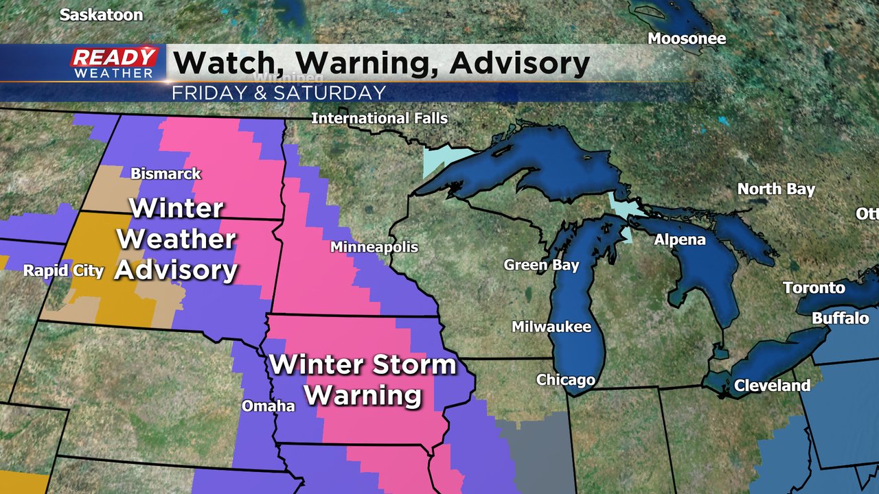
Snow totals in the warning area could reach 6-12" of fresh snow. Another big storm that most of Wisconsin is missing out on.
Download the CBS 58 Ready Weather app to track any more snow chances the next week!