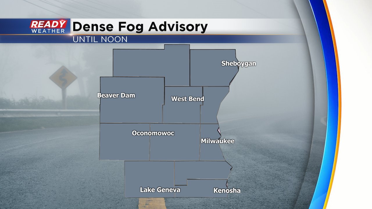
8:30 am Update: Dense Fog Advisory issued through Noon for all of southeast Wisconsin


Updated: 8:30 am Sunday, February 28th:
Dense fog has expanded across southeast Wisconsin this morning with visibility under a half mile in many locations.
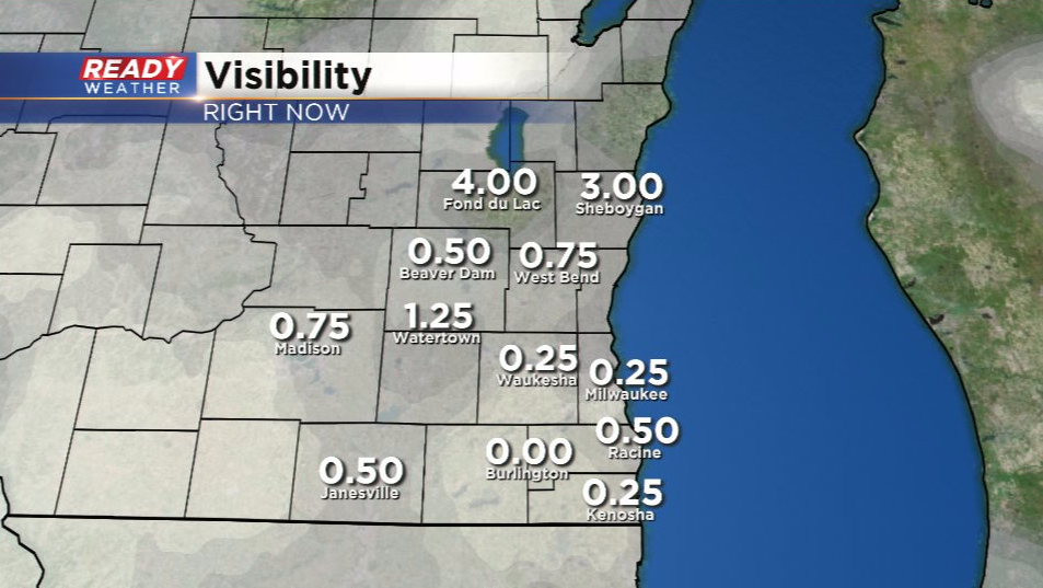
A Dense Fog Advisory is now in place for the entire area through noon today.
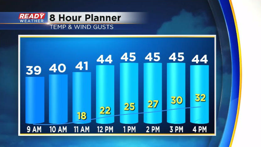
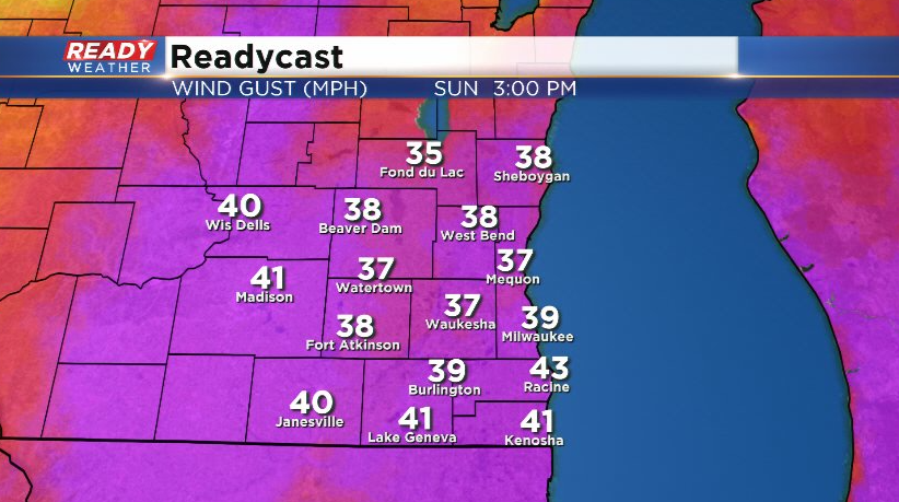
Reduce your speed, use your low beams, and leave plenty of space between you and the car in front of you if you're driving this morning. Additionally, there's some light drizzle and very light rain pushing through the area. This will come to an end around midday as well when the cold front moves through. Expect windy conditions behind the front this afternoon with gusts between 25-35 mph.
-------------------------------------------------------------------------------------------------------------------------------
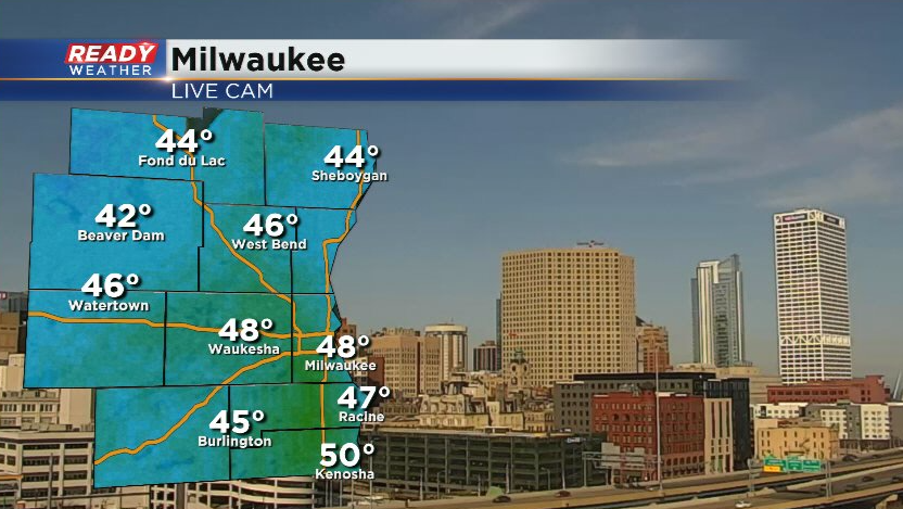
It has been a picture perfect late February day across southeast Wisconsin. As of 3pm, temperatures are in the mid 40s to around 50 degrees under abundant sunshine!
Clouds and fog will develop this evening into tonight ahead of a low pressure system that'll track from the La Crosse area into the UP tonight into Sunday. Some isolated drizzle or spotty rain showers are possible after midnight. Some freezing drizzle will be possible north of Milwaukee before sunrise, which could briefly create patchy slick spots.
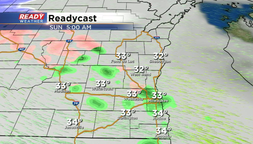
We'll remain on the "warm" side of this low pressure system with temps rising above freezing after sunrise. Isolated rain showers and drizzle will continue through midday until the cold front moves through.
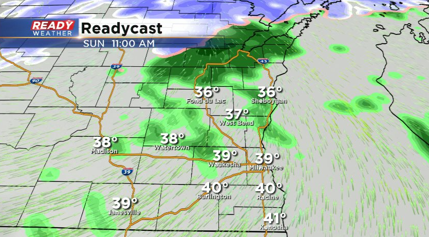
Locally dense fog is also expected to continue through the morning hours, but will clear out in the afternoon as drier air moves in behind the cold front. Winds will be quite strong during behind the cold front with gusts between 30-40 mph possible.
We'll have another chance for a few quick moving, isolated snow showers Monday morning, but then dry weather returns for the rest of the week. After a brief cooldown on Monday, temps will rise back into the 40s by the middle of next week. Download the CBS 58 Ready Weather App to track the drizzle and showers.