
-
3:16

Natalie’s Everyday Heroes: Hiker inspires other women every...
-
1:45

’He had to die on his son’s birthday’: Father killed during...
-
3:12

Crews respond to 3-alarm fire at Glendale apartment building
-
2:05

Video shows teen jumping on police squad during ’chaotic’...
-
2:39

Evers raises pride flag at Capitol, future of tradition depends...
-
1:26

House fire forces evacuations near 38th and Vliet
-
2:14

Wisconsin ranks #8 worst road rage in America, Milwaukee drivers...
-
2:18

’Mothers belong with their kids’: Sheboygan woman detained...
-
0:56

Greenfield students plant with seniors at Clement Manor
-
1:00

Mayor Johnson hosts 3-mile ride through downtown Milwaukee as...
-
2:56

With pep and plenty of prep in their step, local dance group...
-
0:54

Milwaukee County kicks off Pride Month with flag-raising ceremony🏳️🌈

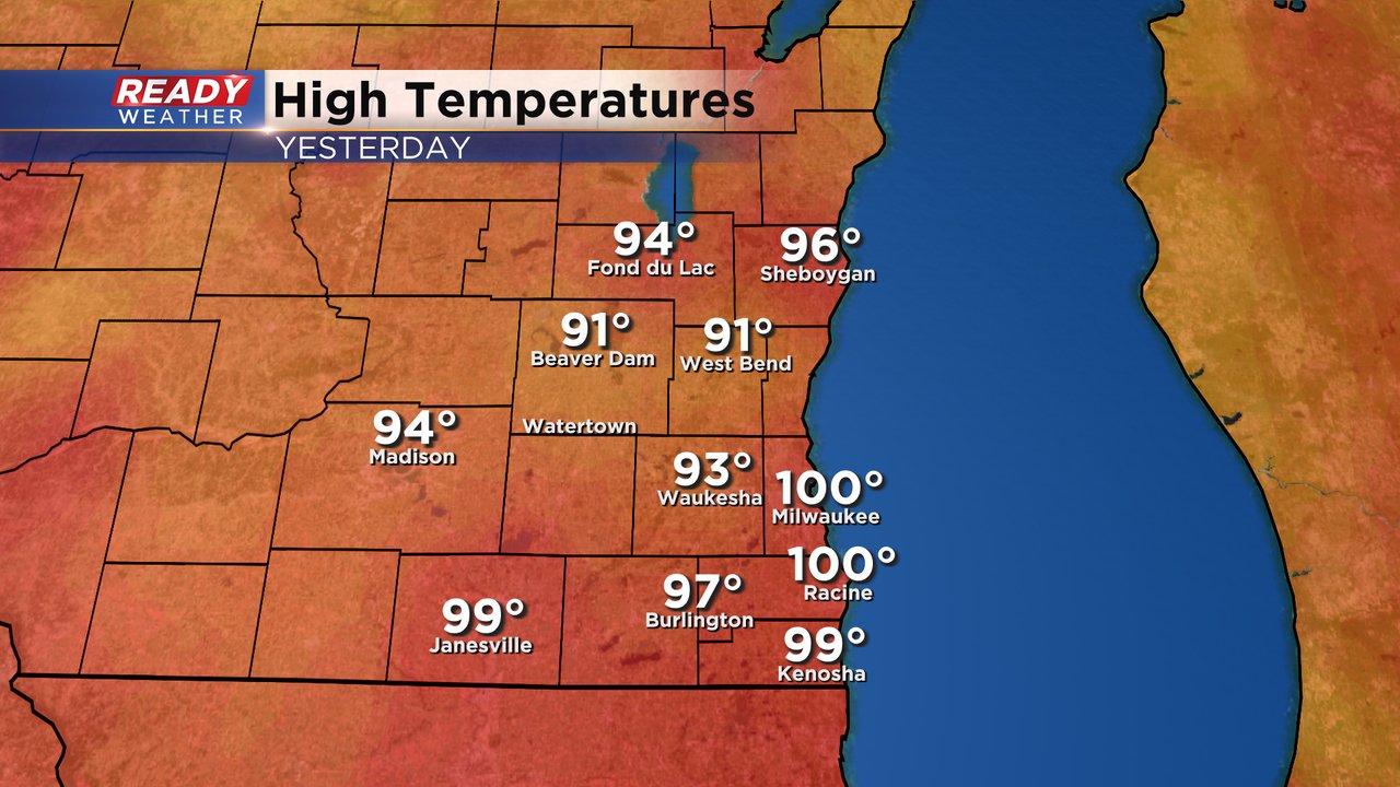
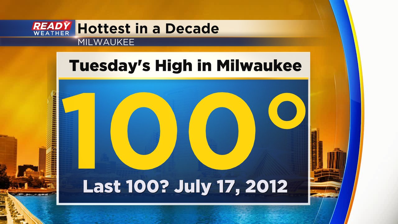
The warmest in a decade! That's what Tuesday was across southeast Wisconsin. Both Milwaukee and Racine hit 100*! Kenosha came close at 99* and the rest of southeast Wisconsin was well into the 90s.
In Milwaukee it was the first time we've hit 100* since 2012 when we had three days in the 100s during the warmest month on record - July of 2012.
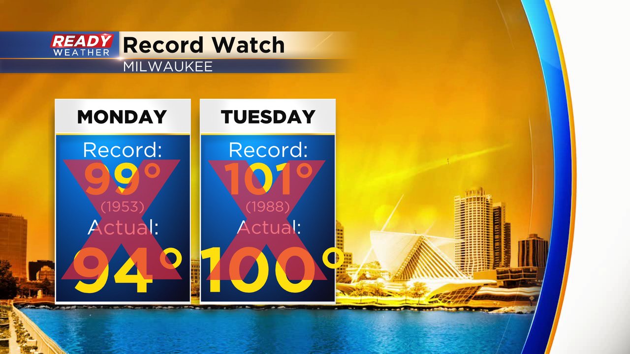
Despite hitting 100* in Milwaukee on Tuesday we did not break a record. So both hot days this week with the middle 90s Monday and 100* Tuesday fell short of the previous records.
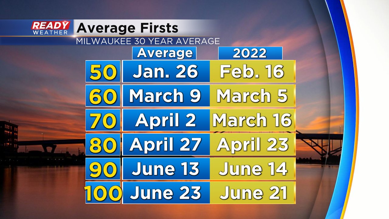
We only average hitting 100* in Milwaukee once every nine years so we were a bit overdue. When we do get into the 100s the average first 100* day is right around now during the last week or so of June. The official long term average is June 23.
Download the CBS 58 Ready Weather app to see the temperatures the rest of the week!