
-
0:46

Video shows end of police chase, rollover crash in Fond du Lac...
-
0:25

Police searching for pig-masked thief who robbed small Burlington...
-
2:07

Mount Mary University launches new Institute for the Advancement...
-
0:35

Spring is coming early with the Greater Milwaukee Golf Show returning...
-
2:09

‘Totally unpredictable’: Safety concerns rise on National...
-
3:31

’Took out his gun and shot him in the head’: Girlfriend who...
-
1:57

CBS 58 Hometowns LIVE: Thursday Nights at MAM
-
2:22

Milwaukee Police Department officials questioned during council...
-
1:02

Howard University students spend spring break mentoring kids...
-
4:34

Multiple weather alerts in effect as a busy stretch of weather...
-
2:25

Video shows moments leading up to suspect being arrested after...
-
2:56

Visit Milwaukee preview: March 13 - 15

A powerful storm system will arrive from the southwest on Wednesday increasing the winds and rain all across southeastern Wisconsin.
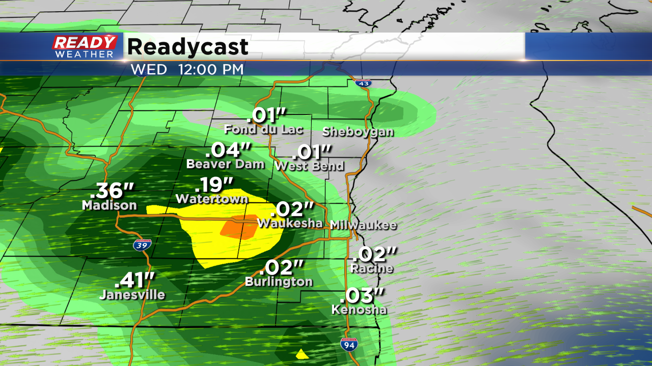
Rain moves in from 6 am through the early afternoon. There could be a break early in the afternoon with more rain and some chances for storms by the evening.
The heaviest rain will arrive for Wednesday night. Embedded storms will be possible as wind gusts approach 40 mph. An isolated strong to severe storm will be possible late Wednesday night.
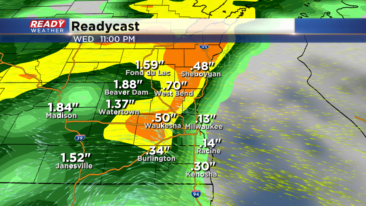
The winds shift south on Thursday as temperatures spike into the 60s. There's another chance for storms on Thursday before the system clears. Rainfall between 1.00" to 2.00" possible! River levels could rise; however, widespread flood watches are not expected.
Sign up for the CBS 58 Newsletter