Noon Update: Storms beginning to weaken


Updated: 11:52 a.m. August 25, 2020
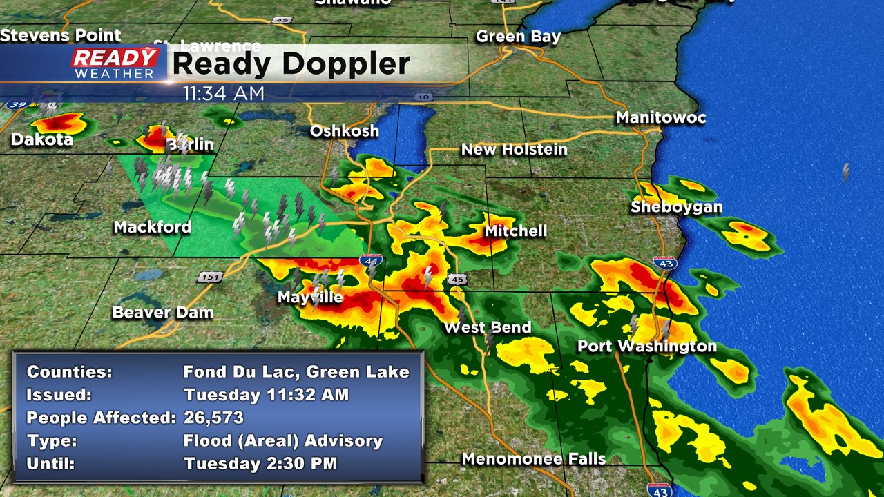
Storms continue to stay under severe limits at this time. While there is a chance for some isolated hail up to about a 1/2" and gusts to 40mph in counties generally north of I-94 west, we should begin to dry out as the afternoon unfolds. A boundary which sits stationary at this time continues to produce storms from northwest Fond du Lac county southeast to around the greater Milwaukee area. This activity should wane by 2pm.
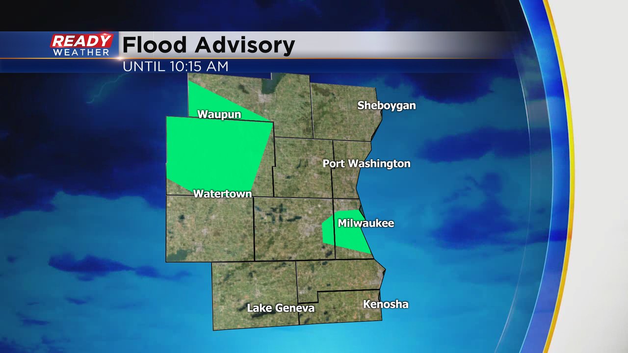
Currently, there is a Flood Advisory for Fond du Lac county until 2:30pm. Some spots in that county have picked up between 2=4" of rain with additional storms possible there that could drop another inch of rainfall. Do not attempt to drive over flooded roadways as some urban flooding is likely at this time.
Elsewhere spots still easily picked up over an inch of rain.
Since we haven't had a lot of rain lately, the ground should be able to soak up the solid amounts most areas received today. There's an isolated chance for storms again Thursday with another wave of what looks to be soaking rain Friday.
- Rebecca Schuld
Updated: 9:39 a.m. August 25, 2020
A few showers and storms continue to roll through the area but the strongest of the storms have passed. A little redevelopment is possible during the afternoon and evening but it's tough to say who has the best chance to see any additional storms.
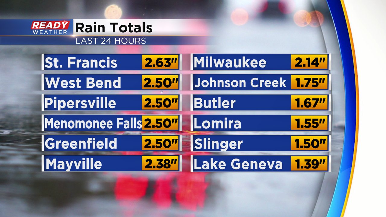
rain totals have started to come in with Menomonee Falls seeing the most around 2.50". Milwaukee also picked up a good chunk with most of the city seeing 1.50-2" of rain and the airport getting just over 1".

------
Updated: 8:01 a.m. August 25, 2020
Rain and storms have continued through most of southeast Wisconsin since midnight and have stayed very strong. The storms are expected to continue through about 10 a.m. with isolated storms possible through the afternoon and evening.
Most of southeast Wisconsin has been very dry over the past two weeks so we needed a good soaking rain. Most spots have already picked up a half to 1.50" of rain since midnight but now we're getting to the point where it may be too much rain. A couple of flood advisories have been issued because of the heavy rain.
------
Updated 5:36 a.m. August 25, 2020
Severe weather ended around 4 a.m. but strong thunderstorms are still moving through southeast Wisconsin with gusty wind, small hail and very heavy rain. As of 5:30 a.m. the strongest storms were located over Milwaukee and Waukesha Counties and moving south.

Expect the rain and storms to continue through mid-morning with dry afternoon conditions and a chance for isolated storms this evening and Tuesday night.
------
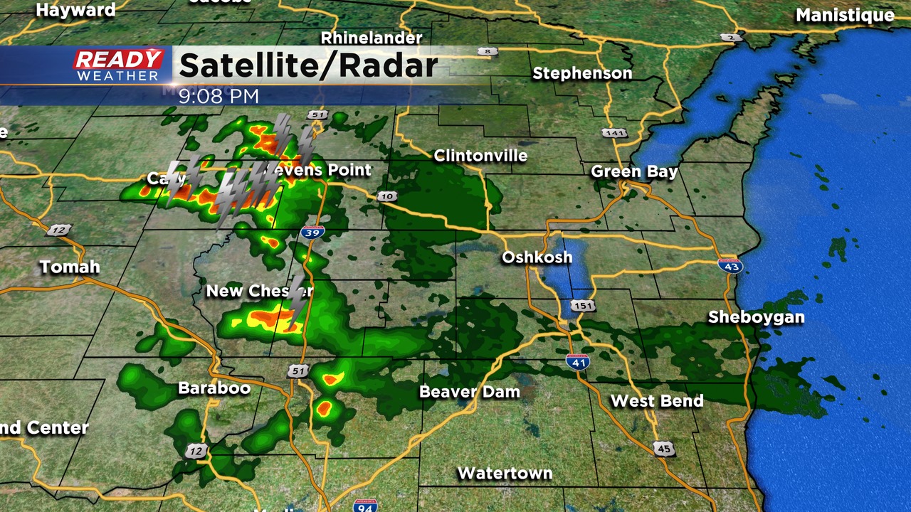
12:45 AM
Scattered showers and storms have arrived across the western part of the area with more developing upstream across central Wisconsin. More elevated storms will develop over the next several hours and move southeast.
The greatest threat for severe weather is winds to 60 mph and hail to the size of quarters.
______________________________________________________________________________________________________________
While some storms may clip our northwestern areas before Midnight, we are now starting to see development near Eau Claire. More storms in that region will fire over the next several hours and get better organized.
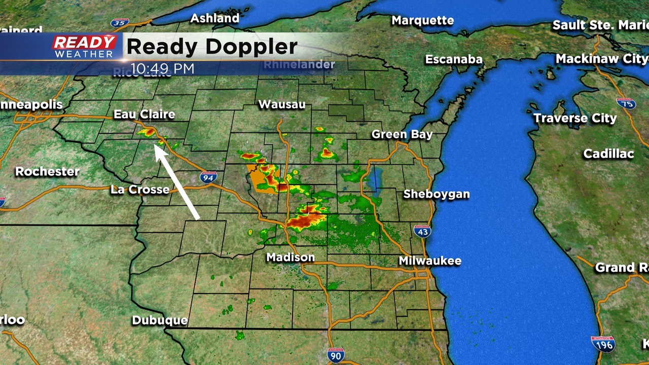
Southeastern Wisconsin will get more storms overnight into the morning commute. Best timing will be from 2 am until 8 am.
9:30 PM Update:
The bigger complex of storms is still expected well after midnight going into tomorrow morning; however, we do have some elevated storms that have popped up just outside our viewing area. Some of these storms could drift into Dodge and Fon du Lac counties.
The slight risk has been shifted a little further north. Best chance for strong to severe storms will be along and north of 94.
No real changes to the overall forecast. The brunt of the storms will hold off until after 2 am.
______________________________________________________________________________________________________________
Today was only the 6th 90 degree day this summer in Milwaukee; however, with all of the 80 degree days, Milwaukee is experiencing the 5th warmest summer on record.
That heat and humidity will also act as fuel for showers and storms late tonight across southeastern Wisconsin. Most of our area is under a slight risk for strong to severe storms. The Milwaukee metro is included within the slight risk.
Damaging winds and very heavy rainfall are the primary threats. Small hail can't be ruled out. These systems feed off of very high dewpoints in the 70s.
A shortwave of energy aloft will trigger these storms to our northwest later this evening. The complex will likely dive southeast and move into our area between Midnight and 7 am.
Storms should clear out fairly quickly Tuesday morning giving way to sun and clouds and highs in the low 80s.