


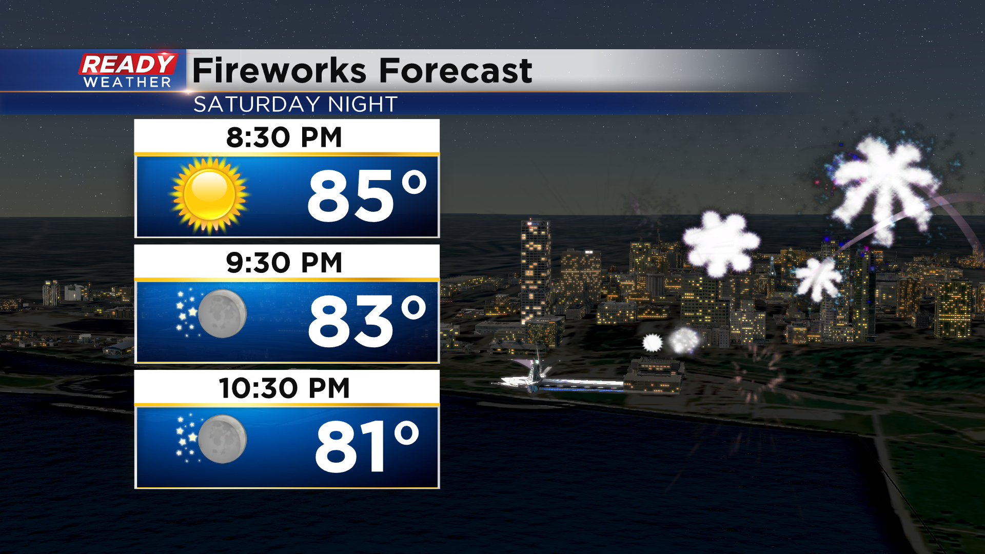
It's been a hot start to the 4th of July weekend with temperatures in the upper 80s and low 90s in most locations as of mid afternoon. While there's been an increase in humidity, the breezy westerly wind has kept it tolerable. Winds will gradually die down to 5-10 mph this evening with temperatures remaining mild in the 80s for any fireworks.
It'll be even hotter and more humid for the 4th of July with temperature rising into the low 90s area-wide with hazy sunshine expected.
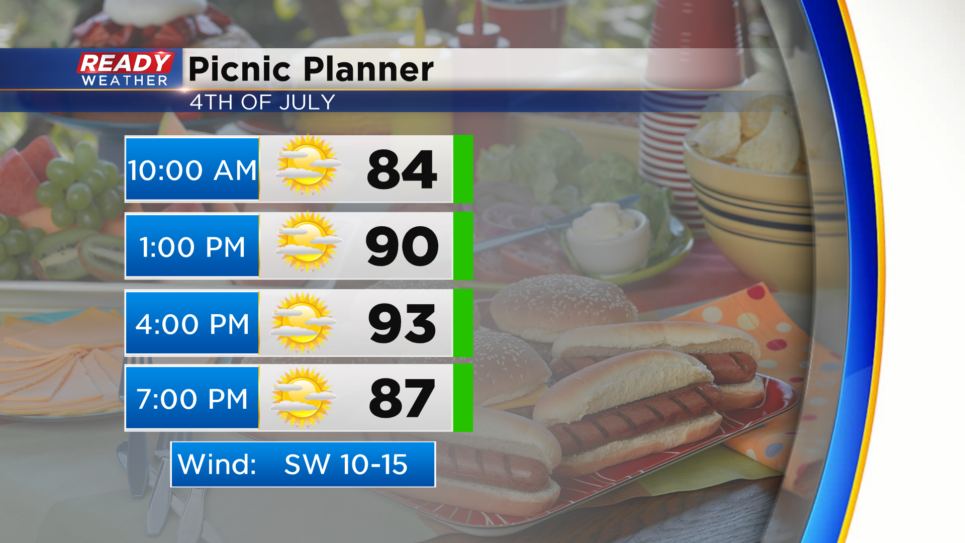
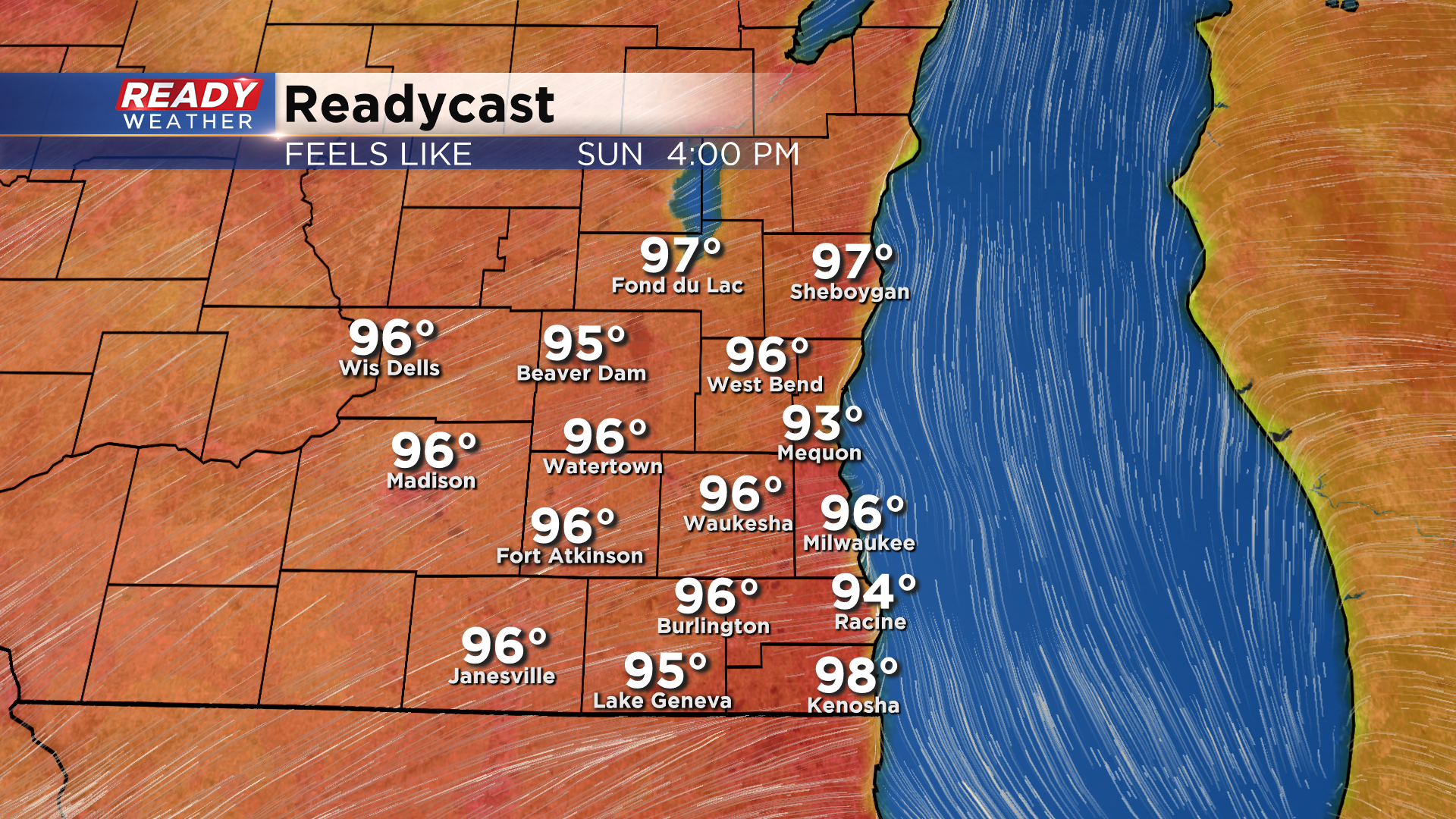
With lighter winds than Saturday and higher dew points, it'll feel more like the mid to upper 90s during the afternoon. Limit your time outdoors and stay hydrated during any 4th of July festivities!
Dry weather and winds around 10 mph are expected Sunday evening with temps in the low 80s for any fireworks displays. A disturbance will track across northern Wisconsin Sunday night, with a weakening line of showers approaching far northern counties around sunrise. Most of these showers will fall apart before they get here, but some may sneak into Dodge, Fond du Lac, or Sheboygan counties.
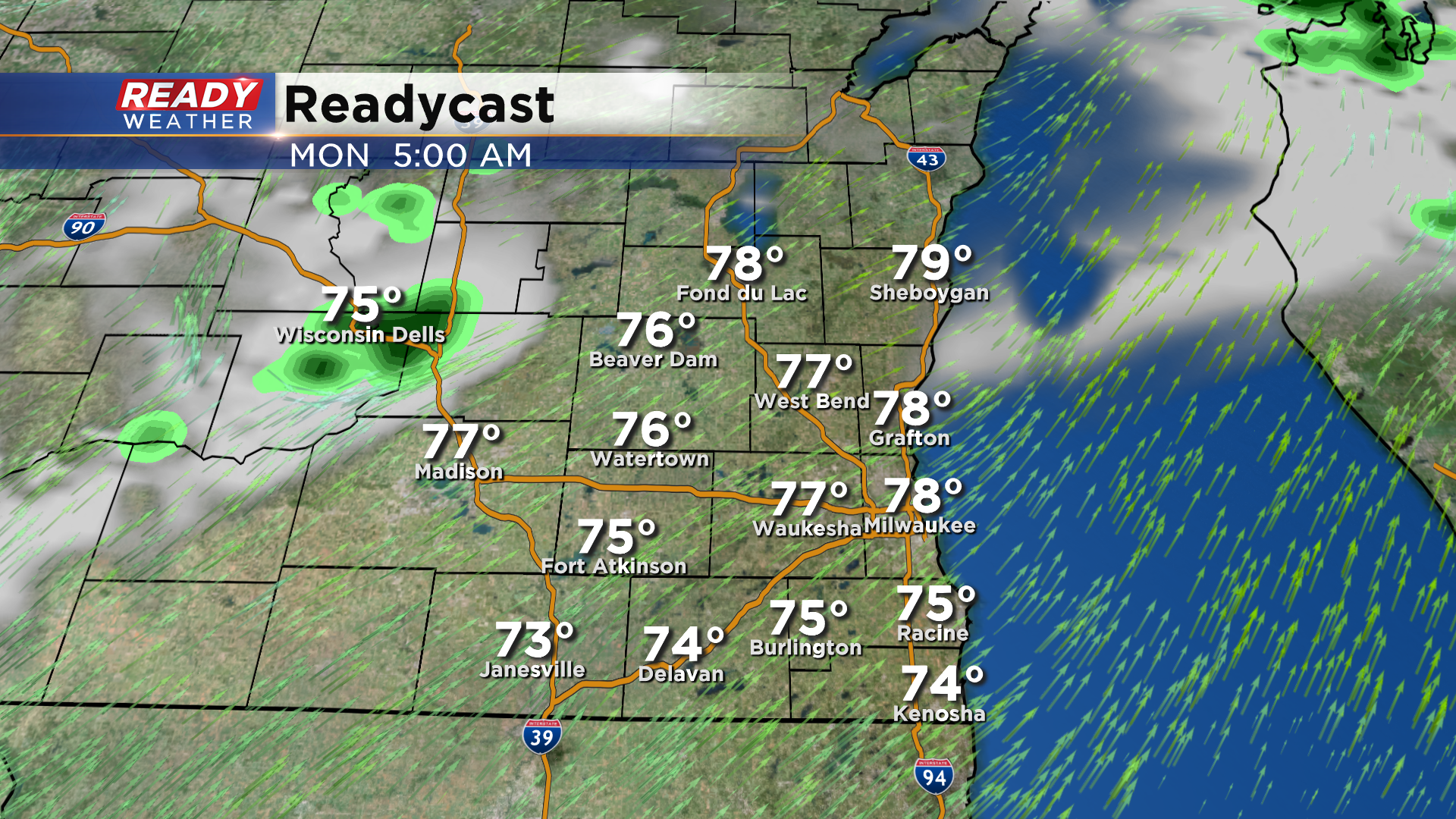
Otherwise expect another hot and humid day on Monday with only an isolated chance of a pop up afternoon storm. Better chances for showers and storms arrive Tuesday evening into Wednesday with a cold front. Download the CBS 58 Ready Weather App to see how much temps will cool behind the front.