Get ready for a mild, active weather week before a weekend cooldown


Updated October 10th, 6:20 P.M.
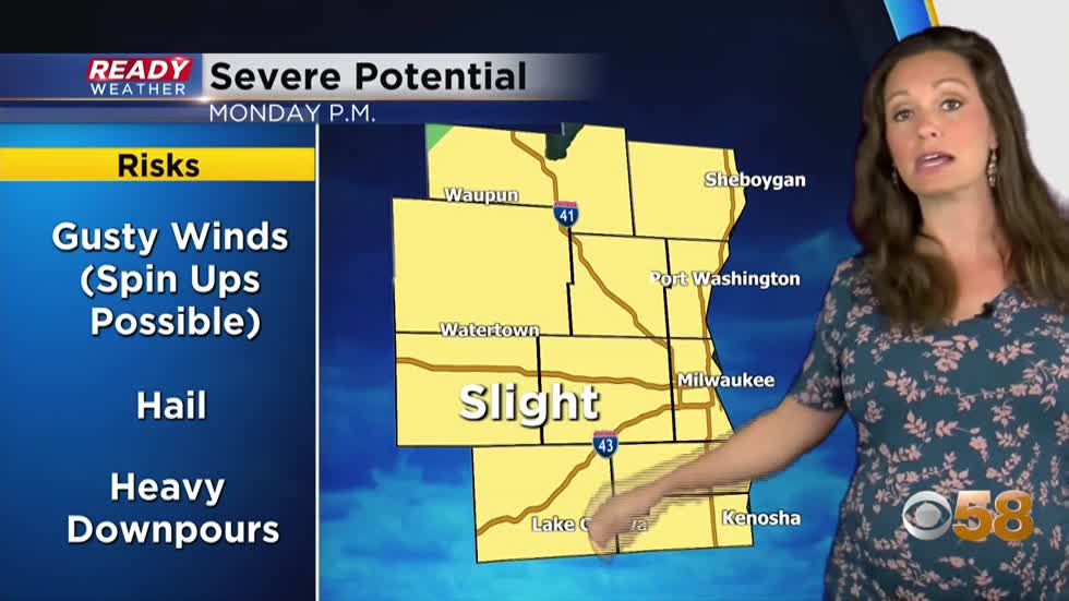
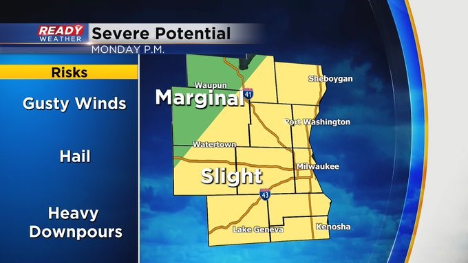
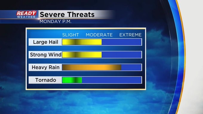
The risk for stronger storms has been slightly expanded to the west. That means the entire viewing area has a chance for strong to severe storms tomorrow. That chance could already be with western by noon, and then for the metro closer to the evening commute and through evening. With mild and muggy air in place plus a decent amount of shear which is wind direction changing with elevation, spin up are possible along with all other modes of severe weather like gusty wind and hail.
MILWAUKEE (CBS 58)--There are a couple of storm chances this week. Sunday, Monday afternoon and evening, and Wednesday afternoon and evening. As it stands now, Monday could feature strong to severe thunderstorms later in the afternoon and evening as a stronger cold front moves in from the west. A "slight" risk of severe weather is in place for most of us too. The jury is still out about Wednesday's event. But the weather players look similar. So stay tuned. With the storms, large hail, heavy rain, and damaging winds are all possible.
Temperatures will stay mild with readings in the low to mid 70s although closer to 80 on Monday. But expect a big cooldown by Friday behind the second, more potent cold front. We're talking highs in the 50s and 60s with lows in the 30s and 40s.