Frost and freeze back in the forecast as temperatures drop back to average


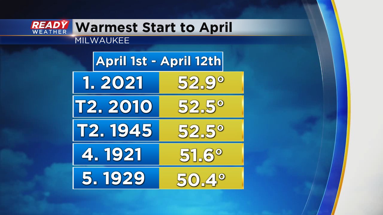
It has been a warm start to April! We've see a few days already in the 70s and our first 80* day of the year! Through the first 12 days of the month it is the warmest start to April on record with an average temperature of 52.9*.
The warm streak will get a little less warm the next five days with highs closer to average in the low 50s. Wednesday looks like the coolest day of that stretch with highs staying in the upper 40s.

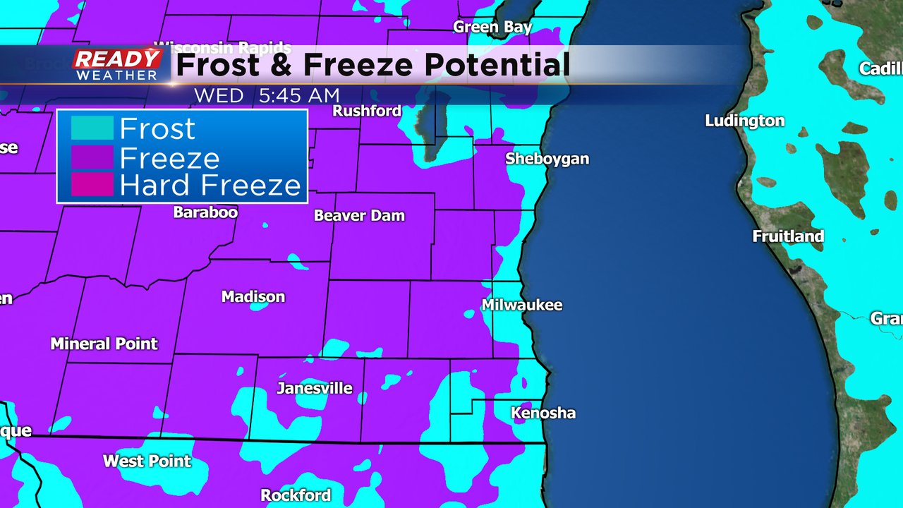
The highs may be staying close to average, but so are the low temps. An average low temperature for this time of year is 37* lakeside and near freezing inland and we will get close to an potentially colder than those numbers through the weekend. Inland locations have multiple for at least frost and a few freezes. Lakeside spots look to stay away from any big freezes but some frost is definitely possible.

Wednesday morning looks like the best chance for a frost and freeze. Inland spots shaded in purple have the best chance to see a widespread freeze and lakeside locations are likely looking at a widespread frost. If you have already done some spring planting you may want to cover those freshly planted plants.
Download the CBS 58 Ready Weather app to track how low temperatures are supposed to get where you live.