8 PM Update: Blustery winds and bitter cold wind chills to continue through Sunday morning


8:15 PM Update:
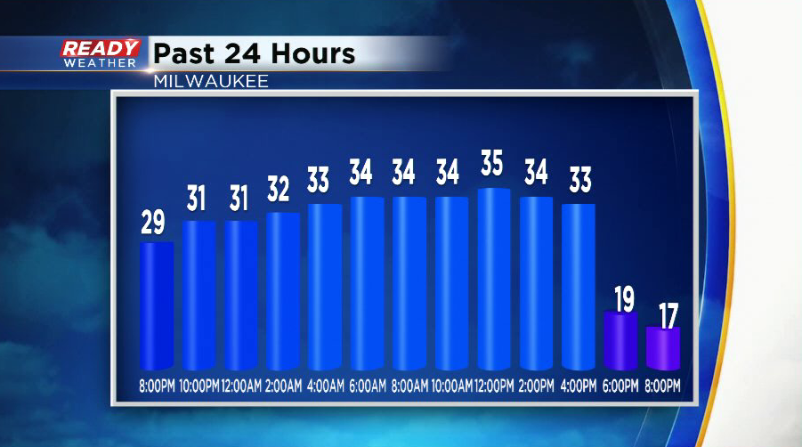
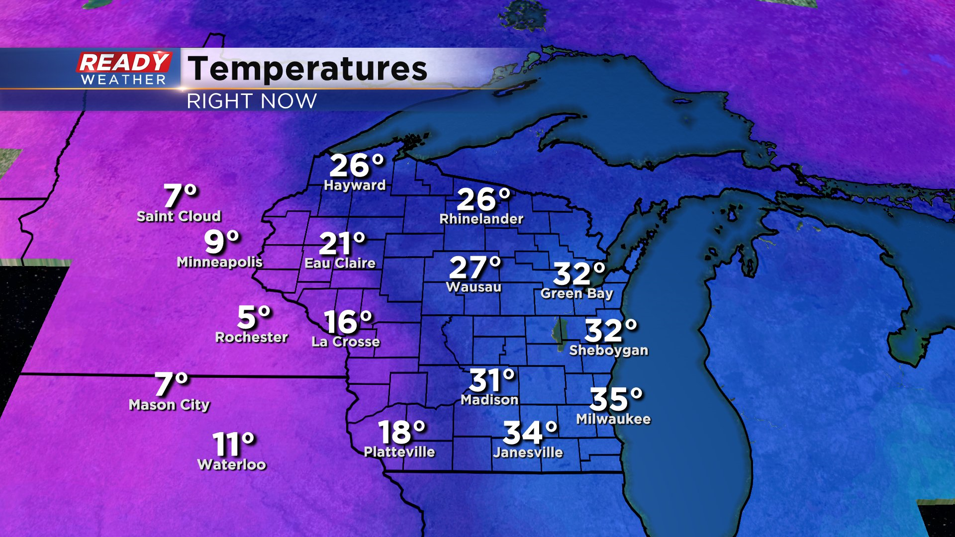
After sitting in the low to mid 30s most of the day, the cold front moved through between 4-5 p.m and dropped temperatures into the teens.
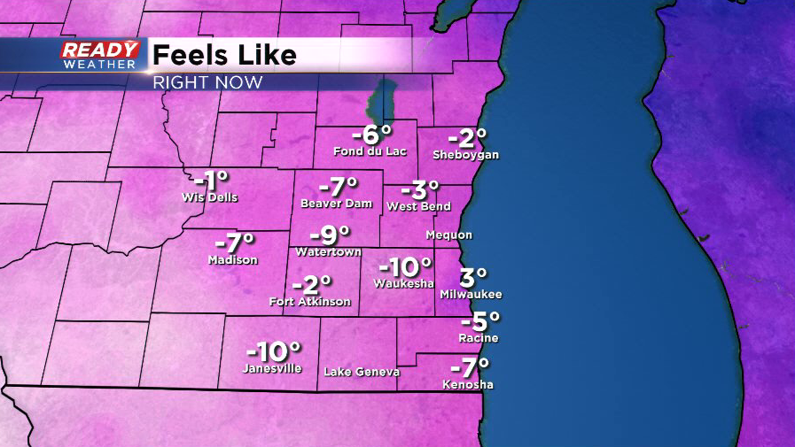
Winds are currently gusting between 30-40 mph, putting wind chills below zero everywhere besides Milwaukee.
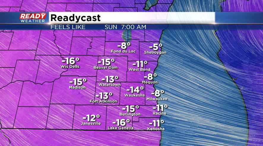
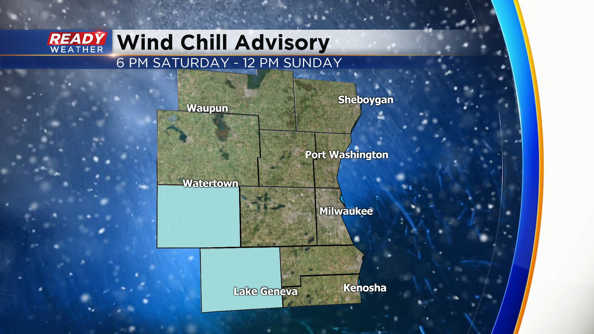
Wind chills will generally be between -5 and -15 degrees overnight, but a few spots could get a cold as -20° in Jefferson and Walworth counties where a Wind Chill Advisory is in effect through noon Sunday. Wind chills will "improve" to the single digits above zero in the afternoon as winds start to ease up.
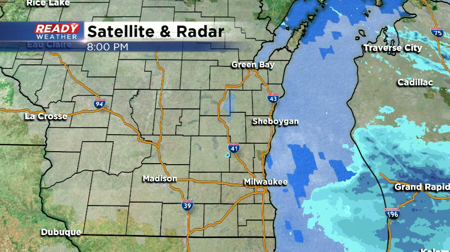
Although nothing is showing up on radar, scattered flurries continue to fly across southeast Wisconsin, along with some patchy freezing drizzle. The flurries may linger into Sunday morning before drier air moves in during the afternoon. No additional accumulation is expected, but watch out for slippery spots on roads!
------------------------------------------------------------------------------------------------------------------------------------------------------------------------------
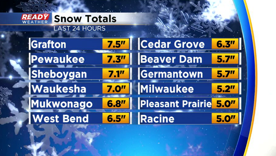
The accumulating snow has come to an end, but a few flurries and snow showers will linger in the area through this evening. Most of the area picked up between 3 and 7 inches of snow, but some spots saw over 7”.
While temperatures are in the low to mid 30s early this afternoon, an arctic cold front has already moved into western Wisconsin. This front will move through southeast Wisconsin between 4 and 6 p.m., causing temperatures to plummet through the 20s and into the low teens and single digits.
This rapid drop in temps will cause a flash freeze of the melted snow and water on the roads, creating more icy spots on roads through this evening.
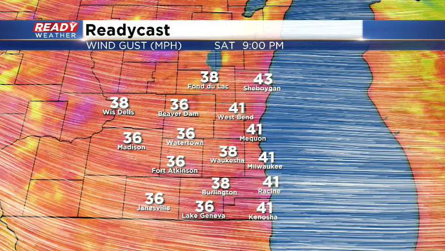
The strongest wind gusts of 35-40 mph are expected this evening behind the cold front, which will create wind chills between -10° and -15° during the evening and approaching -20° early Sunday morning.
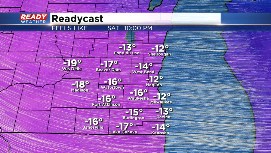
The best chance for -20° wind chills will be in Walworth and Jefferson counties where a Wind Chill Advisory will be in effect this evening through Sunday morning.
The gusty winds will linger through Sunday morning before becoming lighter Sunday afternoon. However wind chills will stay in the single digits above and below zero throughout the day.