


It's been quite the long stretch of dry weather across southeast Wisconsin with no rain in the area since May 19th. That streak will end for some of us today as isolated showers and storms pop along the lake breeze. Folks living near the lake most likely won't see these storms.
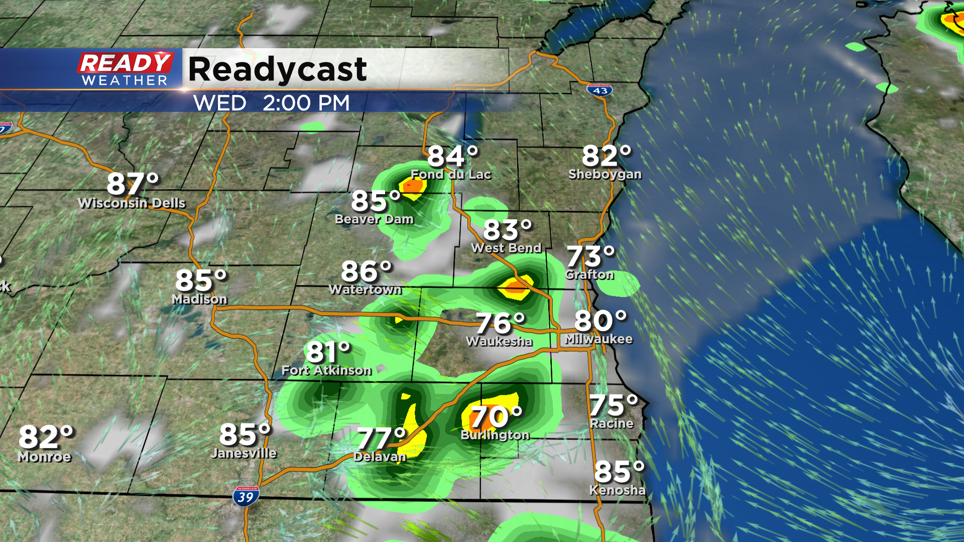
These will fizzle out this evening as the sun goes down. We'll have a similar set up for Thursday, but the lake breeze will be farther inland before storms are able to pop. Best chance for isolated storms Thursday will be west of Waukesha.
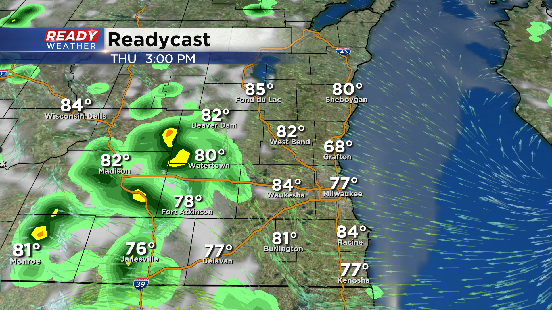
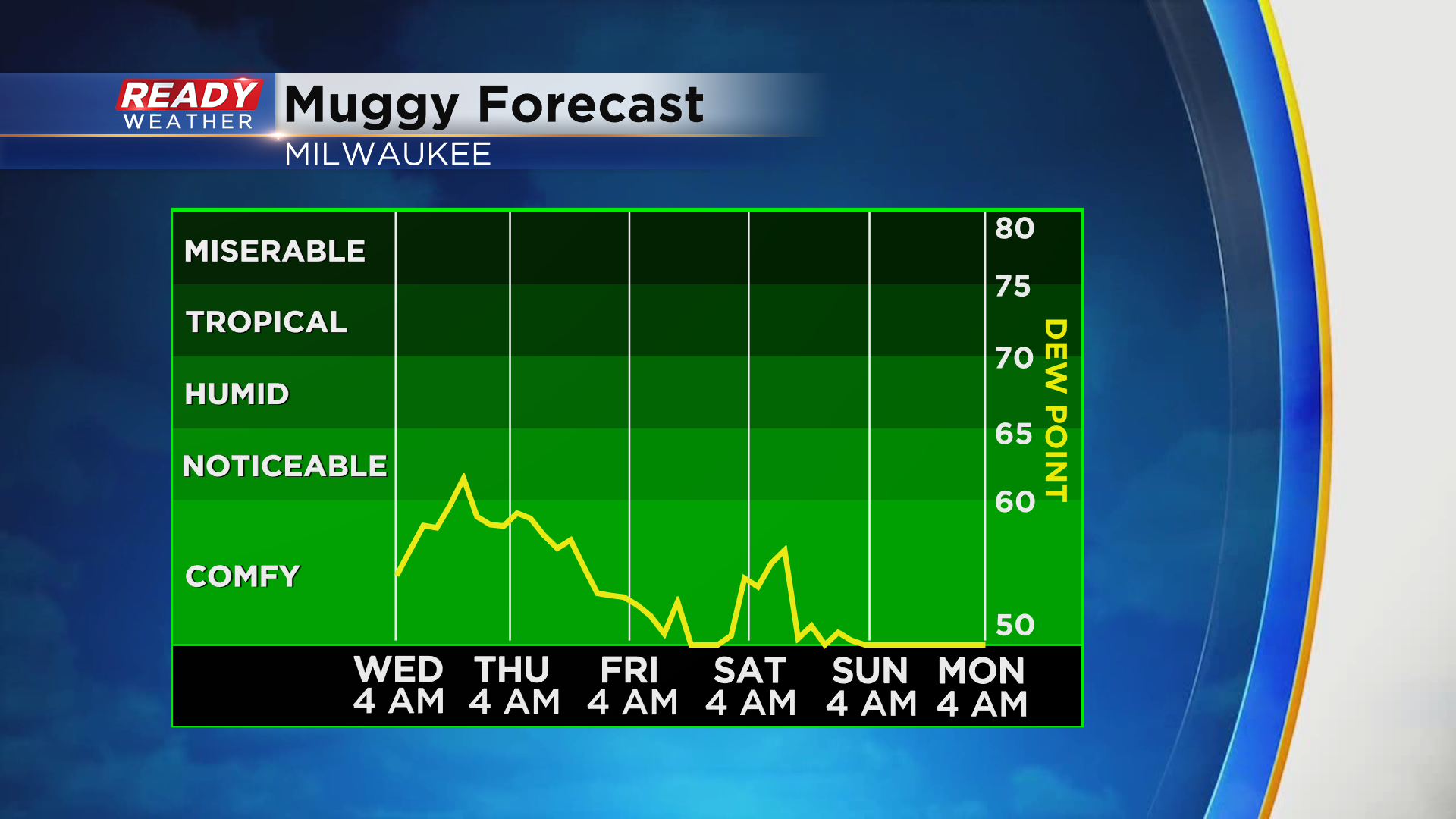
We'll have more noticeable humidity in the area today and tomorrow, which will help these storms develop. Dew points climb into the low 60s today and will still be in the upper 50s Thursday. Drier air starts to work back in on Friday.
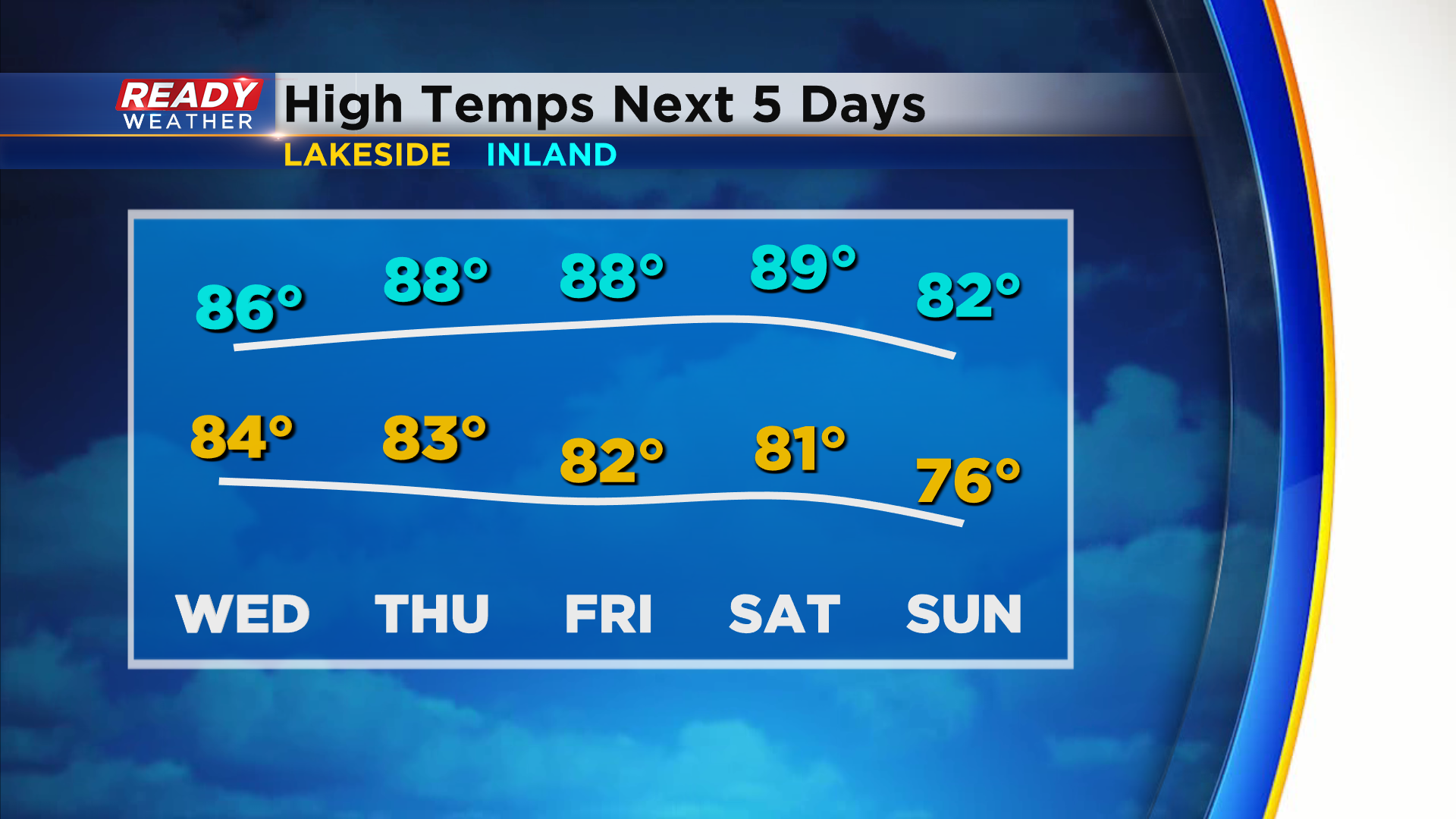
It'll continue to remain very mild for several more days. Highs generally will be in the mid to upper 80s away from the lake with low to mid 80s lakeside until we see a more NE wind on Sunday.
Download the CBS 58 Ready Weather App to keep an eye on the radar this afternoon.