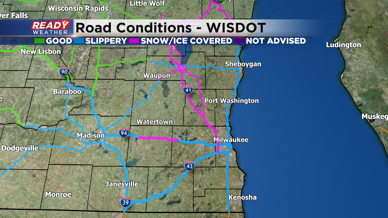
Snow will come to an end after Midnight. Slick roads are a major issue overnight.


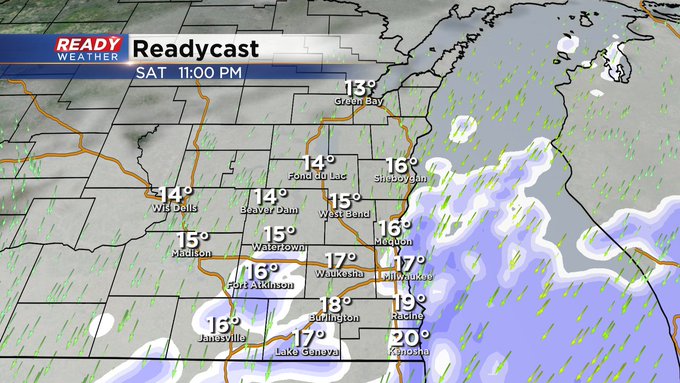
Update as of 11:00 pm Saturday, January 1st
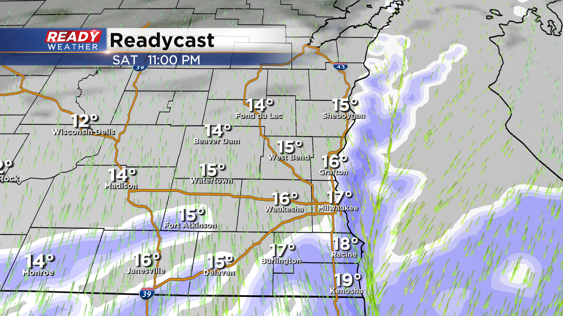
Snow is expected to come to an end around midnight. Lakeside areas within the warning could see some snow linger through 2 am. An additional 1" to 2" of snow is possible within the warning before it's all over.
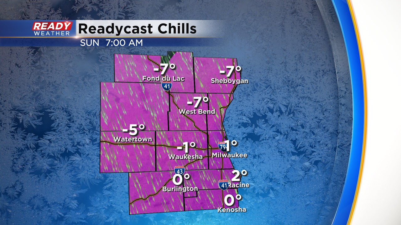
Roads will be a mess for Sunday morning with a lot of temperatures in the single digit and the lower teens. Subzero wind chills are expected for Sunday morning.
______________________________________________________________________________________________________________
Update as of 8:00 pm Saturday, January 1st
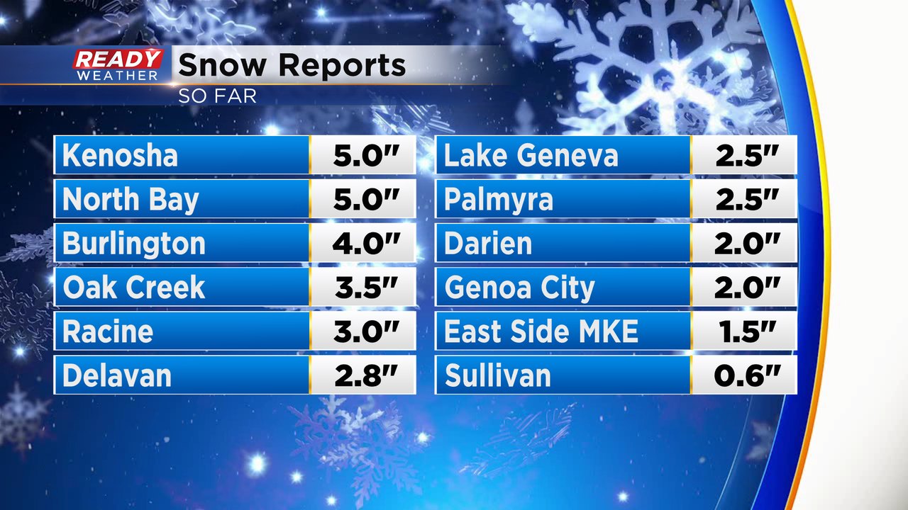
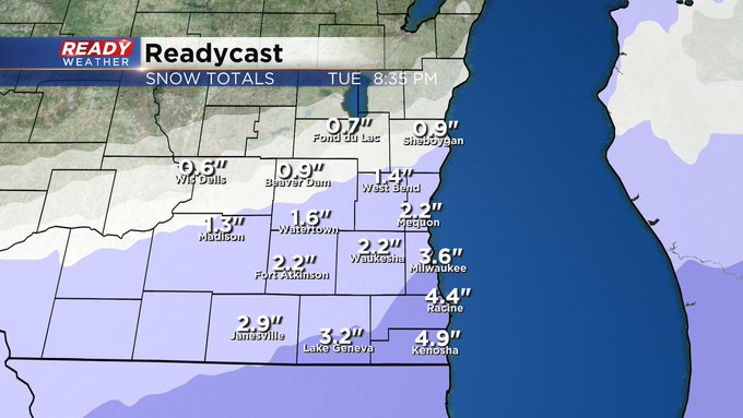
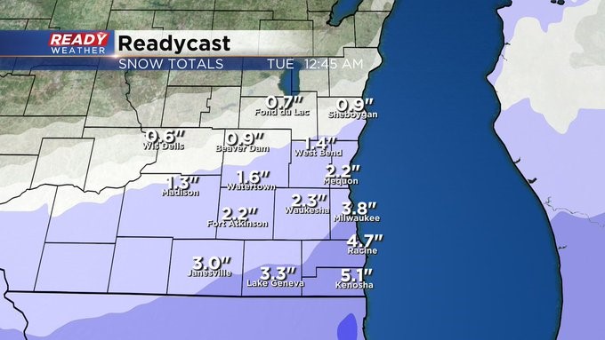
Here are some of the preliminary snowfall reports.
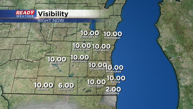
Travel has become very slick tonight, especially across the southern half of our viewing area. Snow is expected to end closer to Midnight before tapering off lakeside after 2 am.
Lakeside areas within the winter storm warning could see a band of snow continue through 3 am. An additional inch or two will be possible along the lake before it shuts down.
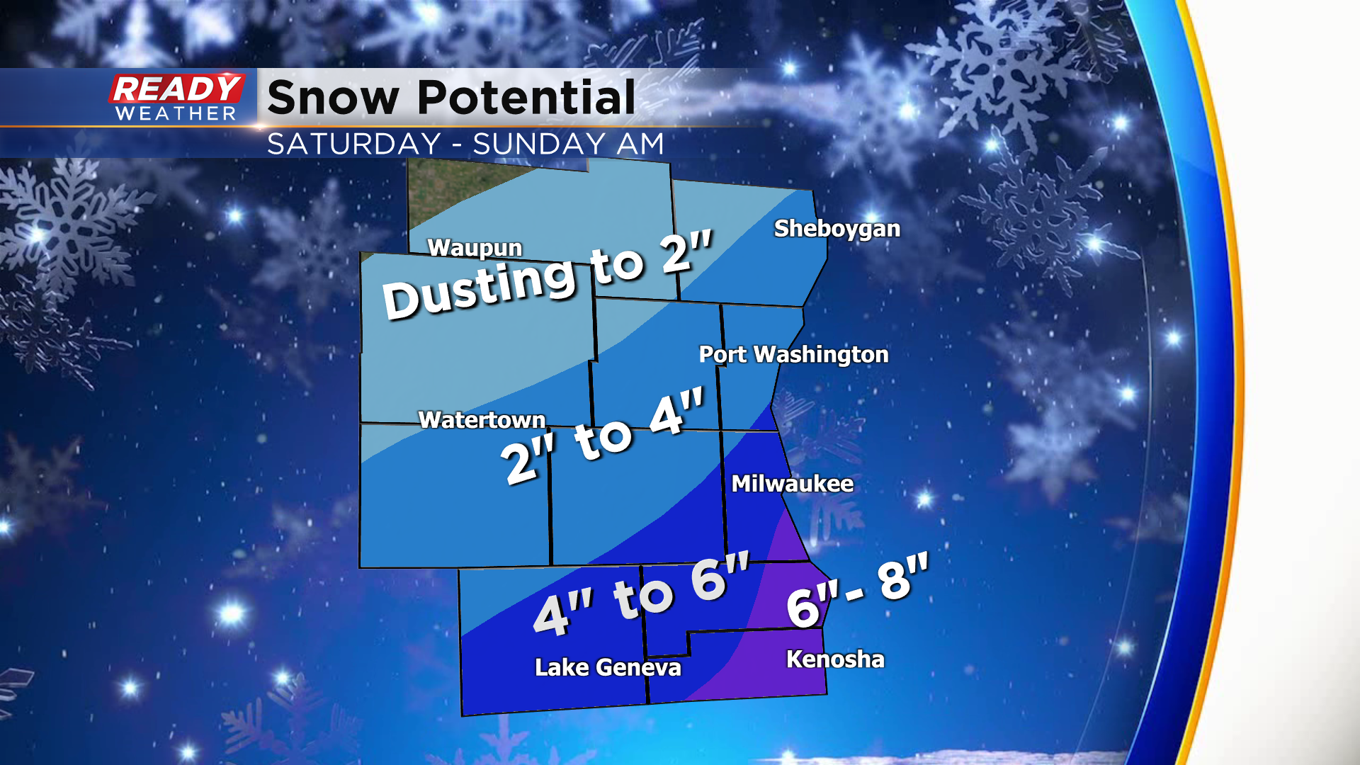
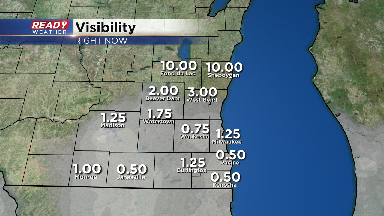
We still expect most of the area along and south of 94 to pick up between 2" to 4". Locally higher amounts over 5" will be confined near the lake.
______________________________________________________________________________________________________________
Update as of 6:00 pm Saturday, January 1st
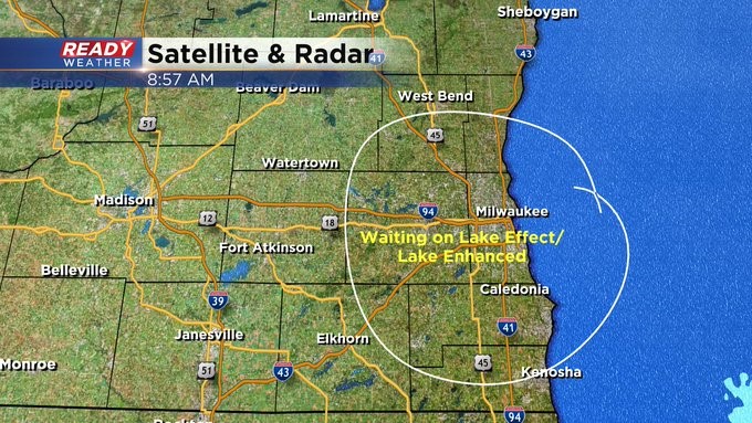
Travel has become very slick across Walworth, Racine, and Kenosha counties. A steady lake enhanced band of snow has remained steady over those areas causing snow. That band has now shifted into southern Milwaukee county. and snow is filling in all across the area.
The heavy steady snow should continue through midnight along and south of 94. Visibility is also down where the heavier snow is falling.
______________________________________________________________________________________________________________
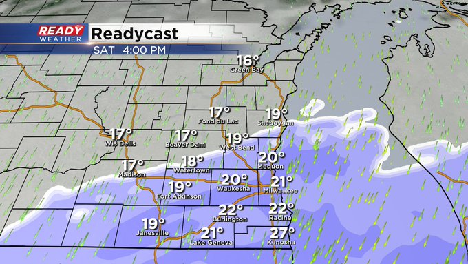
Update as of 4:30 pm Saturday, January 1st
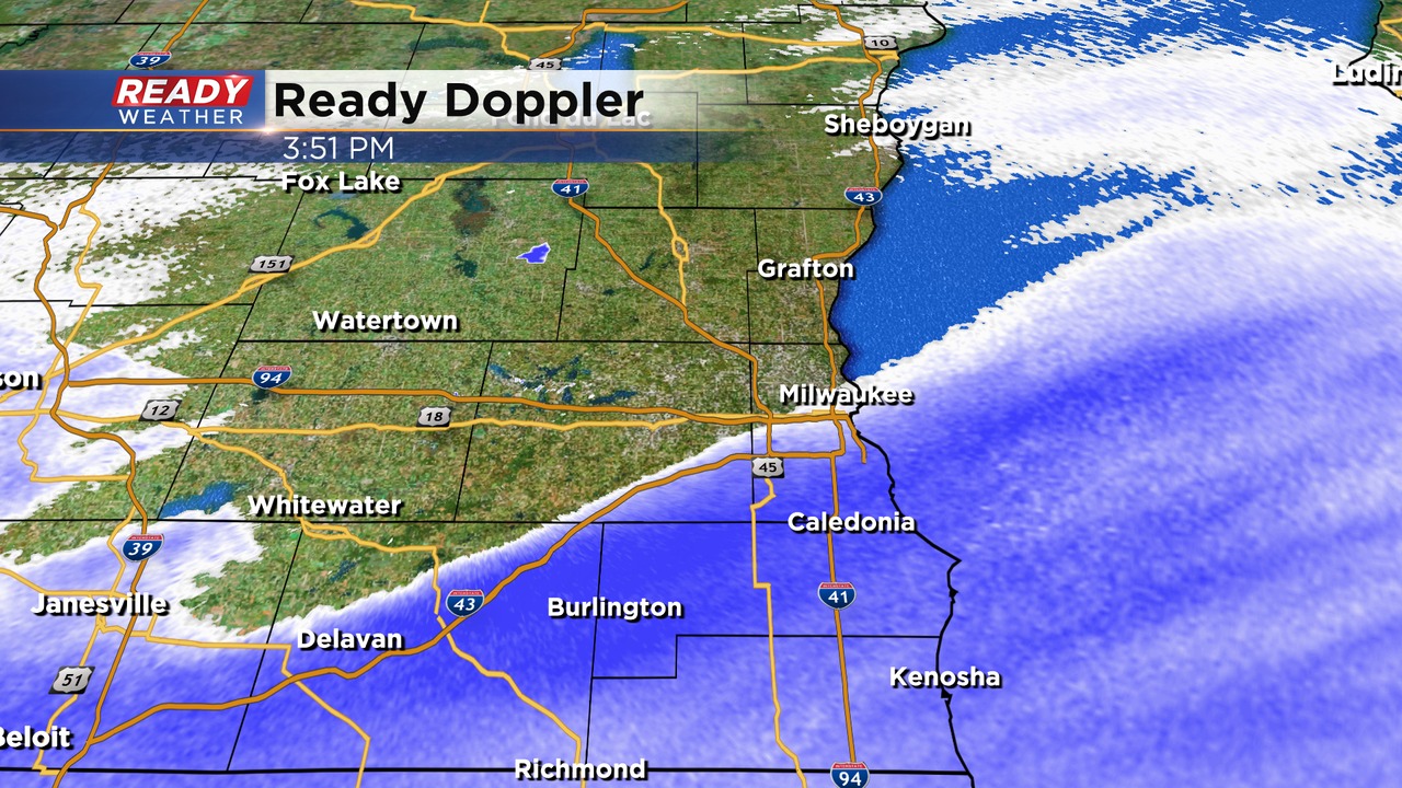
Travel has become very slick across Walworth, Racine, and Kenosha counties. A steady lake enhanced band of snow has remained steady over those areas causing snow. That band has now shifted into southern Milwaukee county.
There is a hole where a lot of our area remains quiet; however, through this evening we do expect that to fill in. Cold temperatures will allow the snow to quickly accumulate on roads.
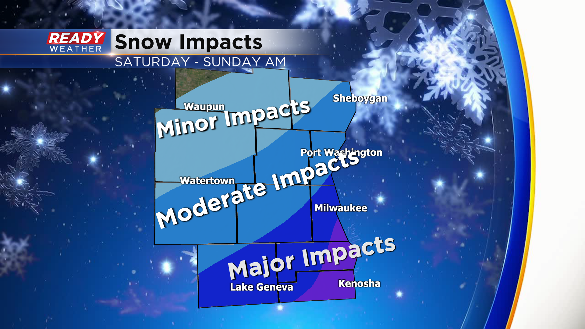
We have decreased the snow totals the further north you go. We still think along and south of 94 there will be many snow totals between 2" to 6".
______________________________________________________________________________________________________________
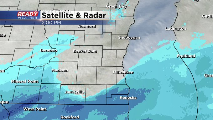
Update as of 2:15 pm Saturday, January 1st
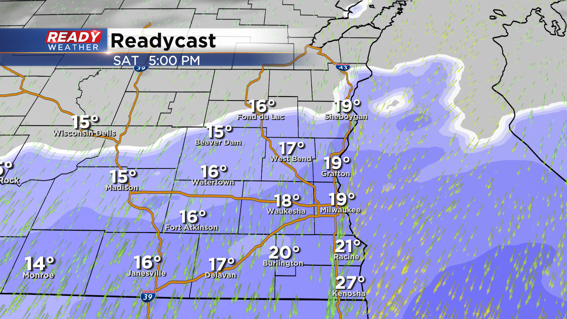
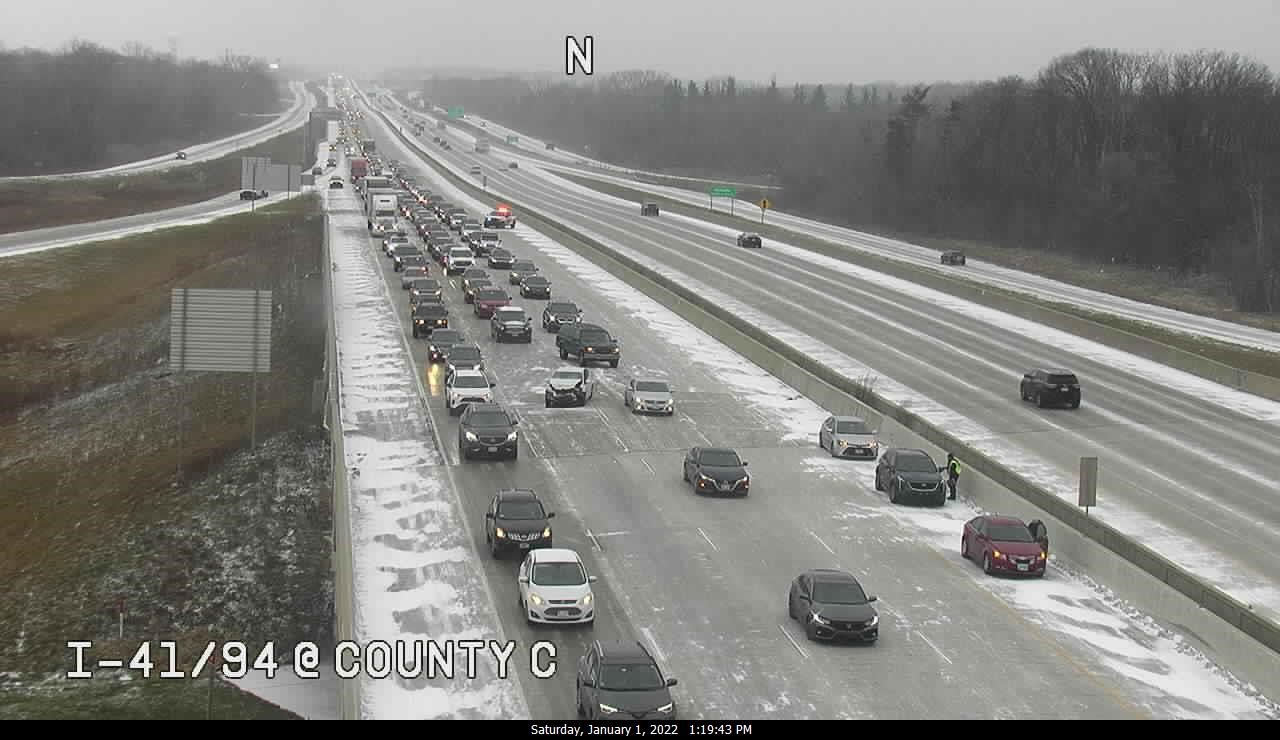
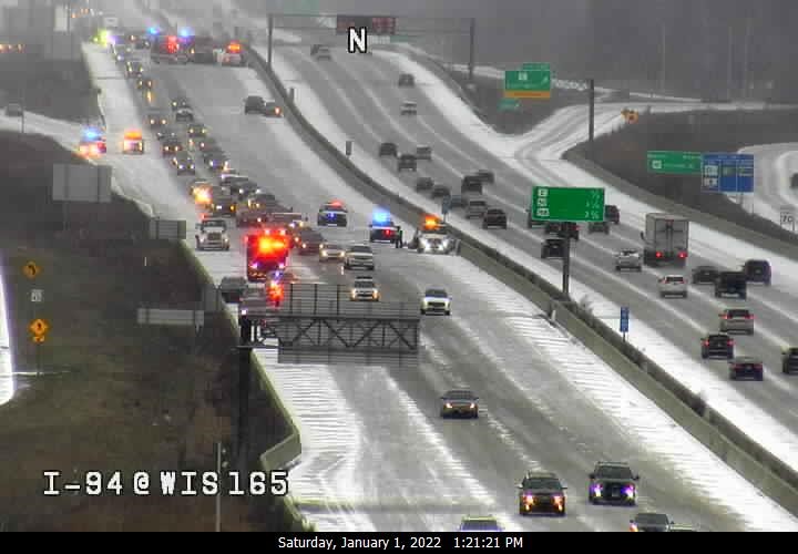
The snow is beginning to move into the metro from the south. In just the last hour or so, we're had reports of multiple accidents on I-94 near the border of Illinois. Please slow down in these conditions. Better yet, hold off going out if you can. It'll only get more slick into tonight. The snow isn't expected to wind down until the overnight. It'll linger along the lakeshore the longest. It still looks like 2-4"+ will be common amounts with much higher totals in some favored lakeshore communities.
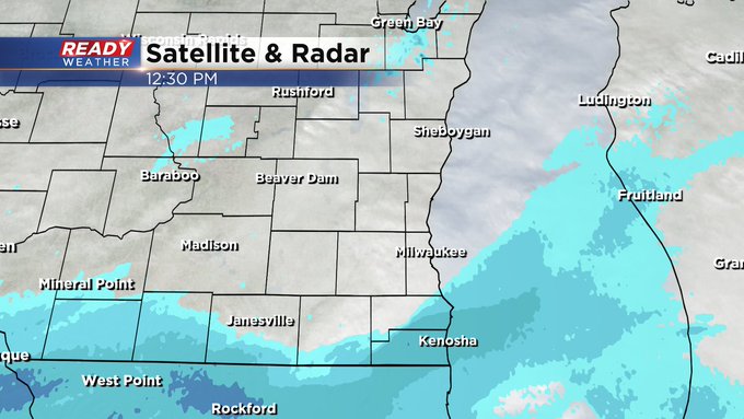
Update as of 12:30 pm Saturday, January 1st
Right on cue. Snow is crossing the state line and starting to impact areas in Kenosha County. Look for the activity to overspread the entire region in a matter of hours. Watch for blowing snow and poor visibility with gusty northeasterly winds. Notice how there's already lower visibility in Kenosha. 2-4"+ general amounts can be expected with higher totals toward the lake. Some places more than 6". Please drive with extreme caution if you have to venture out anytime this afternoon or tonight. Stay tuned to cbs58.com and CBS 58 for further details.
Update as of 10:30 am Saturday, January 1st.
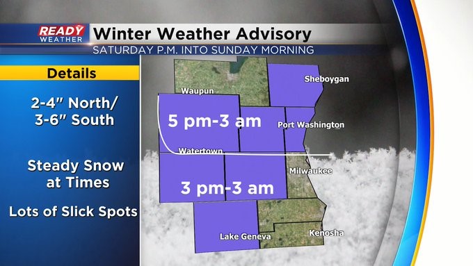
The NWS has trimmed back the winter weather advisory this morning. Dodge and Sheboygan counties have been dropped. There remains a lot of uncertainty regarding how far north the accumulating snow will move. Those counties will receive snow; however, they will remain below advisory criteria.
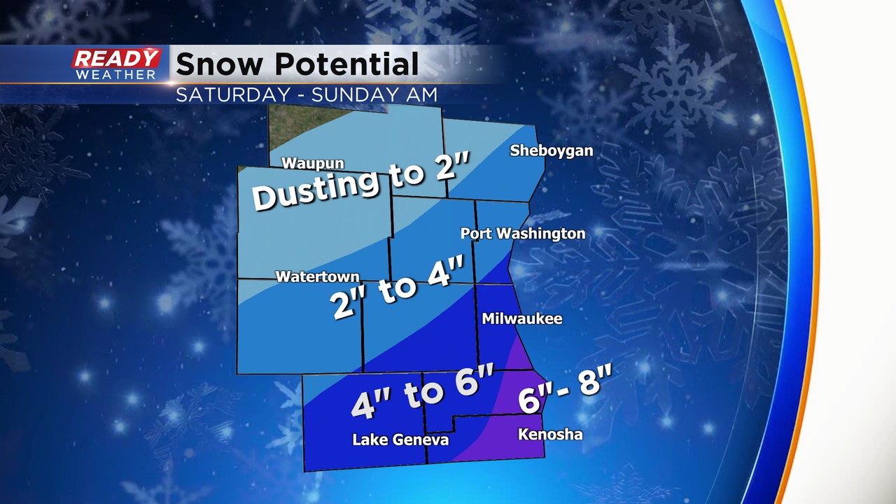
Not many changes in the overall snow forecast. The best chance for 3" to 6" of snow will be along and south of 94. Heaviest snow will be lakeside. With cold surface temperatures plan on slick roads later today. It won't take much snow to create accidents.
______________________________________________________________________________________________________________
Update as of 9:15 am Saturday, January 1st
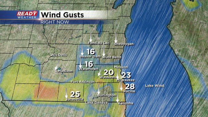
Still quiet on the radar. But that's expected to change between now and lunch time. Look for feeder bands to get going along the lake and eventually moisture will come up from the south. Conditions will deteriorate during the afternoon and only get worse into the evening. The wind will blow the snow around, reducing visibility and temps will stay below freezing so expect lots of slick spots. Below you can see all the advisories over the next 20 hours or so as well as the expected snowfall totals. 3-6" amounts look good with higher numbers lakeside, especially south of Milwaukee. The CBS 58 Ready Weather team will keep updating this discussion as we go through the day so keep checking back and be careful on the roads if you have to go somewhere this afternoon and tonight.
_____________________________________________________________________________________________________________
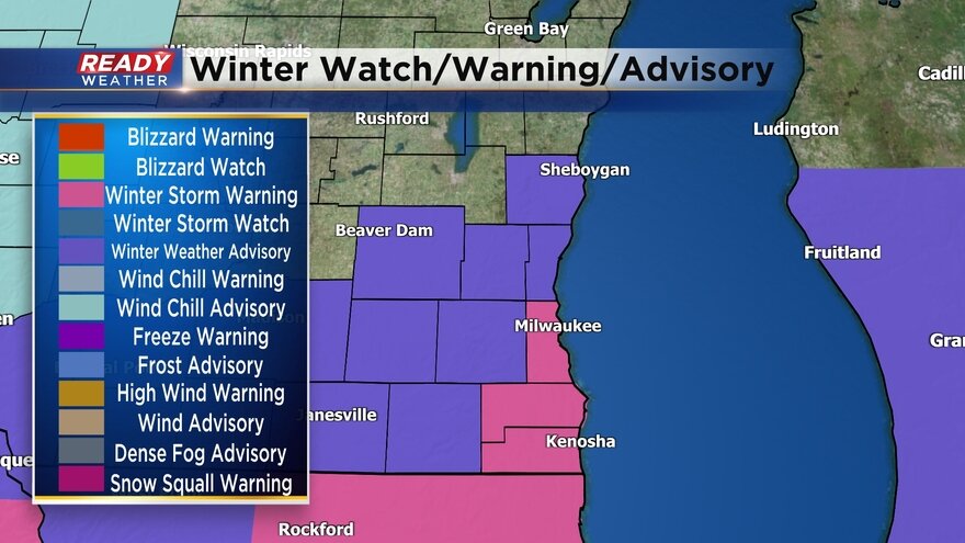
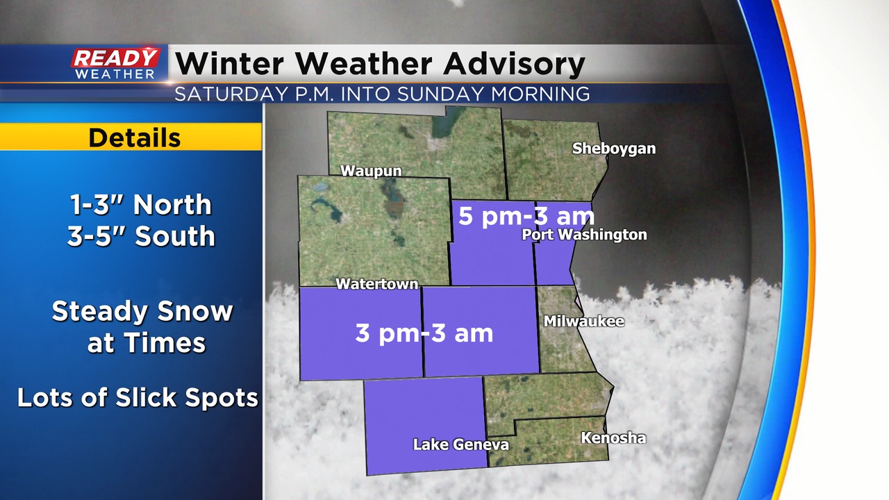
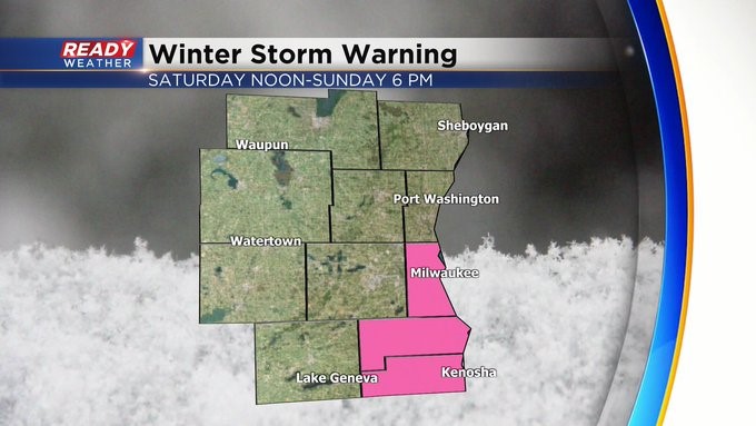
MILWAUKEE (CBS 58)--Mother Nature knows a thing or two about lining up the season with the calendar, especially as we start January. Look for the first snowstorm of the season to impact us as we get into Saturday afternoon. And once it starts, it'll linger into early Sunday morning. But not before dumping 6-10 inches in favored areas by the lake. In fact, A Winter Storm Warning goes from noon Saturday until 6 am Sunday for Milwaukee, Racine, and Kenosha Counties. Away from the lake, there will be lesser amounts, 3-6"+ generally speaking. This is where we have a Winter Weather Advisory. Please drive with extreme caution today if you have to hit the roads.
The coldest air of the season is right behind this system. Expect highs to only be in the teens on Sunday with subzero wind chill numbers. Look for a warmup into next week with highs in the 20s and 30s along with another chance of snow by the middle of the week.