


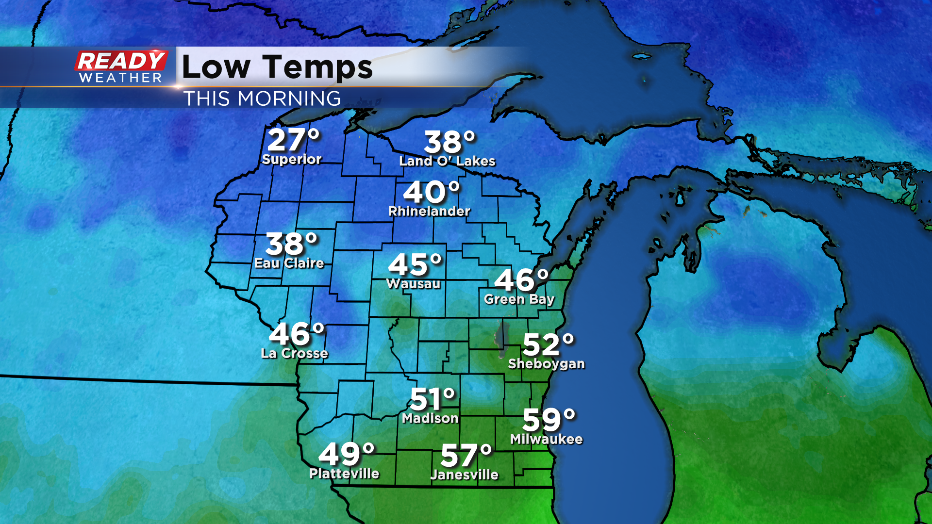
It was a cooler start to the day around the Badger state today with lows in the 40s and 50s in southeast Wisconsin with 20s and 30s up north!
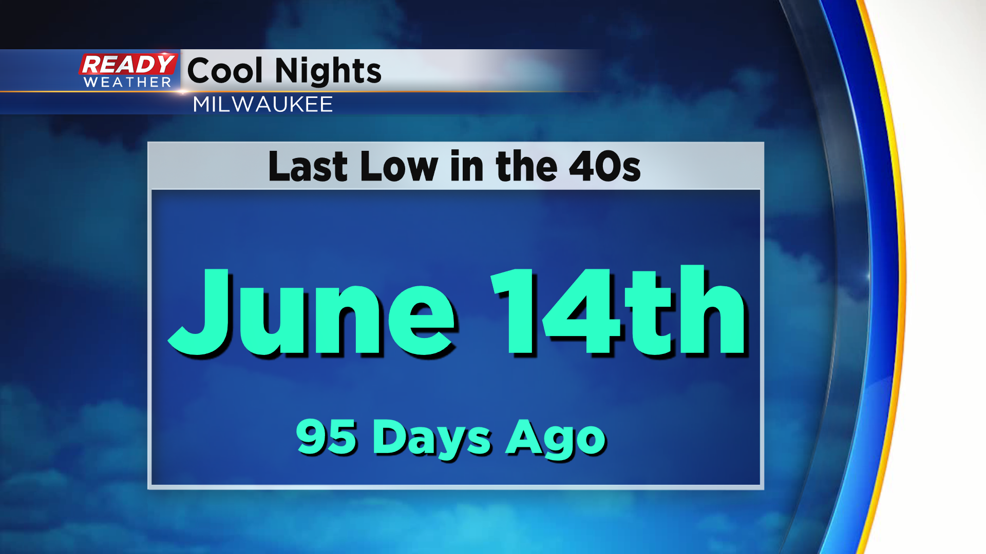
Many spots will likely fall into the 40s tonight as a cool Canadian high pressure system settles into the area. If we do drop into the 40s in Milwaukee, it'll be the first time we've been in the 40s since June 14th.
This cool air mass will be in place through the weekend, with Friday being our coolest day as highs struggle to reach 60°. Thankfully we'll be dry throughout the weekend with plenty of sunshine Saturday and Sunday.
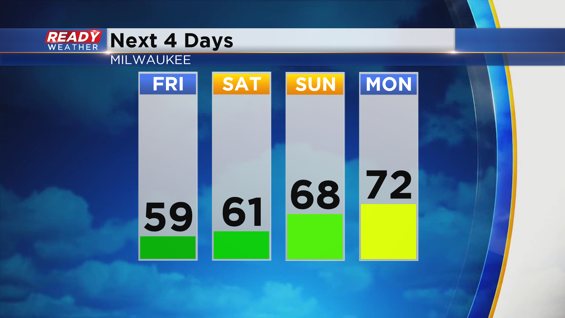
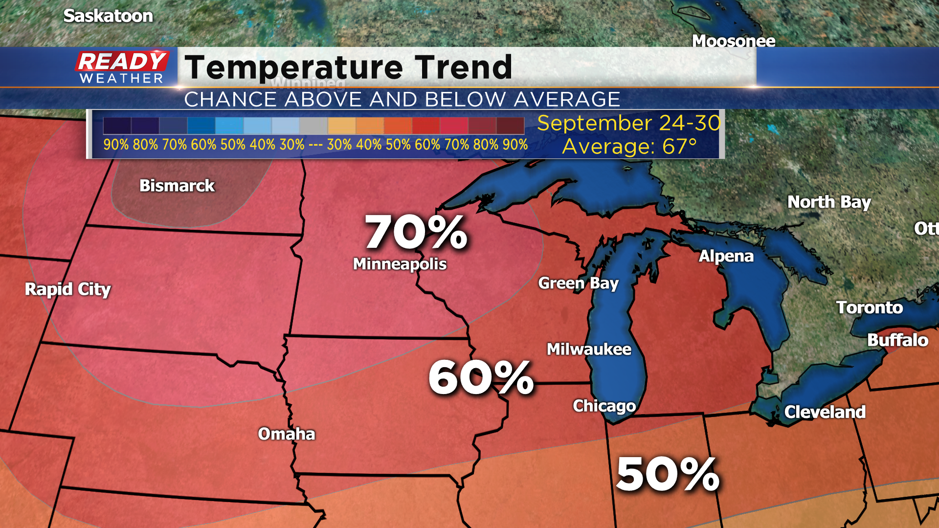
Temps will rise back into the low 70s on Monday and could remain in the 70s for a while. The 8 to 14 day temperature outlook that takes us through the end of September has a 60 to 70% chance for above normal temperatures. Normal highs by the end of the month are in the mid 60s.
Download the CBS 58 Ready Weather App to see if there's any rain in the forecast.