Fall's last weekend reveals more cold air by Sunday

-
2:39

Only thing consistent about this forecast is the inconsistency
-
1:39

Milwaukee Juneau wins the Division 4 state title against Cambridge
-
1:00

Wisconsin Parkinson’s Association using ping pong to help those...
-
0:59

200 firefighters climb 30 flights of stairs in annual fundraiser...
-
1:18

Victim identified in deadly quintuple shooting on Milwaukee’s...
-
1:06

People gather in Milwaukee’s upper east side to protest Trump...
-
1:24

Schlesinger’s Saturday Showcase (3/21)...Spring Home & Garden...
-
2:48

The first weekend of spring features wild swings and a bit of...
-
2:43

’They are almost mentally broken’: Wisconsin TSA workers...
-
1:02

Marquette women’s lacrosse holds Pancreatic Cancer Awareness...
-
2:02

City of Port Washington planning commission votes to limit hours...
-
1:28

Covering all the bases: Brewers preview variety of new stadium...

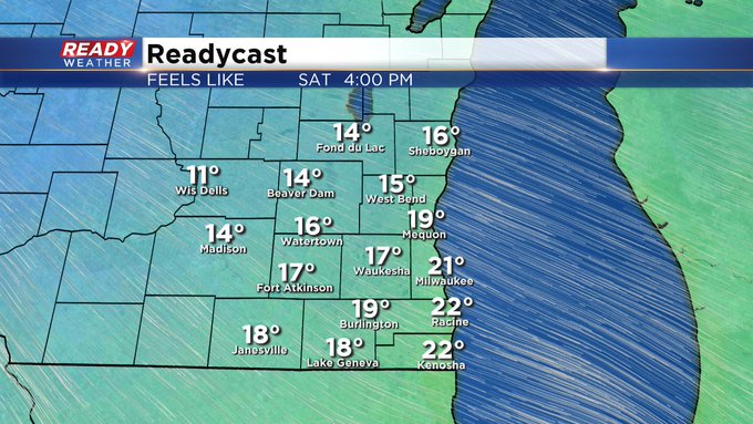
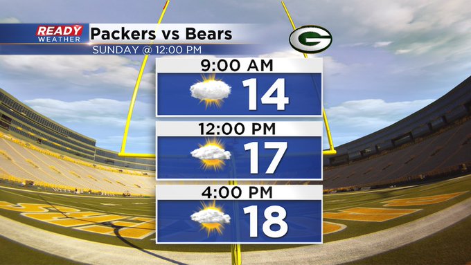
Milwaukee (CBS58)--Don't get used to the near 40 degree temps today. Readings take a slide as soon as later Saturday as arctic air begins to intrude, at least for a while. Highs will struggle to get into the 20s by Sunday. Any wind will make it feel that much colder. In fact, look for wind chill numbers to stay in the lower teens for the second part of the weekend. Heading to the Packers game on Sunday, dress for winter! Look for highs only near 20 with the real feel deal near 10!!

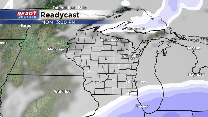
Our next best shot of snow comes Monday, especially the second part of the day. The computer models are still wrangling with the date, but it looks like the southern half of the viewing area could get a glancing blow.
Stay tuned for further updates thorughout the weekend with CBS58 Ready Weather forecaster Sam Kuffel.