Fall temperatures arrive right in time for the start of autumn


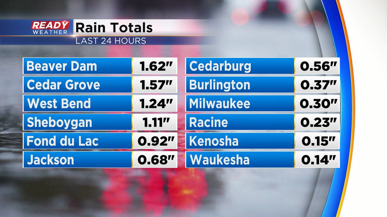
A strong fall cold front arrived Monday night with a decent amount of rain. A few storms from 10 am to 4 pm were on the strong to severe side with gusty wind. Our northern counties saw the most rain with over 1.50" of rain in a few locations.
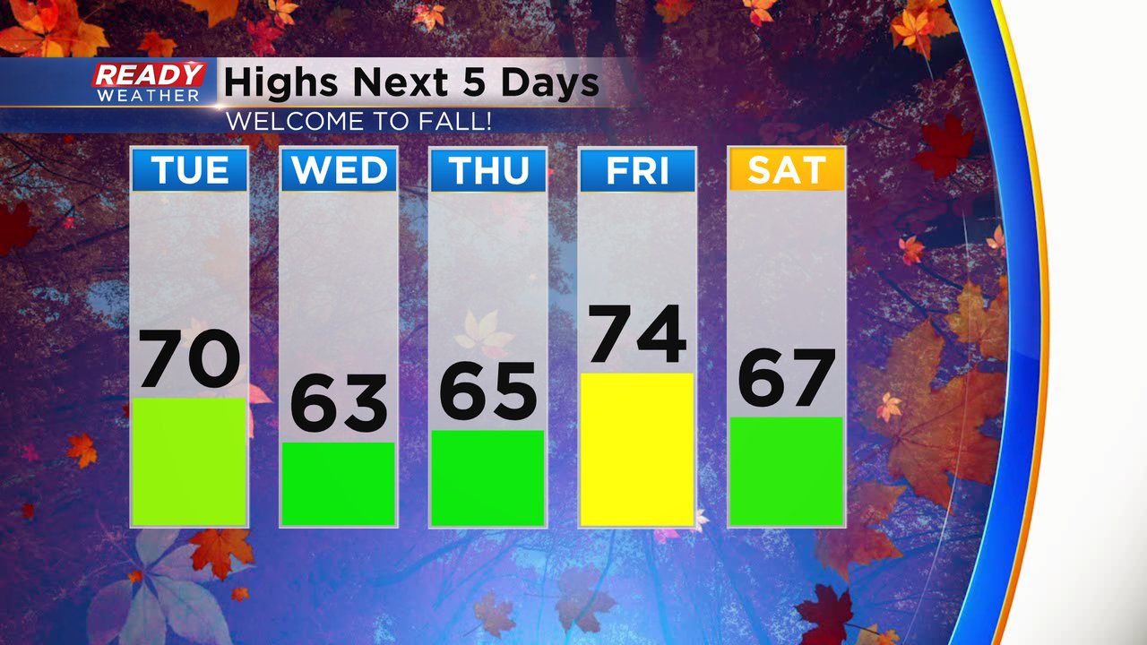
A few isolated sprinkles and showers will be possible the next few days as clouds stick around but the rain chance doesn't look super good at all. Official highs on Tuesday will go down in the middle to upper 70s which is where we were at just after midnight. Since then, temperatures have dropped into the 60s. Afternoon temps on Tuesday will struggle to hit the upper 60s and then stay in the low to middle 60s for the first few days of fall on Wednesday and Thursday. Friday is a warmer day before a cool and pleasant first weekend of fall.
Dew points early Tuesday were still in the middle 60s but have already dropped into the 50s and will continue to fall during the day. Humidity levels will fall off the Muggy Meter chart as dew points drop into the 40s Wednesday and Thursday.

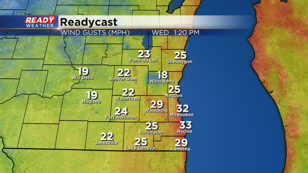
As temperatures stay on the cooler side the wind gusts will increase. Expect a breezy day on Tuesday as cooler air filters in. The wind will stay strong Tuesday night and both Wednesday and Thursday could see wind gusts over 30 mph at times.
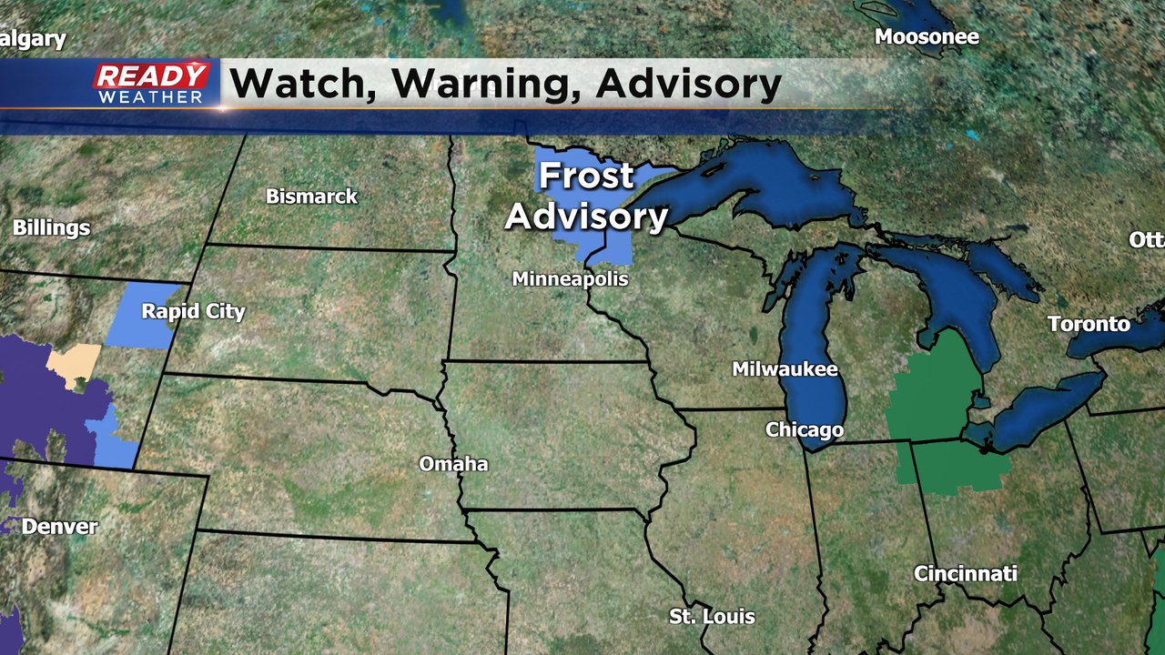
The fall feel will get cold enough that a frost advisory has been issued for a few counties in far northwest Wisconsin in the Duluth/Superior area as well as the arrowhead of Minnesota. Temperatures there could drop into the mid 30s Wednesday morning. Our coldest morning locally will be Thursday morning when an isolated upper 30 is not out of the question inland.
Download the CBS 58 Ready Weather app to track the fall temps.