


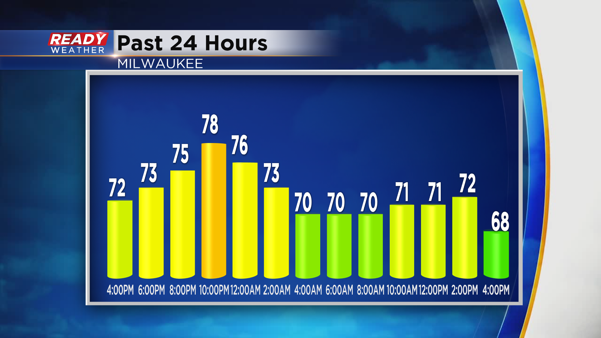
It's been a backwards day today in the temperature department. Milwaukee had its high temperature of 74° shortly after midnight, with temps dropping into the 50s and 60s late this afternoon behind a cold front.
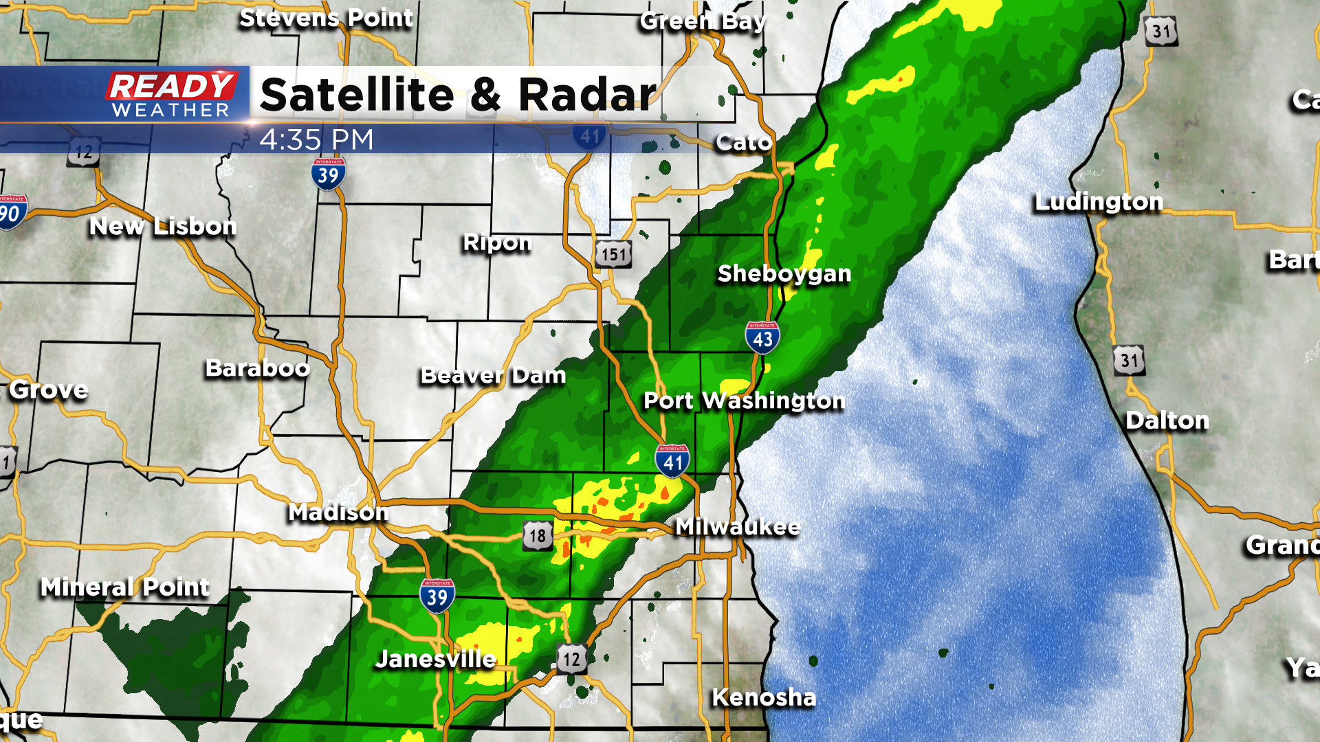
A band of rain is trailing behind the cold front and is slowly pushing eastward. This will continue for far eastern/southeastern Wisconsin this evening, lingering in far southeastern parts of the area overnight.
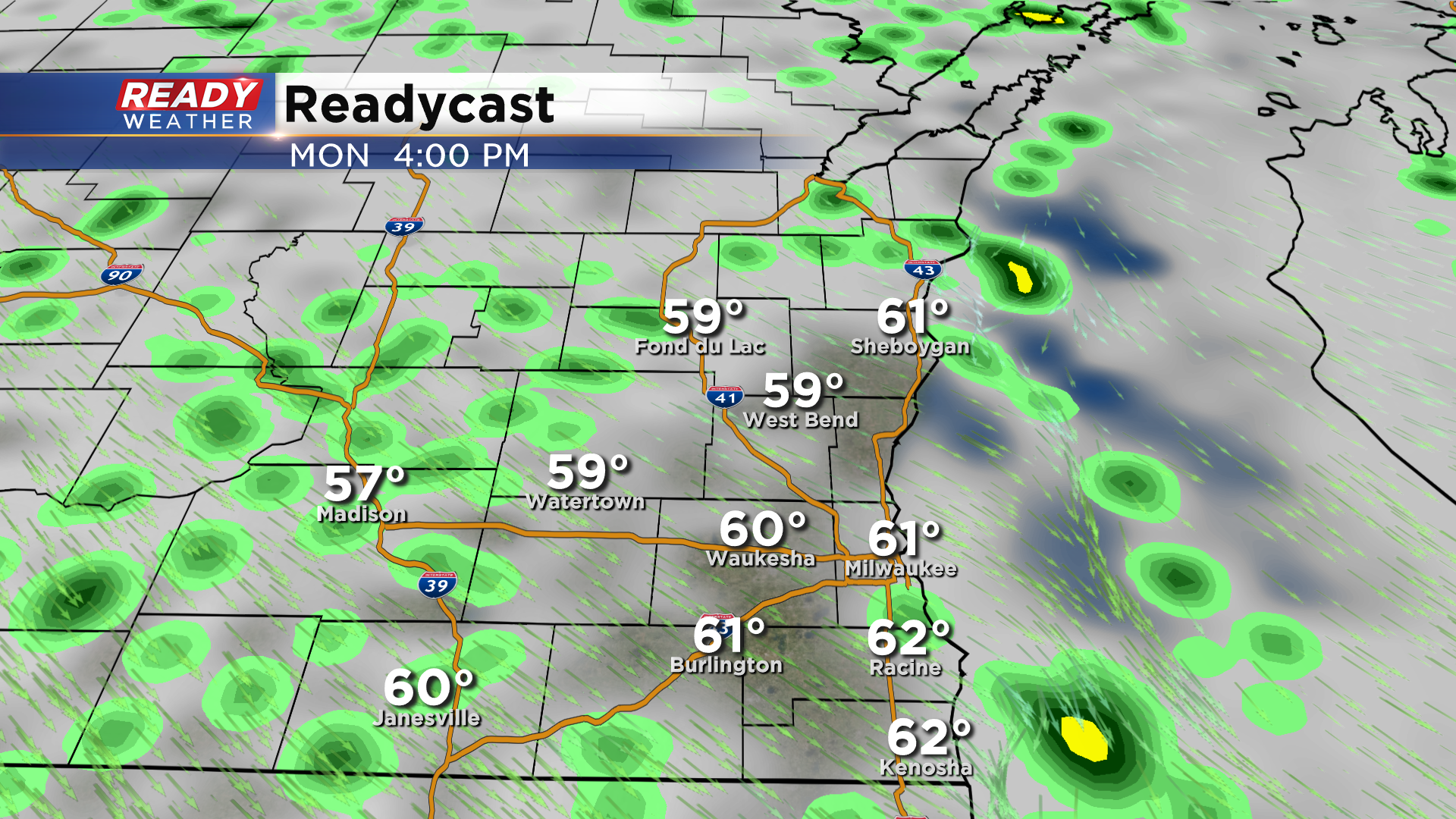
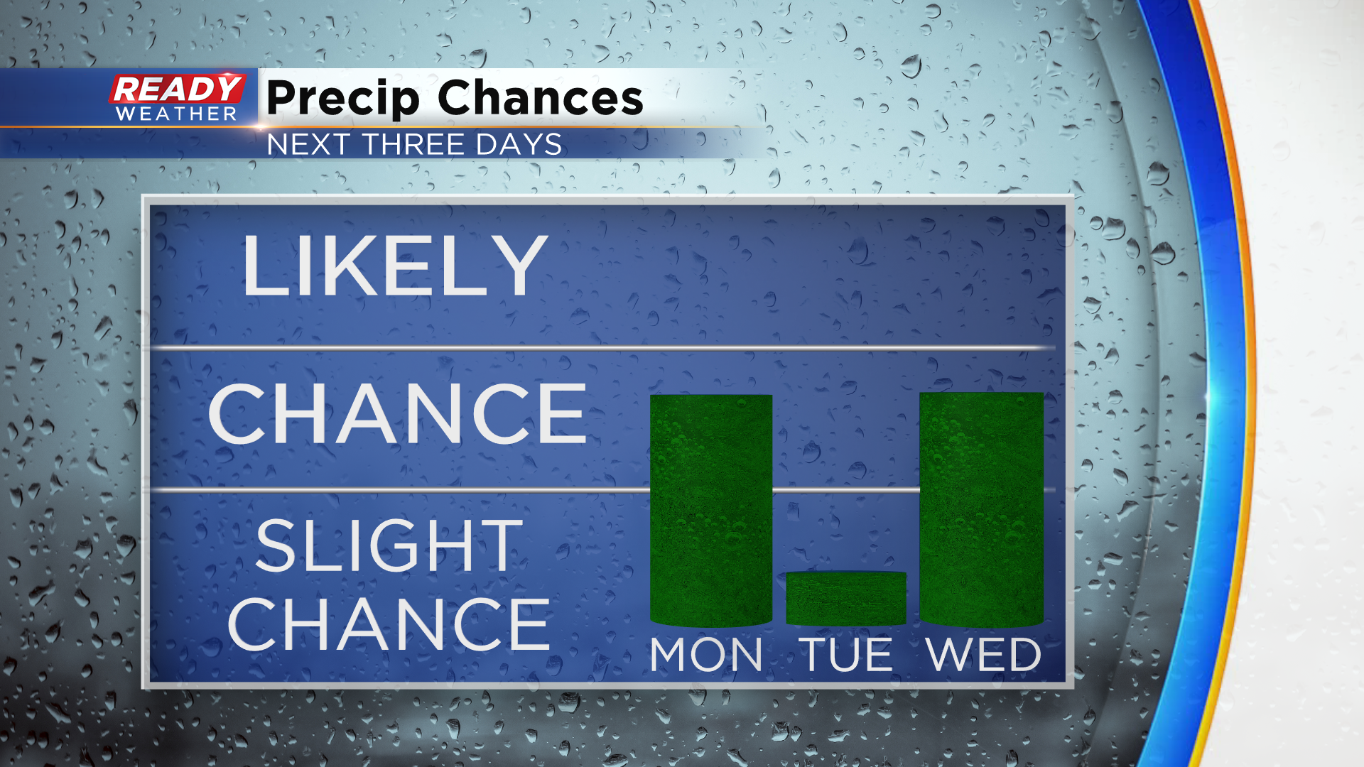
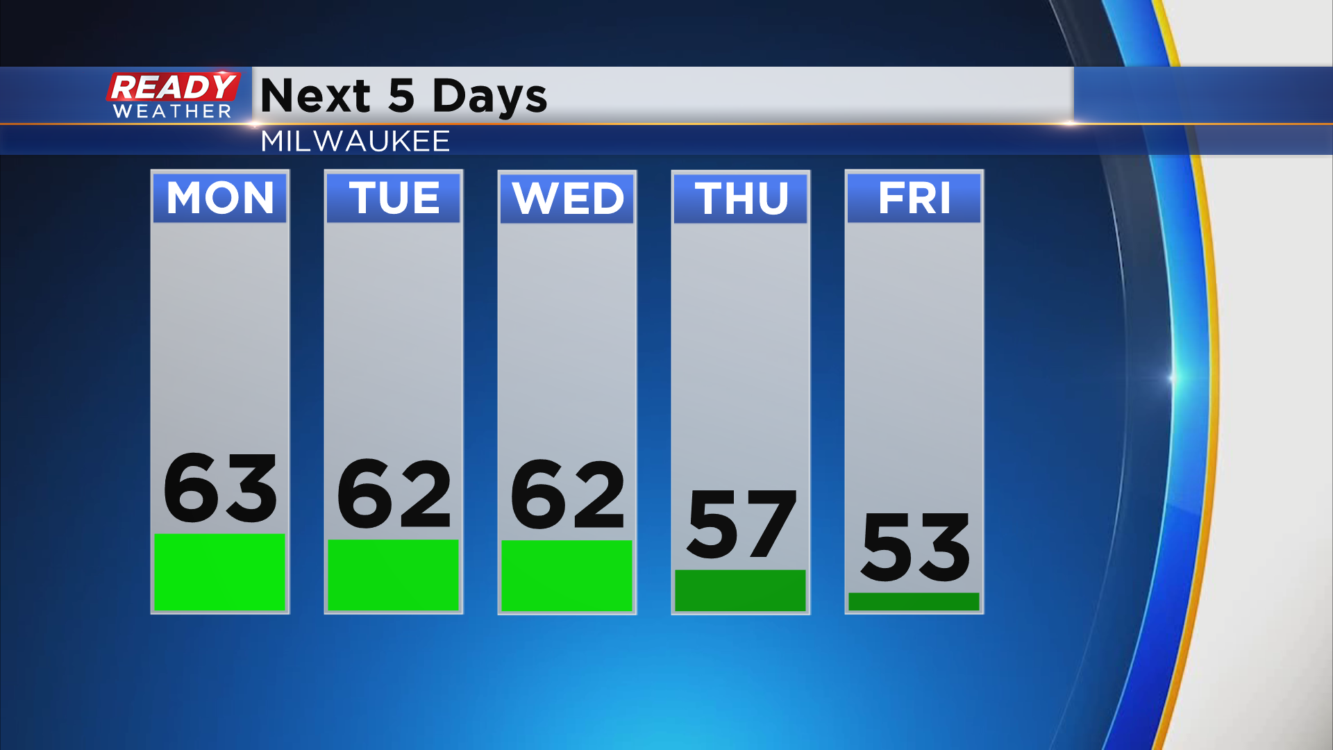
Most of the area should dry out Monday morning, but we can't rule out a few lingering showers near the lake around sunrise. Instability showers will then pop up Monday afternoon.
Tuesday should be dry for most as afternoon pop up showers will be confined to the northern half of the state. A better chance for scattered showers will return Wednesday afternoon and Thursday.
Highs will generally be in the low 60s through Wednesday, but will drop into 50s behind Thursday's strong cold front.
See how long the 50s will stick around by downloading the CBS 58 Ready Weather App.