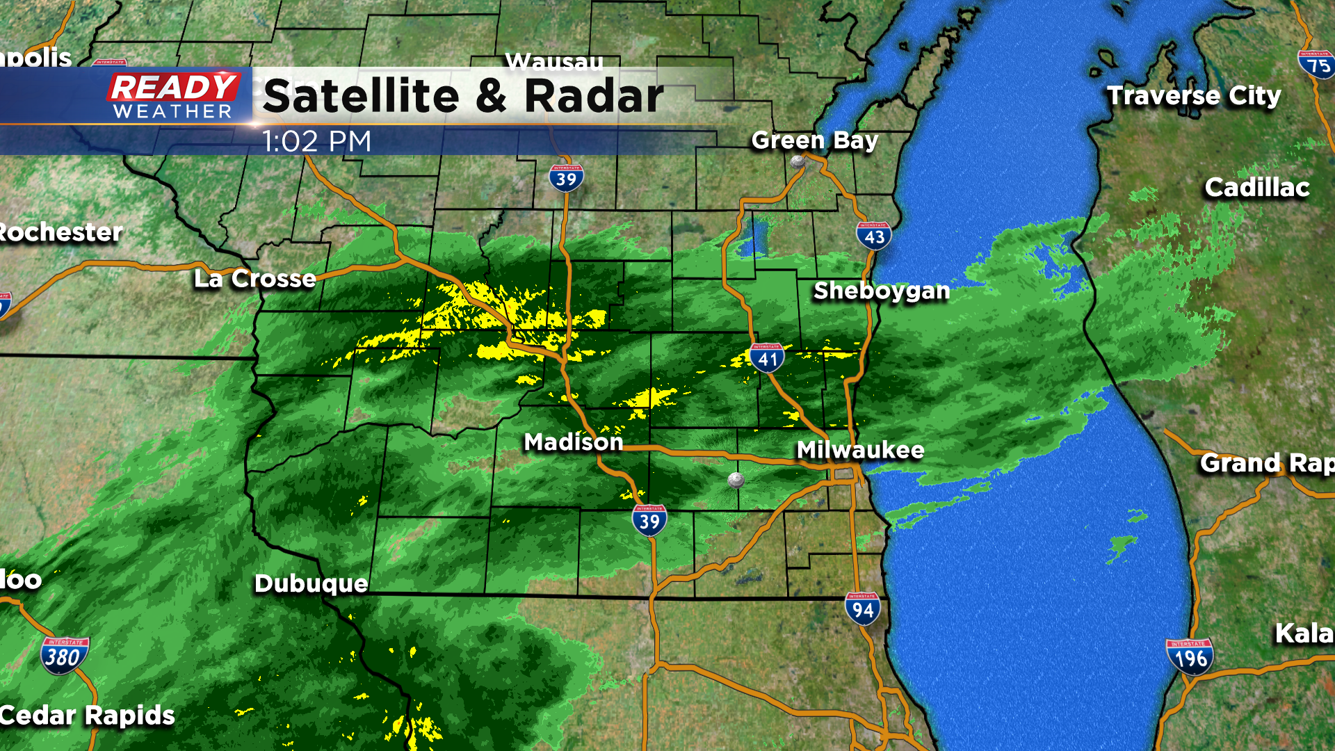
Keep that umbrella and rain jacket handy for the rest of today as steady, light rain continues to move through the southern half of the state.
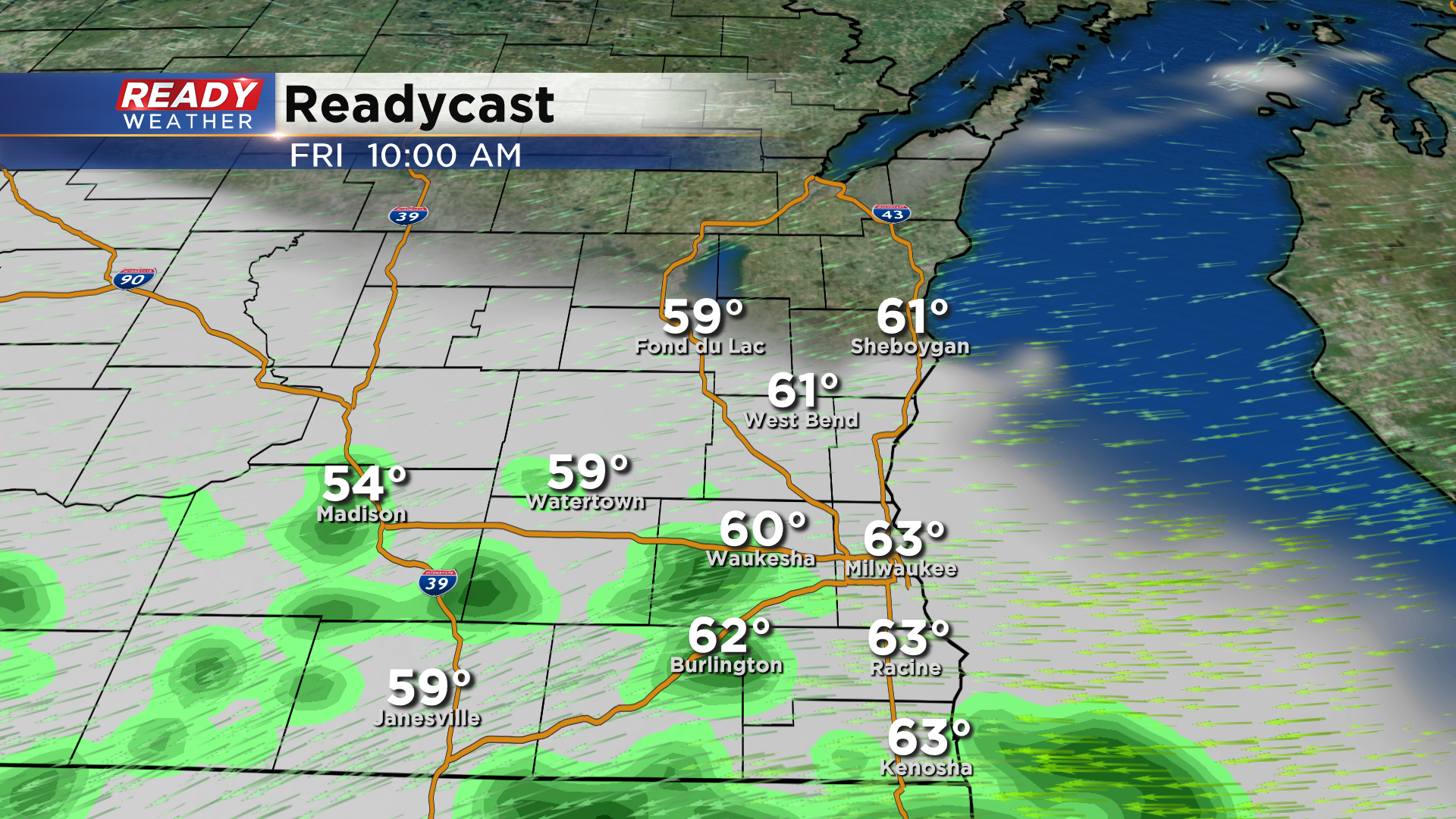
High pressure moving in from the north will finally push the stalled front far enough south later today that most of southeast Wisconsin should get a break from the rain on Friday. However, a few isolated showers may linger early Friday morning south of I-94.
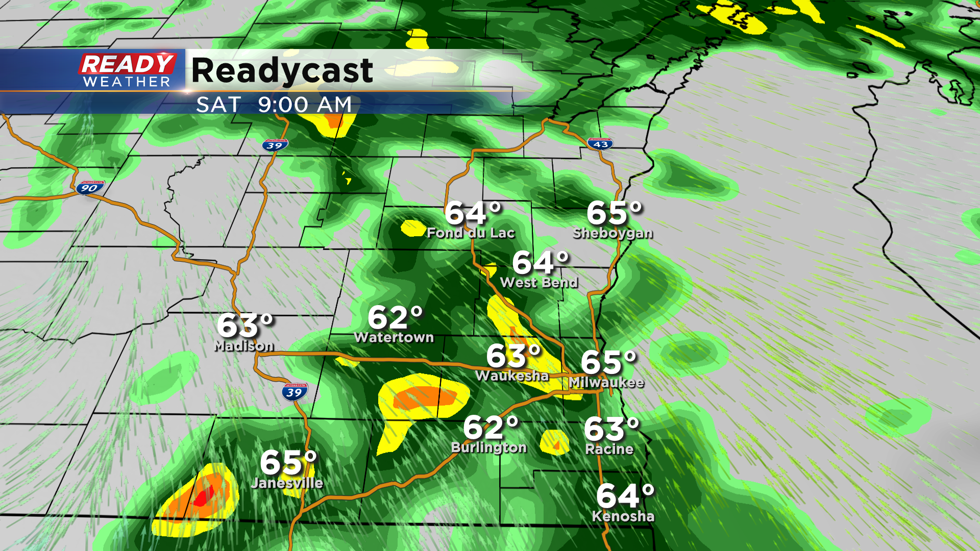
After a dry afternoon, rain and a few rumbles of thunder will move back in Friday night and continue through at least early afternoon Saturday as a low pressure system tracks through the state. Once this low pressure system clears the area Saturday night, we’ll have a well-deserved dry stretch of weather through most of next week!
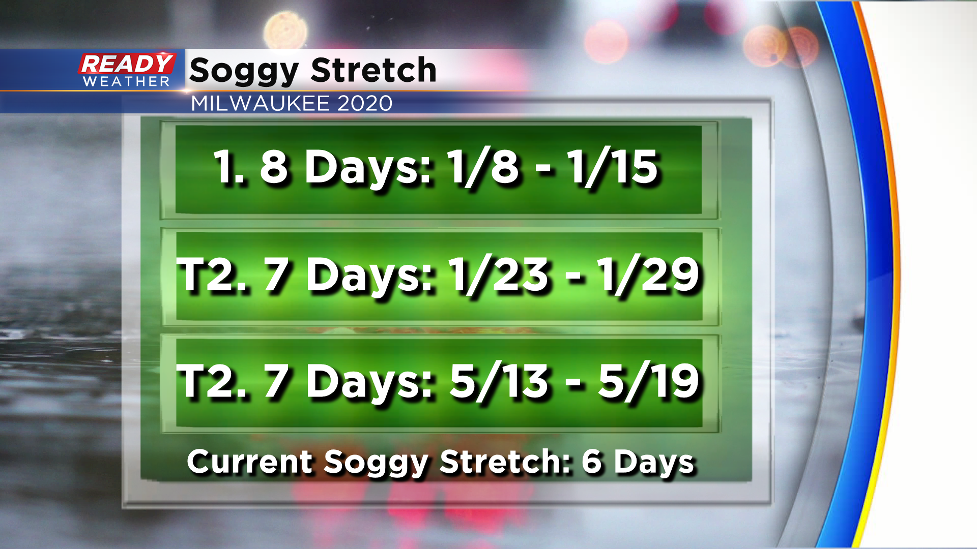
We’re in the midst of one of our soggiest stretches so far this year, with today being our 6th straight day with a least a trace of rain. If we receive the expected rain Friday and Saturday, that would mark 8 straight days of wet weather, which would tie the longest stretch Milwaukee has had this year. The other 8 day stretch of wet weather occurred from January 8th through the 15th where we saw both rain and snow.
Download the CBS 58 Ready Weather App to see how much warmer temperatures will be next week when the sunshine returns.
