Burst of snow Monday morning then drying for a few days


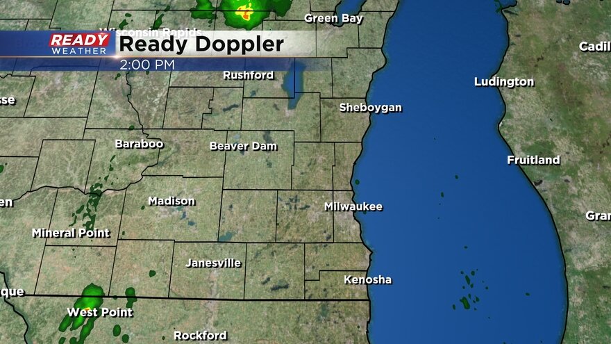
Our long duration light snow event is almost over but not before it drops some quick accumulation Monday morning. A burst of moderate snow has been moving north to south through southeast Wisconsin since 2 AM Monday with moderate snow currently rolling through Waukesha and Milwaukee Counties right in time for the peak morning rush.
Here's a look at the radar that will update with time:
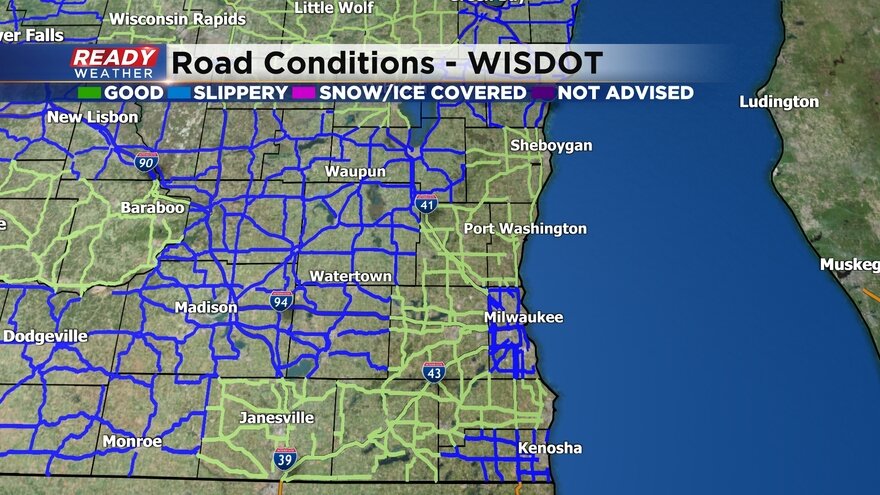
Road conditions are getting worse as the snow rolls through. Most of southeast Wisconsin is reporting slippery road conditions with some snow covered roads in northern counties.
Here's a look at road conditions that will update with time:
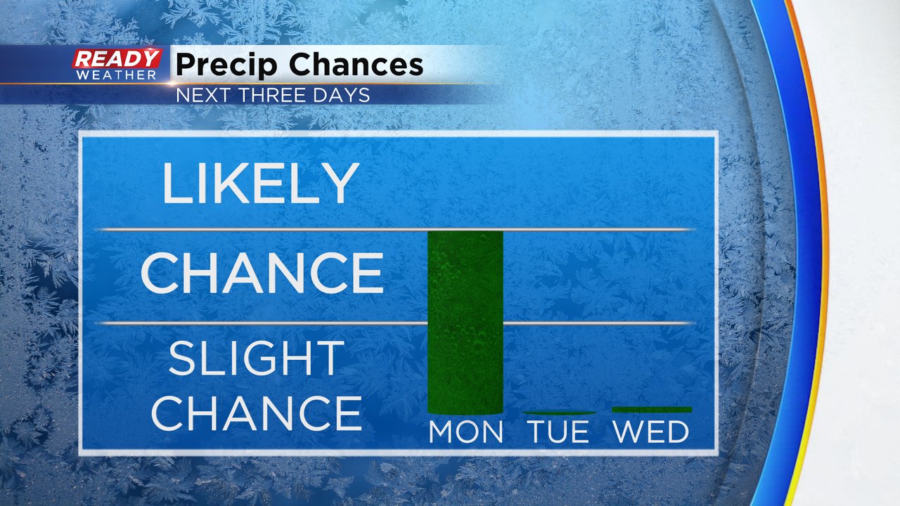
Monday's snow should wrap up by midday with just a flurry chance in the afternoon. After Monday our precipitation chances go down with dry conditions expected both Tuesday and Wednesday.
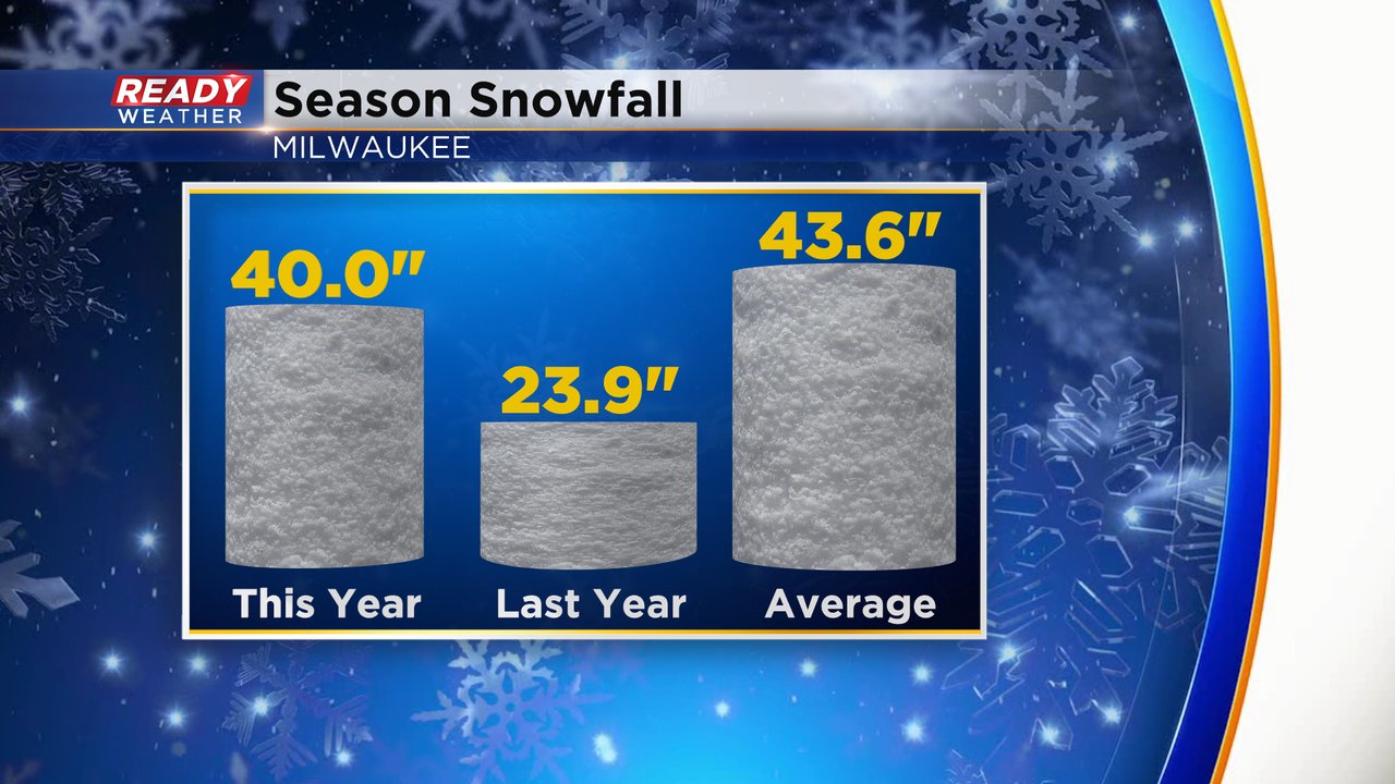
Going into the new work week Milwaukee is doing really well on snowfall for the season. After our big snow at the end of last week and a little light snow over the weekend the city is sitting at officially 40" of snowfall. That is just a few inches below average and much, much better than where we were on snowfall last year.
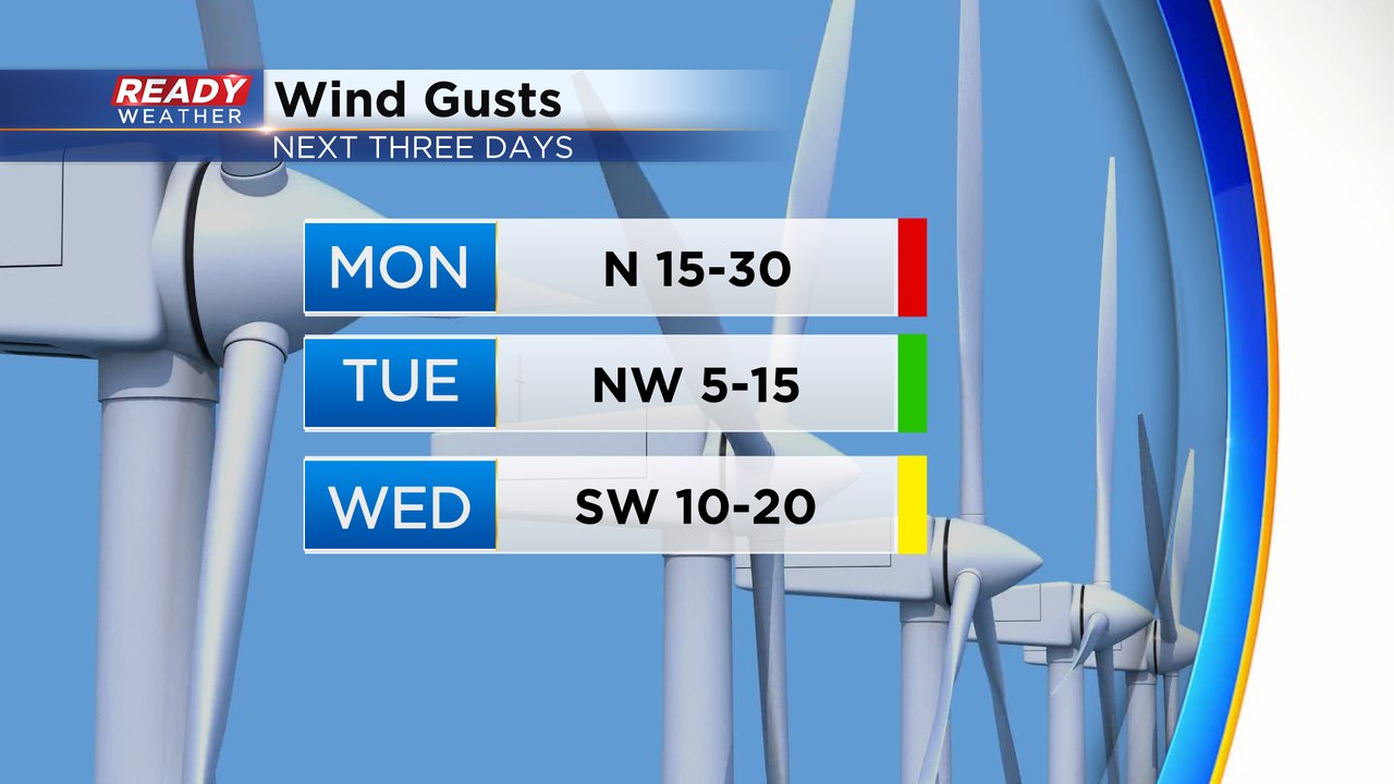
Wind gusts will remain high on Monday to 30 mph out of the north. That wind will lighten up during a chilly Tuesday then rebound on Wednesday shifting to the southwest bringing in some warm air.
Download the CBS 58 Ready Weather app to track the next chance for rain and snow.