Brief warm up to start the weekend before another shot of arctic air arrives


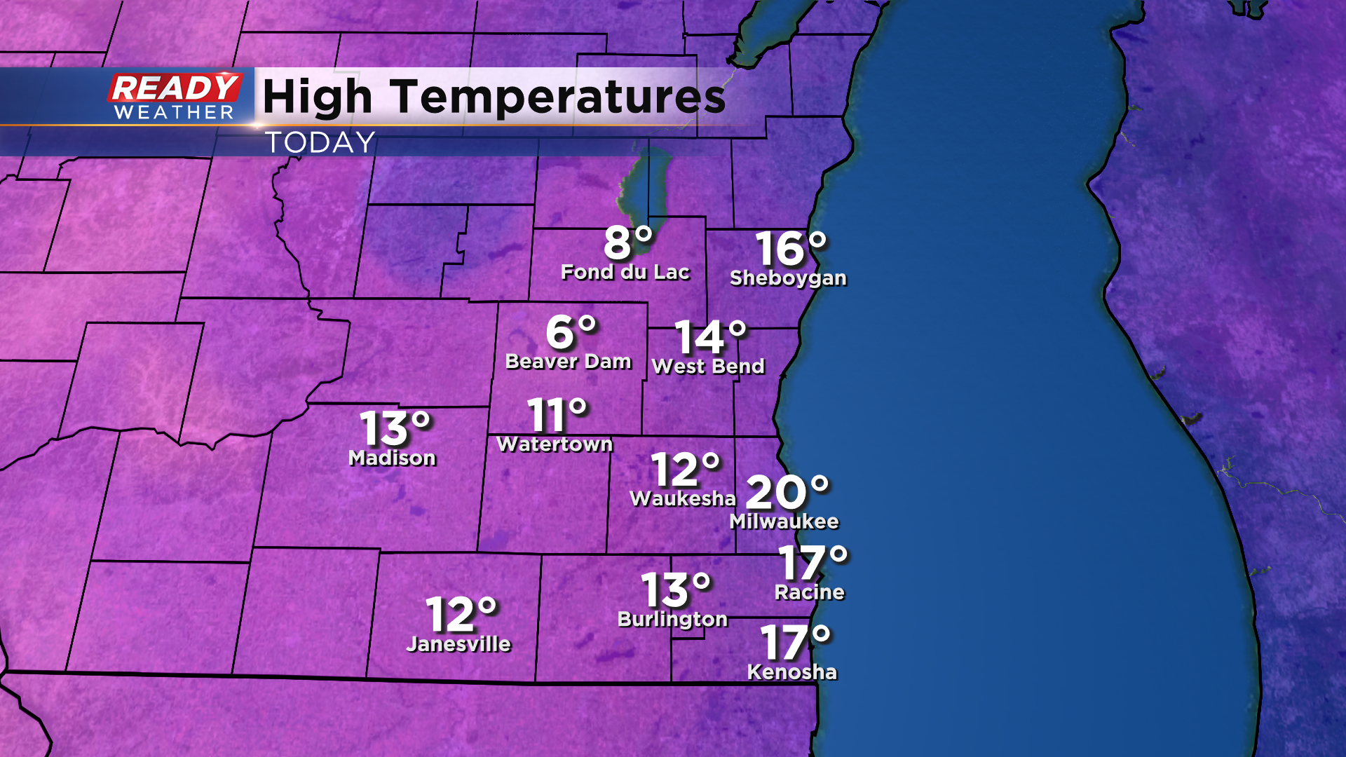
It's been quite a cold day across southeast Wisconsin with temps in the teens for most, but spots well inland haven't been able to warm out of the single digits.
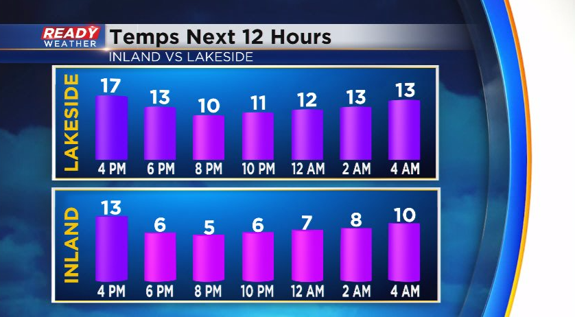
Temps will bottom out in the single digits this evening before rising into the teens overnight as a breezy southerly wind kicks in.
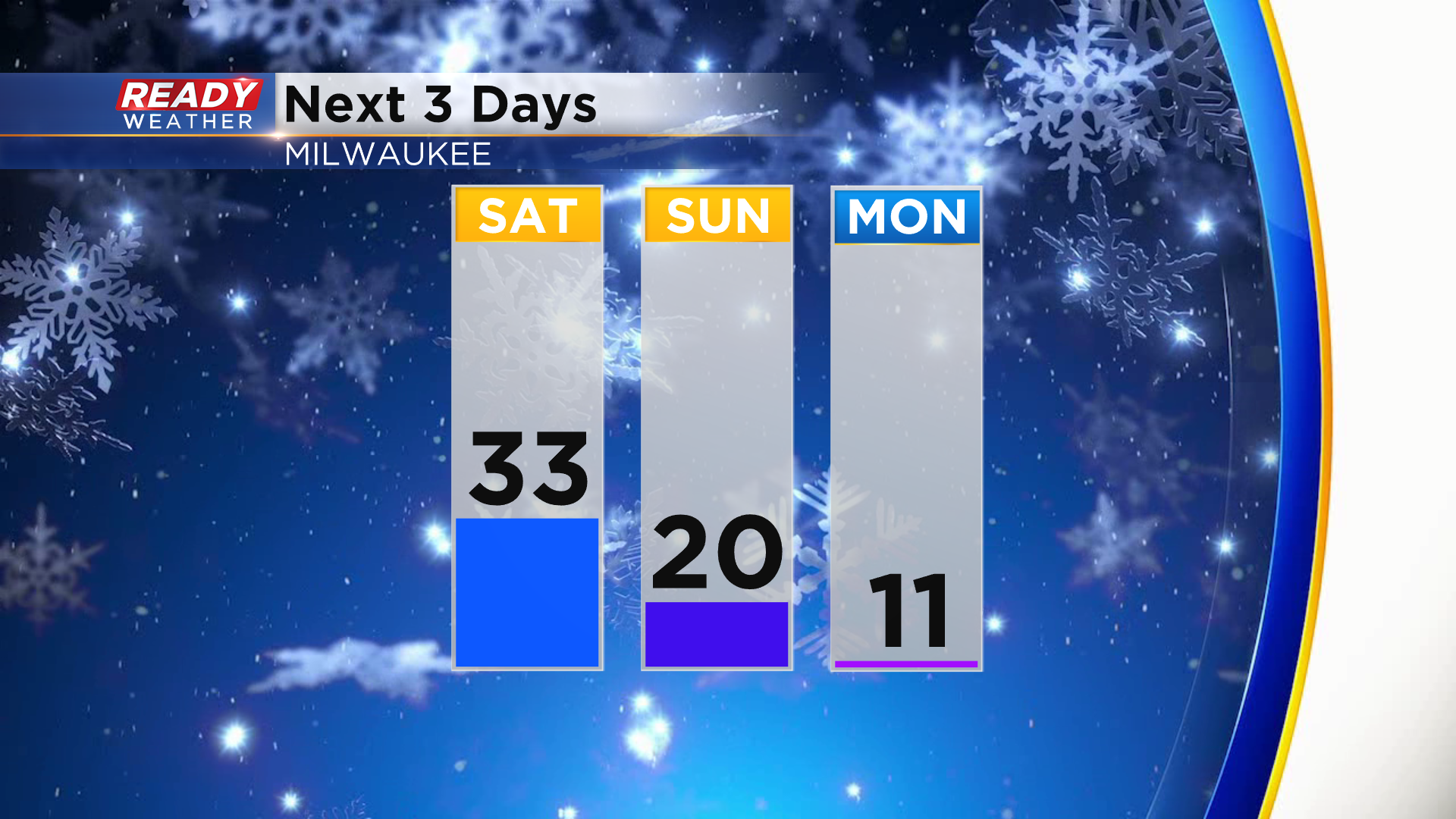
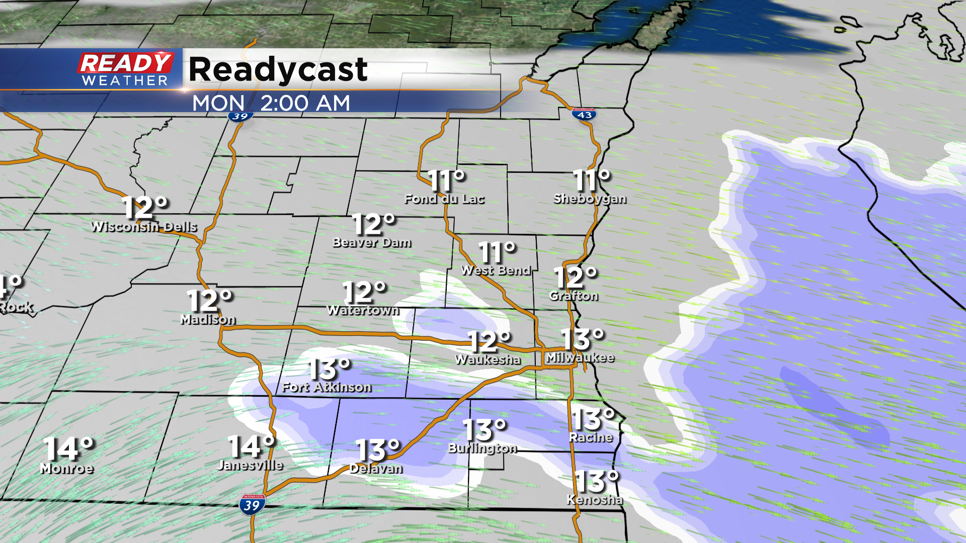
This southerly wind will boost temps into the upper 20s to low 30s on Saturday ahead of a cold front. That front moves through early Sunday morning, causing temps to plummet back into the teens for highs to start the week.
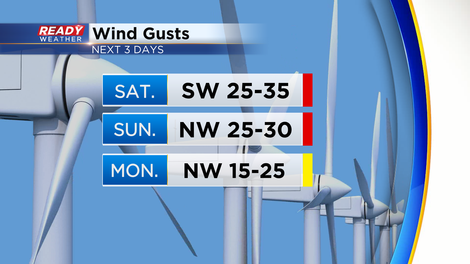
Inland spots likely won't get out of the single digits on Monday, and it'll feel even worse once you factor in the wind. Southerly wind will gust between 25-35 mph on Saturday, so it'll still feel chilly despite the warmer temps. Gusts of 20-30 mph continue on Sunday with gusts up to 25 mph on Monday.
This will hold wind chills at or below zero throughout Sunday. Monday into Monday night will feel the coldest with feels like temps around -10° during the day and approaching -20° at night. Besides the cold temps and breezy winds, we'll have two small chances for precip. this weekend. The first arrives Saturday evening ahead of the cold front. Isolated freezing drizzle is possible in far southeast Wisconsin after sunset with the threat ending late evening.
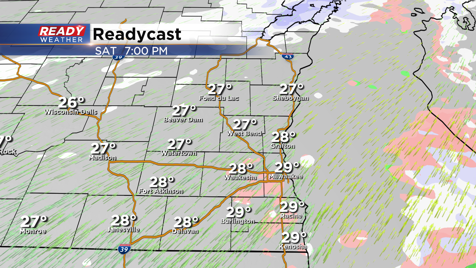
Areas from Milwaukee southward may experience minor icing, which could lead to slick spots. After a dry day on Sunday, a weak system will track through after midnight Sunday night, triggering a few light snow showers. These end before sunrise, but also may lead to patchy slick spots into the Monday morning commute.
Download the CBS 58 Ready Weather App to track the cold and precip chances.