


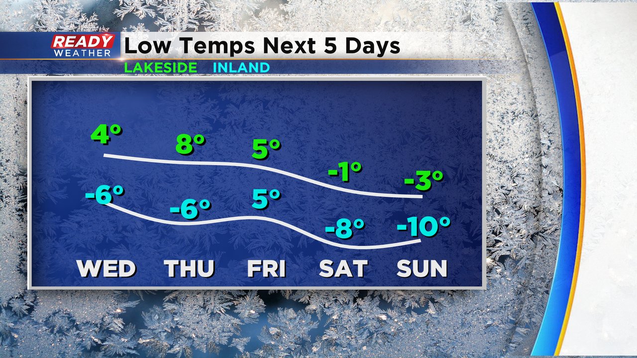
We had another round of dangerous cold Tuesday morning with wind chills as cold as -25. A wind chill advisory was issued for inland and northern counties because of the cold chills. Low temperatures the next few mornings will range from the single digits above-zero lakeside to bellow-zero inland before another round of dangerous cold arrives for the Valentine's Day weekend.
Wind chills Tuesday afternoon will rise into the single digits just above or just below-zero and they end up in the -15 to -5 range Wednesday morning. Thursday morning's wind chills will be similar. Both of those days will likely not see a wind chill advisory because it won't be cold enough but as temperatures cool down for the weekend wind chill advisories are once again likely.

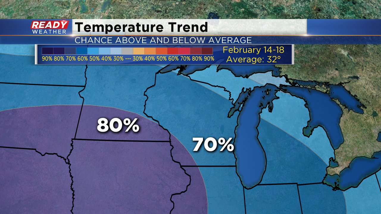
Unfortunately there's no change in our temperature trend which still shows a 70-80% chance for below-average temps for most of next week. By the end of next week we may see temps get a little better with highs around 20 but getting back to average highs in the low 30s might not happen until March.
Download the CBS 58 Ready Weather app to track the temps and see when it looks like we might warm back up.