


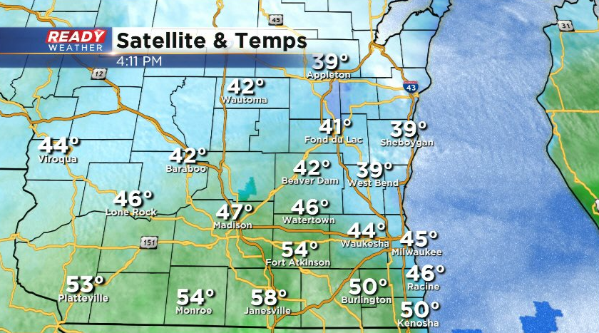
It's been a rather gloomy day for most of southeast Wisconsin with low clouds and temps stuck in the 40s everywhere except far southeastern WI.
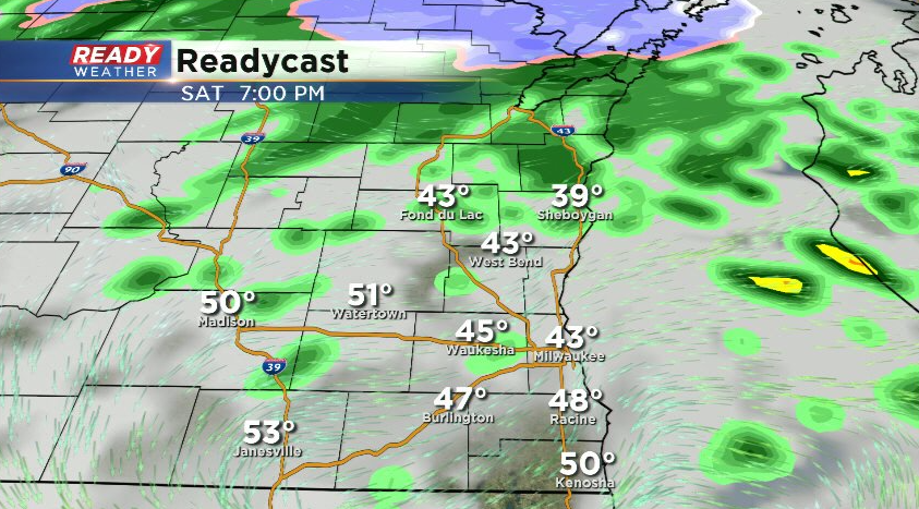
We've been dry for a majority of the afternoon, but a few more spotty showers will be possible this evening as a low pressure system tracks through the area. Don't be surprised if you hear a rumble of thunder or have some soft, pea sized hail in any showers that develop.
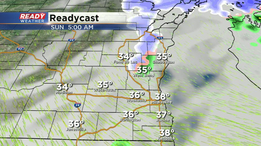
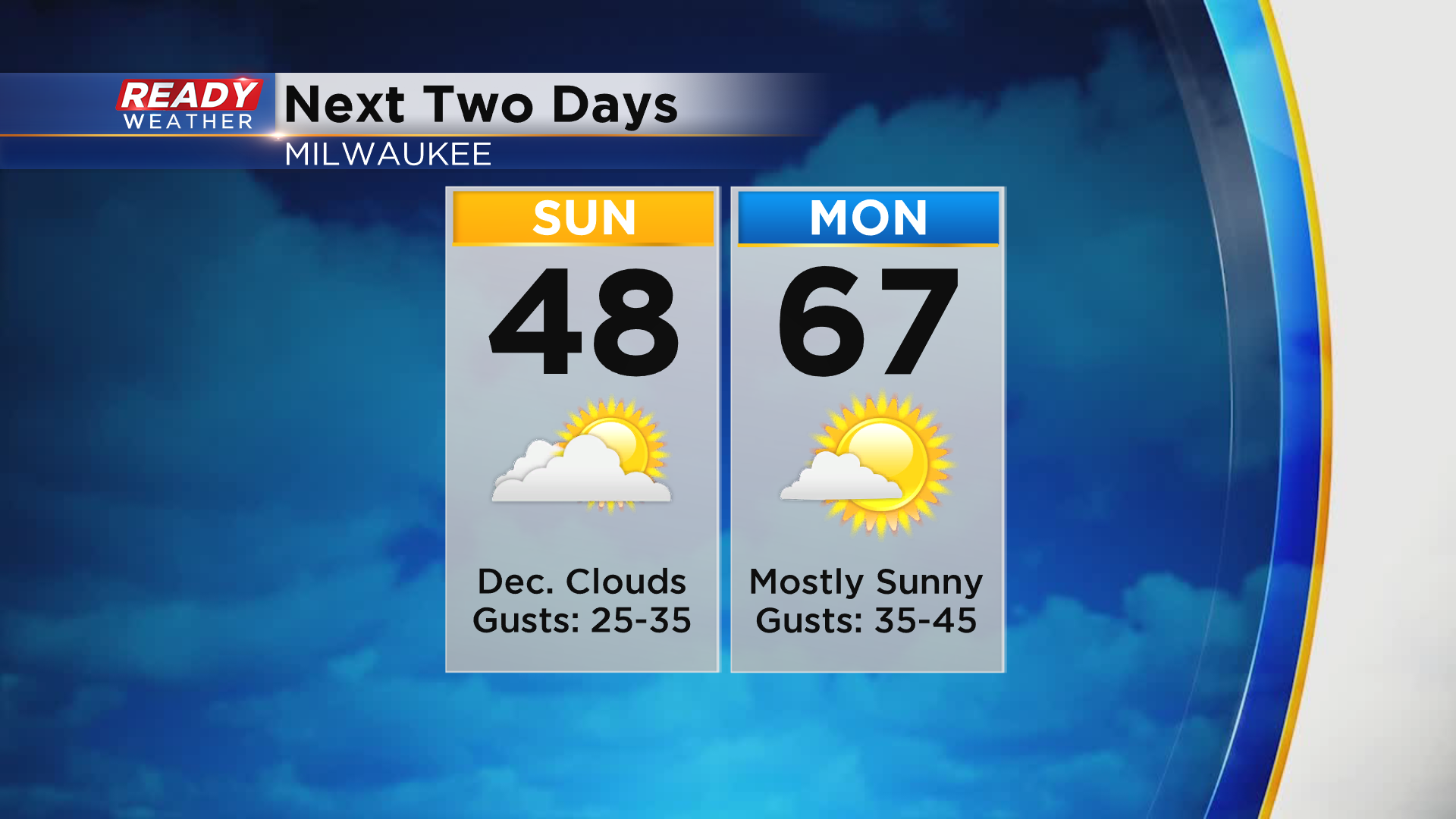
While the cold front will move through around midnight, a few showers are possible on the backside of this system very early Sunday morning north of I-94. A few wet snowflakes may mix in with any lingering precip ending by 8am at the latest.
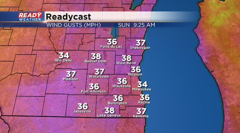
Clouds will gradually start decreasing mid to late morning with more sunshine expected in the afternoon. However, winds will become strong behind that system with frequent gusts between 25-35 mph. A few gusts may approach 40 mph. This will make it feel like the upper 30s to around 40° most of the day despite temps in the mid to upper 40s.
Winds will be even stronger on Monday with gusts between 35-45 mph, but it'll be a S/SW wind which will boost temps into the mid to upper 60s with plenty of sunshine.
Those 60s aren't here to stay quite yet. A cold front will move through Tuesday morning and bring much colder air in for Wednesday and Thursday. Download the CBS 58 Ready Weather App to see how chilly it'll be for Opening Day.