



A cold front is slowly, but surely, working through southeast Wisconsin this morning. No storms associated with it, but it is gradually bringing in lower humidity.
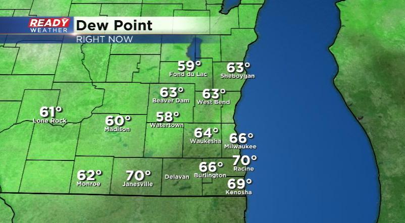
Dew points will be more comfortable today, and with a northeasterly breeze temperatures will be comfortable as well with highs in the upper 70s to around 80 well inland.

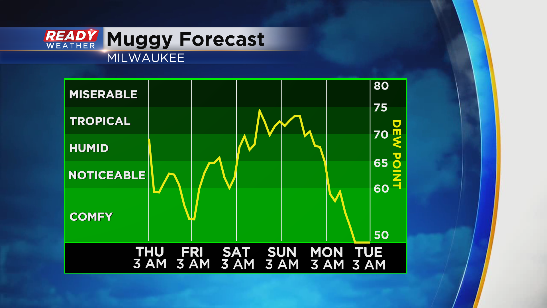
The warmth and humidity won't be away for long, so enjoy today. Temps warm back into the low to mid 80s Friday with dew points back into the mid 60s. The real muggy air returns this weekend with dew points back into the 70s.
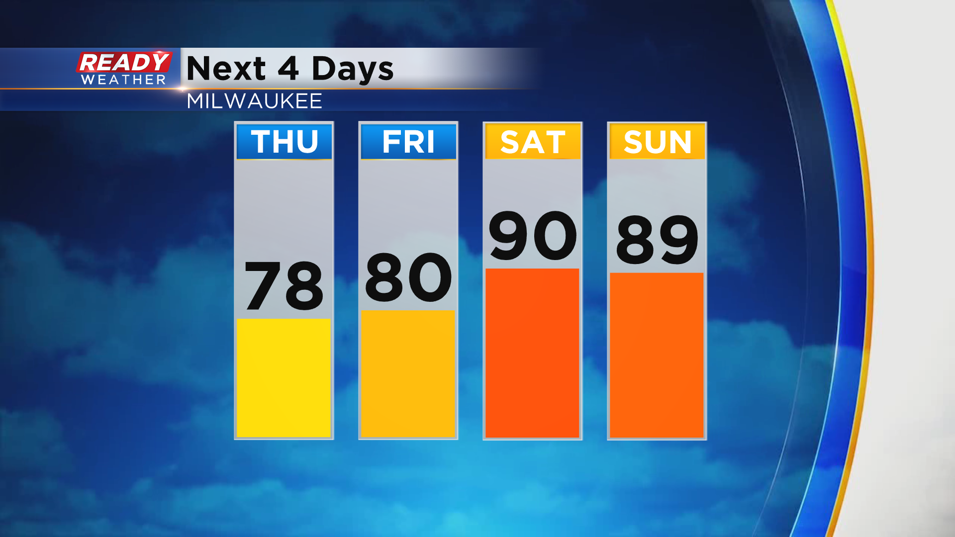
The heat will return this weekend as well with highs in the upper 80s to around 90 both days.
Dry weather will continue today through the day on Saturday, but a few scattered storms may return late Saturday night into Sunday morning with the best chance being north of Milwaukee. A better chance for scattered storms arrives later Sunday into Sunday night.
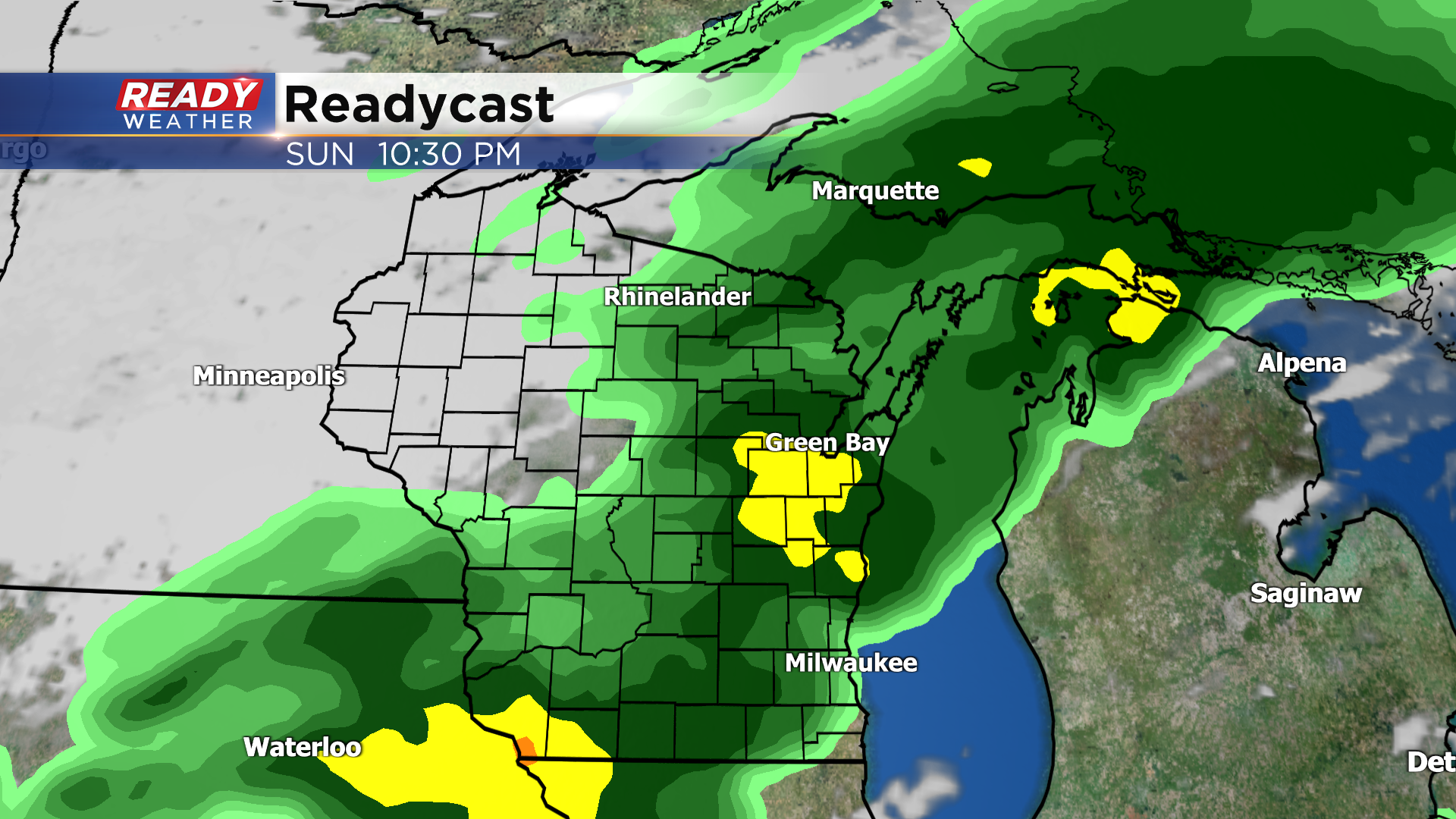
Download the CBS 58 Ready Weather App to track the weekend storm chances.