Look for a little snow & then a lot of cold into the new year
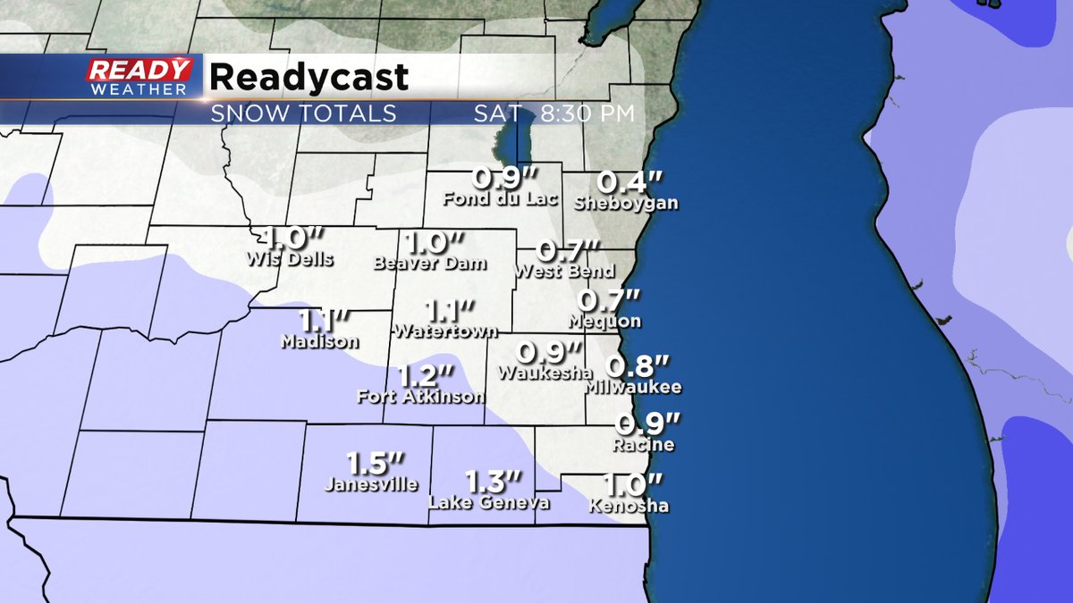
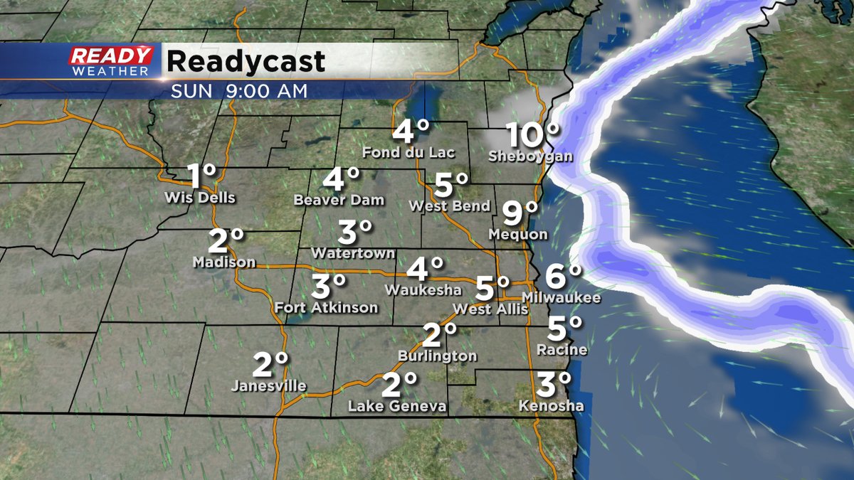
A quick moving system today will give our region a glancing blow of light snow, mainly south of I-94, this afternoon into the evening hours. An inch of precipitation could fall, just like yesterday, in this general region. Lake effect snow on Sunday is our next chance for snowfall. But it depends on how far the feeder bands come onshore in terms of who gets what.
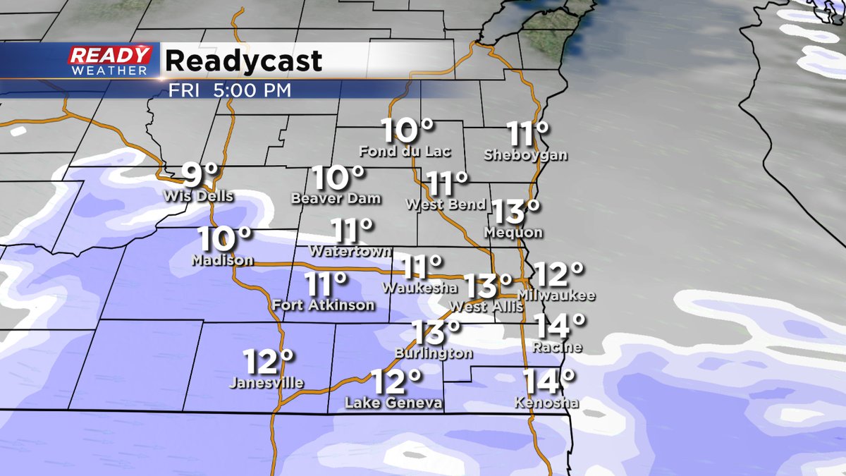
Meantime, savor the mid teens today for highs because much colder air is coming our way. Perhaps some of the coldest temperatures of the season. We're talking highs in the single digits into early next week (and year). The wind chill numbers will be at dangerous levels, at least -20 to -25 degrees if not colder. Please limit your time outside to less than 15 minutes if you can. Also, keep in mind frostbite can happen in less than a half hour with weather conditions like this.
