Arctic Blast and Snow for Valentine's Day Weekend
The weather pattern continues to become active toward the Valentine's Day weekend. Another batch of arctic air will come through late Friday night into Saturday morning dropping temperatures to 0!
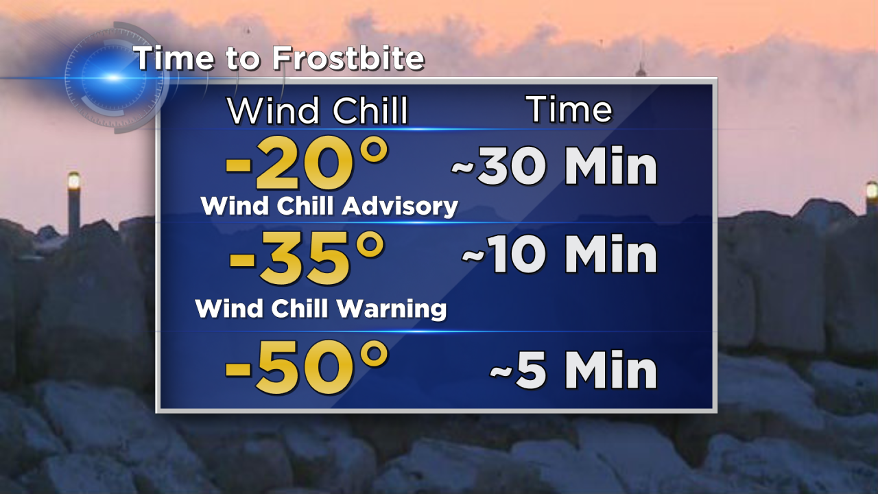
The winds Friday will turn northwesterly during the late afternoon and early evening. This will allow very cold arctic air to descend upon southeastern Wisconsin. The winds will increase to 20 mph, and that will mean frigid wind chills by Saturday morning. We are expecting wind chill values around 20 below. That will be very close to wind chill advisory criteria; moreover, exposed skin could experience frostbite within 30 minutes.

The cold air won't lift for Valentine's Day. With cold air already in place, a disturbance aloft will create the lift for scattered morning and afternoon snow showers on Sunday. The timing will change as we head into the weekend, but right now it looks like snow could arrive as early as 6 am Sunday morning. The snow is forecast to stick around through the early afternoon before tapering off by the evening.
This type of system will encounter very dry air, so high snow ratios will create light and fluffy snow. Early estimations are for 1" to 3" of snow across the area. If that happens there would likely be slick roads due to surface temperatures in the low 20s.
This forecast will continue to change. We will bring you the latest information as we head into the busy Valentine's weekend!
