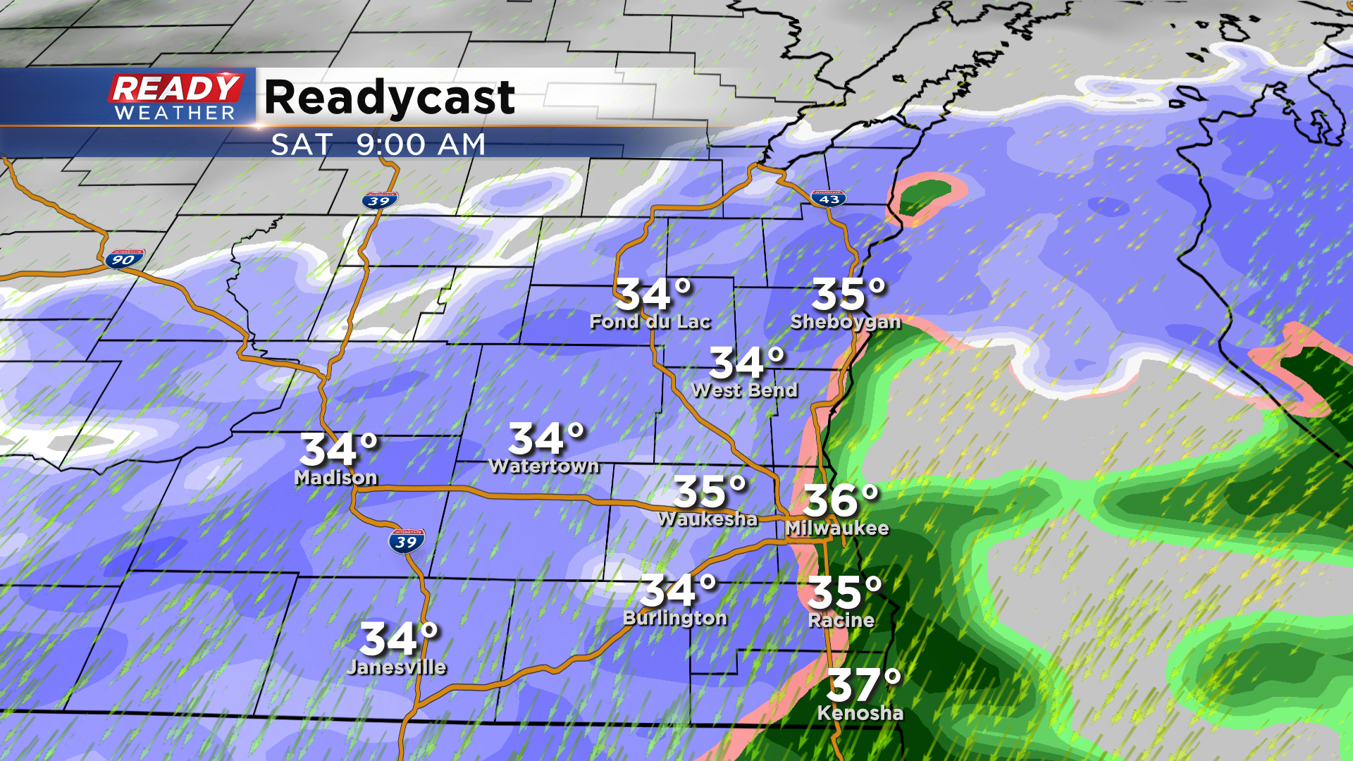
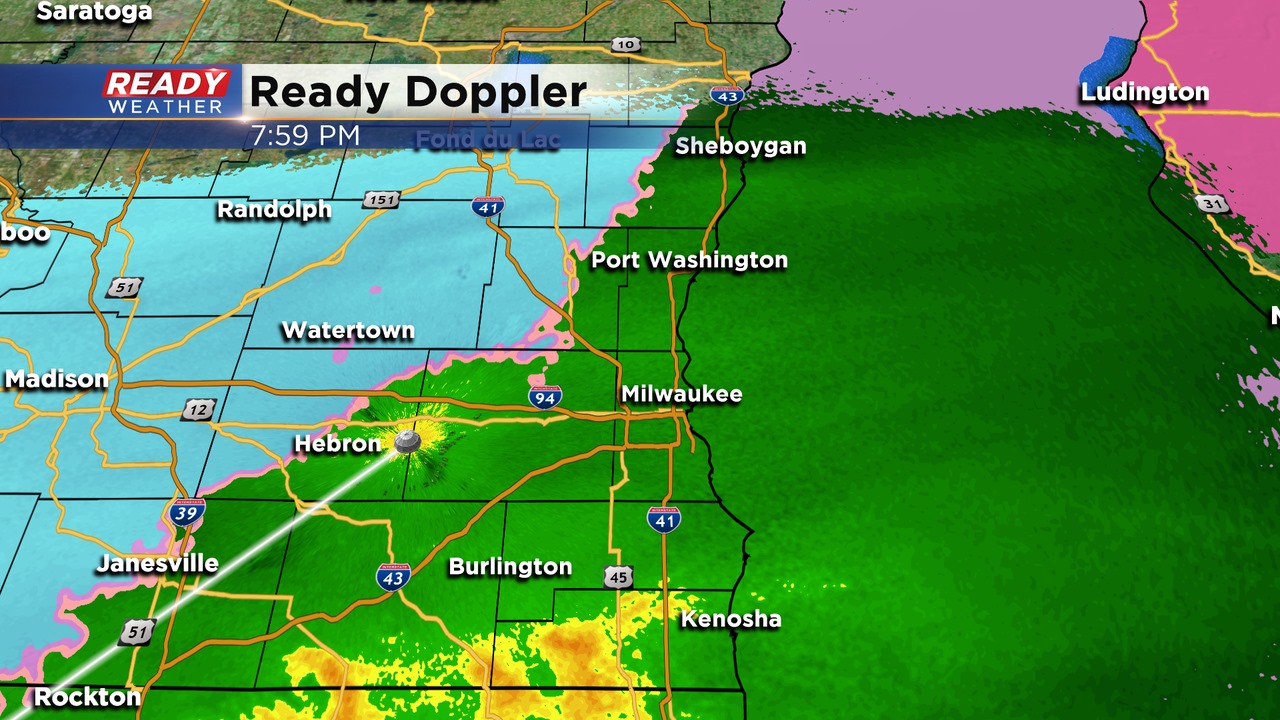
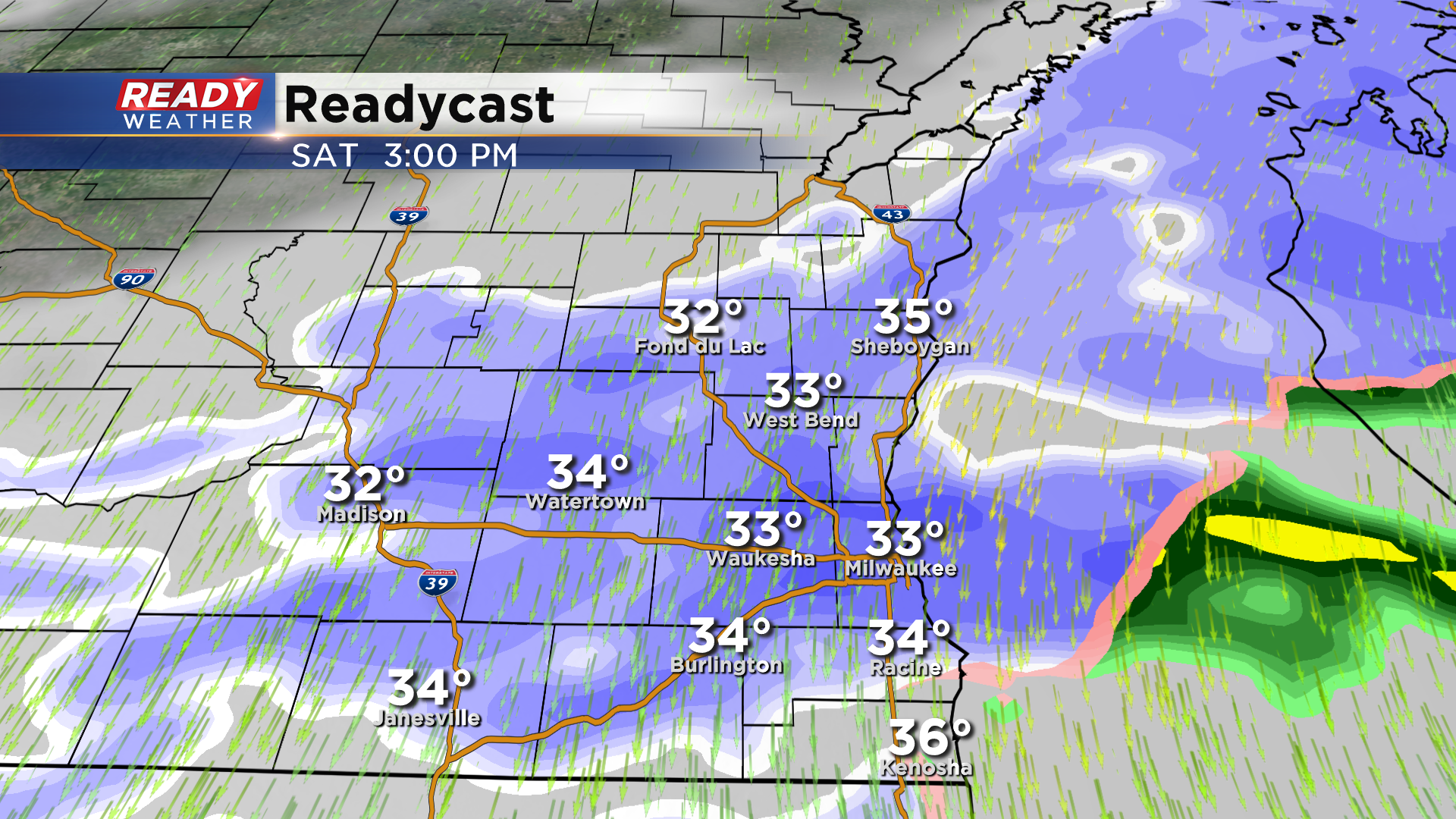
Afternoon Update: Snow tapers off from west to east late this afternoon
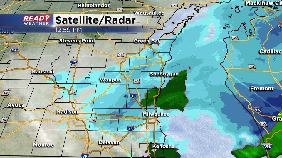
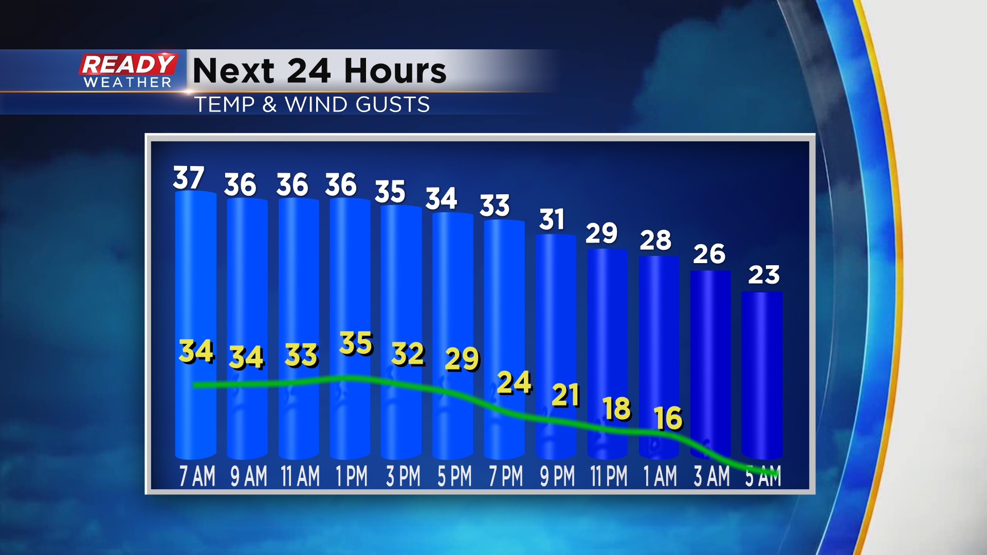
The back edge of the snow will rotate through this afternoon and early evening. Any additional accumulation will be less than an inch. Flurries are possible this evening; however, the measurable snow will be done.
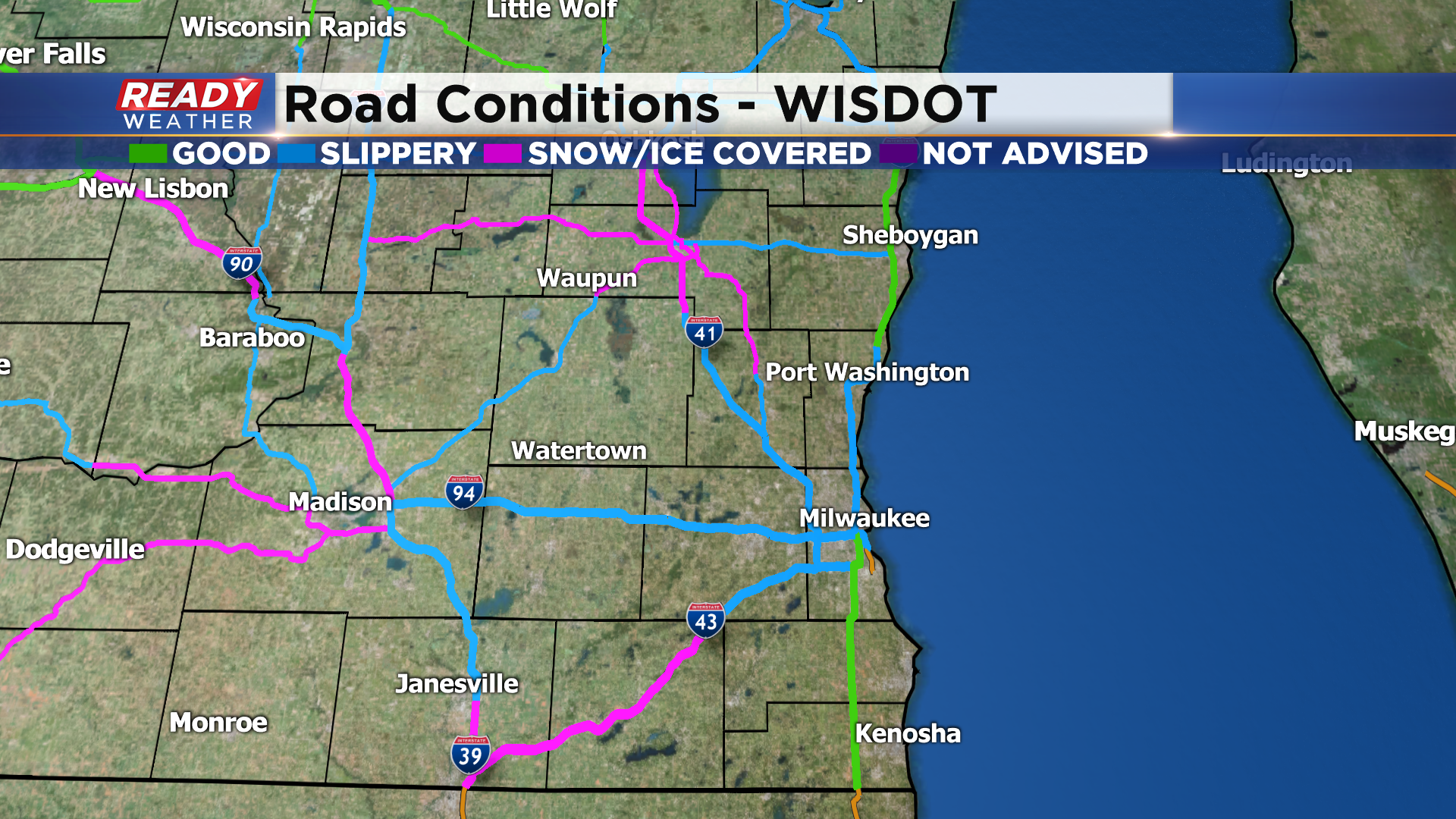
Secondary roads are slick in spots, so use caution this afternoon.
Sunday will be cold in the 30s under a mostly cloudy sky, but at least there won't be snow to contend with.
______________________________________________________________________________________________________________
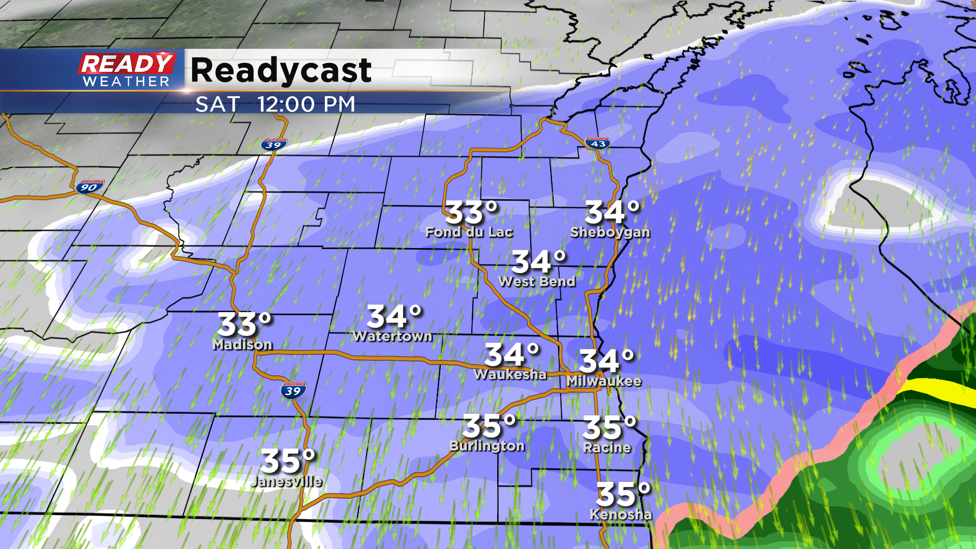
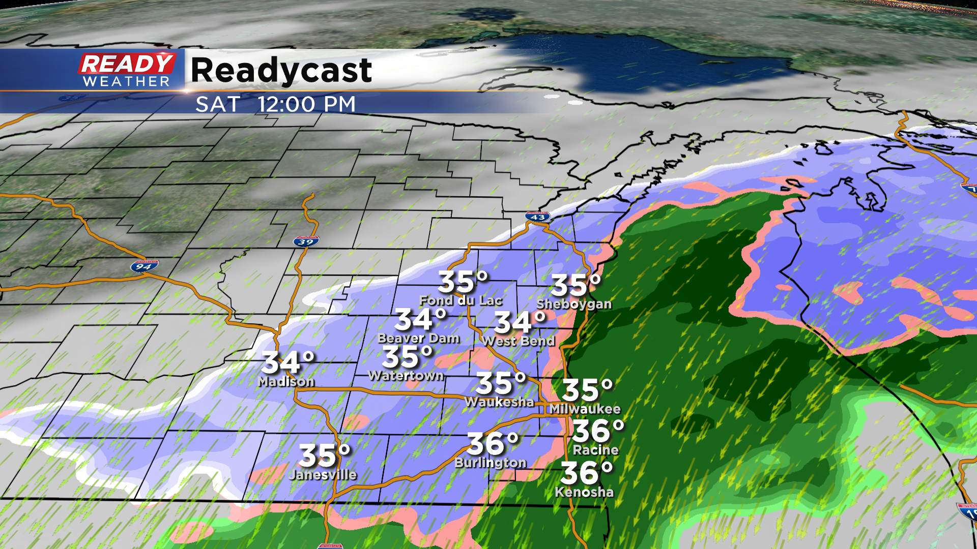
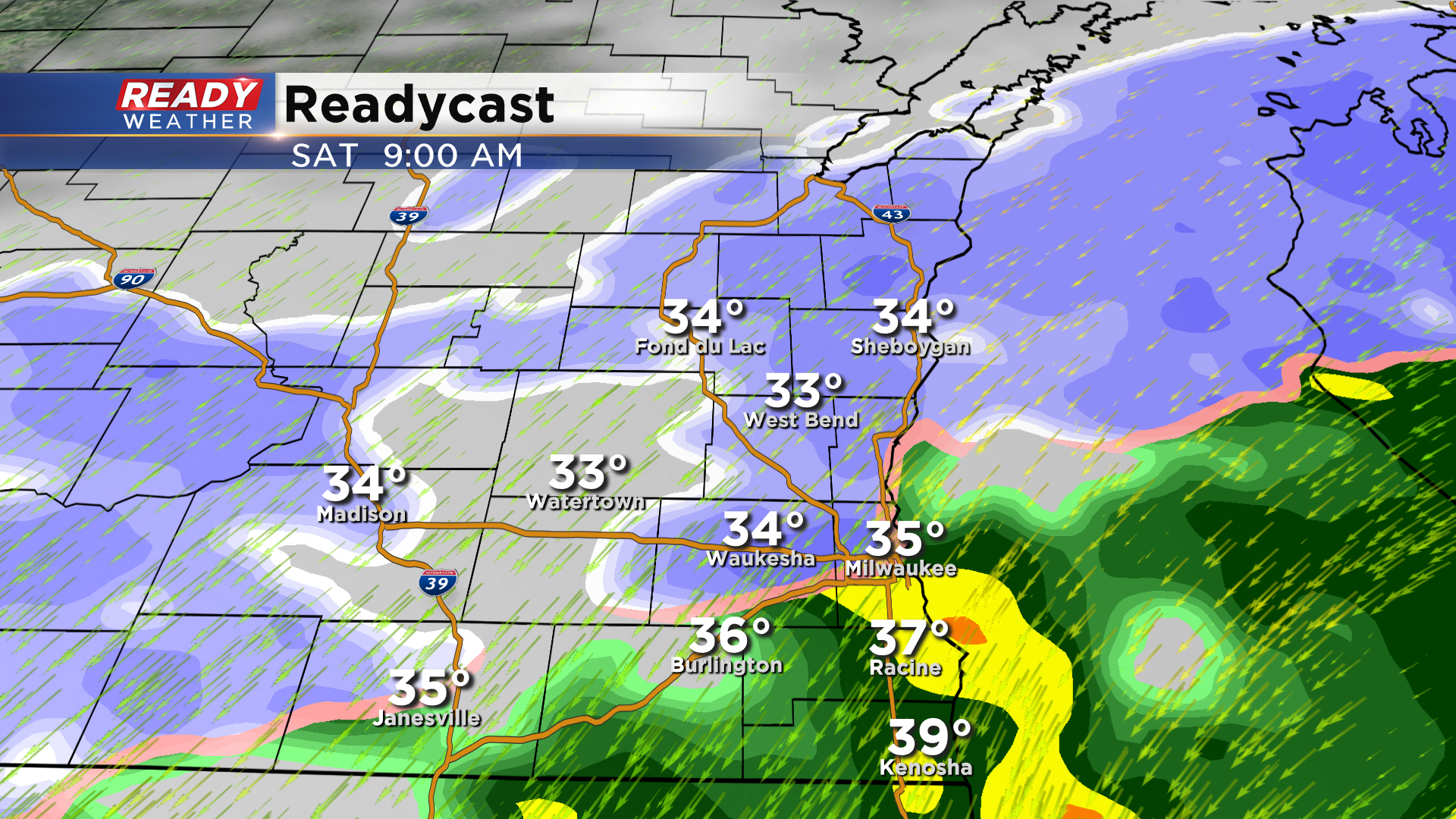
Updated 12 pm: Saturday, December 12th:
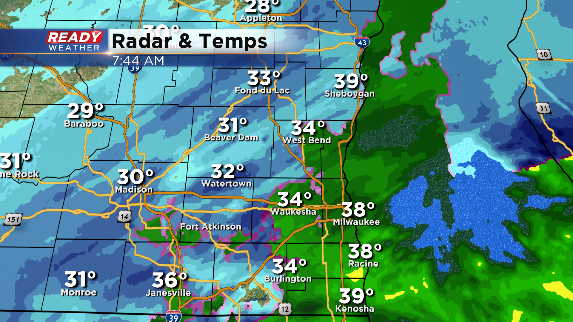
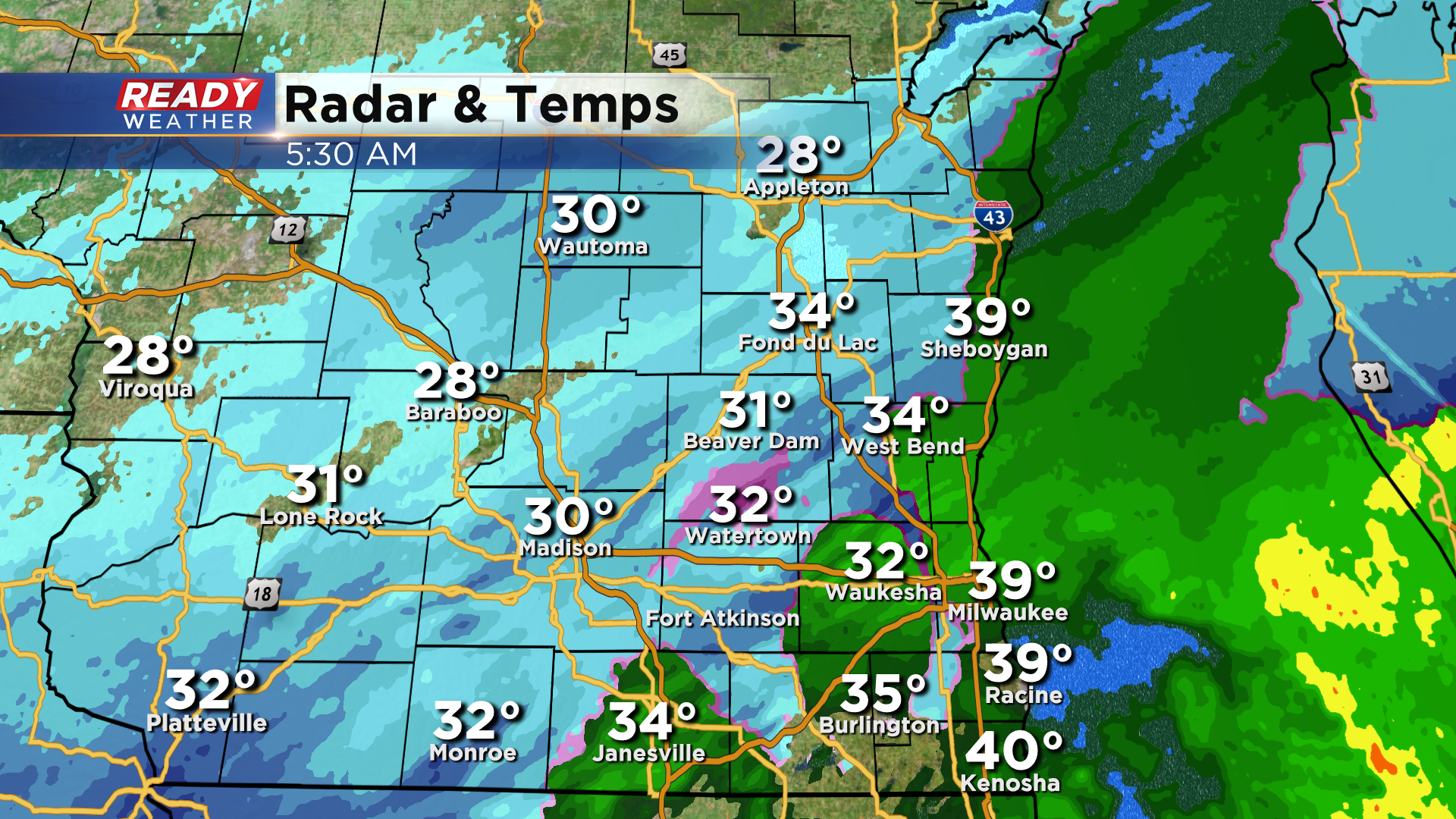
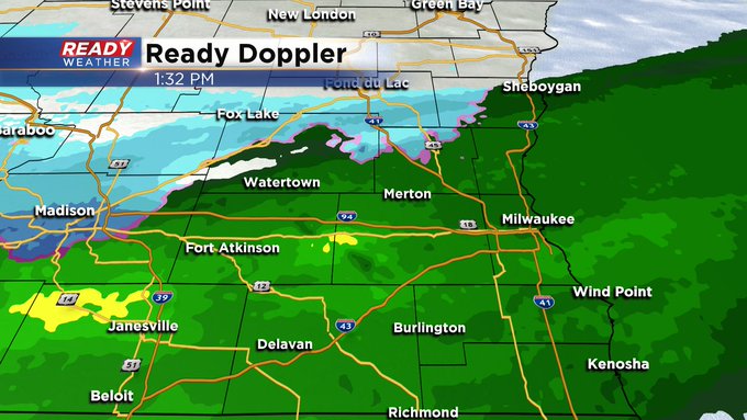
Light to moderate snow continues to fall across southeast Wisconsin. An additional inch or so of accumulation is possible NW of Milwaukee, but little to no accumulation is expected lakeside as temps are too warm.
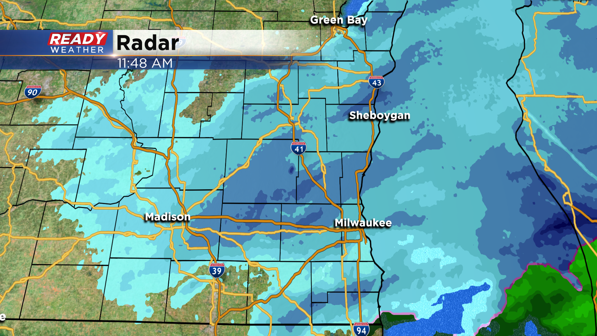
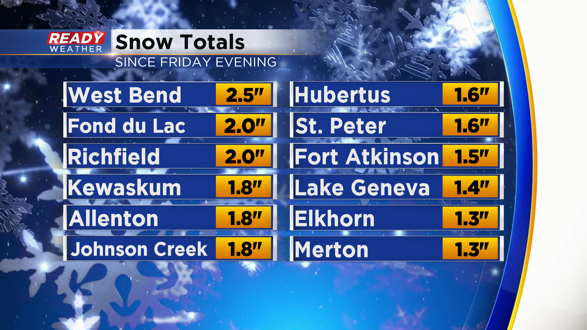
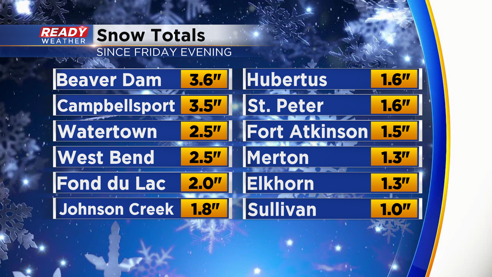
Even though snow is still accumulating, here's a update on the heaviest amount we've seen so far.
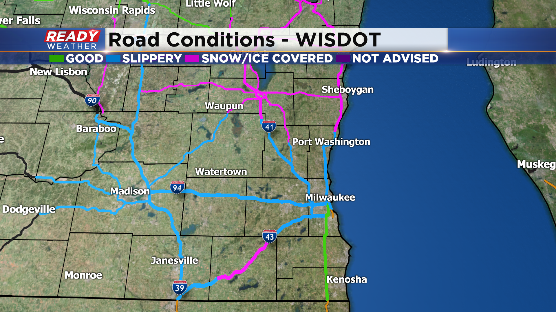
Roads around the metro are wet and slippery, but overall not in bad shape. Snow is sticking to the ground well west of the lake, so road conditions worse the farther west you go.

------------------------------------------------------------------------------------------------------------------------
Updated 10 am: Saturday, December 12th:
Rain has transitioned over to snow across nearly all of southeast Wisconsin. We're still seeing a bit of rain mix with the snow right along the lake in Milwaukee and Racine, but that should completely transition over to snow within the hour.
Roads are starting to deteriorate away from the lake, with multiple accidents being reported on I-94 between Elm Grove and Pewaukee. Expect roads to become more slippery and snow covered through the morning.
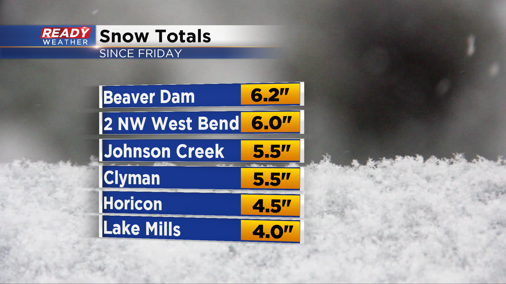
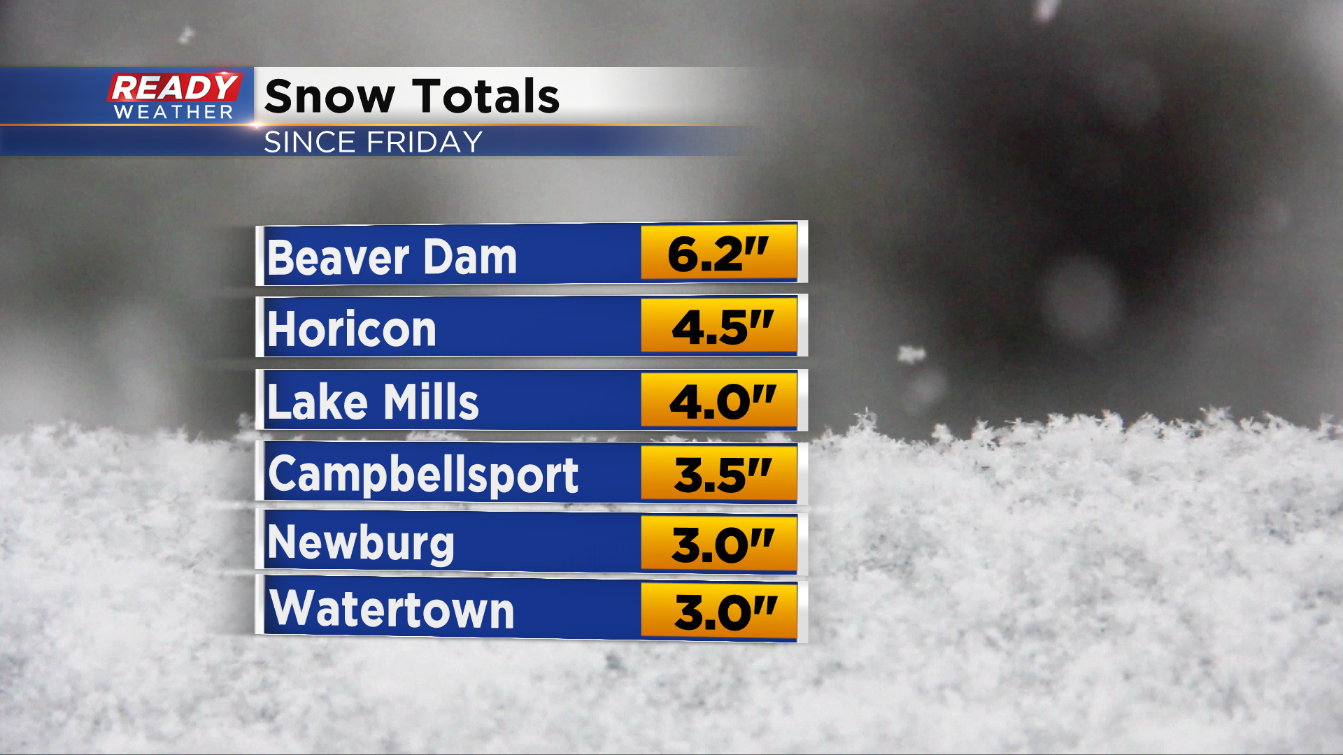
Beaver Dam is one of the few locations that didn't see a period of rain overnight, so they're currently the big "winner" with 6.2" of snow.
Most inland spots picked up 1-2" overnight.
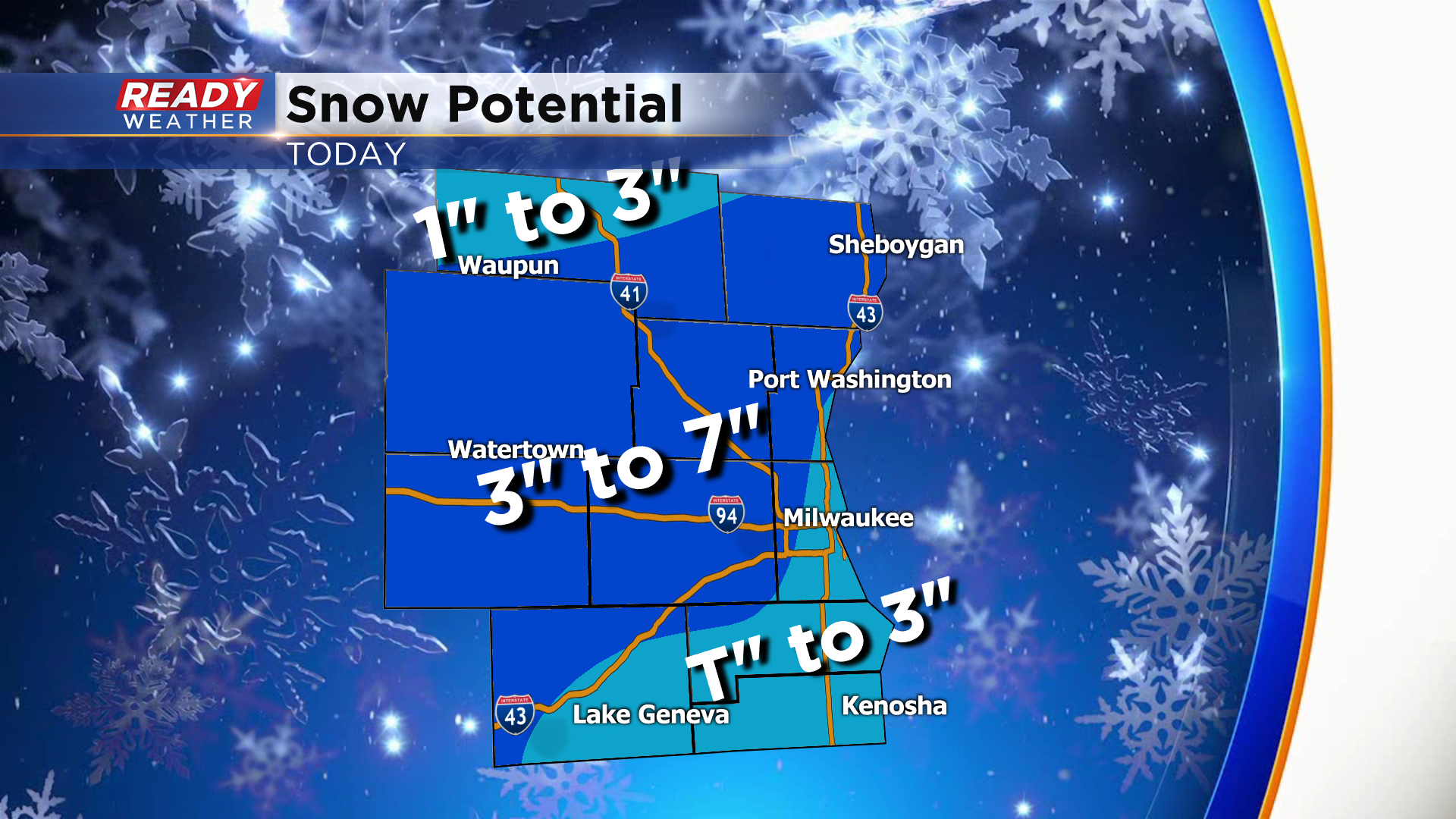
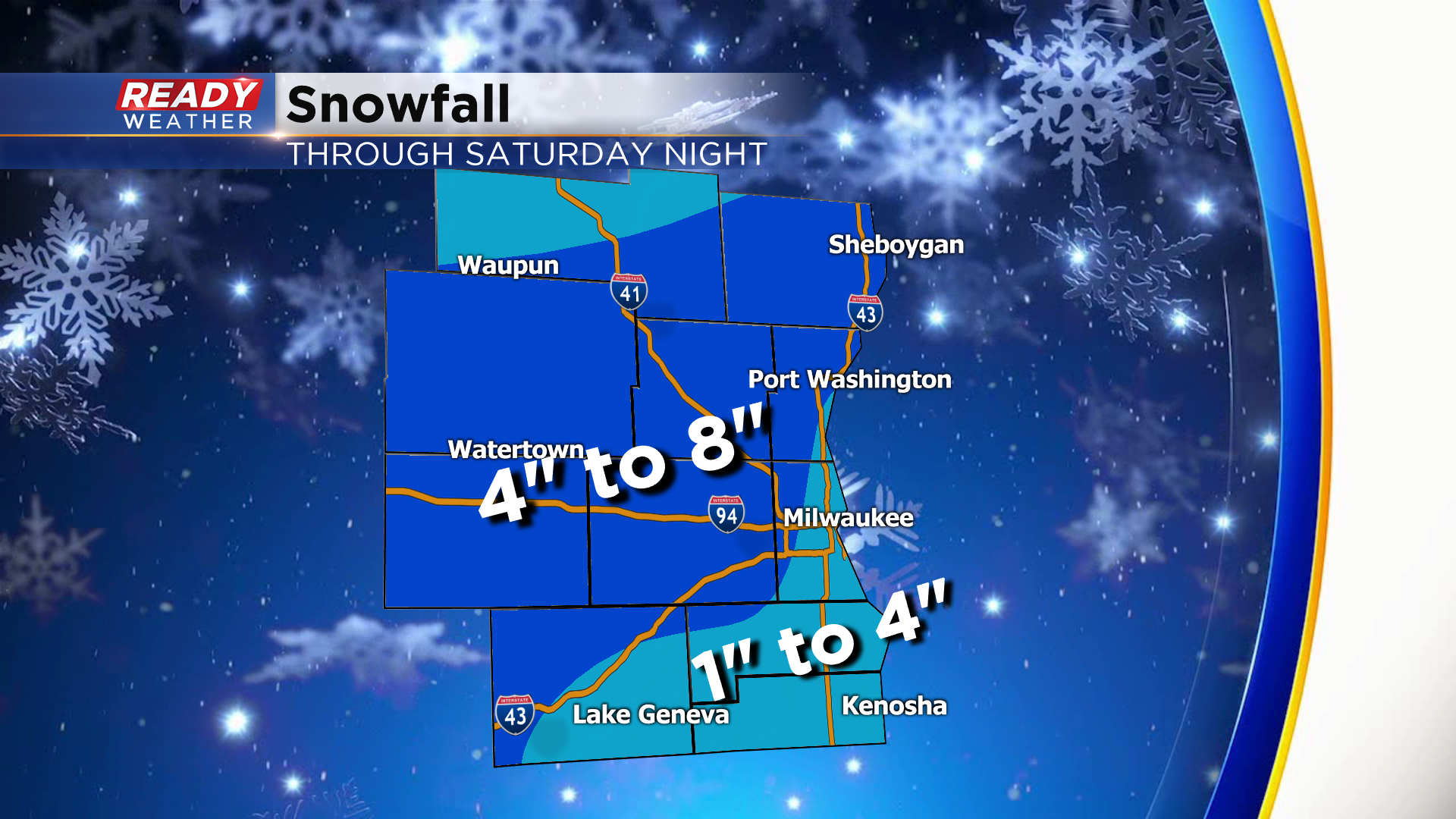
Still expecting an additional 2-4" away from the lake, with a coating of slush to up to 1.5" lakeside. The brunt of the snow will be done by mid afternoon, but a few snow showers may linger near the lake before completely ending around 7 pm.
---------------------------------------------------------------------------------------------
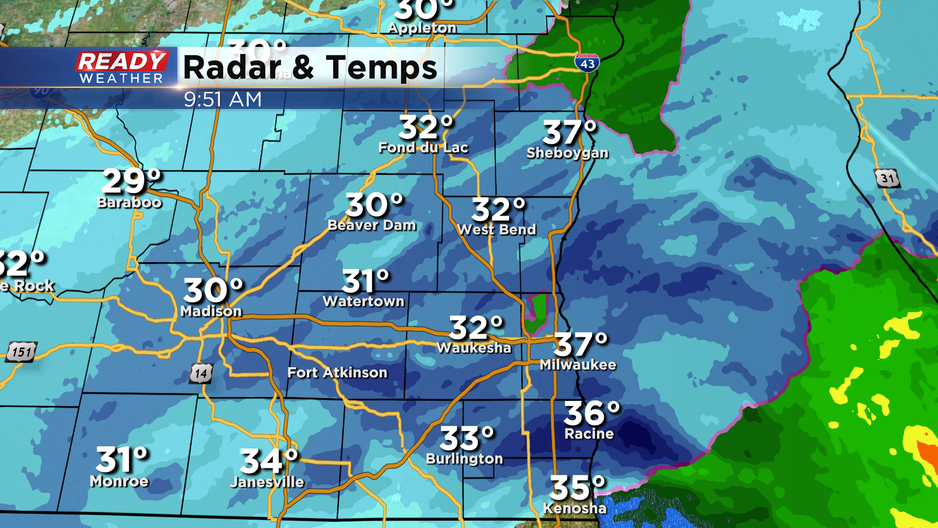
Updated 7:50 am: Saturday, December 12th:
Still seeing mainly rain along the lake this morning, but we're starting to transition back to wet snow from West Bend to Waukesha to Burlington. Some bursts of moderate to heavy snow (dark blue) are moving into the area, so expect rapidly deteriorating visibility and snow to accumulate quickly away from the lake.
This transition back to snow will continue from west to east over the next 1-3 hours. The worst of the snow and visibility will occur this morning through early afternoon. Inland areas picked up between 0.5-2" in most places overnight. An additional 2-4" is possible away from the lake before snow ends this evening.
-------------------------------------------------------------------------------------------------------------------------------
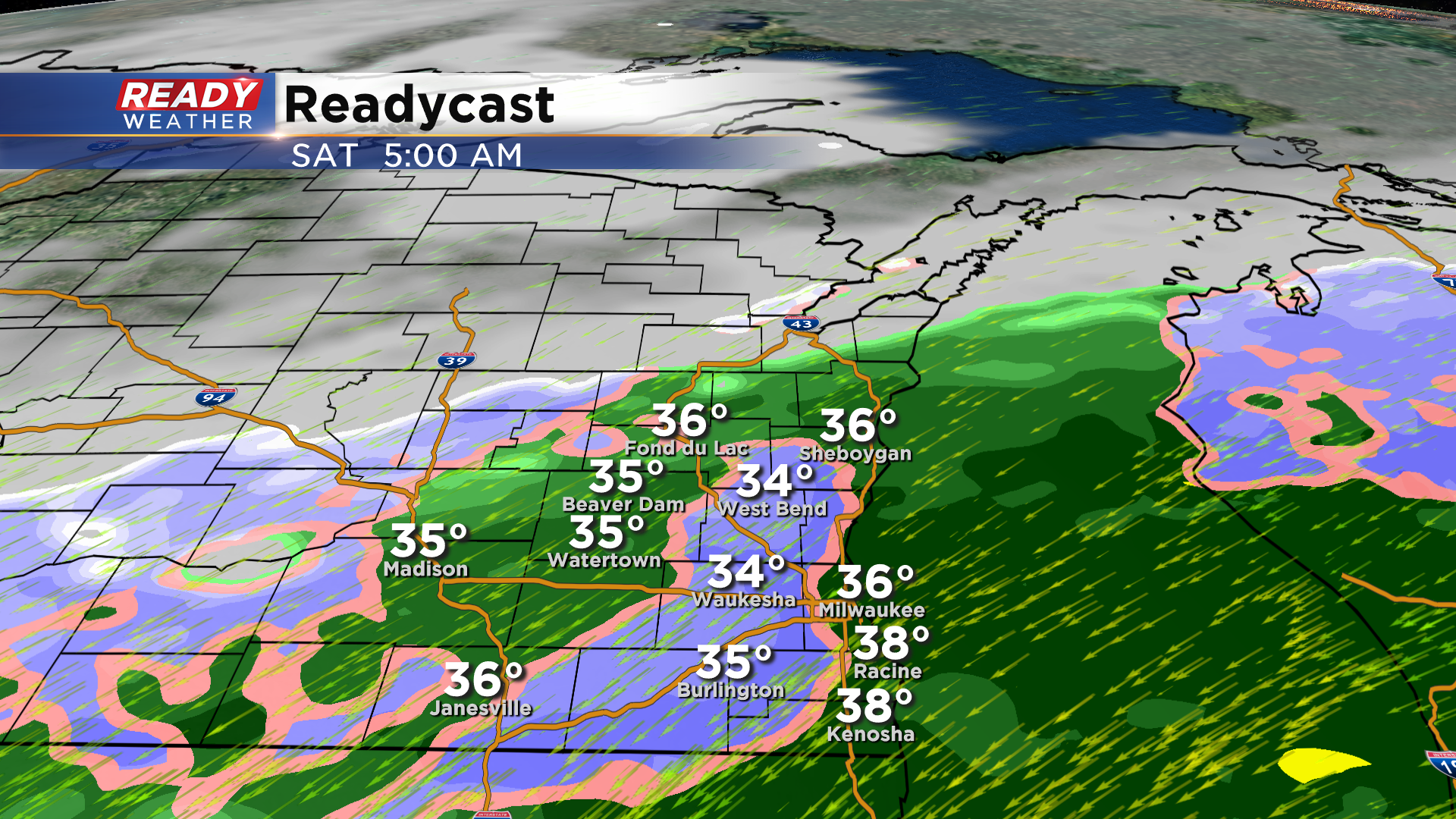
Updated 5:50 am: Saturday, December 12th:
Areas well away from the lake continue to see snow early this morning, but warmer air has allowed and snow to change to primarily rain near the lake, mixing with wet snowflakes at times.
The warmer air and rain has made road either wet or slippery across most of southeast Wisconsin this morning, but roads are snow covered once you get up to Sheboygan and Fond du Lac counties.
As we progress over the next 1-3 hours, rain should change back over to wet snow away from the lake, but spots east of I-94 in Milwaukee, Racine, and Kenosha counties could still be a mix of rain and snow.
Lakesides areas are expected to change over to snow between 10am - Noon at the latest. Snow will continue into the afternoon before tapering off this evening.
Snow will be heaviest this morning, with moderate to heavy snow possible at times west of the lake. Snow will be coming down hard enough to accumulate on roads and greatly reduce visibility from mid morning to early afternoon.
We don't have many snow reports at this point besides 3.6" in Beaver Dam as of 1:30 am. An additional 2-5" is possible inland with Tr. - 3" possible in lakeshore counties. Highest totals in lakeshore counties will be in western parts of the counties with only minor slushy accumulations right along the lakeshore.
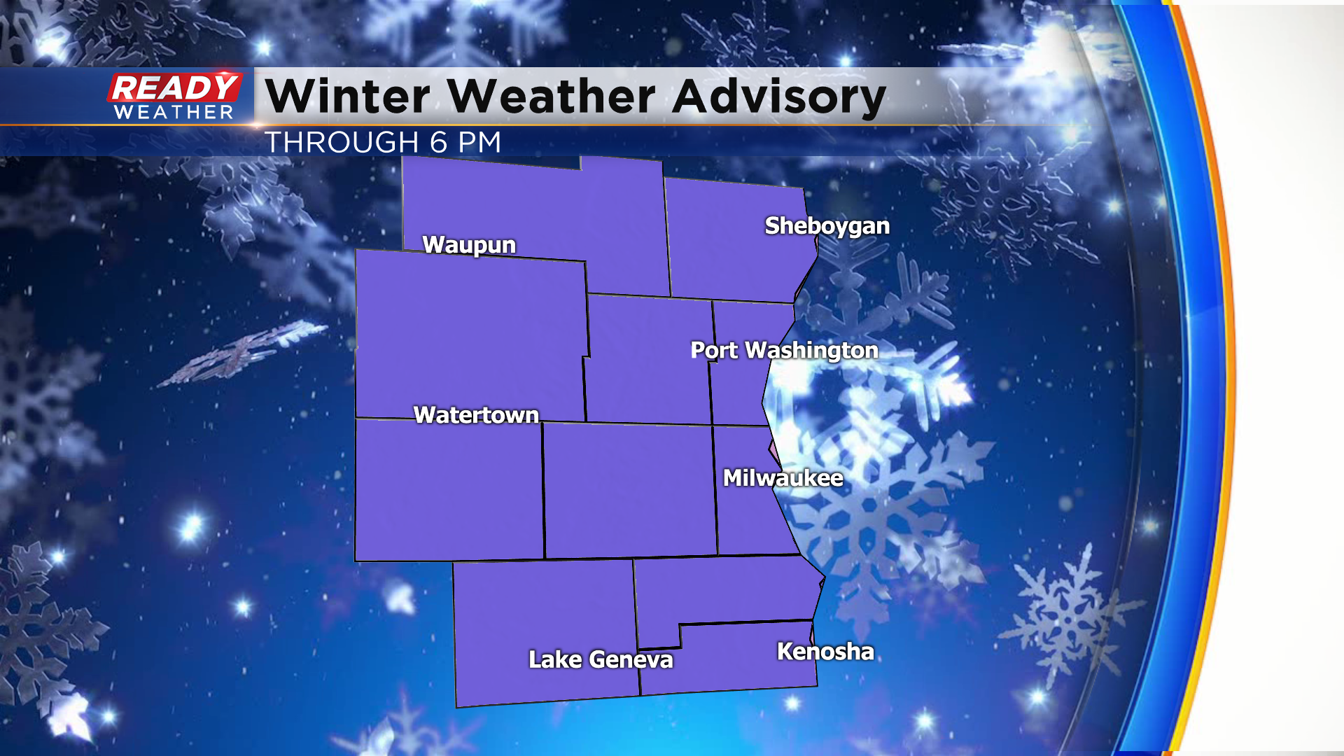
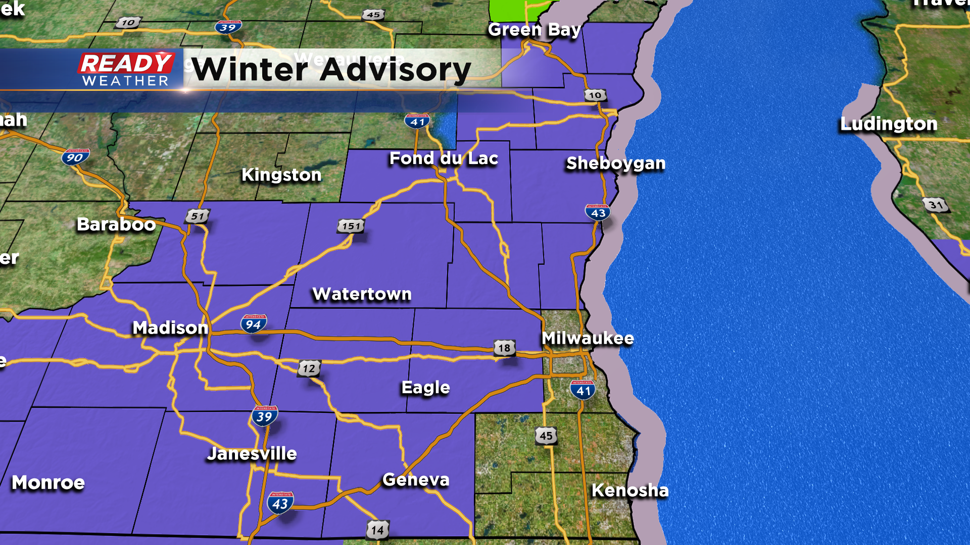
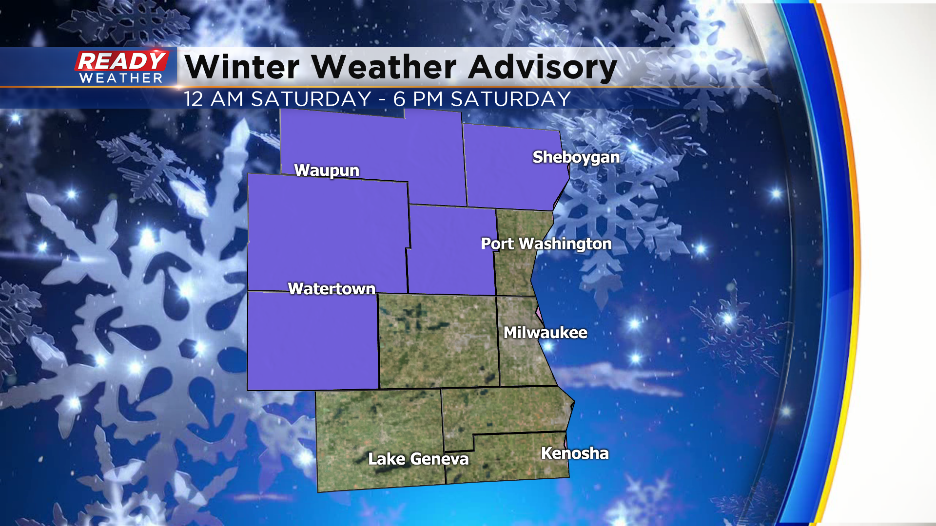
Since western spots could see a few inches of wet snow, the Winter Weather Advisory has been expanded to include all of southeast Wisconsin.
Wind will also continue to be a factor today, continuing to gust from the NE between 30-40 mph. This will cause large waves and lakeshore flooding, but also could cause blowing and drifting well inland where the snow isn't as wet.
------------------------------------------------------------------------------------------------------------------------------
Most of the area will experience snow overnight into Saturday morning. Watch out for low visibility, slick roads, and plenty of slush. The exception will be right along the lakefront with that northeast wind. Strong northeast winds between 20 and 30 mph should keep most of the lakefront rather mixy with little no accumulation.
Once the winds start to shift out of the north by the late morning, that mix will turn into snow. Snow showers are expecting to continue through early Saturday evening tapering off to flurries. No snow is in the forecast for Sunday.
West of the lake we expect 3" to 7" of heavy wet snow! Along the lakefront a trace to a few inches is forecast.
______________________________________________________________________________________________________________
Updated 9:00 PM: Friday, December 11th
The new winter weather advisory has included Waukesha, Walworth, and Ozaukee counties. It has taken some time, but the rain has changed over to snow. The lakefront will remain mixy overnight into Saturday morning.
We do expect the lakefront to shift to all snow by the late morning into the afternoon, but snow totals there will be lower. Most of the area will pickup between 3" to 7".
______________________________________________________________________________________________________________
Western counties continue to report snow this evening; however, we still expect that most of the areas will remain rain throughout the evening.
That strong northeast wind and the relatively warmer lake waters continue to keep the majority of the area liquid. Notice some of the bright colors in Kenosha and Walworth counties above. That's known as bright banding, and that's the radar showing snow melting as it moves through the column.
Gradually after midnight we will expect more rain to turn over to snow rom west to east.
Between 1 am and 4 am most of the area will change over to snow west of Lake Michigan. The lakefront will likely remain rain into Saturday morning with a strong onshore flow.

By noon tomorrow most of the area will experience snow, but there's a lot of uncertainty about the lakefront. It will likely toggle between rain and snow most of Saturday. I wouldn't be surprised if very little accumulates there.
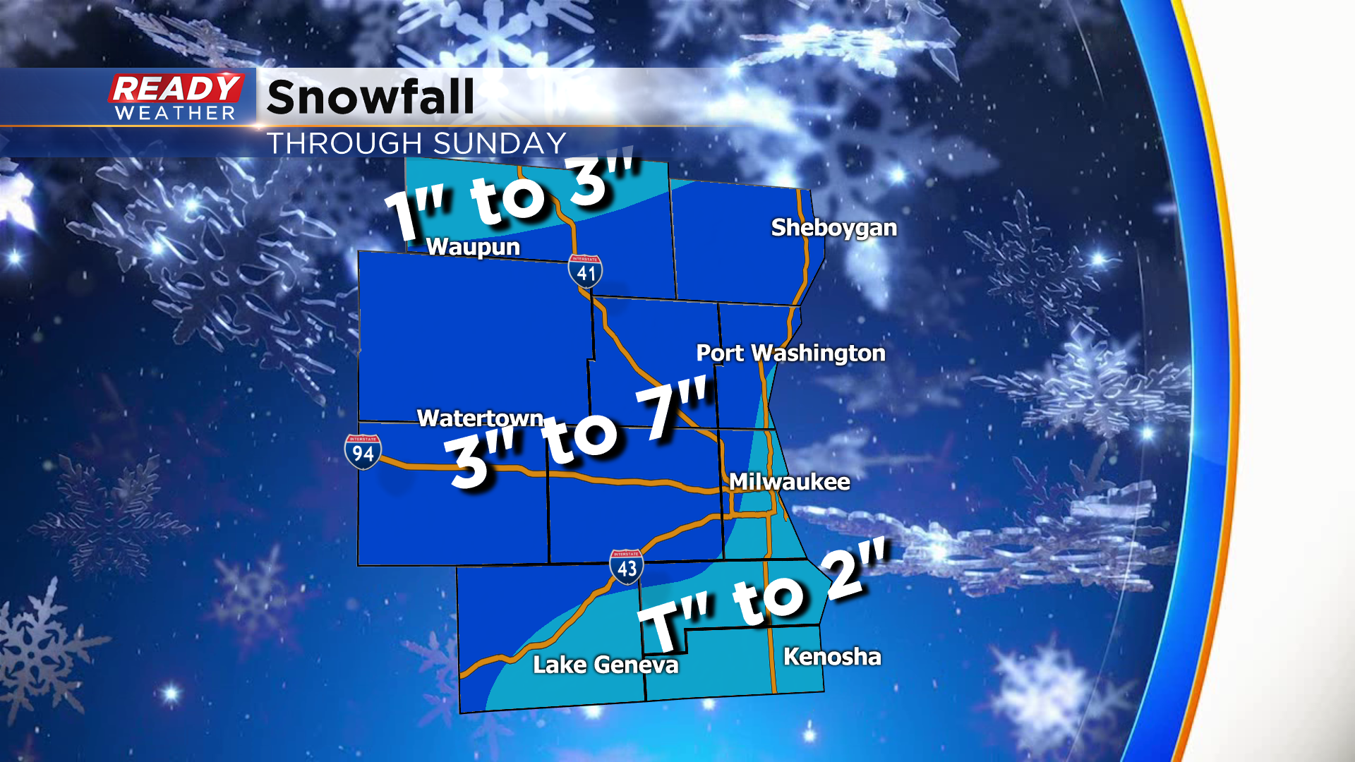
The greatest uncertainty will be from Milwaukee south along the lakefront. The rain to snow change will limit accumulation in those areas. Generally a swath of 3" to 6" of very wet snow is expected west of the lake. Some locally higher totals is possible.
______________________________________________________________________________________________________________
Updated: 1:30 pm Friday December 11th: Updated: 11:00 am Friday December 11th:
Rain is now covering most of the viewing area.
___________________________________________________
We've been advertising this wet weather coming in for the weekend. Additionally, strong northeast wind will be wrapping into the center of this storm system.
Updated: 10:10 am Friday December 11th:
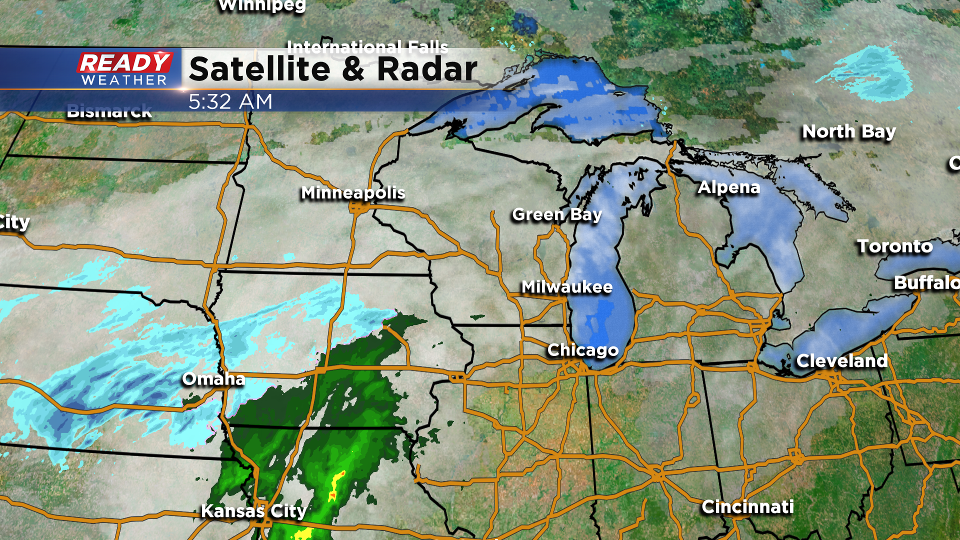
Radar looks active, but as of 10 am none of the rain or snow is reaching the ground yet in southern Wisconsin. Rain will start to reach the ground over the next 1-2 hours and continue through the afternoon. The rest of the forecast remains on track.
-------------------------------------------------------------------------
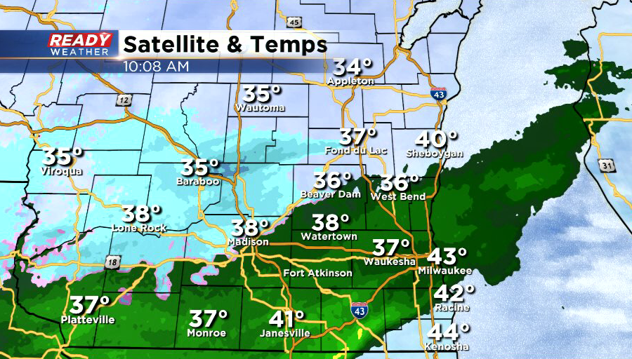
All is quiet across southeast Wisconsin this morning with temperatures sitting in the mid 30s inland and low 40s lakeside. The low pressure system is still getting its act together to our southwest, but it's already starting to bring some rain into Iowa.
Rain will start to move into southeast Wisconsin this afternoon and will likely remain all rain through the evening along the lake.
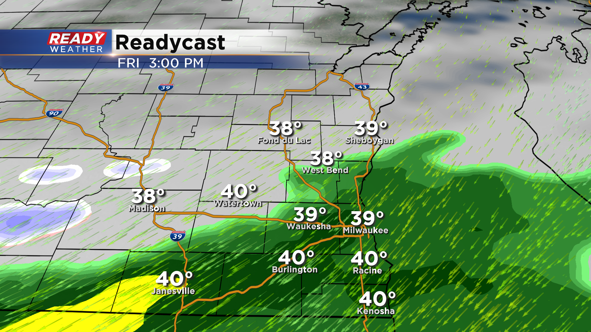
However, rain will start to mix with and change over to wet snow well north and west of the lake during the evening and overnight hours. Latest data suggests a persistent wind off the lake will keep temperatures warm enough near the lake for primarily rain through tonight from Milwaukee to Kenosha. Some wet snow may mix in at times in the western portions of these counties, but the best chance for snow will remain north and west of the city.
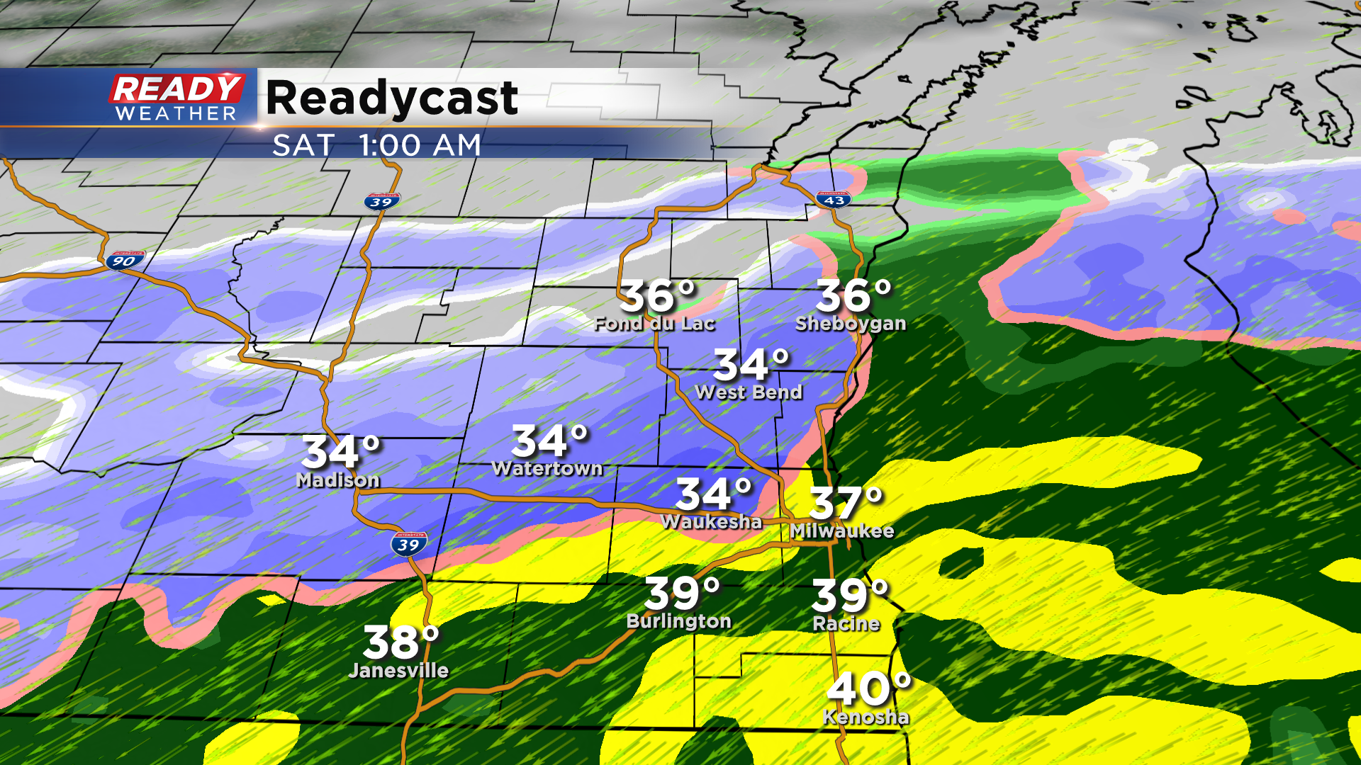
Precipitation could still be rain or a rain/wet snow mix in Milwaukee, Racine, and Kenosha Saturday morning, depending on temperatures, but by late morning enough cold air will be wrapping into the area to change the rain over to snow.
Snow showers will continue through the afternoon and will come to an end late Saturday evening.
With more rain expected lakeside, snow totals will be lower compared to inland locations that change over to snow sooner. Between 4 to 8 inches is expected away from the lake, with 1 to 4 inches lakeside. Areas right along the lake could have under an inch of slush, while western portions of lakeshore counties have the better chance at a few inches. If temperatures are a couple of degrees cooler, snow totals would end up a couple inches higher.
Since the highest totals are expected inland, a Winter Weather Advisory has been issued for Fond du Lac, Sheboygan, Dodge, Washington, and Jefferson counties beginning at midnight tonight through 6pm Saturday.
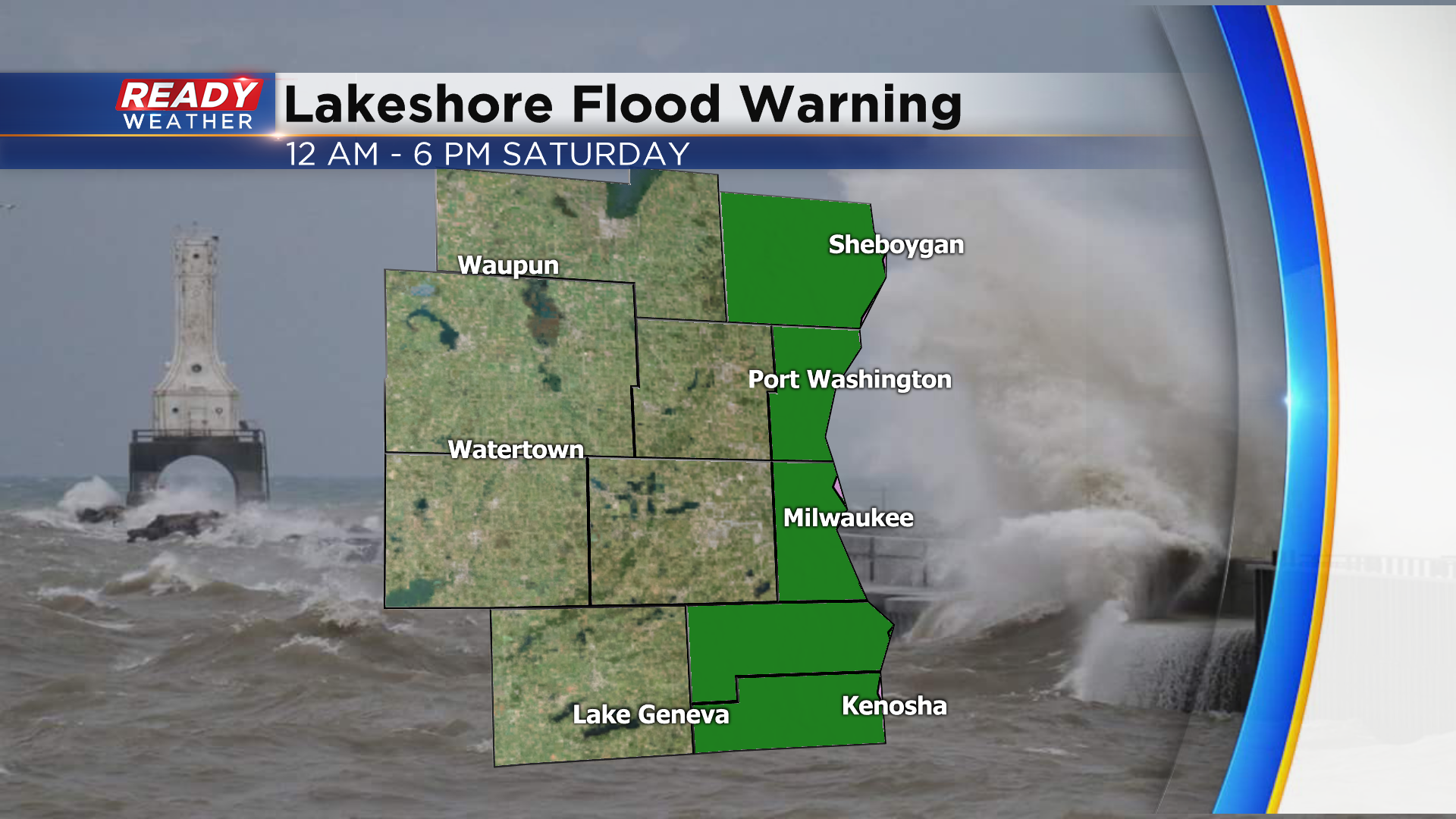
Winds will also be strong today and especially Saturday, with gusts between 25-35 mph expected. Winds will be from the northeast, which could create waves of 8-12 ft. A Lakeshore Flood Warning has been issued for all lakeshore counties for Saturday as flooding and erosion is expected.
Snow will come to an end Saturday night with quiet and chilly weather expected on Sunday. Download the CBS 58 Ready Weather App to track the rain and snow as it moves into the region.
