Accumulating snow expected Wednesday
Posted: Dec 12, 2017 3:38 AM CDT
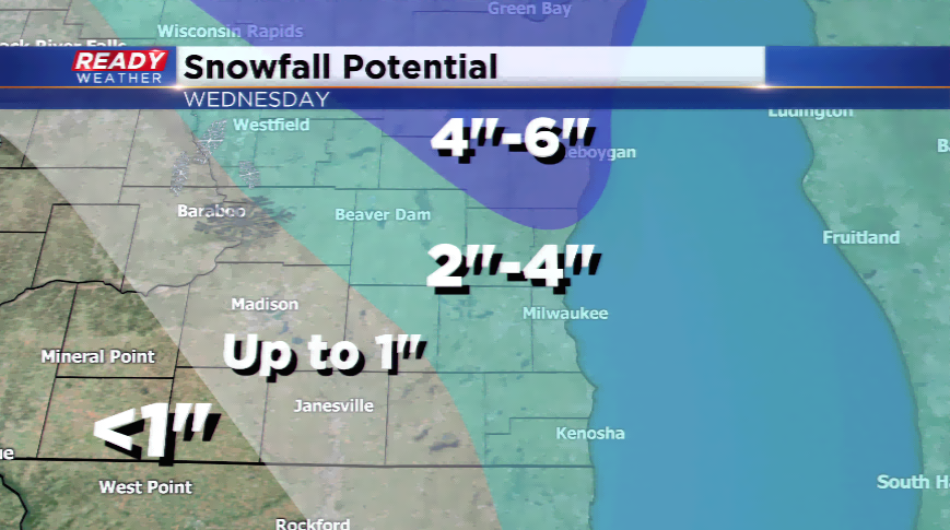
Another round of accumulating snow is expected tomorrow in southeastern Wisconsin. Models have been trending in the upward fashion in terms of snowfall totals. Some spots could see as much as 6" of snowfall, especially north of the metro.
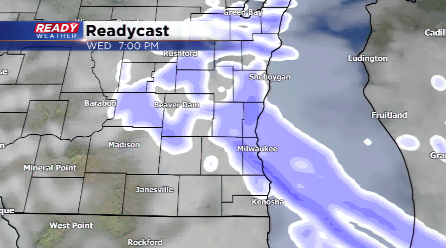
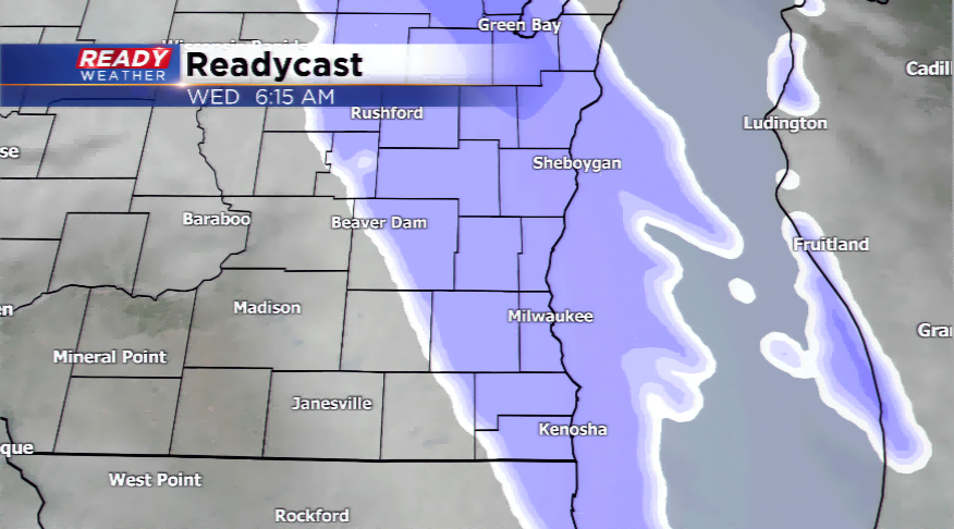
The timing takes the snow into the area as early as Wednesday morning, before finally tapering off by the night hours tomorrow night. Most spots area-wide will see 2"-4", with less to the southwest, and more in our northern areas. A snow band will setup to our north possibly producing between 4"-6" of fresh powder.
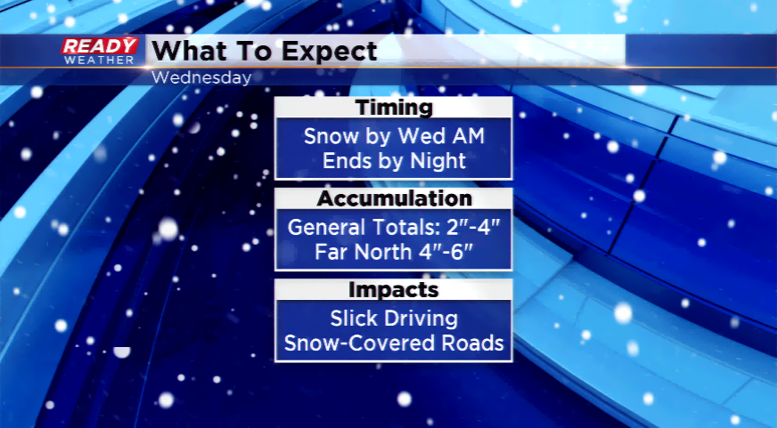
The confidence continues to rise that snow will be in the forecast. This means driving conditions will worsen during the day, especially where the snowfall will be heaviest.