Dangerous cold expected through Valentine's Day


Updated: 5 am Sunday, February 14th:
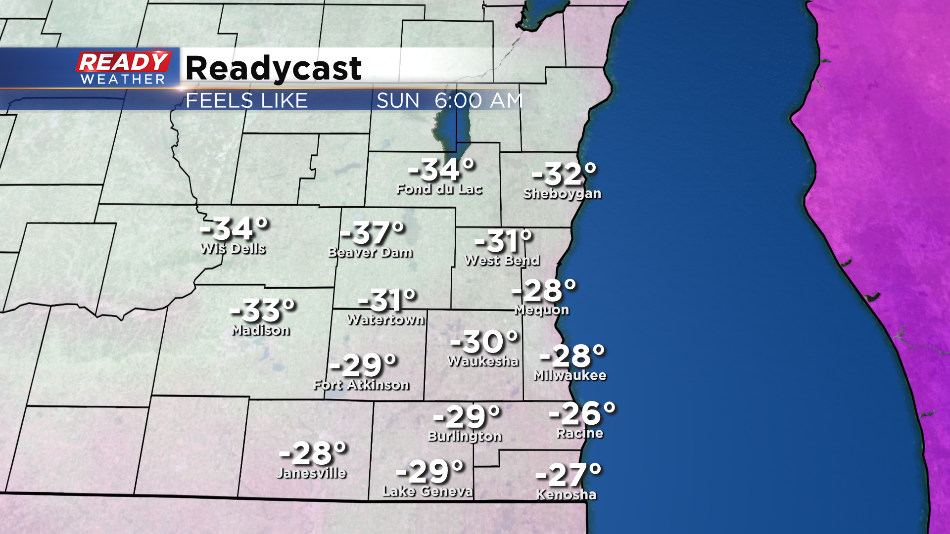
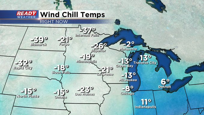
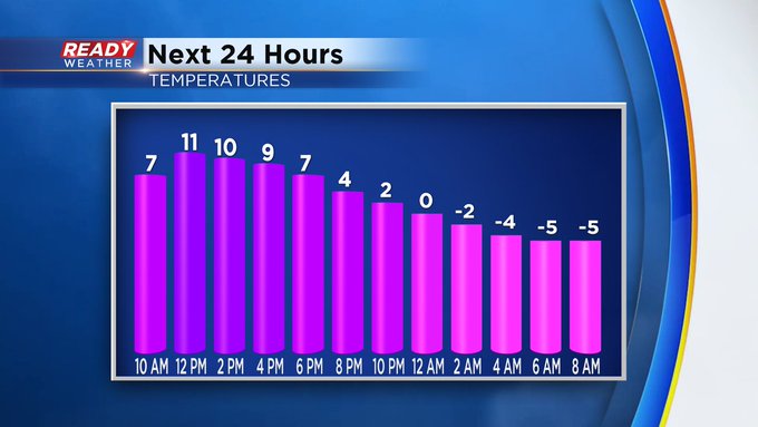
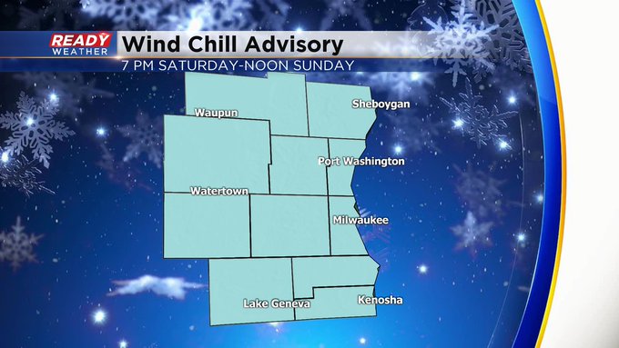
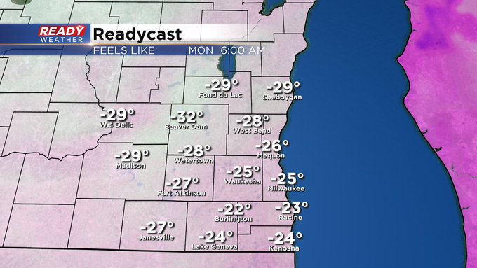
The Wind Chill Advisory is now in place through Monday morning. At times Sunday morning, it’ll feel like -30 to -35. There’ll be a brief break Sunday afternoon before it feels like -20 to -35 Sunday night/Monday morning. Please limit your time outside to ten minutes at most to avoid frostbite. Improvements come starting later Monday. In fact by the middle of the week, we’ll see highs in the 20s. 30s possible by next weekend.
Updated: 6 pm Saturday February 13th:
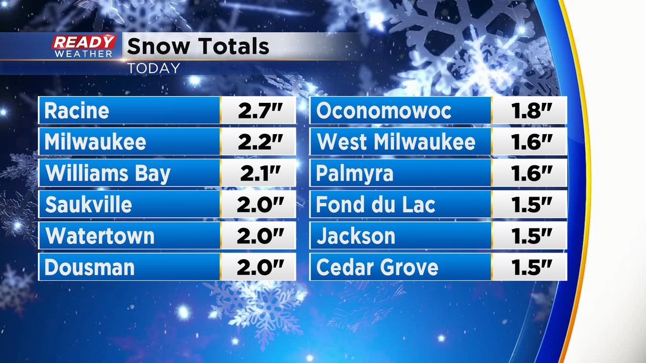
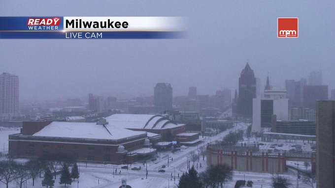
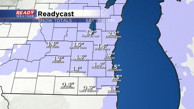
The snow has come to an end across southeast Wisconsin with most of the area picking up around 2".
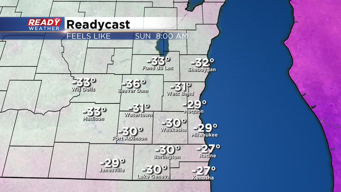
The clouds left as quickly as the snow, setting the stage for a brutal cold night. Temperatures will fall into the single digits below-zero lakeside with teens below-zero well inland. Once you factor in the 10-15 mph winds, it'll feel like -25° to -35° tonight through midday Sunday.
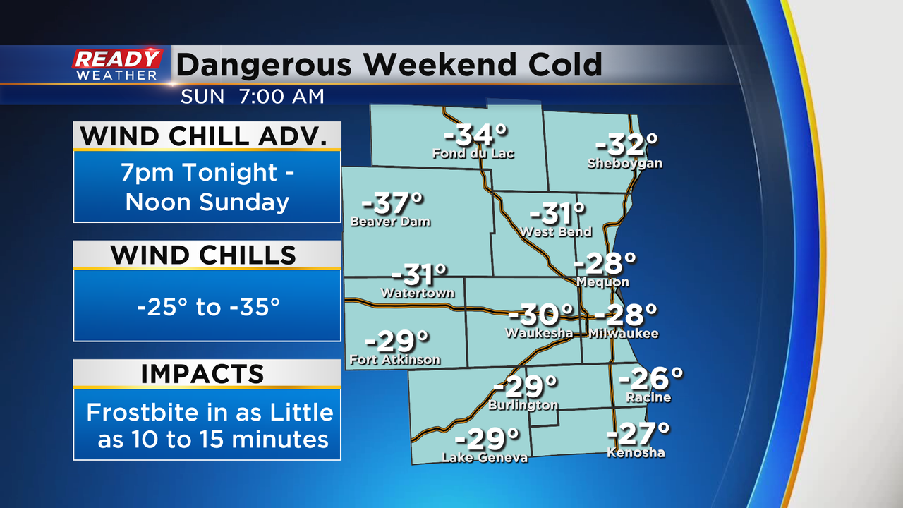
Frostbite is possible in as little as 10-15 minutes on exposed skin when wind chills are this cold. A Wind Chill Advisory runs through Noon Sunday for all of southeast Wisconsin, but wind chills will only improve to -10° to -20° Sunday afternoon.
--------------------------------------------------------
Updated: 3pm Saturday February 13th:
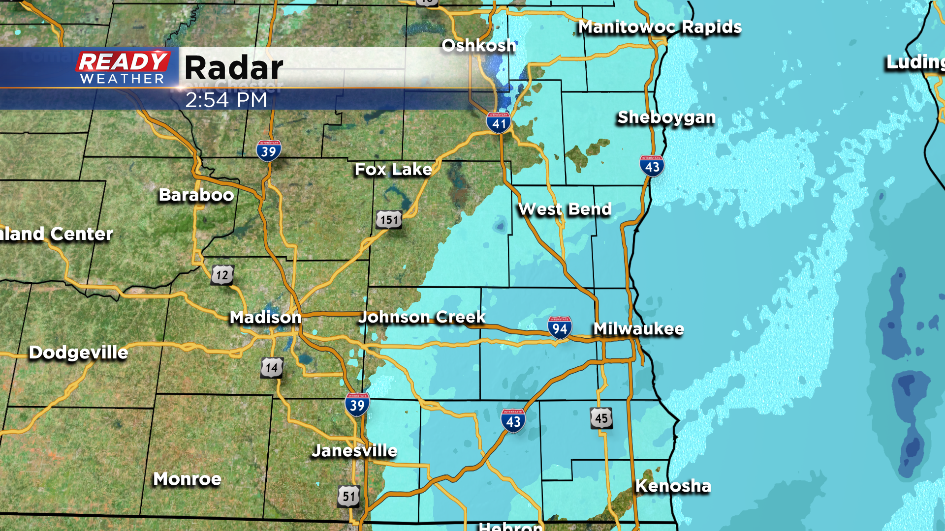
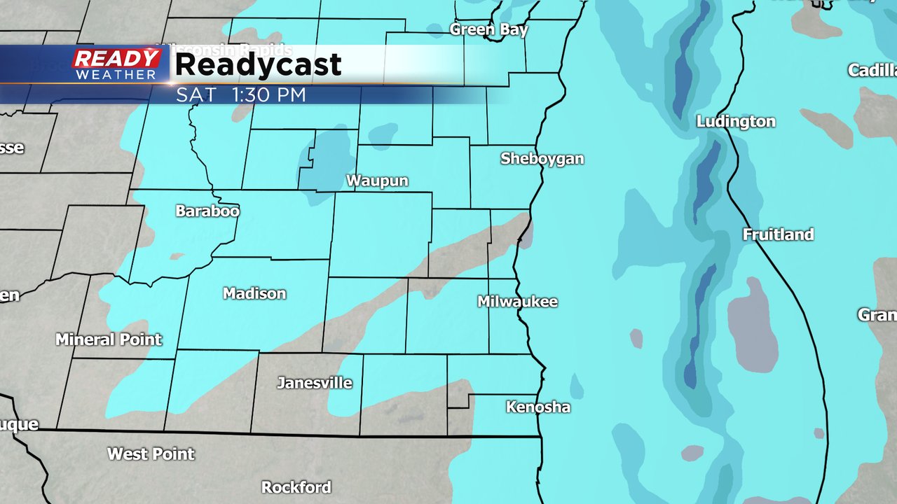
The back edge of the snow is moving into western portions of Dodge and Jefferson counties as of 3pm. Snow will end for most of southeast Wisconsin by 4pm and will clear the lakeshore before 5pm.
Skies are clearing out quickly behind the snow, which will cause temps to plummet into the single digits and teens below zero tonight. Factor in the NW wind between 10-20 mph and wind chills will drop between -25° and -35° tonight through Sunday morning. Frostbite will be possible in as little as 10 minutes overnight.
A Wind Chill Advisory begins at 7pm for all of southeast Wisconsin and runs through Noon Sunday.
----------------------------------------------------------------------------
Updated: 1pm Saturday, February 13th:
Light snow continues to fill back in across southeast Wisconsin. A few pockets of more moderate snow are pushing through as well.
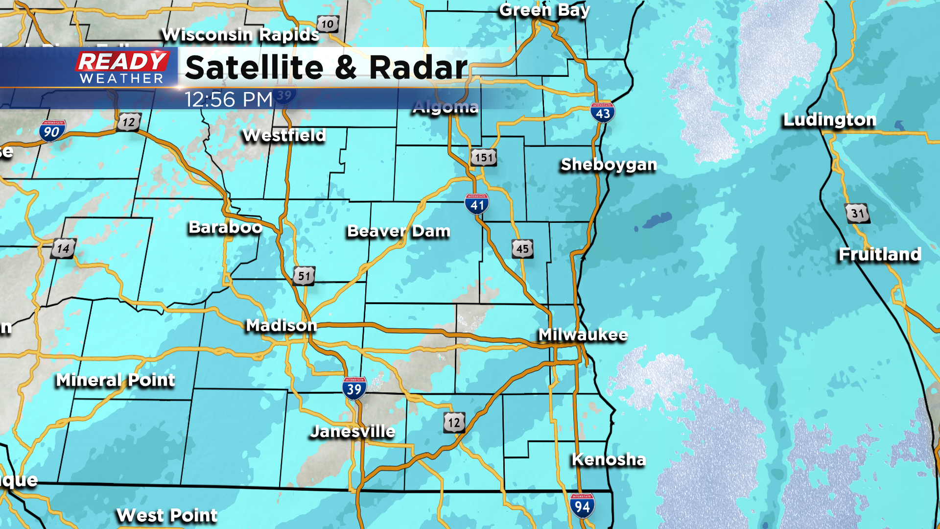
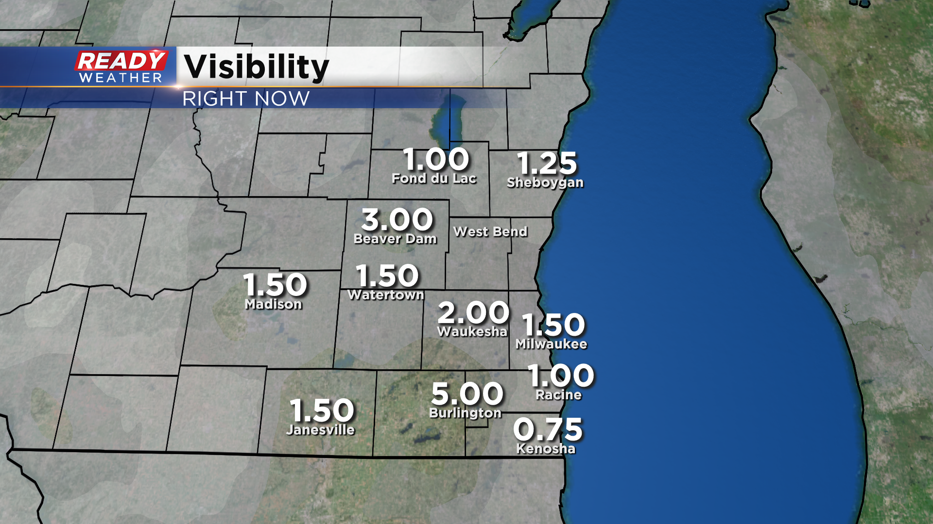
Roads remain slippery and snow covered across southeast Wisconsin, and visibility is being reduced to a mile or less at times in the more moderate snow bands.
Snow will come to an end around sunset with bitter cold temperatures and wind chills settling in for tonight.
---------------------------------------------------------------------------------------
Updated: 11am Saturday, February 13th:
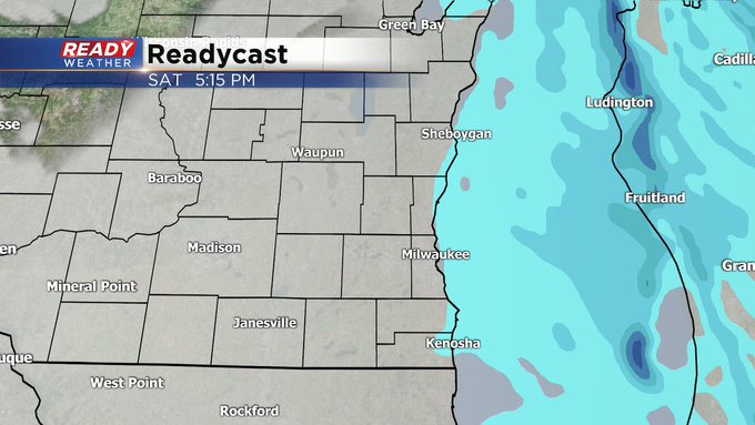
Light snow continues to fall across southeast Wisconsin, but there are a few breaks in the snow in parts of the area as of 11am. The snow in southwest Wisconsin will fill in moves across the area this afternoon.
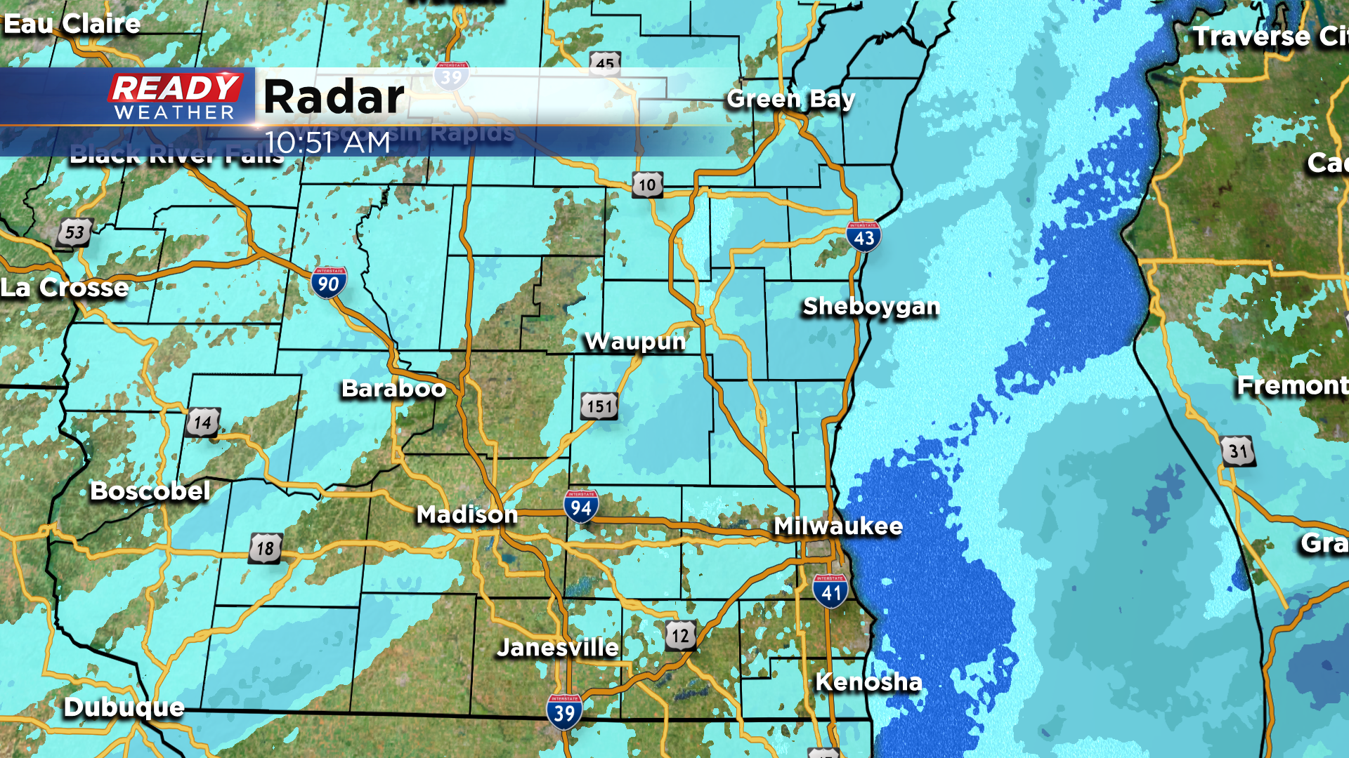
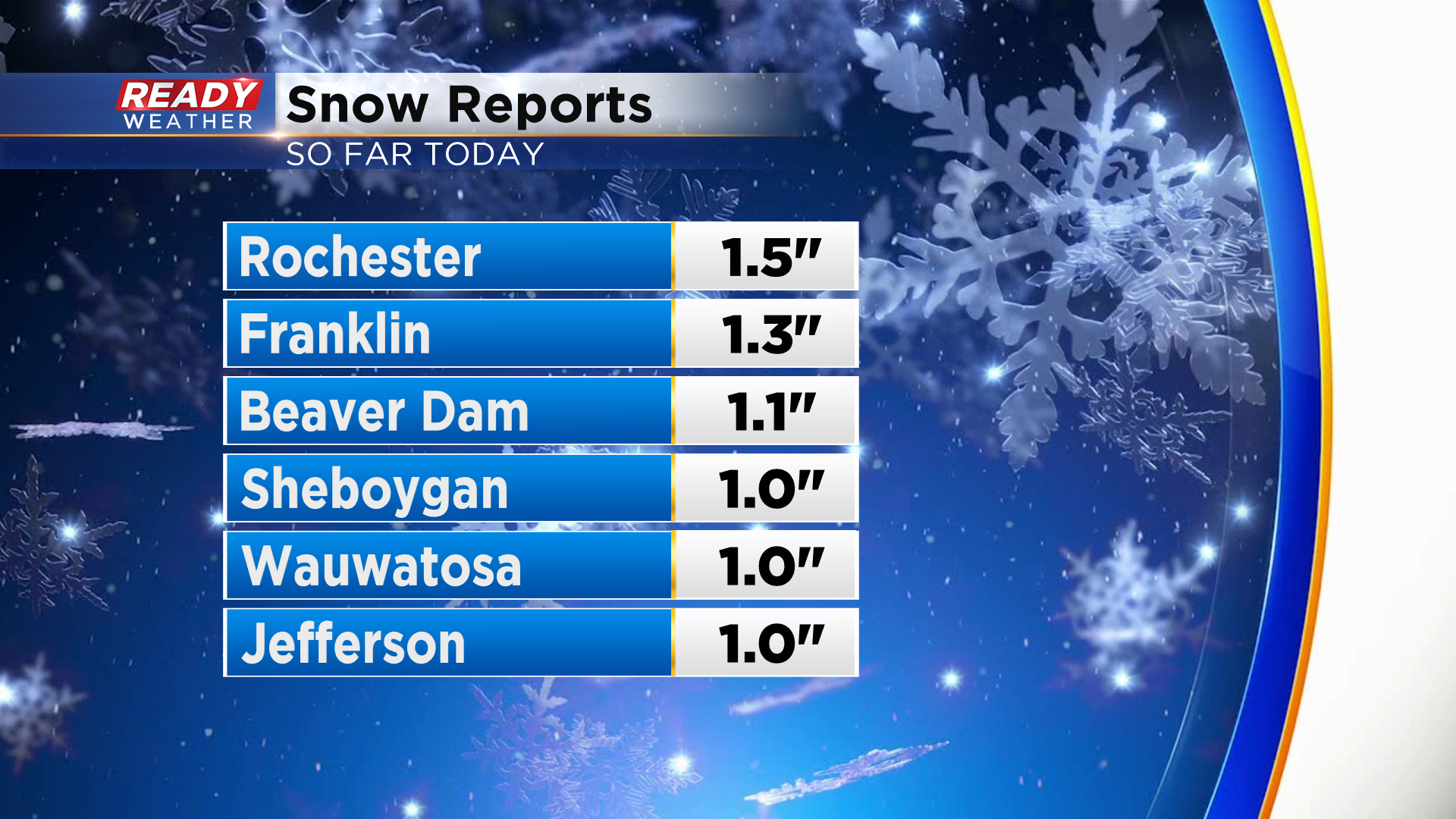
Most of southeast Wisconsin has picked up about an inch to inch and a half of snow so far today. An additional inch is possible before the snow comes to an end late this afternoon.
The fluffy snow combined with single digits temps above and below zero has created snow covered and icy roads with numerous accidents being reported throughout the area.
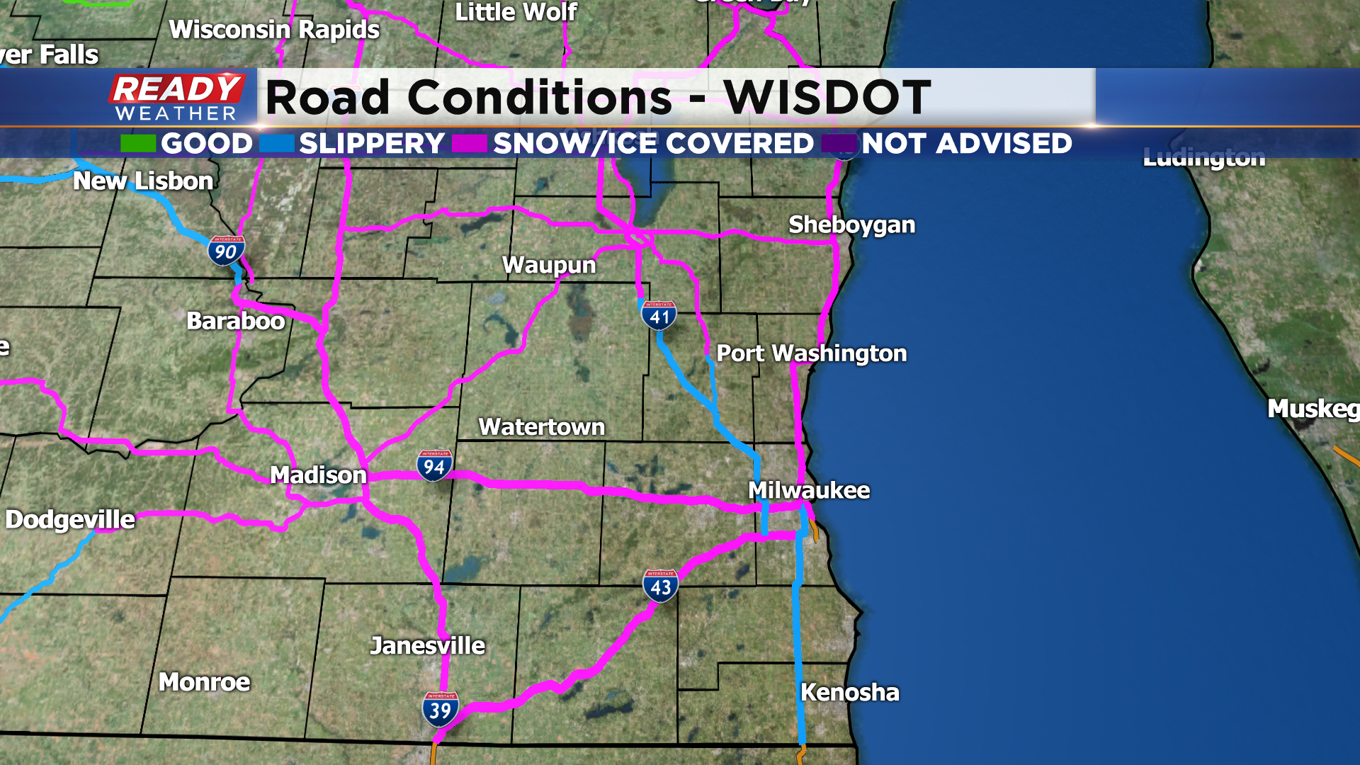
Drive slow and with your headlights on if you venture out today.
--------------------------------------------------------------------------------------------------------------
9:00 am Saturday Update...
The snow continues to fall and eventually the temperatures will as well. Please use extreme caution when driving today. We've had many reports of spinouts. The snowfall will taper off late in the day but not before dropping a few powdery inches. Watch the extreme cold coming tonight. At times it'll feel like -20 to -30 through Sunday and into Monday.
Stay tuned to CBS58 and cbs58.com throughout the day for updated weather information.
_________________________________________________________________________________________________________
7:30 am Saturday Update...
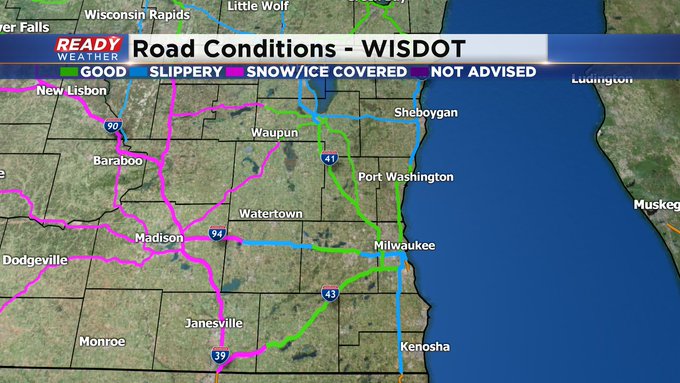
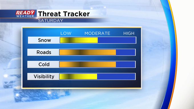
The roads are getting hazardous for travel. We're getting word of lots of spin outs already this morning. As you recall, many of the accidents Friday morning happened because of the light snow falling. The salt really isn't as effective at temps below 25 degrees. Typically at around 30 degrees, a pound of salt can melt more than 46 pounds of ice. When the temp drops to zero, it's only a few pounds. (At extremely cold temps, calcium chloride or magnesium chloride works better than sodium chloride.) So please slow it down. After the snow ends late in the day, then we focus on the very dangerous chill coming. At times Sunday into Monday, it'll feel like -30 to -35. So please limit your time outdoors.
____________________________________________________________________________________________________________
MILWAUKEE (CBS 58)--It's a very active weather pattern this holiday weekend. First the snow. We could see a few powdery inches through the afternoon, making for tricky travel. Salt isn't really effective with these low temperatures (anything under 15 degrees, really). So please take it easy on the roads.
Then we get blasted with lots of dangerous chill. A Wind Chill Advisory is up for the area from 7 pm tonight until noon on Valentine's Day Sunday. At times, it'll feel like -30 to -35 degrees. Frostbite can set up in 15 minutes! Obviously limit your time outside to probably ten minutes or so. Keep the pets inside as well.
I set a let up in temperatures as soon as Monday afternoon. Maybe even temps in the 20s by midweek and then 30s by next weekend.