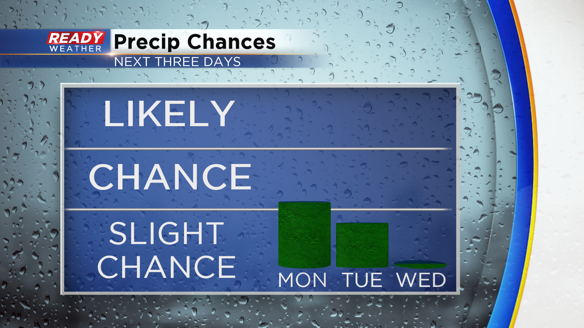
A couple of isolated shower/storm chances to start the work week


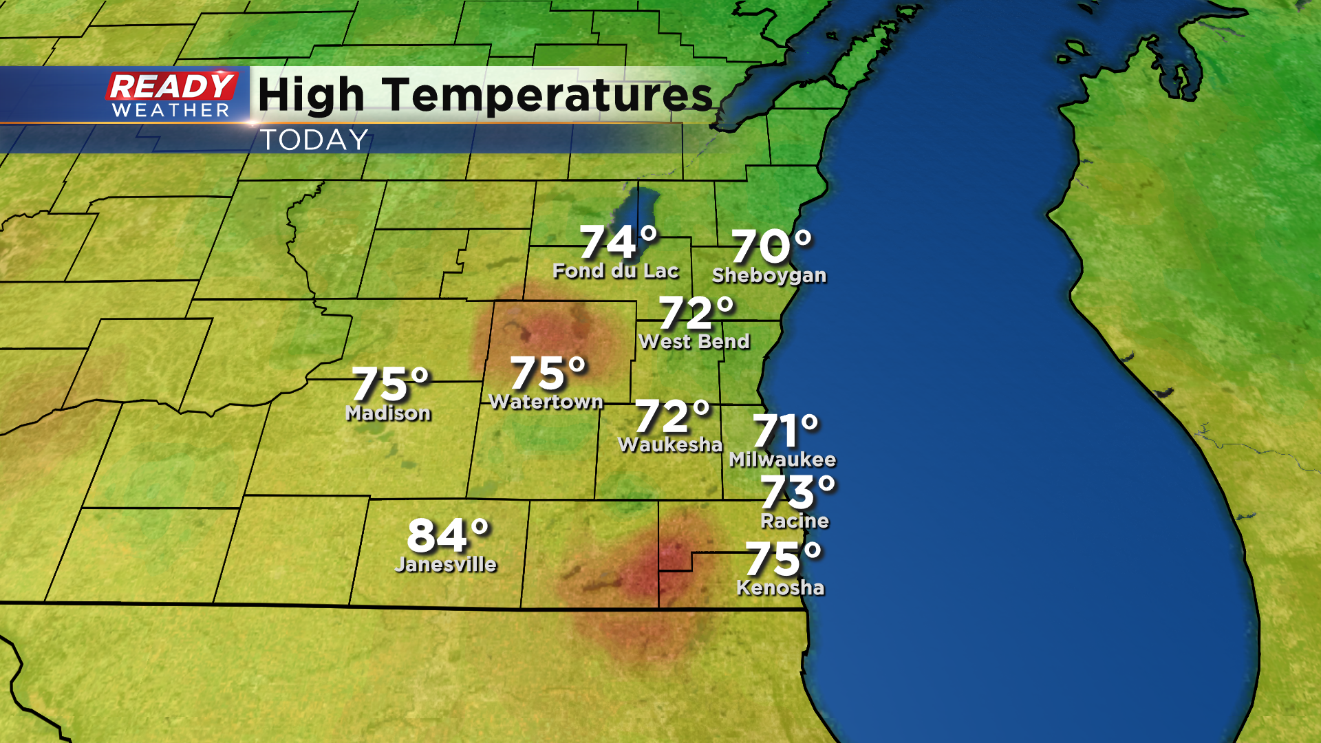
Today was another fantastic late summer day across southeast Wisconsin with plenty of sunshine and temperatures in the low to mid 70s.
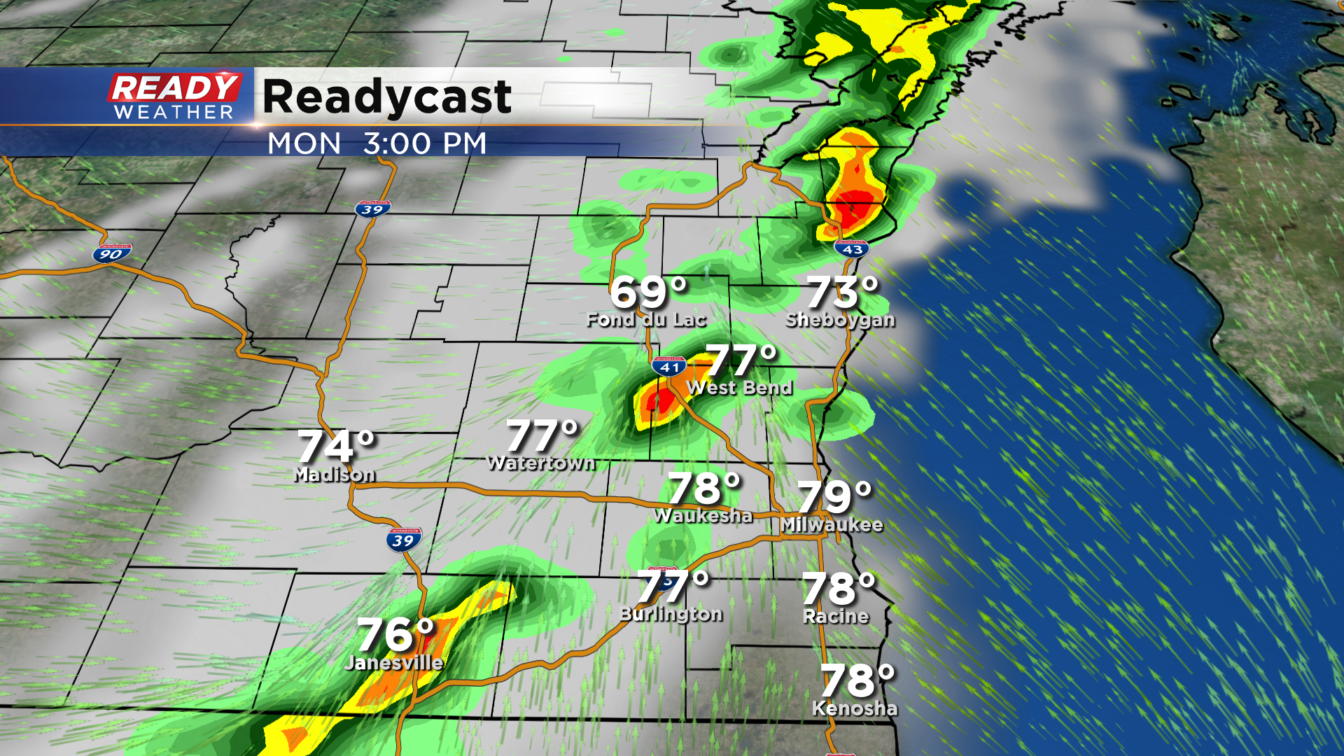
A few more clouds will roll into the area tonight ahead of a cold front. That front will work its way through the Badger State on Monday, but most of the energy with that front will be in northern Wisconsin. While the best chance for showers will be up north, a few isolated showers and storms are possible tomorrow afternoon to early evening as that front moves through.
That front will settle just south of the state on Tuesday, but another wave of energy riding along the front may trigger an isolated shower later in the day with the best chance coming south of I-94.
Temps will warm back into the upper 70s on Monday thanks to a southerly wind, but will cool into the mid 70s behind the front on Tuesday.
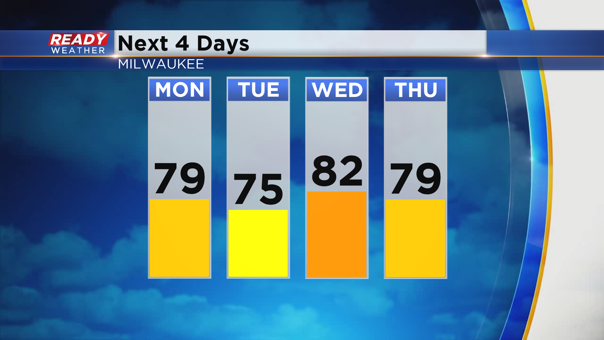
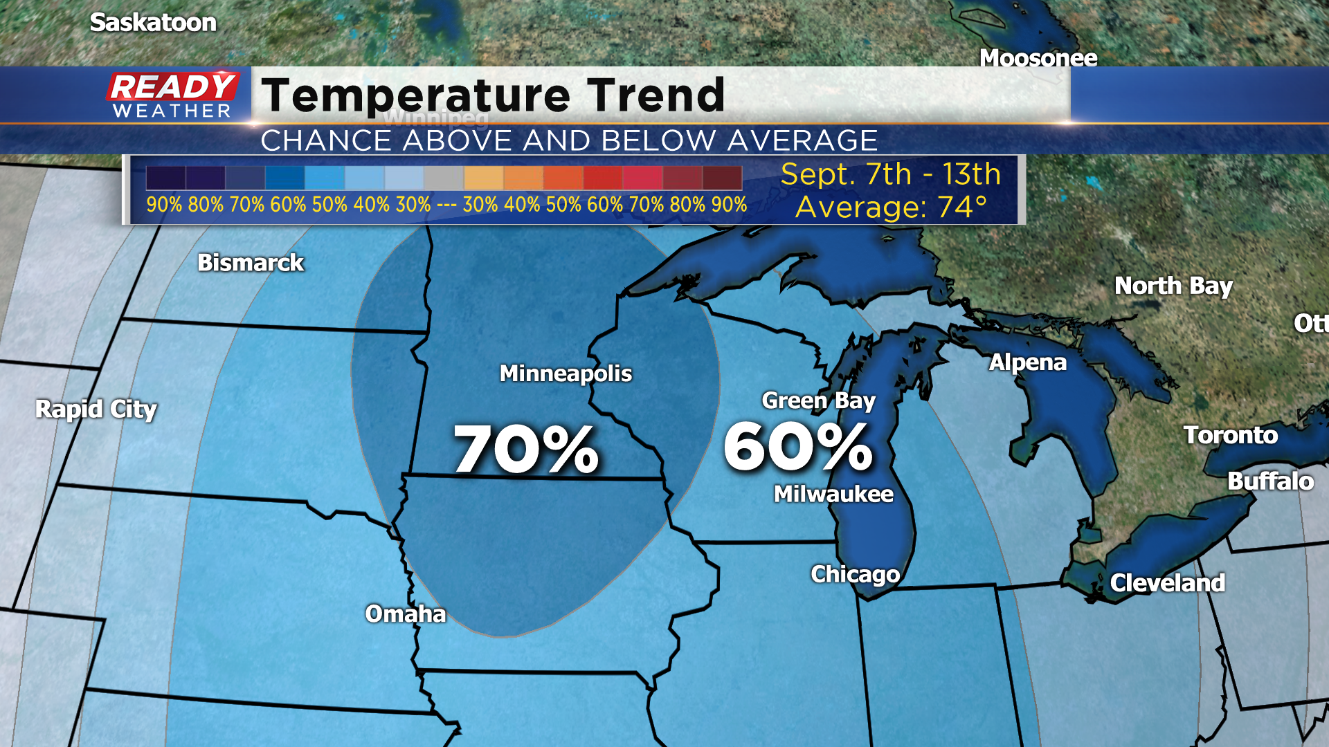
While temps warm back up to around 80 degrees during the middle of the week, there may be a taste of fall on the way during the week of Labor Day. Below normal temps are favored during the first half of next week with normal temps that time of year in the mid 70s.
Download the CBS 58 Ready Weather App to see how cool we could be around Labor Day.