6pm Update: Tracking Saturday's Storms
First things first, what an amazing day! We hit 82° in Milwaukee this afternoon. That's warmth we haven't felt since mid September, with our last warmer day at 87° on September 19th.
With this heat around and an approaching cool front, we are still watching for storms this evening and tonight. Thankfully Easter Sunday should be dry with a clearing sky a high near 70.
Overall the severe threat won't be widespread, but a few isolated warnings can't be ruled out tonight with gusty wind and some hail. While an isolated evening storm is possible, most activity holds off until around 10pm in the metro.

And latest data points to an even later onset, so much of the active weather may hold off until closer to midnight. Check it out:

Lingering showers and storms will likely continue in the predawn hours of Sunday before drying. The rain will be gone by Easter sunrise, so church services should be ok, but a few clouds will still be around during the morning.
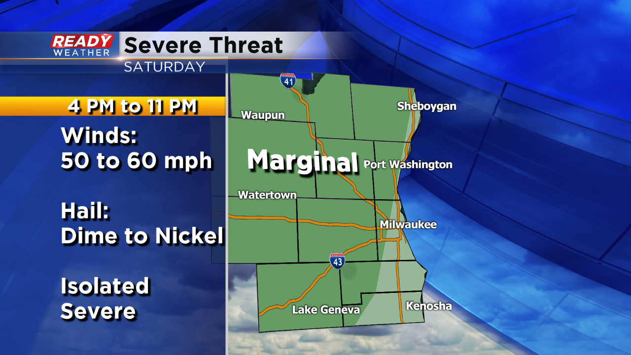
If storms turn severe they could produce quarter size hail and winds over 50 mph. Most of the hail would likely be dime to nickel size. In order for a storm to be considered severe, you need winds over 58 mph, and or hail to 1.00" in diameter. Most of our area is under a "marginal risk" for strong to severe storms to occur.
Please download the Ready Weather App to receive watches and warnings and your Ready Doppler right to you phone!
