


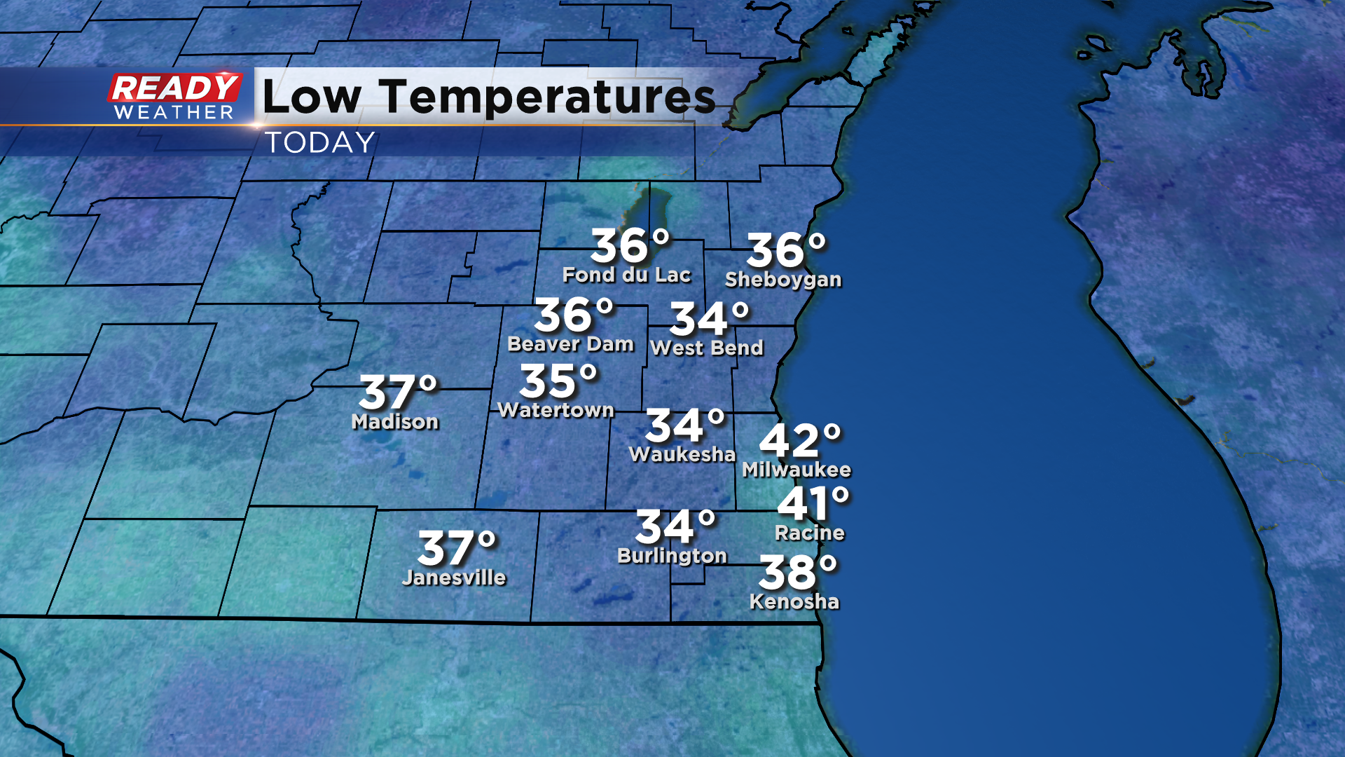
Today was a fantastic fall day across southeast Wisconsin with plenty of sunshine and blue sky, but it started off as our coldest morning since mid May with many spots away from the lake falling into the mid 30s with light frost.
Winds won't be completely calm tonight and will turn to the south, so lows will only fall into the low to mid 40s. These southwest winds will help usher in another batch of wildfire smoke that is currently sitting over Iowa.
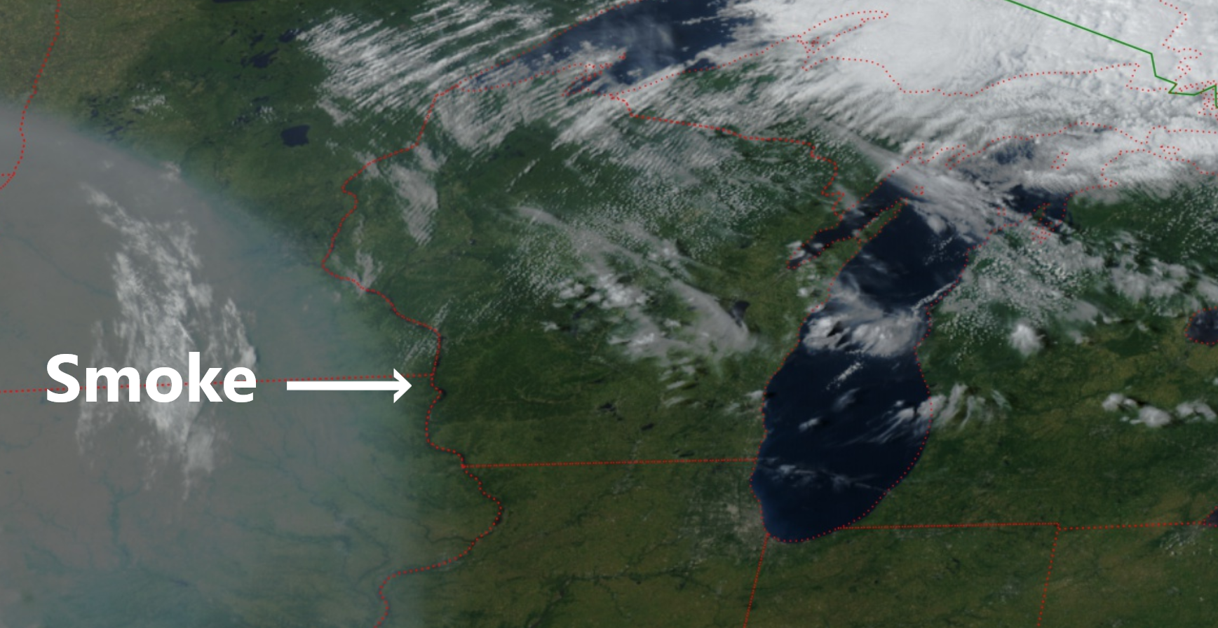
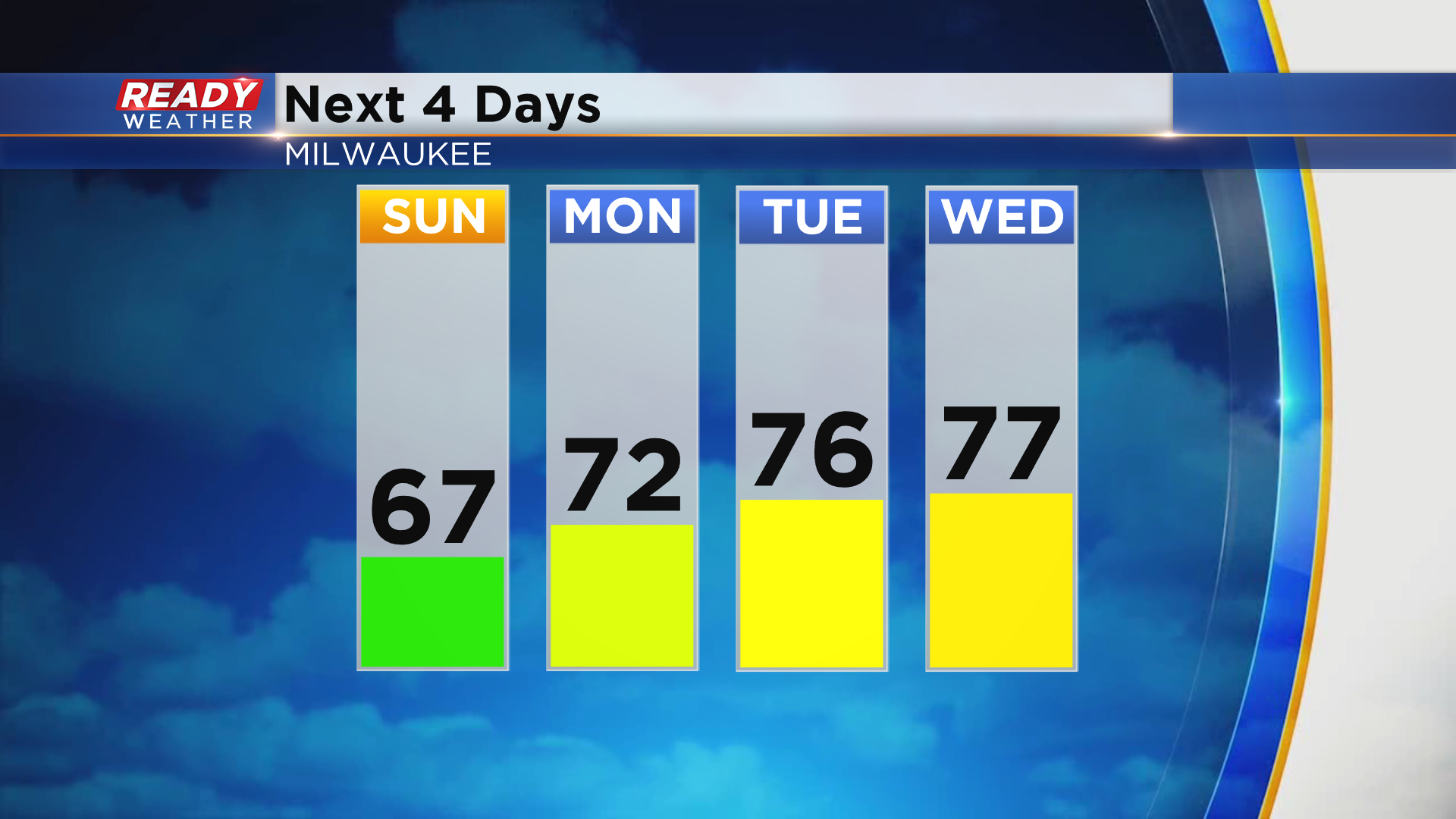
This smoke will filter our sunshine on Sunday, but temps will continue to warm a couple of degrees compared to today. Southerly winds throughout the first half of the week will help temperatures warm back into the low 70s Monday and mid to upper 70s Tuesday and Wednesday.
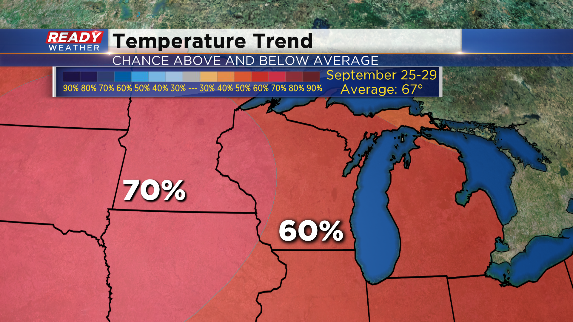
Mainly dry weather will continue this week with our only chance for a couple of showers coming on Thursday with a weak front, and even that chance is only around 20%. It doesn't look like that front will bring in cooler temperatures. The 6 to 10 day temperature outlook has a 60% chance for above normal temperatures (normal = 67°) heading into next weekend.
Download the CBS 58 Ready Weather App to see how warm temps could get by the end of the week.