White Christmas? Watching a potential storm for next week.
I know we still are a week away, but a storm system is looming for late next week. This storm is being picked up by both the GFS and EURO models, and while there are differences in the timing, it's something we will need to watch closely before Christmas.
Both models develop a surface low pressure area over the panhandle of Oklahoma. That's important because those types of lows bring southeastern Wisconsin the heaviest type of snow. As the low deepens, it pulls deep gulf moisture north and plenty of cold air from the northwest. As the extreme temperatures converge, the low continues to strengthen.
Right now the models are showing snow developing on Thursday into Friday morning. The track is pivital to where the heaviest band of snow will setup. We will continue to monitor the changes as we get closer.
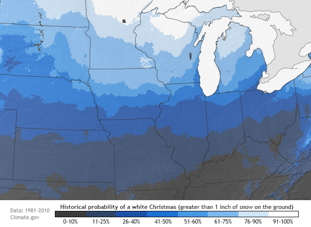
Milwaukee climatologically has a 41% to 50% chance for a white Christmas. If this system does hold together, it would almost guarantee a white Christmas for us this year. The cold behind this system would keep the snow around through Christmas day!
