


Today most of the area warmed into the lower 70s. It's been 180 days since Milwaukee's last 70. April weather can be very cruel. By Wednesday highs will be in the 30s with accumulating snow chances for the commute.
A major spring storm will take shape across the Midwest Wednesday through Friday. Thankfully the majority of the snow will stay across central and northern Wisconsin; however, we will see some snow coming on Wednesday.
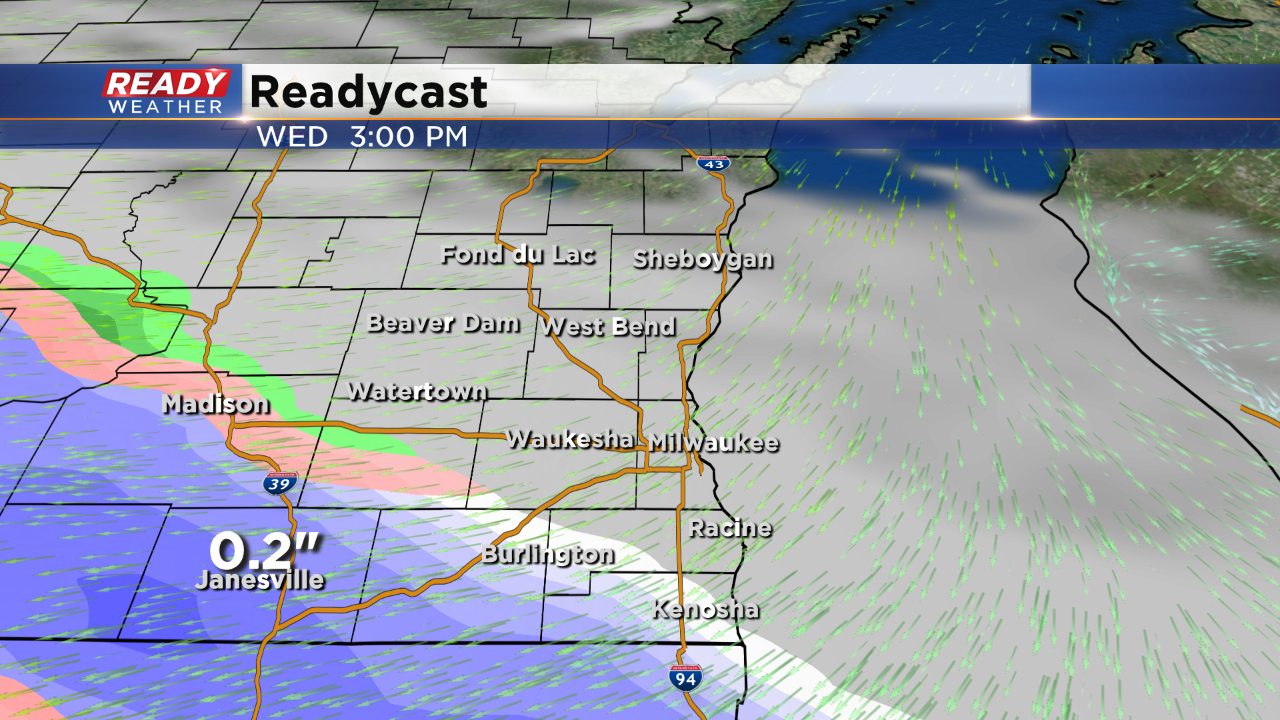
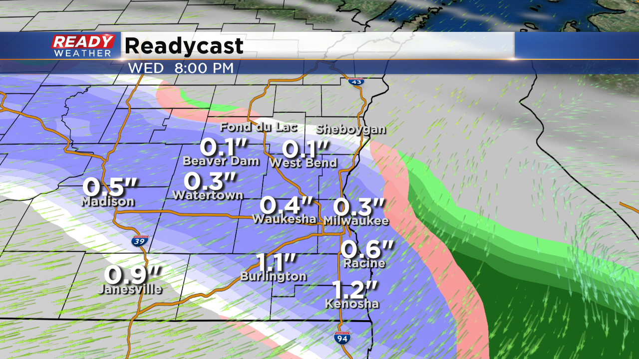
The snow will arrive between 3 pm and 6 pm, just in time for the evening commute. Temperatures will be in the middle to upper 30s, so grassy areas will mainly be impacted.
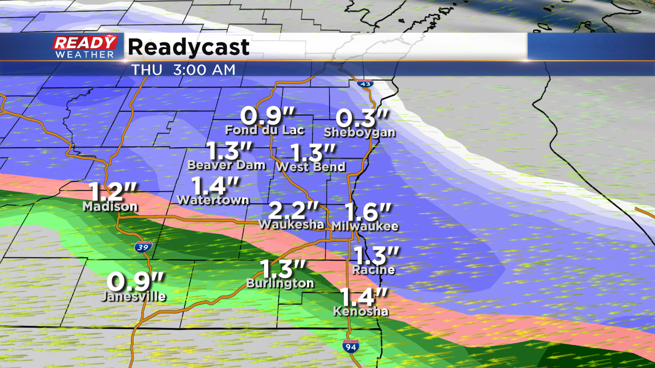
The snow has a chance to intensify across our northern counties late Wednesday night into Thursday morning. Some roads could be an issue for early Thursday morning.
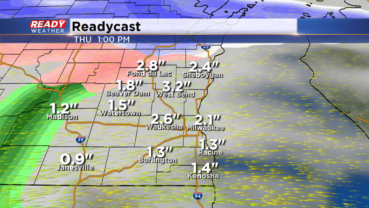
Our northern counties will have the best chance for 2" to 5" inches of snow. Along and south of 94 we are expecting an inch or two. The snow is expected to turn back over to rain on Thursday with another chance for light snow on Friday.