


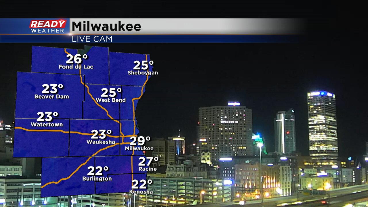
After a chilly start to the month of April, temperatures will be on a warming trend over the next few days. We're starting off in the 20s again this morning, but the wind isn't as strong so it doesn't feel as cold as Thursday morning.
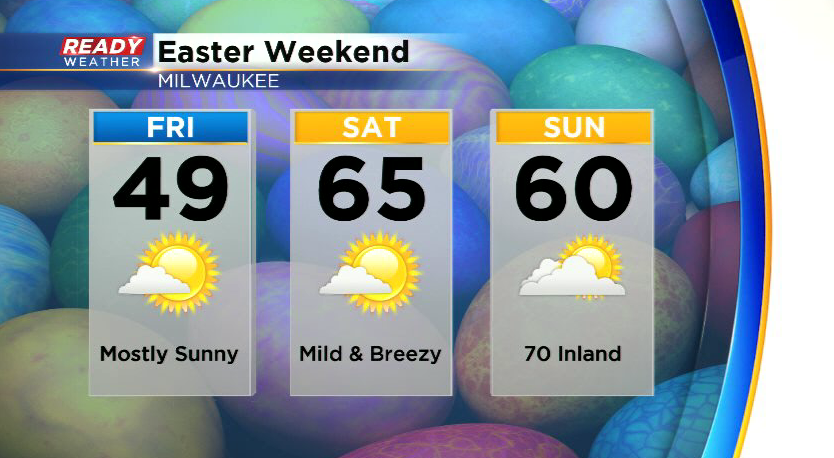
After a batch of clouds passes by this morning we'll be left with mostly sunny skies with temperatures rebounding back to normal in the upper 40s to around 50, but a lake breeze will develop in the afternoon and drop temps into the mid 40s lakeside. Southwest winds will pick up tonight and will boost temps into the mid to upper 60s on Saturday with plenty of sunshine! Inland spots could make a run at 70° on Easter Sunday, but winds will be from the southeast so lakeside areas will likely be stuck in the upper 50s to around 60°.
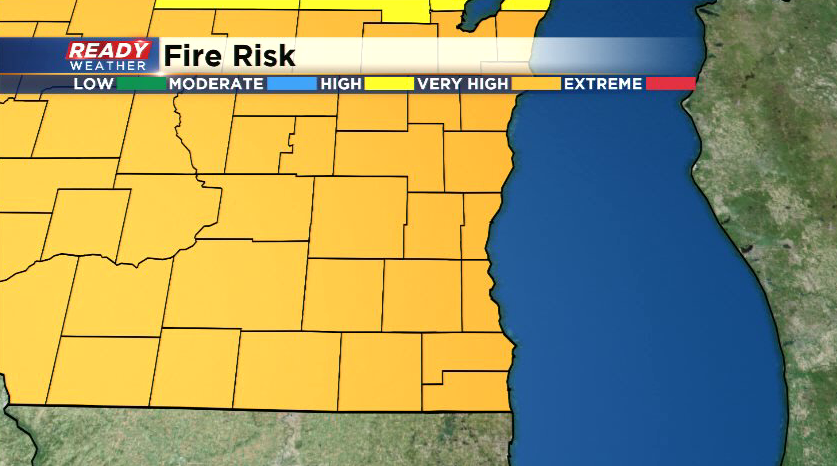
With the dry and breezy weather in place, fire danger remains very high across all of southern Wisconsin. This elevated fire danger will continue through the holiday weekend, so avoid any outdoor burning.
While dry weather continues throughout the weekend, active weather returns throughout next week with multiple chances for rain and storms. Download the CBS 58 Ready Weather App to see the full forecast.