Waiting on lake effect snow showers to take hold late Sunday into Monday


3:15pm Update:
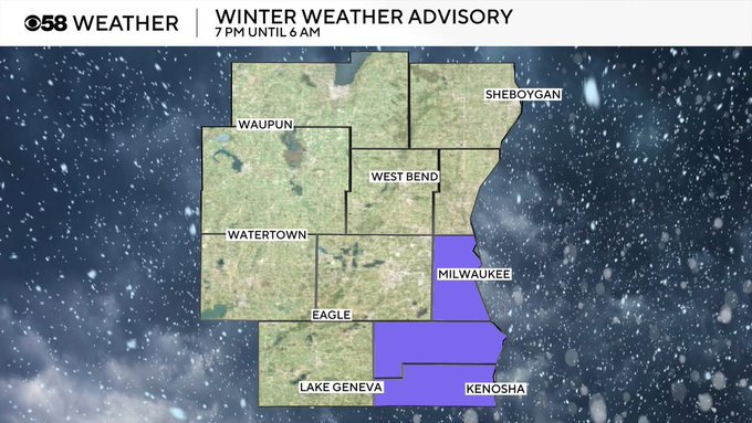
A Winter Weather Advisory has been issued for Milwaukee, Racine, and Kenosha Counties from 7pm this evening until 6am tomorrow morning. A band of lake effect snow is expected with the potential for significant snowfall to develop depending on winds. 2-5" of snow is anticipated based off of the wind direction as of now, with the Monday morning commute looking to be impacted. Gusty winds will likely blow snow and reduce visibility along with spots of ice making roadways slick.
MILWAUKEE (CBS 58)--Talk about your "wind reliant" forecast. It all depends on where the wind is coming from Sunday night into Monday as to how much snow we get. If it's a more northerly flow (like most computer models are showing), we get a slight accumulation lakeside, and places like Chicago and northwest Indiana get hammered with 6-12" of snow. But any wiggle room (northeasterly wind), this entire forecast can change drastically. Best advice is to stay tuned to developing conditions, especially if you are lakeside. Meantime, lingering snow showers remain in the forecast for Monday and Tuesday. Then we trend warmer with the temperatures with readings back in the 50s for many by the second part of the week. Next weekend is trending a bitter wetter and staying mild too.


