Storms Blasted Through Parts of Southeastern Wisconsin
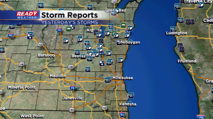
A line of severe thunderstorms carved through parts of Wisconsin including a chunk of the CBS58 viewing area yesterday afternoon and evening. Several counties were under Severe Thunderstorm Warnings because of the threat of high winds and large hail. In all, 55 storm reports around the viewing area, mainly north of I-94 in our northern and northwestern counties. Several trees were reported down in Dodge, Fond Du Lac, and Washington Counties from the storms. At 2:30am this morning, 12,605 people were still without power, the largest population in the Washington County area. All of the activity was over by midnight last night.
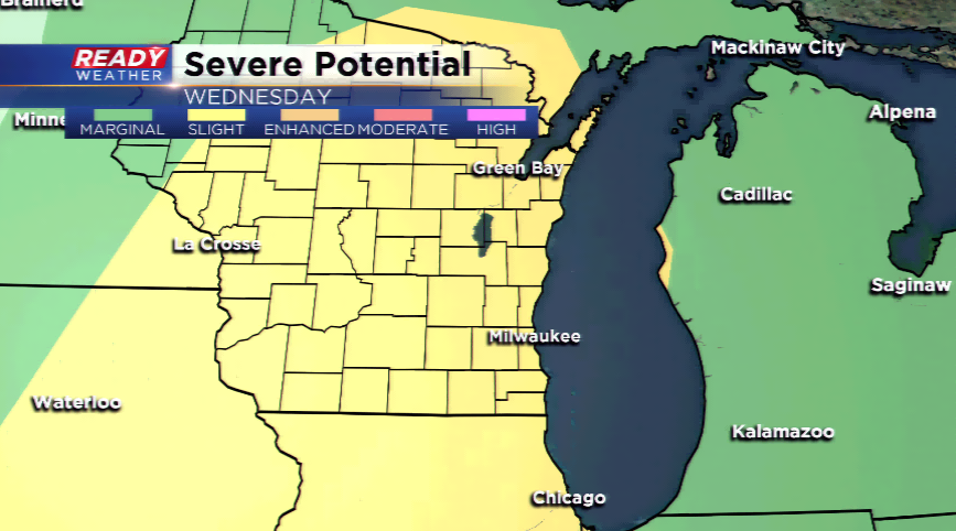
With more severe weather ingredients in place, the active weather pattern will continue for SE Wisconsin. Some cooler air will move in with the lake breeze driving in, so today will not be as busy as yesterday. Any storm that pops up today could lead to gusty winds and small hail. The Storm Prediction Center has all of the area under a *marginal* risk of severe weather, level one out of five under the severe weather criteria. An approaching cold front on Wednesday will help set the stage for another round of nasty thunderstorms. The SPC already has a *slight* risk for severe thunderstorms, level two under that banner. Main risks with these storms that will develop by the afternoon will be large hail and damaging winds. The thunderstorms threat will continue into Wednesday night before diminishing and drying out on Thursday.