Winter Storm Watch issued for parts of SE Wisconsin beginning Sunday
Updated 2:45 p.m. November 23, 2018
UPDATE: A Winter Storm Watch has now been issued for parts of SE Wisconsin beginning Sunday.
A winter storm watch has been issued for parts of SE Wisconsin for Sunday! There remains a lot of uncertainty to where the heavy snow will setup. pic.twitter.com/2xpDuk1bjG
— Drew Burgoyne (@CBS58Drew) November 23, 2018
------
A developing winter storm remains likely for the end of the Thanksgiving holiday weekend. This has the chance to cause issues on the roads Sunday into Monday, which might impact your travel plans.
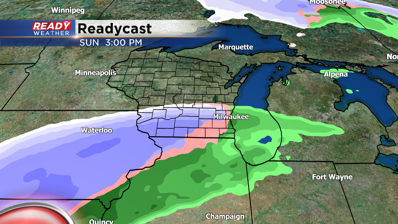
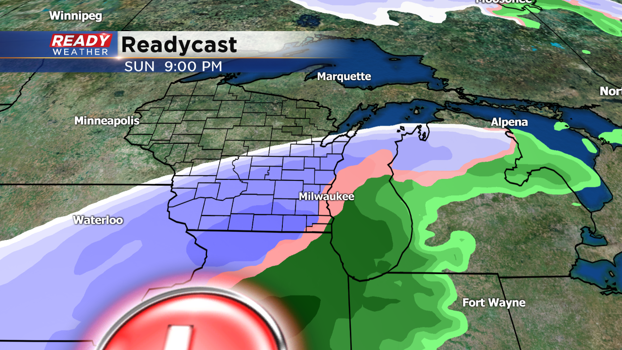
The biggest question remains the track of the surface low. Most models are consistently placing the track of the low across central Illinois. This would bring a deformation zone of snow right across southeastern Wisconsin on Sunday.
A mix of rain and some sleet will be possible Sunday morning into the afternoon. The lake will likely keep the low levels warmer right along the lakefront, so it will take longer for the rain to turn over to snow there.
As the low pulls northeast a significant band of snow will move across southeastern Wisconsin Sunday evening into Monday morning. Several inches of snow will be possible; however, until the track of the low is determined, we won't be posting snow totals. Bottom line this storm will have the capability of producing accumulating snow that could impact roads and travel.
We will continue to update the forecast!


